
Mount Mansfield is Vermont’s tallest mountain at 4,393 feet. It’s a mountain range found within the Mount Mansfield State Park that covers 44,444 acres in Chittenden, Lamoille, and Washington counties.
The mountain covers the towns of Underhill, Jeffersonville, and Stowe. Mount Mansfield’s foothills cover some of Cambridge, too. While people debate how the mountain got its name, my childhood school hikes up the mountain often led to stories involving Vermont landowners along both sides of the ridge and a town that no longer exists.
When Mansfield formed in 1815, some residents lived on the west side of the slopes and others lived on the east side. The others lived on the east side. Crossing the peak proved difficult, however, so officials decided to merge the two sides of Mansfield with Underhill and Stowe.
Where Is Mount Mansfield?
So, where in Vermont is this mountain? It’s in the northern part of the state. The Appalachian Mountain system extends approximately 2,000 miles from Alabama to Newfoundland and Labrador in Canada. As it passes through Vermont, the stretch called the “Green Mountains” extends for 250 miles and creates the state’s popular Long Trail that hikers follow from one end of the state to the other. Completing all 250 miles qualifies you to join the End-to-Enders Club.
The highest part of the Green Mountains is Mount Mansfield. Mount Mansfield starts in Underhill and ends in Stowe, though the mountain’s foothills spread beyond those towns.
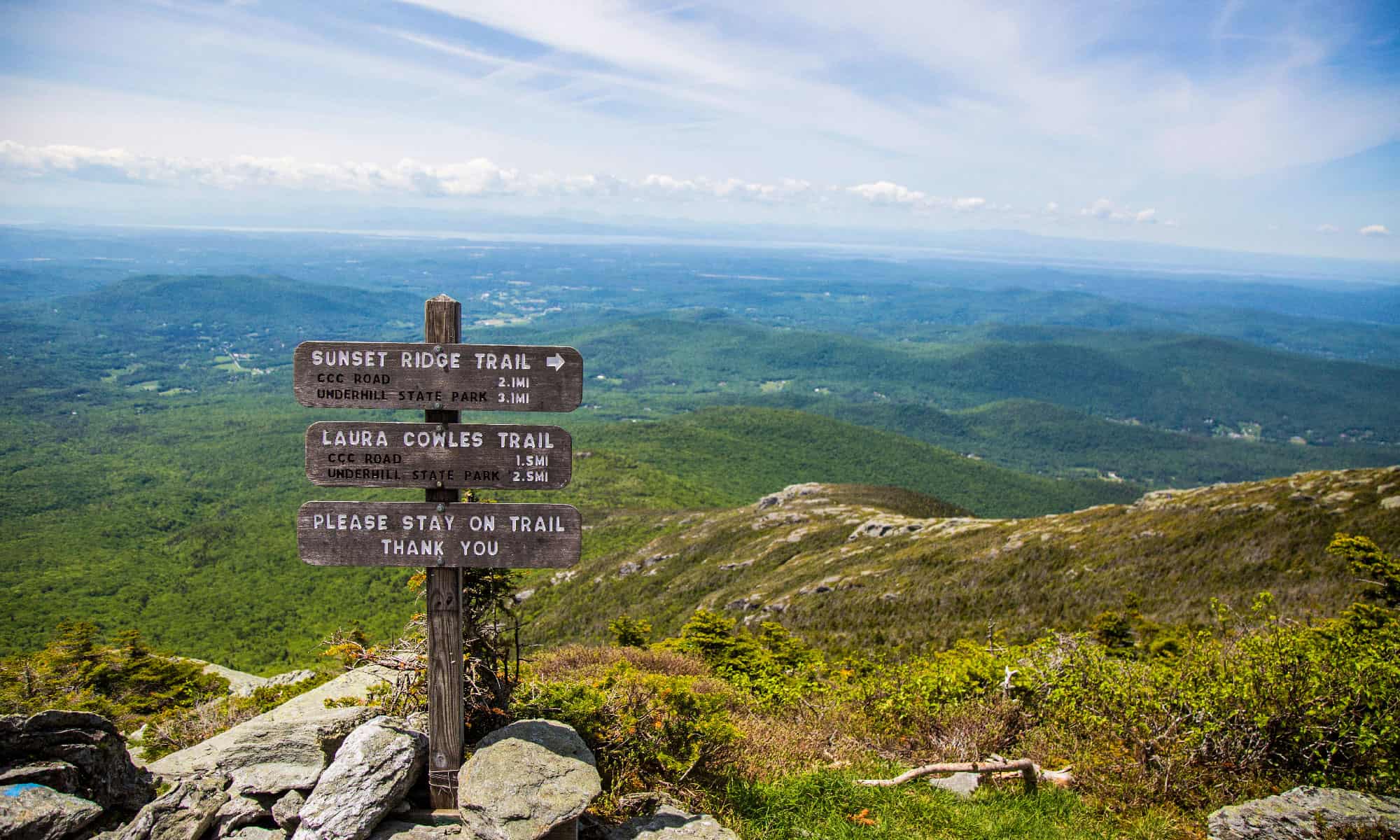
How do you reach the highest peak? Hike to the top along the popular Sunset Ridge Trail from Underhill State Park. Or, take the Auto Toll Road in Stowe. If you’re okay with twists, turns, and sharp inclines, drive up Smuggler’s Notch/Route 108.
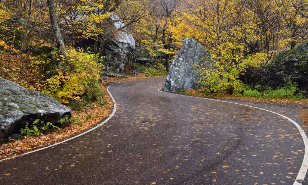
Smugglers’ Notch’s seasonal winding mountain road offers little room for longer RVs or vehicles towing a trailer.
©Reimar/Shutterstock.com
If you decide to drive from Jeffersonville or Stowe using Smugglers’ Notch Scenic Highway, do not make the same mistake that many drivers make every year. Smugglers’ Notch is a winding, hairpin curve route with boulders creating no space for larger vehicles and trucks, but the road brings you to Smugglers’ Notch State Park where hiking trails bring you to the top.
Smugglers’ Notch Pass is the local name for Route 108, and snow closes it each season. As some drivers ignore the warning signs, an average of eight trucks get stuck each year, which closes the road for hours. If you have an RV or are towing a trailer on your trip, skip Route 108 as the fines for getting stuck are costly.
How Does It Rank in Comparison to Other U.S. and Vermont Mountains?
Vermont has four other mountain peaks topping 4,000 feet, but Mount Mansfield tops Killington by 157 feet. People refer to the mountain as resembling a face with the forehead to the north, the higher chin, which is the highest peak, and the lips. The chin is 4,393 feet in elevation. The state’s other tallest mountains are:
- Killington Peak at 4,236 feet
- Camel’s Hump at 4,081 feet
- Mount Ellen at 4,081 feet
- Mount Abraham at 4,016 feet
Head to the other side of the U.S., and Mount Mansfield’s height may not seem as impressive. In Vermont, however, it’s a towering peak that draws skiers and hikers.
How Did Mount Mansfield Form?
In the Ice Age, as glaciers melted, Mount Mansfield was one of the New England mountains resulting from glacial melt. Only three areas in Vermont still have alpine tundra from the Ice Age, and Mount Mansfield is one of them. The Mount Mansfield Natural Area became a National Natural Landmark in 1980, and hikers need to use care at the summit’s 200 acres of alpine tundra.
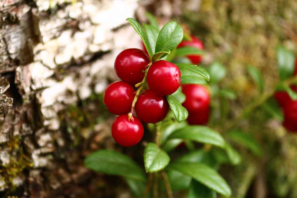
Mount Mansfield’s alpine plants include many high-elevation plants including lingonberry.
©iStock.com/Svetlana Sinichkina
The mountain itself is predominantly mica and quartz schist bedrock covered in loam, sand, and silt. Within that loam grows alpine plants like alpine sweetgrass, bog bilberry, Greenland stitchwort, and lingonberry. Signs alert hikers to the alpine plants.
What Animals Call Mount Mansfield Home?
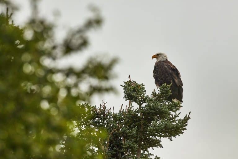
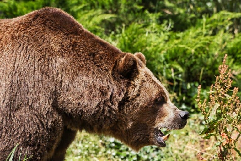
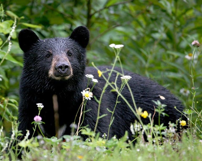
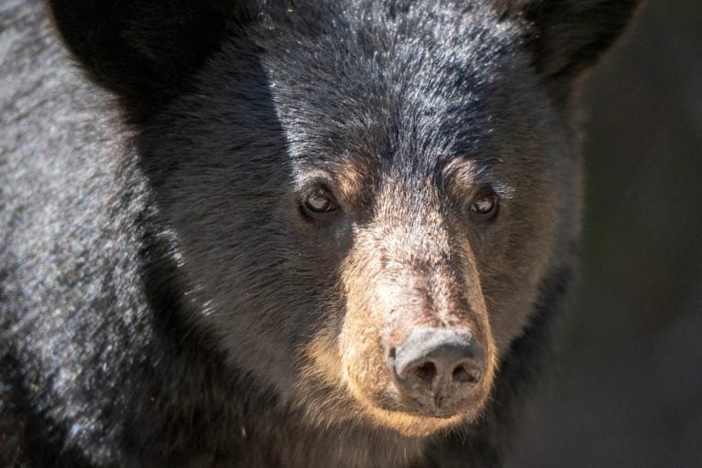
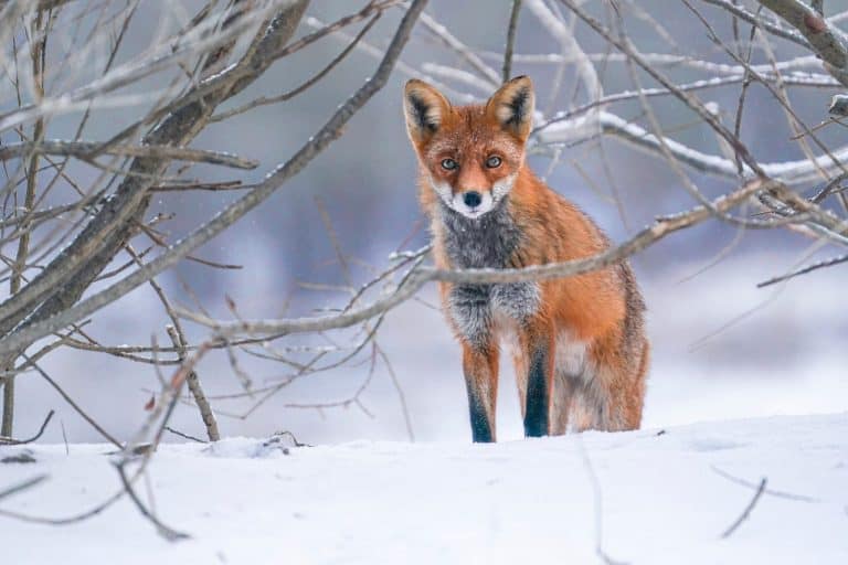
With its elevation and cliff faces, you might wonder about the animals along the hike to the top of Mount Mansfield. It’s not as many as you might think, but there are a few big animals to be cautious of. Black bears, white-tailed deer, and moose are the largest. However, hikers also spot wild turkeys, bobcats, bald eagles, and peregrine falcons. In the foothills, expect to see or hear coyotes, great horned owls, and red foxes.
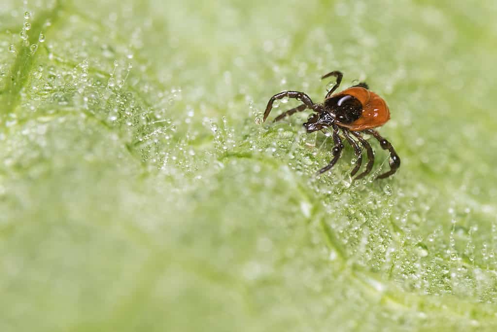
Lyme disease is a risk when walking in Vermont woods and fields.
©iStock.com/Ladislav Kubeš
Tuck your pants into your socks and shirt into your waistband and set off up the trails of Mount Mansfield. Black-legged ticks dominate Vermont woods, and they carry Lyme disease. Stick to the trails, and it’s easier to avoid them as you climb Vermont’s tallest mountain.
.