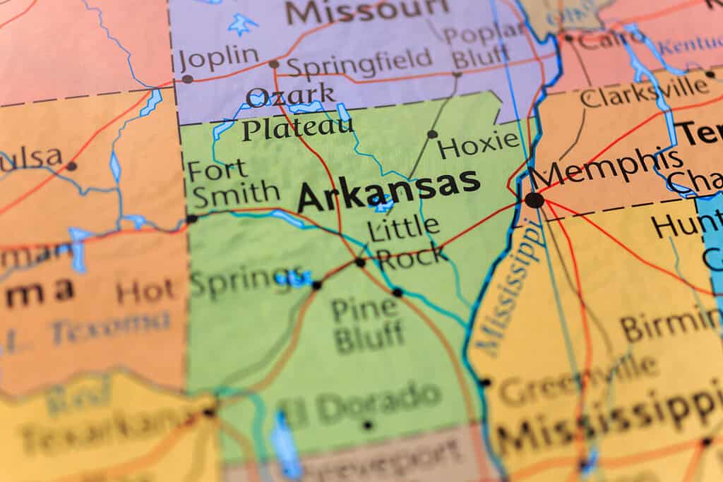
How wide is Arkansas, you wonder? What’s the total distance from east to west? Answering such questions would be easier if the U.S. States were created on a grid. And while some of the Western U.S. states come close to resembling precise grids, most U.S. state boundaries are far from uniform squares on the map. The Lower 48 contiguous U.S. States borders were shaped by a complex interplay of historical events, natural features, and political negotiations. Each state’s boundaries tell a story, from the meandering rivers of the South to the jagged mountain ranges of New England. And so it is with Arkansas. At its widest, the Natural State measures 270 mi (435 km). Continue reading to discover more about Arkansas!

Though some Western U.S. states come close to resembling precise grids, most U.S. state boundaries are far from uniform squares on the map.
©Alexander Lukatskiy/Shutterstock.com
How Wide Is Arkansas?
Arkansas is a landlocked state located in the South/Central United States. Not exactly Southeastern or Southwestern, nor a Gulf Coast state, Arkansas is somewhat of an outlier. The state’s boundaries are defined by natural geographic features and agreements with neighboring states. Arkansas’s northern boundary is defined by the state’s border with Missouri, although the Mississippi River forms a small portion of the northern boundary in the Northeastern corner of the state. The eastern boundary of Arkansas is defined by the Mississippi River. This river separates Arkansas from the state of Mississippi and, to a lesser extent, Tennessee.
To the south, Arkansas is formed by its border with Louisiana. The western edge of Arkansas is defined by its borders with Texas and Oklahoma. The widest part of the state is located to the north, between Tennessee and Oklahoma. At its widest point, the eastern edge of Arkansas is located in Mississippi County, near the town of Huffman. The western border is in Washington County, approximately 20 miles southwest of Fayetteville. The eastern portion of the widest part of Arkansas is in the Mississippi Delta, known for its fertile farmland. The western part is defined by the thickly forested Ozark Mountains.

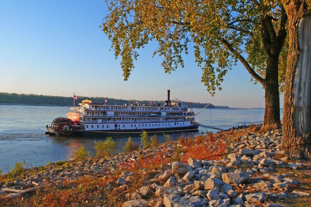
The eastern boundary of Arkansas is defined by the Mississippi River, seen on the distant shore.
©iStock.com/ianpjones
How Wide Is Arkansas? At-A-Glance
| Question | Answer |
|---|---|
| How wide is Arkansas? | 270 mi (435 km); Chickasaw National Wildlife Refuge |
| How tall is Arkansas? | 240 mi (386 km); fairly uniformly |
| How narrow is Arkansas? | 150 miles (242 km); southern boundary |
| What is the highest point in Arkansas? | 2,753 feet (840 m) above sea level; Mount Magazine |
| What is the lowest point in Arkansas? | 55 feet (17m) above sea level; Ouachita River |
| Where is the geographic center of Arkansas? | 12 miles northwest of Little Rock in Pulaski County |
| How big is Arkansas? | At 53,179 square miles (137,733 km²), Arkansas ranks 29/50 in total area. |
| When did Arkansas become a state? | Arkansas was the 25th state to enter the Union on June 15, 1836. |
| What is the capital of Arkansas? | Little Rock |
| How many people live in Arkansas? | 3 million |

The State Capitol of Little Rock stands lit by bright sunshine. The Arkansas River is visible in the background.
©Real Window Creative/Shutterstock.com
What Does Arkansas Mean?
The word Arkansas is derived from a French pronunciation of a name used by the indigenous Quapaw people for the region. The Quapaw people originally called themselves Ugakhpa or Ugahxpa, which the French settlers in the area transcribed as Arkansa. Over time, the name evolved into its current form, Arkansas, the final s considered a pluralization of the original form.
As a word of French origin, it was decided by official decree that the final s would be silent. In 1881, the state passed legislation stating that the pronunciation was officially from henceforth and forever more Arkansaw. This pronunciation preserved the memory of the original Quapaw people while recognizing the contributions of the French explorers. Some folk, especially those outside the state, refer to the river as the ar-KAN-zas placing the emphasis on the second syllable. This pronunciation is a source of humor and confusion, and as Papaw used to say, “just plain wrong.”

Some folk, especially those outside the state, refer to the river as the
ar-KAN-zasplacing the emphasis on the second syllable. Pictured: The Arkansas River with the Little Rock skyline in the background.
©Sean Pavone/iStock via Getty Images
How Wide Is Arkansas? Relatively Speaking
Heading west, U.S. states tend to get larger, in contrast with the smaller, more compact states of New England. This reflects the wide-open spaces and frontier history of the American West. From Alaska’s 2,000-mile plus width to Deleware’s 9 miles (14 km) at its narrowest point, the fifty United States come in a wide variety of shapes and sizes! Centrally located as it is, it should come as no surprise that Arkansas is a moderately wide state:
| State | Width |
|---|---|
| Alaska | 2,272 (3,658 km) |
| Hawaii | 1.604 (2,581 km) |
| California | 827 (1.331 km) |
| Texas | 800 (1287 km) |
| Montana | 629 (1012 km) |
| Arkansas | 270 mi (435 km) |
| New Hampshire | 68 (109 km) |
| New Jersey | 65 (104 km) |
| Vermont | 40 (64 km) |
| Rhode Island | 37 (60 km) |
| Deleware | 35 (56 km) |
Five Fresh Facts About Arkansas
- The Arkansas State Bird is the mockingbird
- Arkansas is a diamond-bearing state. Crater of Diamonds State Park offers visitors the opportunity to dig for diamonds.
- The Arkansas state insect is the honey bee.
- Over 1/2 of Arkansas is forestland. Over 19 million acres account for 56% of the Natural State’s area.
- Hot Springs, Arkansas is well-known for Bathhouse Row. The eight historic bathhouses on the row were constructed between 1892-1923. Many of them are still operational.
The photo featured at the top of this post is © RBraley / CC BY-SA 4.0 – License / Original
Thank you for reading! Have some feedback for us? Contact the AZ Animals editorial team.


