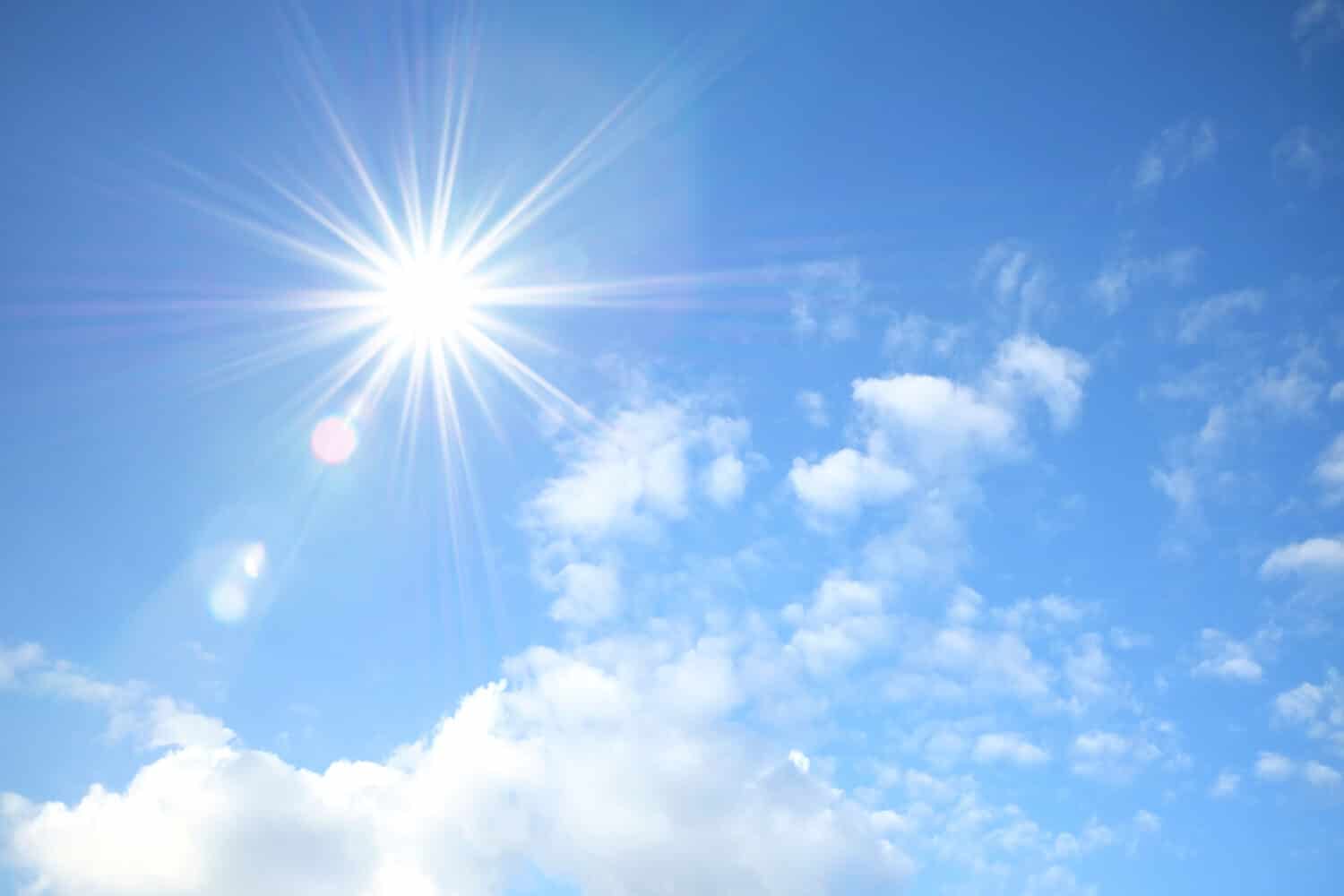

Clouds are a fascinating and ever-changing part of the Earth’s atmosphere, playing a crucial role in weather patterns and climate. Observing and understanding them can provide valuable insights into imminent weather changes and atmospheric conditions. They come in various shapes, sizes, and altitudes, each with its distinct characteristics.
Cirrus Clouds
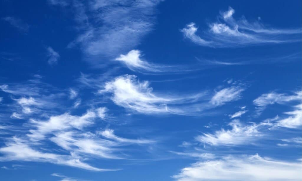
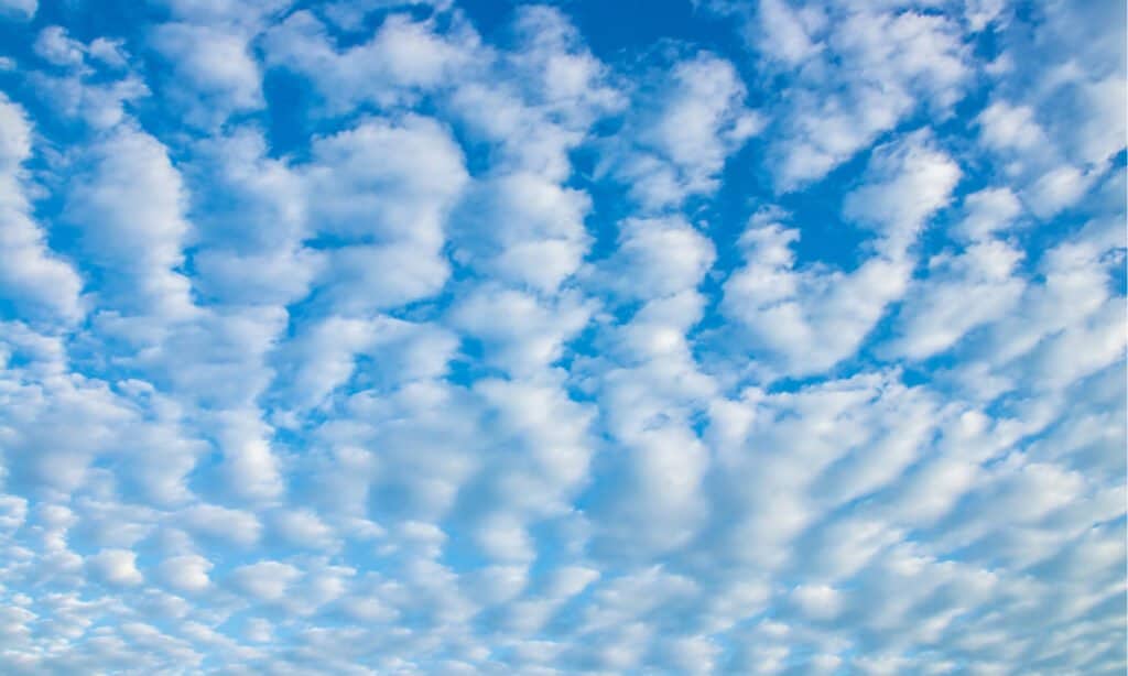
The cirrus type forms at high altitudes.
©CE Photography/Shutterstock.com
Cirrus clouds are high-altitude types that form at an elevation of about 20,000 to 40,000 feet (6,000 to 12,000 meters) above sea level. They appear wispy and thin, with a delicate, feathery texture. Composed mainly of ice crystals, they often indicate fair weather and are visible before or during the approach of a warm front. These types are shaped by high-altitude winds, known as jet streams, which stretch and pull its ice crystals into their characteristic elongated shapes.
Identifying cirrus types can be an exciting skill, especially for weather enthusiasts and outdoor enthusiasts. Here are some key features and tips to help you recognize them:
High Altitude
They are the highest of all types and are visible in the uppermost layer of the atmosphere. They appear at altitudes where other types are absent, creating a sky-high appearance.
Feathery Texture
Cirrus types have a unique feathery or wispy texture. They often have thin, stretched-out strands that appear almost like horse tails or feathers. The delicate appearance of these types is a distinguishing characteristic.
No Shadow
Due to their high altitude and thin composition, they do not cast shadows on the ground, unlike lower-level clouds.
Sun or Moon Halo
One way to identify this type is by looking for a halo around the sun or moon. These halos form due to the refraction of light through the ice crystals in the cloud, creating a luminous ring around the celestial body.
Appearance before Weather Changes
Cirrus clouds are visible before the arrival of weather changes. They indicate approaching warm fronts, which can bring a shift in weather conditions from fair to cloudy or overcast.
Cumulus Clouds
Cumulus clouds are puffy and form at lower altitudes.
©Prapat Aowsakorn/Shutterstock.com
Forming at low to middle altitudes, generally below 6,500 feet (2,000 meters), cumulus clouds are puffy and white. They are the classic “cotton ball” types, often resembling fluffy cotton candy. Cumulus clouds are a result of rising warm, moist air condensing as it reaches cooler altitudes. They typically indicate fair weather, but they can develop into cumulonimbus clouds, which bring thunderstorms and heavy precipitation.
Identifying them is relatively straightforward, as their appearance is quite distinctive.
Shape
They have a well-defined, puffy shape with a flat base and a domed, cauliflower-like top. Their appearance is often likened to the cotton balls used for arts and crafts.
Texture
They have a soft, billowy texture, and their edges are usually well-defined and rounded.
Color
They are mostly white, but their color may vary depending on the angle of the sunlight. During sunrise or sunset, they may take on shades of pink, orange, or gold.
Arrangement
They are often scattered across the sky, appearing individually or in small groups. They rarely cover the entire sky in a continuous layer.
Stratus Clouds
Stratus clouds appear as layers and cover the lower portions of the sky.
©Cristian Zamfir/Shutterstock.com
Forming in uniform layers, stratus clouds are a low-altitude type that covers large portions of the sky. They appear gray and featureless, often bringing overcast skies and drizzling rain or light snow. Stratus clouds form when moist air near the ground is cooled and condenses. They can also persist for extended periods and can be associated with dreary, gloomy weather.
Identifying and remembering them is crucial for understanding imminent weather changes and planning outdoor activities.
Appearance
They have a distinct appearance that sets them apart from other cloud types. They appear as a featureless, low-hanging cloud layer with a uniform, gray or white color. Unlike cumulus clouds, which have distinct puffy shapes, they lack any noticeable structure or well-defined edges. Their flat, layered appearance often gives the impression that they are “stuck” to the sky.
Low Altitude
One of their most defining characteristics is their relatively low altitude. They typically form at altitudes below 6,500 feet (2,000 meters), which makes them one of the lowest types in the atmosphere. Their proximity to the ground contributes to their ability to bring light precipitation and overcast conditions.
Overcast Conditions
They often result in overcast or gray skies, where the entire sky is covered by the thick layer. The sun and stars are usually obscured, and the diffuse light from the cloud cover creates a muted, dimly lit environment.
Light Precipitation
They are associated with light precipitation, such as drizzle, light rain, or light snow. This layer is usually thick enough to produce a continuous and steady stream of precipitation over an extended period, often leading to damp and gloomy weather.
Stable Weather Patterns
They appear during stable atmospheric conditions, where warm, moist air near the ground lifts and cools. The cooling causes the water vapor in the air to condense into small water droplets, forming this layer. As a result, they are often associated with stable weather patterns, with little change in temperature or wind conditions.
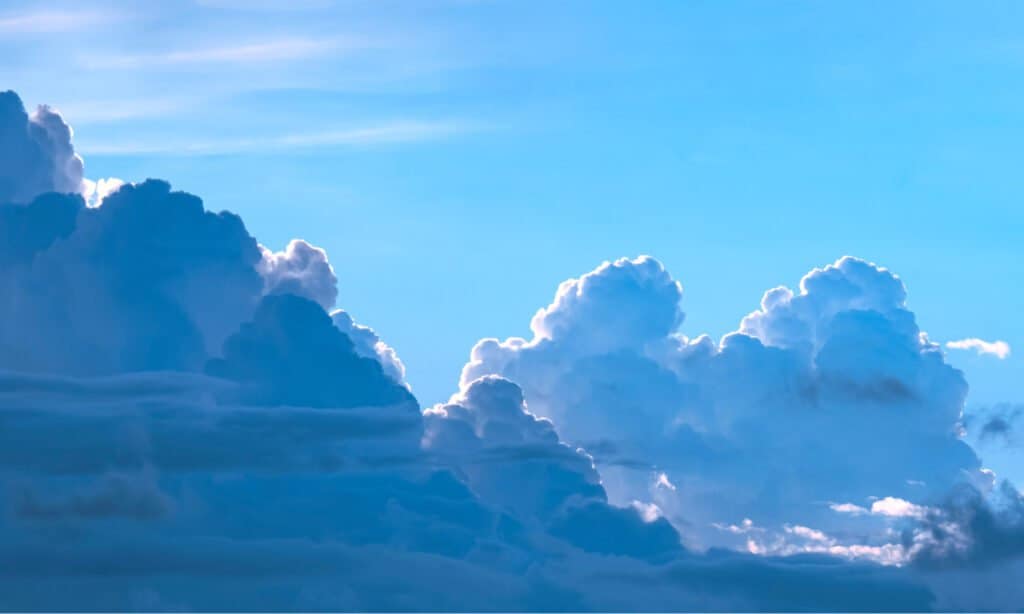
Cumulonimbus Clouds
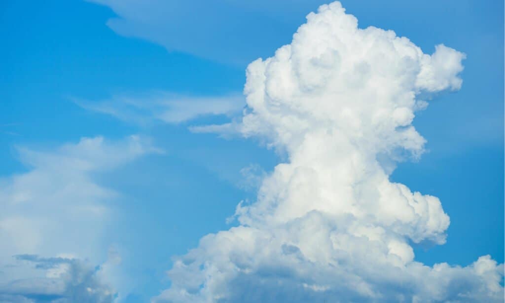
Tall and towering, cumulonimbus clouds extend vertically like skyscrapers.
©Verin/Shutterstock.com
Cumulonimbus clouds are tall, towering types that extend vertically through multiple atmospheric layers, reaching great heights. They are present during thunderstorms, heavy rain, lightning, and sometimes hail. They form from cumulus clouds that experience rapid vertical growth due to strong updrafts. Cumulonimbus clouds are a common sight during warm and humid weather, signaling the potential for severe weather events.
Identifying and remembering them can help individuals stay informed about potentially severe weather conditions and take necessary precautions.
Towering Vertical Development
They are massive, towering, and extend vertically through multiple atmospheric layers. Their tops can reach incredible heights, sometimes reaching into the stratosphere. This vertical development is a key distinguishing feature that sets them apart from other types.
Anvil Shape
As they grow taller, they often spread out at the top, forming an anvil-like shape. This anvil top results from the cloud encountering the stable layer of the atmosphere called the tropopause, which acts as a “lid” and prevents further upward growth.
Dark and Dense Appearance
They typically have a dark and dense appearance, especially when fully developed. The base can be at various altitudes, but it often looks flat and relatively dark, indicating the presence of a significant amount of water droplets and ice crystals.
Precipitation and Thunderstorms
They are notorious for producing intense precipitation, ranging from heavy rain to snow and hail. Lightning and thunder are also common occurrences within them due to the strong updrafts and rapid vertical motion of air.
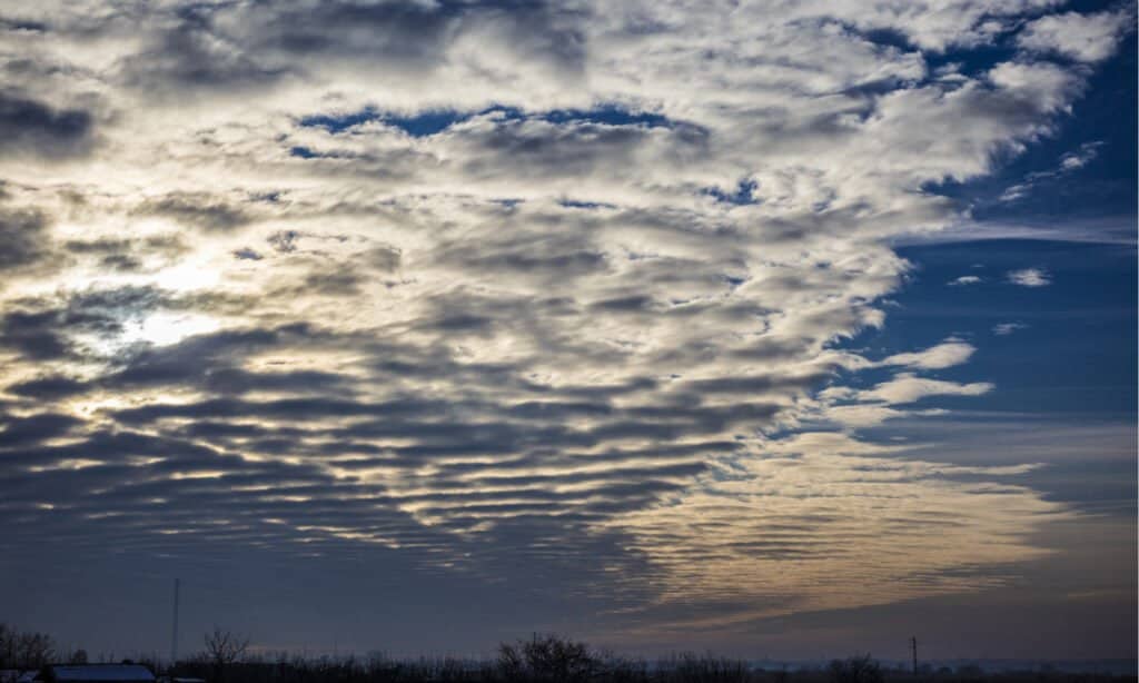
Altostratus Clouds
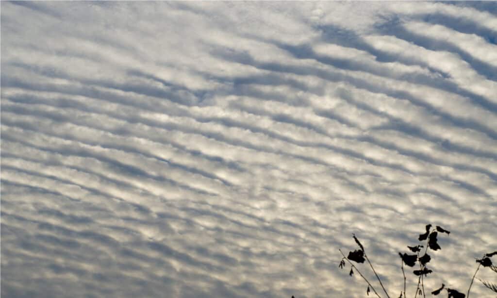
Like other stratus types, altrostratus clouds appear in a sheet-like formation mid-level in the sky.
©coco312/Shutterstock.com
Altostratus clouds are mid-level types that form at altitudes between 6,500 and 20,000 feet (2,000 to 6,000 meters). They appear as a thick, grayish sheet, often covering the entire sky. Altostratus clouds can be precursors to precipitation, and their presence may indicate an approaching warm or occluded front. They consist of water droplets and sometimes ice crystals, depending on the temperature at their altitude.
Uniform Layer of Clouds
Their first noticeable feature is their uniform and continuous appearance. They tend to cover a significant portion of the sky, sometimes blocking out the sun partially or completely. This uniformity distinguishes them from other types like cumulus, which appear as separate and distinct masses.
Grayish Appearance
They usually have a grayish color, often lighter near the edges and darker towards the center. Their appearance can vary depending on the thickness of the layer and the amount of sunlight penetrating through them.
No Clear Outline
Unlike cumulus clouds, which have well-defined edges, they appear more blurred and featureless. The absence of distinct shapes helps differentiate them from other types.
Sun or Moon Halo
In certain conditions, they may produce a faint circular ring around the sun or moon, known as a halo. This optical effect occurs due to the scattering of light by the tiny water droplets or ice crystals within the layer.
No Precipitation
They often form ahead of warm fronts or low-pressure systems but do not typically produce precipitation on their own. Unlike nimbostratus clouds, which are thick and dark with steady rain, these might indicate impending weather changes but are not immediate precursors to rain.
Altocumulus Clouds
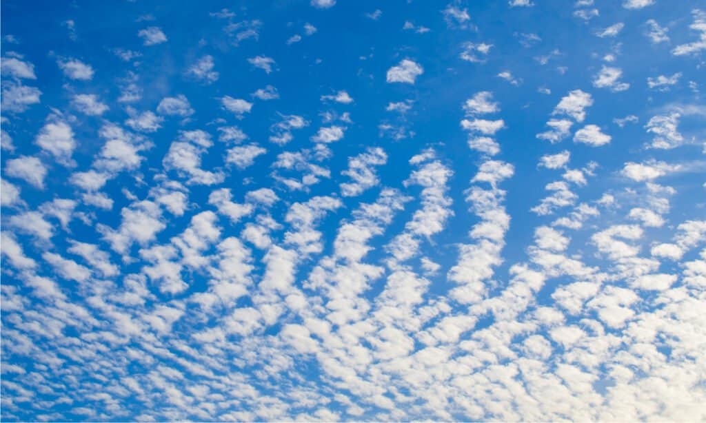
Appearing in patches, altocumulus clouds are often arranged in rows.
©Thon Varirit/Shutterstock.com
Altocumulus clouds are mid-level types that form between 6,500 and 20,000 feet (2,000 to 6,000 meters) above sea level. They appear as rounded masses of white or gray patches, often arranged in rows or waves. They consist of water droplets and appear during fair weather. However, their presence can signal the approach of a warm front or instability in the atmosphere.
Identifying and remembering them can be helpful in understanding the current weather conditions and predicting potential changes.
Characteristics of Altocumulus Clouds
They consist of water droplets and sometimes ice crystals, depending on the temperature at their altitude. They appear as small, separate cloudlets or larger patches, with well-defined edges. The cloudlets often have a globular, cotton-like appearance and are typically smaller than cumulus clouds. These are different from higher cirrocumulus clouds, which appear at similar altitudes but have smaller, more uniform cloudlets.
Cloud Arrangement
They often form in rows or waves across the sky, giving them a distinct appearance. Their organized structure sets them apart from the more scattered appearance of cumulus clouds. They may also appear in layers, overlapping one another, creating a textured and wavy sky pattern.
Color and Transparency
They are usually white or gray, but their color can vary depending on the angle of the sun and the presence of other atmospheric particles. They are not as thick or dense as nimbostratus clouds and allow sunlight to partially filter through, creating a mottled or dappled effect on the ground.
Weather Implications
They generally appear during stable atmospheric conditions. Their presence may indicate fair weather, but they can also signal the approach of a warm front or instability in the atmosphere. When altocumulus clouds appear in the morning, they often dissipate throughout the day, while their appearance in the afternoon may signal the possibility of thunderstorm development later in the day.
Nimbostratus Clouds
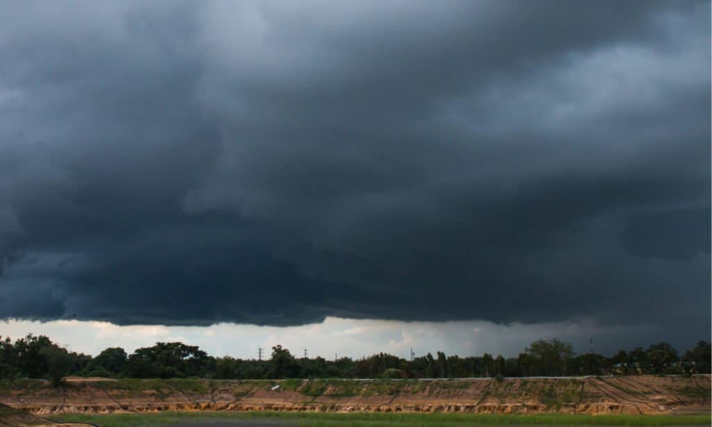
Appearing during rainy periods and monsoons, nimbostratus clouds usually produce a lot of precipitation.
©Somyot Mali-ngam/Shutterstock.com
Nimbostratus clouds are dark, thick, and uniform types that produce continuous precipitation, such as rain or snow. They form in a layer that often extends over a wide area, obscuring the sun and creating overcast conditions. They usually show up with steady, prolonged precipitation, making them prevalent during prolonged rainy periods.
Uniform, Dark Appearance of Clouds
They have a distinct gray or dark gray appearance, which is due to their significant thickness and ability to block out sunlight. They often cover large portions of the sky, creating a widespread and continuous overcast layer.
No Visible Outlines
Unlike cumulus or cumulonimbus clouds, nimbostratus clouds do not have well-defined edges or individual formations. Instead, they blend seamlessly into one another, creating a uniform, featureless layer.
Continuous Precipitation
Nimbostratus clouds are precipitation types, so they appear during steady and continuous rain or snowfall. The precipitation produced by them is usually light to moderate, but it can persist for extended periods, resulting in prolonged rainy or snowy weather.
Low Altitude
Nimbostratus clouds form at low altitudes between the surface and around 6,500 feet (2,000 meters). They often appear at the base of other cloud layers, such as altostratus clouds, indicating an unstable atmospheric condition.
Stratocumulus Clouds

Stratocumulus clouds appear at a low altitude in lumpy shapes with defined edges.
©SubstanceTproductions/Shutterstock.com
Forming between 1,500 and 6,500 feet (500 to 2,000 meters) above sea level, stratocumulus clouds often indicate stable atmospheric conditions. They form at low altitudes as a series of lumpy, grayish patches with defined edges. They can sometimes bring light precipitation, but they are not as thick or dark as nimbostratus clouds.
Texture of Clouds
Stratocumulus clouds have a characteristic appearance of smooth, rounded, or lumpy patches with well-defined edges. The individual cloud elements often merge into larger formations, creating a continuous overcast or patchy sky cover.
Color
They typically have a grayish or white color, depending on the amount of sunlight that reaches them. The presence of sunlight can make them appear brighter, while cloud cover may give them a more uniform gray hue.
Altitude
They form at relatively low altitudes, typically between 1,500 and 6,500 feet (500 to 2,000 meters) above sea level. Their positioning in the lower atmospheric layers distinguishes them from cirrus or altostratus types, which form at higher elevations.
Stable Weather
They are present during stable atmospheric conditions. Unlike cumulonimbus clouds, which indicate instability and thunderstorm potential, stratocumulus clouds rarely produce significant precipitation.
Widespread Cover
They often cover large areas of the sky, creating overcast or partly cloudy conditions. They are common in regions where air masses are relatively uniform and have minimal vertical motion.
Cirrocumulus Clouds
Forming at a high altitude, cirrocumulus clouds appear in small, rounded rows.
©KETNARONG/Shutterstock.com
Cirrocumulus clouds are high-altitude types that appear as a series of small, white, and rounded patches, often in rows or groups. They form at an altitude similar to cirrus clouds, between 20,000 and 40,000 feet (6,000 to 12,000 meters). Cirrocumulus clouds consist mainly of ice crystals and indicate fair weather. They are sometimes called “mackerel sky” because they resemble the patterns on fish scales.
Small and White Clouds
They appear as tiny, individual cloudlets, similar to grains of sand or fish scales. They are much smaller than other cloud types, and their white color is a result of the ice crystals reflecting sunlight.
Rounded and Patchy Clouds
Cirrocumulus clouds typically form in rows, patches, or groups, creating a textured appearance in the sky. The rounded edges of these patches help differentiate them from other types.
High Altitude
As high-level clouds, cirrocumulus clouds form at elevations well above the typical weather-producing clouds. They are visible in the upper regions of the troposphere and often indicate fair weather conditions.
Fine Texture
When observing cirrocumulus clouds, you might notice a fine, delicate texture within each cloudlet. This texture is a result of the individual ice crystals that compose the cloud.
Contrails

Short for condensation trails, contrails aren’t a cloud type, but exist as cloud-like formations in high altitudes.
©Viktorio Marianov Nitov/Shutterstock.com
Contrails, short for “condensation trails,” are not a natural cloud type but are worth mentioning as they are cloud-like formations. They consist of visible trails left behind by aircraft at high altitudes. They form when the hot exhaust gases from jet engines mix with the cold air of the upper atmosphere, causing condensation and the formation of ice crystals. Contrails can persist for several hours and can spread, sometimes contributing to cloud cover and affecting local weather patterns.
Contrails are relatively easy to identify in the sky, and their appearance can provide valuable information about the weather conditions at high altitudes. Here are some key characteristics to help identify contrails:
Location and Altitude of Clouds
Contrails are visible at high altitudes, above 25,000 feet (7,600 meters), where the air is cold enough to support the formation of ice crystals. They often appear behind aircraft traveling at cruising altitudes.
Straight Lines
Contrails typically form in straight lines following the path of the aircraft. They can appear as single trails or in parallel lines if multiple aircraft are flying in the same direction.
Persistence
Contrails can persist in the sky for varying durations, depending on factors such as humidity levels, temperature, and wind patterns. They may dissipate quickly if the air is dry or persist and spread if the atmosphere is more humid.
Spreading and Feathering
In certain atmospheric conditions, contrails can spread and feather out, creating a wider and more diffuse appearance. This phenomenon of “persistent contrails” can contribute to the formation of cirrus clouds.
Sunlight Interaction with Clouds
Contrails are often more visible when they catch sunlight, especially during sunrise or sunset, creating a striking contrast against the sky.
Clouds are an integral part of Earth’s atmosphere, shaping weather patterns and affecting our daily lives. Understanding the different types of clouds is essential for meteorologists, weather enthusiasts, and anyone interested in gaining insights into atmospheric conditions. From the high, wispy cirrus clouds to the towering cumulonimbus clouds associated with thunderstorms, each cloud type tells a unique story about the state of the atmosphere. By observing and appreciating the diverse and ever-changing forms of clouds, we can deepen our connection with the natural world and better prepare for the weather conditions that affect our lives.


How to Add Us to Google News


Thank you for reading! Have some feedback for us? Contact the AZ Animals editorial team.