
Known as the “Land of Enchantment,” New Mexico is filled with stunning scenery and boasts a rich cultural history. For those hoping to explore the wonders of the state by bicycle, there are plenty of options. However, only one of them winds through the Organ Mountains Desert Peaks National Monument and covers nearly 300 miles of southern New Mexico desert. Let’s take a closer look at the longest biking trail in New Mexico.
The Monumental Loop
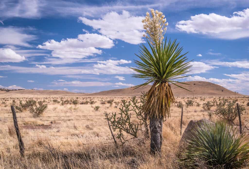
The Monumental Loop spans 250 miles of the Chihuahuan Desert pictured here.
©John A Davis/Shutterstock.com
The longest biking trail in New Mexico is the Monumental Loop. The route spans 250 miles of the Chihuahuan Desert with the town of Las Cruces serving as its start and end point.
This route includes one of the longest sections of single-track in the area and incorporates many stretches of Las Cruces’ local trail network. In addition to single-track stretches, the trail is made up of backcountry dirt roads and sandy washes. It forms a sweeping figure eight loop through a diverse desert landscape. Not only is this route the longest in the state, but it offers an incredible opportunity to explore the Organ Mountains Desert Peaks National Monument. It also offers a glimpse of an Apollo training site at Kilbourne Hole, sites used by Billy the Kid and Geronimo, the resting place of legendary lawman Pat Garrett, and parts of the Butterfield Stagecoach Trail.
History of the Longest Biking Trail in New Mexico
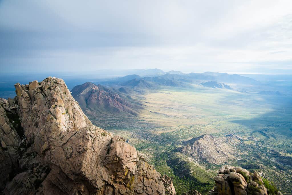
The route, designed to be a complete tour of the Organ Mountains Desert Peaks National Monument, put Las Cruces on the map.
©Rosemary Woller/Shutterstock.com
The Monumental Loop was developed by Matt Mason and Pablo Lopez with the support of other bikepackers. The route was first published in 2017 and put Las Cruces on the map as a bikepacking destination.
The goal of this bikepacking route was to offer a means of exploring the diverse desert landscape of southern New Mexico by bicycle. It was designed to be a complete tour of the Organ Mountains Desert Peaks National Monument. However, riders of the original route, renamed DangerBird, gave feedback that certain sections were hard to navigate. The Monumental Loop route has undergone some significant reroutes in response. It’s now a smoother ride that avoids sandy, rocky areas when possible. The updated route still passes through all sections of the national monument and seven wilderness areas.
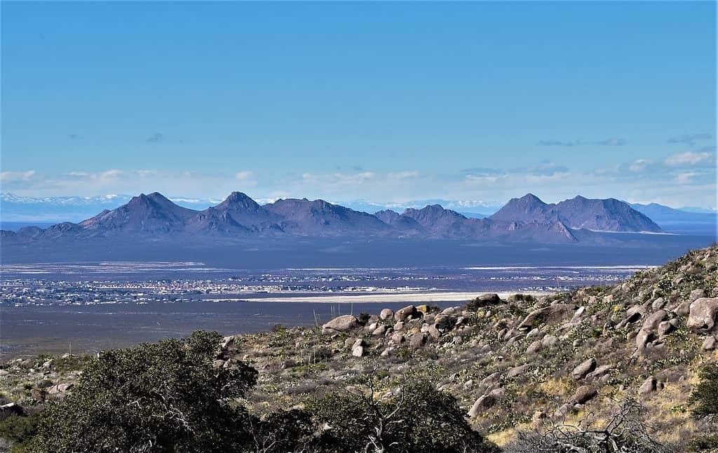
Where Is the Monumental Loop Located on a Map?
The Monumental Loop is located within the Organ Mountains-Desert Peaks National Monument area.
The town of Las Cruces, New Mexico’s second-largest city, is the Monumental Loop’s start and end point. Las Cruces lies along the Rio Grande and is 225 miles south of Albuquerque, New Mexico and 42 miles northwest of El Paso, Texas. It is 41 miles north of the Mexican border.
Navigating the Great Divide New Mexico Trail
This route includes one of the longest sections of single-track in the area and includes many stretches of Las Cruces’ local trail network.
©Anna Westman/Shutterstock.com
Be sure to download the map to a device you’ll carry with you and bring a printed copy along for the ride. The route can be envisioned as four segments:
Segment 1: Las Cruces to Hatch – 56 miles
Singletrack mixed with mostly multi-use paths and irrigation ditches make up the first stretch. Tonuco Mountain is picturesque but a challenge. There are several resupply points along this section of the ride.
Segment 2: Hatch to Mesilla – 57 miles
Pavement for a couple miles leads into the Sierra de Las Uvas. As the route crosses over the mountains there are about 12 miles of challenging riding before it eases into a glide across the desert plains. The ride then drops down into Old Mesilla.
Segment 3: Mesila to La Union – 50
Singletrack trail makes up the majority of this section. There are incredible views of the Organ Mountains and a plethora of other ranges. Winding through many farms and orchards within the Rio Grande Valley, the ride takes you into La Union.
Segment 4: La Union to Las Cruces – 84 miles
The final stretch is flat and scenic riding, bordering the many wilderness areas of Cone Country. Killbourne Hole and Aden Crater are just two examples of features to explore along this section of the trail.
How Long Does It Take to Ride?
The Monumental Loop takes an average of five days to ride. Andrew Strempke completed the ride in record time, finishing in 24 hours and 18 minutes.
Camping Along the Longest Biking Trail in New Mexico
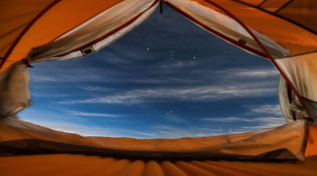
Set your campsite up outside of any washes to increase warmth and avoid being surprised by a flash flood!
©iStock.com/Aidong Ning
Throughout the route, primitive camping sites are available. These are typically sandy, dry, and flat. Set your campsite up outside of any washes to increase warmth and avoid being surprised by a flash flood! Also place distance between your tent and surrounding vegetation to avoid roaming creatures, spikes, and thorns. It’s discouraged to camp near cattle tanks, guards, and corrals. Even when traversing public land, it’s best to treat ranching structures as private property to avoid any trouble.
Food and Water Sources Along the Trail

Plan to have four liters of water capacity. Water is available at regular intervals along the route, generally every 20 miles.
©Daxiao Productions/Shutterstock.com
Full-service stops are available in the towns of Las Cruces, Doña Ana, Radium Springs, Hatch, Vado, and Vinton. There are some great options for food enroute, especially in Hatch, the green chili capital of the world!
Plan to have four liters of water capacity. Water is available at regular intervals along the route, generally every 20 miles. Cattle tanks are noted on the map and often have water, but they aren’t totally reliable. It’s a good idea to filter this water as well as any other source you find along the way. Know that the water locations on the western half of the trail are slightly less reliable. Always take advantage of a water source when you come across one!
Conditions of the Monumental Loop
This is an excellent trail to ride in the winter. Anytime from October through April is a great time to ride. Plan for warm days but chilly nights. A 30-degree rated sleeping bag will help keep you comfortable. In the summer months, the route shouldn’t even be attempted as temperatures will often be above 100 degrees, making for a potentially dangerous ride.
The terrain along the Monumental Loop is a mixed bag of gravel roads, singletrack, sandy arroyos, and doubletrack. Roughly 96 percent of the route is rideable, but there are a few areas where pushing or carrying your bike may be called for. The longest stretches of sandy and rocky areas to watch out for occur near Tonuco and White Gap Pass. The recommended tire size for this route is 2.4 inches. Although 2.0-inch tires will work as well, you might find yourself pushing a bit more. Tubeless tires are essential for the sometimes-rough terrain and make sure to bring a repair kit along with you!
Elevation and Difficulty of the Trail
The trail ascends a total of 7,796 feet and reaches a high point of 5,805 feet. This is a moderately difficult trail with varied terrain, some steep climbs, and challenging obstacles. This bikepacking route is more of a mountain biking challenge than a low-key desert tour. If you’re up to the challenge, logistical preparation is key to ensuring a successful ride along the longest biking trail in New Mexico!
Wildlife on the Longest Biking Trail in New Mexico
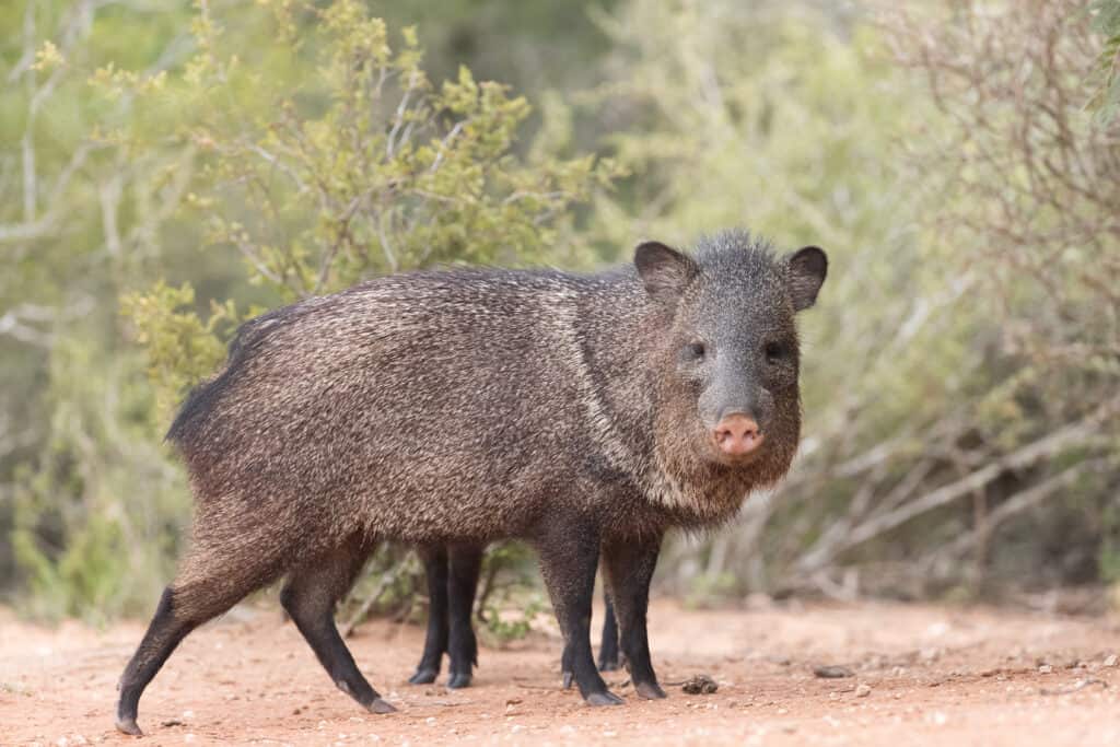
Javelina call the Chihuahuan Desert home.
©Dennis W Donohue/Shutterstock.com
Coyotes are sure to be heard howling in the night, but like many desert occupants, they will be elusive during the daylight hours. In-flight raptors are a common sight, soaring the skies as they search for reptiles and jackrabbits. Mule deer, bobcats, and javelina call the Chihuahuan Desert their home. Although not common in the winter months, scorpions and snakes inhabit the area.
Bikepacking is an incredible opportunity to engage with a landscape bring yourself into a state of harmony with the natural world. So, have fun exploring and be sure to respect the territories you traverse along your way!
The photo featured at the top of this post is © Naya Dadara/Shutterstock.com


How to Add Us to Google News


Thank you for reading! Have some feedback for us? Contact the AZ Animals editorial team.