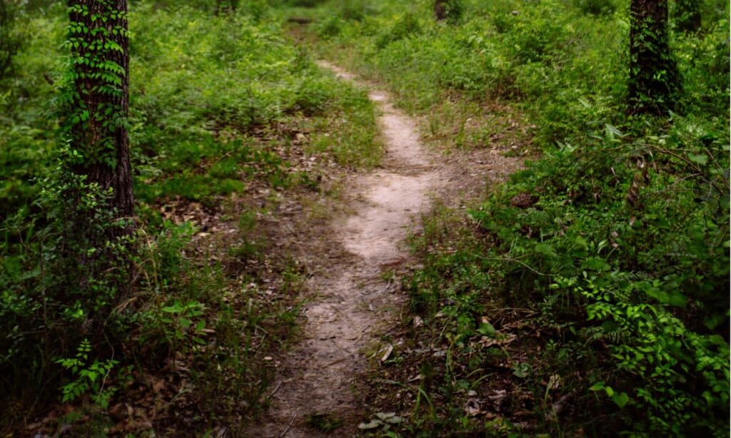
With two national parks, twelve nationally protected areas, and eighty state parks and leisure facilities, Texas is the second-biggest state in the United States. The Lone Star State features one of the country’s most diversified ecosystems, so you may go through marshes, woodlands, grasslands, plains, and beautiful, rocky desert hikes. Hiking is the most effective way to discover these natural areas.
Texas has plenty of good hiking opportunities, including arid canyons, crystal-clear streams, and woodlands. In this article, we’ll talk about the longest of them all. We’ll cover everything you need to know about the trail, including the history of the trail, a brief description, the best times to hike, and hiking the trail. There is also a section covering the Lone Star Hiking Trail Club.
Let’s get down to it!
The Longest Hiking Trail in Texas: Lone Star Hiking Trail

The Lone Star Hiking Trail offers views of the East Texas landscape, including magnolia trees, thick pine forests, and sections near Lake Conroe.
©iStock.com/va103
If you’re searching for a challenging hike in Texas, look no further than the Houston area. The Lone Star Hiking Trail (LSHT) is the longest hiking trail in the state, with approximately 130 miles of pathway running through the Sam Houston National Forest. It is the only long-distance National Recreation Trail in the state. It goes across Sam Houston National Forest, which is about an hour north of Houston. The LSHT offers hikers a taste of East Texas landscape, including lovely magnolia trees, thick pine forests, and sections near Lake Conroe. It also has a relatively flat topography with spectacular wildflower displays in the spring and autumn.
History
The construction of the Lone Star Hiking Trail was authorized by the U.S. Forest Service in 1967. The Boy Scouts of America, the Sierra Club, and others were involved in marking and building the first 20 miles, which were finalized in 1968. In 1972, the path was officially handed over to the USFS, and in 1978, an expansion was approved and implemented. The Lone Star Chapter of the Sierra Club was created in 1996.
Description

The Lone Star Hiking Trail stretches 96 miles across the Sam Houston National Forest.
©iStock.com/va103
The Lone Star Hiking Trail stretches 96 miles across the Sam Houston National Forest (approximately between Richards and Cleveland). The path has roughly 128 miles of clear pine and hardwood forests, flowing rivers, and the infrequent marsh if you want to include loop trails which are wonderful for day walks. The trail provides various hiking opportunities, from short family outings to overnight backpacking adventures, with handy markings along the way. Hikers are permitted to camp for most of a trail (except when camping is limited to hunter camps and dedicated hiking sites during hunting seasons). Close to the trail, several campgrounds are built with restroom facilities and activities like canoeing and fishing.
Old hardwoods, tall pines, and thick, vine-tangled woodland cover the trail, which is sometimes separated by distant lakes, streams, and creeks, some of which are home to alligators. Many people believe that the other half of Texas – the left part, west of Austin – is the Texas wilderness. However, while the LSHT lacks the high-desert atmosphere of Big Bend or the limestone hills of Central Texas, the tranquility of its deep woods will teach you what true Texas wildness is. Even though the terrain is flat, it is rough as hell.
Best Hike Times
Because Texas summers are exceptionally hot and humid, the ideal times to explore the trail are likely in the spring and autumn, whether for a round trek, a double-back, or training toward completing a thru-route. Spring and autumn hikes provide moderate temperatures and spectacular Texas colors, which are essential for safety and aesthetics.
Access and Camping
There are 15 trailhead parking spots along the path and two campgrounds, viz. Stubblefield, about 15 miles from the trail’s western end, close to the northern edge of Lake Conroe, and Double Lake, about 20 miles from the eastern end. Other than deer hunting season, you can set up camp at any off-trail location. Nonetheless, there are numerous entry points to the path and multiple rest stops.
Hiking the Route
If you’re coming for the first time and want to see other Lone Star Hiking Trail areas, the Magnolia Section is a must-see, especially in the spring when the trees are in full glory. The entire path (the 96-mile route solely) is expected to take about ten days to be completed at a leisurely pace, with adequate resources, and in favorable weather for those who are enthusiasts and well equipped. Apart from September to January, when there are limitations in place, camping is allowed throughout the year, and there are dedicated campgrounds and sites along the trail. If you’re planning a multi-day hike, always plan ahead, prepare properly, and have contingencies in place.
You don’t have to travel the entire 130 miles, which may occasionally be used as a training field for thru-hikers on the Pacific Crest Trail and the Appalachian Trail. You can cover a few miles or spend the weekend trekking around one of the trail’s campsites on a day excursion. Short tours or overnight stays will give a good idea of what this unique region offers, with its highly wooded trails, plentiful animals, and nighttime coyote howls.
The Lone Star Hiking Trail Club

The Lone Star Hiking Trail Club was founded in 1995 to disseminate information about the trail and provide volunteer opportunities.
©Michael Allyn/Shutterstock.com
Houston’s local Lone Star Hiking Trail Club is the best repository for all matters trail-related. They’ve published a trail guide for thru-hikers that includes constantly updated information on trail environments, water sources, and much more. Whether you’re planning a day trek or a thru-hike, the definitive handbook, The Lone Star Hiking Trail: The Official Guide to the Longest Wilderness Footpath in Texas, should be your first stop.
The Lone Star Hiking Trail Club (LSHTC) was founded in 1995 to disseminate information about the trail and provide volunteer opportunities. Every second and fourth Saturday of the month, club members go hiking on the LSHT, and they invite anyone interested to join them for free.
According to a Texas Lifestyle Magazine story, in 2014, the club led 962 hikers through 7,602 miles, walking the whole of LSHT 10 times. This is an average of 7.9 miles per event. If you’re looking for more information on guided hikes, check out the organization’s schedule for trip descriptions and meeting points.
Where Is the Lone Star Hiking Trail Located on a Map?
The Lone Star Hiking Trail is a 96 mile long hiking trail with an additional 32 miles of loop and crossover trails that are footpath-only. It crosses public lands of the Sam Houston National Forest, private lands, a corner of Lake Conroe, and Interstate Highway 45.
The photo featured at the top of this post is © iStock.com/va103
Thank you for reading! Have some feedback for us? Contact the AZ Animals editorial team.


