
British Columbia brings mild weather and a temperate climate, proven by the lush and mountainous Cordillera landscape. It makes up Canada’s western border, pressed against the Pacific Ocean. Touching Alaska and Washington, this province contains the third-highest population in its entire country. With sandy beaches and various fjords, finding remote spots in British Columbia is surprisingly easy, depending on the time you want to spend alone.
With the easygoing nature of locals and the beautiful scenery, nearly 3 million international travelers visit British Columbia every year. Where can you go to get away? Rather than visiting the popular Totem Poles in Stanley Park or the sandy beaches of the English Bay, explore one of British Columbia’s remote spots.
Remote Spots To Safety Visit In British Columbia
Atlin
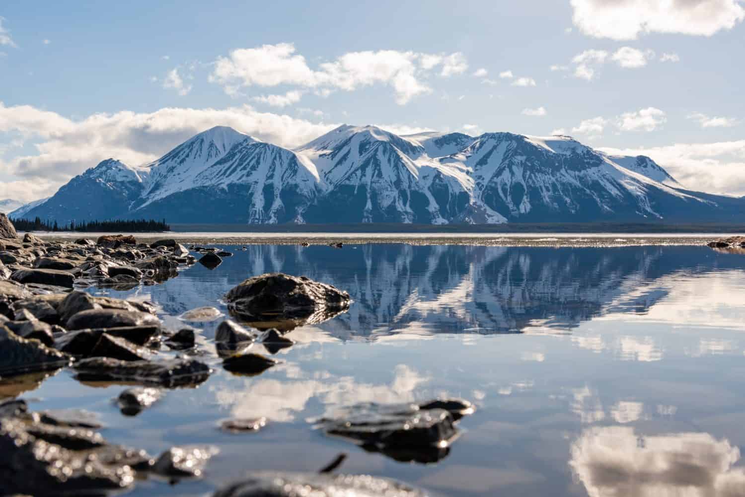
You only need to drive 2-3 hours from Skagway, Alaska, to reach Atlin.
©Scalia Media/Shutterstock.com
Coordinates: 59°34’46.8″N 133°41’13.6″W
With a reputation for its incredible beauty, one of the best remote spots in British Columbia to visit is Atlin. Known for its rich history of gold mining, the Klondyke Gold Rush drove the population to 10,000. While the buildings remain, there are less than 500 full-time residents nowadays. In July every year, an event called Tea on the Tarahne, a social fundraiser for locals on the ship by the same name.
The only way to access this small community is by driving through Yukon when you reach the northern section of YT-37 N and turning left onto Yukon 1 W. You need to stay on this segment of the path for about 335 kilometers before Atlin Road takes you to Surprise Lake Road.
West of Tatla Lake
The nearby community is located in the middle of three mountain valleys and offers a home to less than 200 people.
©Kevin Kung/Shutterstock.com
Coordinates: 51°54’19.3″N 124°35’51.6″W
If you want to get away from the normal noise of the city, taking a trip to Tatla Lake gives you plenty of time to yourself. The lake has a reputation for its kokanee fishing, which is best in the spring and summer. The lake reaches a maximum depth of 38.4 meters and stems from the Fraser River drainage basin.
The best way to get to Tatla Lake is by taking Highway 20 northwest, which goes through Chilanko Forks, Redstone, and Alexis Creek. This highway is the only way to access the area.
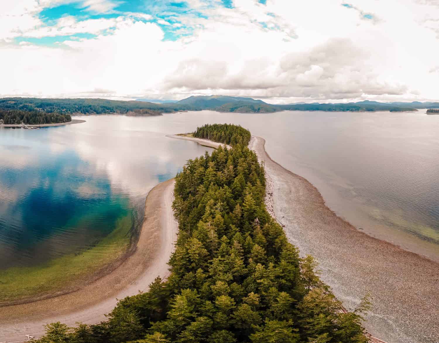
Haida Gwaii
Visit the Pesuta Shipwreck along Haida Gwaii’s shores for incredible salmon fishing.
©Russ Heinl/Shutterstock.com
Coordinates: 53°06’09.4″N 132°02’24.2″W
Found along the western coast of British Columbia, Haida Gwaii is one of the most beautiful remote spots in British Columbia. With a temperate rainforest environment, the remote location has many recreational activities for the few that journey here. The location, which was previously called the Queen Charlotte Islands, features the Haida Heritage Centre, where you can learn more about the local history and culture. The local visitor’s website urges anyone to visit to take the Haida Gwaii Pledge before they arrive.
The only way to reach Haida Gwaii is by using a boat or seaplane to take them across the Hecate Strait. BC Ferries is the popular choice for visitors who want to travel by water, though air service is offered if you want to travel from Prince Rupert or Vancouver.
Triangle Island
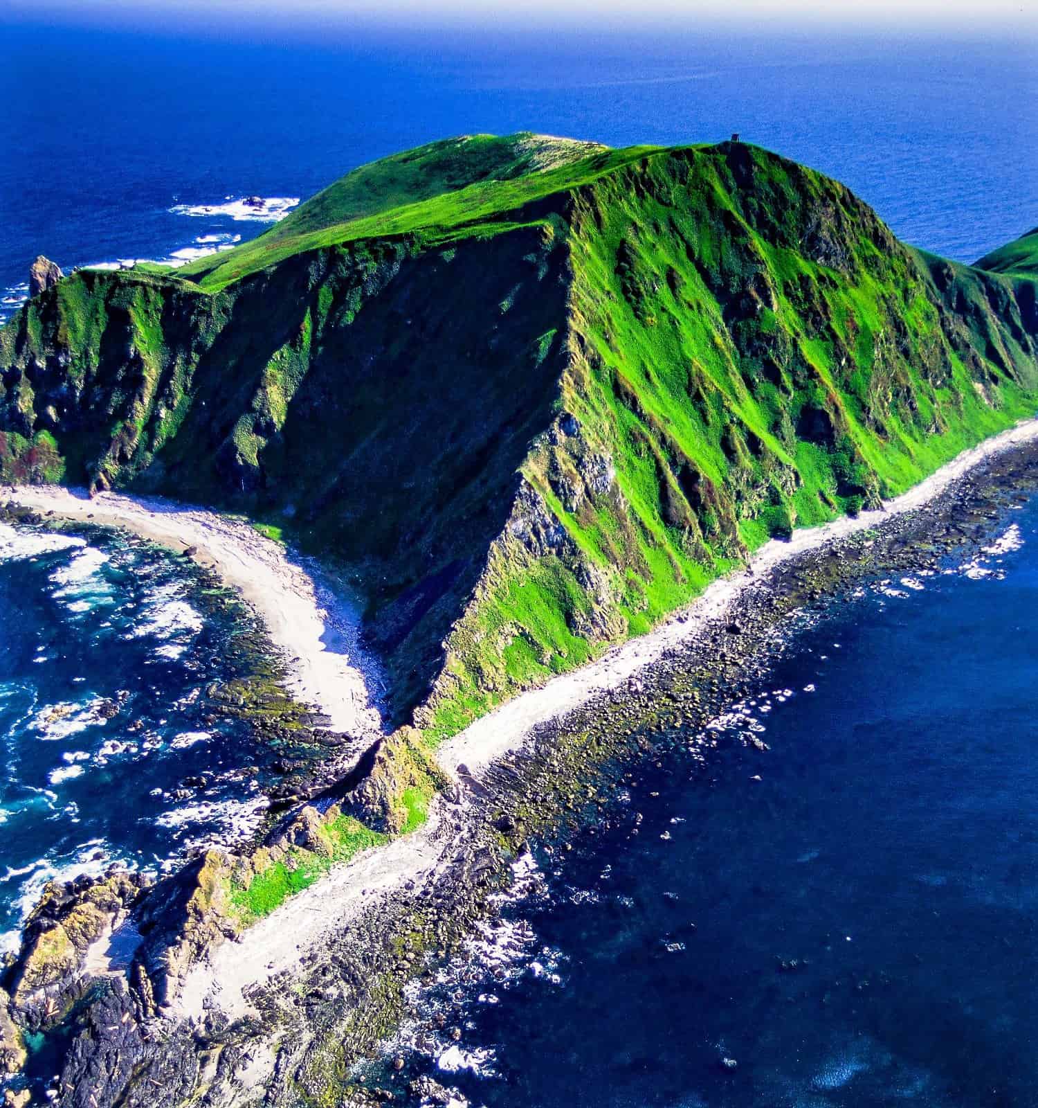
Triangle Island gets its name from the unique shape of the land.
©Russ Heinl/Shutterstock.com
Coordinates: 50°51’50.4″N 129°04’56.2″W
Known for its massive seabird population, Triangle Island spans 290 acres of British Columbia’s land. It has the largest population of Cassin’s auklets in the world. Triangle Island’s frequent and forceful wind keeps trees from growing on the land, but salmonberry and salal bushes cover it. The area has many cliffs and rocky shores, but walking along it isn’t an option.
To see Triangle Island, you need to travel about 50 kilometers from Cape Scott, heading northwest. However, the uninhabited area is a protected space for the seabirds that live there, so the public cannot visit. Only a handful of researchers have been allowed to visit through the years, but you can sit at the corner of Vancouver to gas at the high peaks.
Tweedsmuir Provincial Park
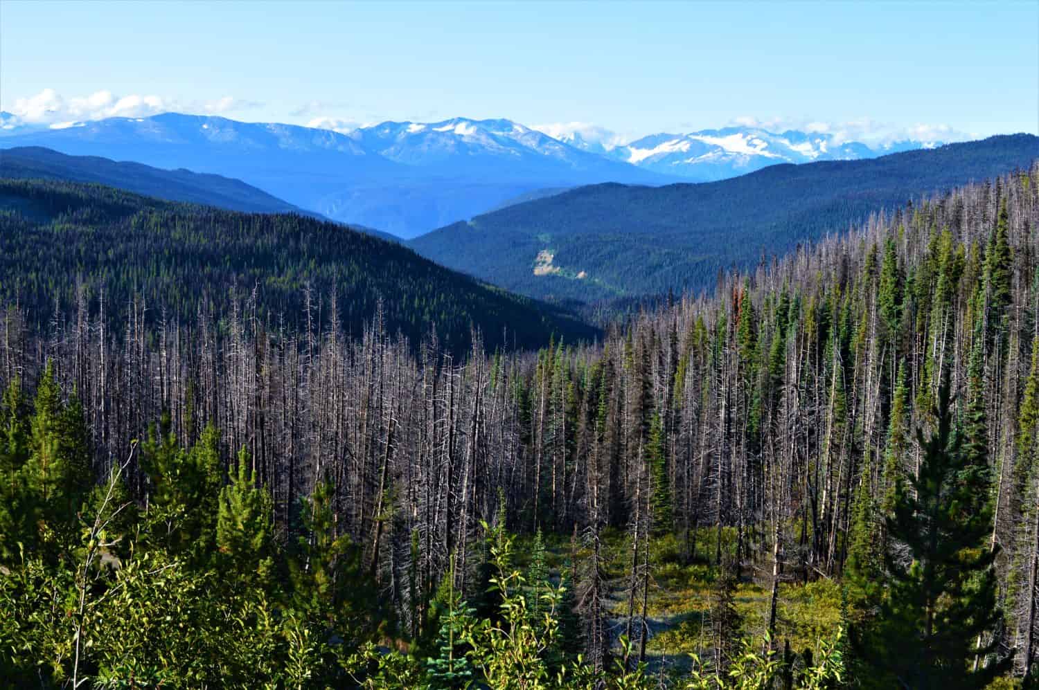
Tweedsmuir Provincial Park has many outdoor recreation activities for anyone who wants to enjoy nature.
©Anna Dunlop/Shutterstock.com
Coordinates: 52°35’44.1″N 126°04’16.2″W
One of the most beautiful (and accessible) remote spots in British Columbia is Tweedsmuir Provincial Park. With boating, camping, hunting, and fishing, this location still gives you space to get away in northern Vancouver. They are open all year with multiple campgrounds. Since the park is isolated and park staff patrols it intermittently, this remote place should only be trekked by someone with wilderness experience and proper supplies. The area is known for both grizzly and black bears, particularly from May to October, because of the abundance of salmon in the Atnarko, Bella Coola, and Dean Rivers.
The park is near Bella Coola, surrounded by the Ootsa-Whitesail Lakes reservoir and the Coast Mountains. It takes about 10.5 hours to drive from Vancouver, heading west on BC-20.
Quadra Island
One of the many places to check out at Quadra Island is Beeches Mountain, a 2-kilometer wilderness trail that offers a major challenge to experienced hikers.
©fokke baarssen/Shutterstock.com
Coordinates: 50°08’59.1″N 125°16’32.6″W
Quadra Island is the home of 2,700 residents in the Discovery Islands. Most people live here for the scenery and outdoor activities, venturing to Quathiaski Cove and Picturesque Heriot Bay. Maude Island and Cape Lazo offer incredible scuba diving opportunities. If you want to stay above water, you can also take a canoe on the water for a different view.
To get to Quadra Island from Vancouver, your drive takes a few hours, but you need to board a ferry to Nanaimo and from Nanaimo to Quadra Island. Though the time to travel is at least 10 hours to and from the island, the beautiful scenery makes it easy to pass the time.
The 7 Most Remote Spots in British Columbia And How to Safely Get There: A Summary
| Location | Coordinates |
| Atlin | 59°34’46.8″N 133°41’13.6″W |
| West of Tatla Lake | 51°54’19.3″N 124°35’51.6″W |
| Haida Gwaii | 53°06’09.4″N 132°02’24.2″W |
| Triangle Island | 50°51’50.4″N 129°04’56.2″W |
| Tweedsmuir Park | 52°35’44.1″N 126°04’16.2″W |
| Quadra Island | 50°08’59.1″N 125°16’32.6″W |
The photo featured at the top of this post is © Chris Babcock/iStock / Getty Images Plus via Getty Images


How to Add Us to Google News


Thank you for reading! Have some feedback for us? Contact the AZ Animals editorial team.