
Illinois spans 57,915 square miles in the Midwestern region of the US. Its largest and most popular city is Chicago, which is located on the southwestern shore of Lake Michigan. However, you might be wondering which states border Illinois. Illinois currently shares a border with Indiana, Iowa, Kentucky, Michigan, Missouri, and Wisconsin. So, keep reading to discover everything you need to know about them!
Indiana
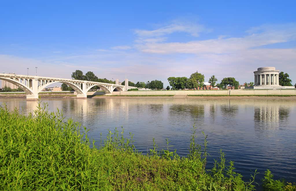
A section of the border between Indiana and Indianapolis follows the Wabash River.
©SNEHIT PHOTO/Shutterstock.com
Border length: Approximately 300 miles
One of Illinois’ longest borders is that which it shares with Indiana, being approximately 300 miles long. In the northern region, the border begins in the Chicago area of Lake Michigan before heading south in a straight line. It then joins the Wabash River, which it follows until it reaches the Ohio River and the Kentucky border.
Indiana spans 36,421 square miles and has an estimated population of 6.85 million. The capital is Indianapolis, which is also the largest city with a population of around 871,500. Indiana is known for its motor racing, hosting the popular Indy 500 every year. The state is also known for its extensive farmlands as well as its largely flat topography.
Iowa

The vast Mississippi River marks the boundary between Illinois and Iowa.
©dangarneau/ via Getty Images
Border length: Approximately 200 miles
The border between Iowa and Illinois follows the Mississippi River for its entire length of approximately 200 miles in a section to the northwest of Illinois between the Illinois-Missouri border and the area where the Illinois-Wisconsin border begins. Although there are a few slight deviations along the route, the border is largely in the center of the river for its entire length.
Like Indiana, Iowa is known for its large farming industry and is one of the leading producers of pork. Iowa has a population of approximately 3.2 million people, with the major cities being Cedar Rapids, Davenport, and the state capital Des Moines.
Kentucky

The border between Illinois and Kentucky closely follows the Ohio River.
©Corey B Stevens/Shutterstock.com
Border length: Approximately 110 miles
Also following a river, this time the Ohio River, is the border between Kentucky and Illinois. The border is approximately 110 miles long and is mostly located on or close to the Illinois side of the river.
Kentucky is most famous for its horse racing industry, especially given the location of the Kentucky Derby, which is held in the state every year. However, it’s also known for its whisky and bourbon, with several large distilleries in the state. The capital city is Frankfort, but the largest is Louisville, which is also one of the most popular cities to visit.
Michigan

The border between Michigan and Illinois is located in Lake Michigan.
©Jake Hukee/Shutterstock.com
Border length: Approximately 55 miles
The most unique border in Illinois is the border between Illinois and Michigan which is approximately 55 miles long. This border is a water border that is located within Lake Michigan itself. Illinois owns 1,526 square miles of the lake and has 63 miles of shoreline, 22 miles of which are in the Chicago area. Lake Michigan is one of the Great Lakes and is the second-largest by area, spanning 22,404 square miles. Illinois and Michigan are not the only states to border the lake, with Indiana and Wisconsin also sharing it.
As well as Lake Michigan, Michigan also has thousands of other lakes and a freshwater coastline of 3,288 miles. It is also known for its two peninsulas, which are divided by the Straits of Mackinac. Michigan has an estimated population of 10 million, of which around 112,000 people reside in the capital, Lansing.
Missouri

Kansas City is the largest city in Missouri.
©Sean Pavone/iStock via Getty Images
Border length: Approximately 360 miles
To the southwest, and also bordering Illinois by following the route of the Mississippi River, is Missouri. Again, with the exception of a few slight deviations, the state line is located in the center of the river for approximately 360 miles.
Missouri spans 69,715 square miles and shares its name with the Missouri River, which runs through it. Although the high number of rivers in the state give way to floodplains and rich alluvial areas, the state also forms part of the Great Plains, which can be found in the northwestern region of the state. The capital city of Missouri is Jefferson City, although the largest and most well-known is Kansas City, with a population of around 509,000 people.
Wisconsin

Wisconsin features several rocky and hilly areas in the Western Uplands.
©MarynaG/Shutterstock.com
Border length: Approximately 183 miles
Lying to the north of Illinois is Wisconsin, and the two share a border of approximately 183 miles. The state has several distinctive geographical regions, and the two that touch the Illinois state line are the Western Uplands and Eastern Ridges and Lowlands.
The Western Uplands are largely rocky and hilly areas, with numerous rivers and streams crossing them. However, the Eastern Ridges and Lowlands feature a large plain that is situated at elevations between 700 and 900 feet, as well as a slope with two significant ridges. The western end of the state line begins at the Mississippi River, while the eastern end crosses through several smaller lakes before it ends in Lake Michigan.
Although the capital is Madison, the largest city in Wisconsin is Milwaukee, with a population of approximately 555,640. Wisconsin is particularly well-known for its dairy products, but especially cheese, and is often called “America’s Dairyland”.
The photo featured at the top of this post is © EleSi/iStock via Getty Images


How to Add Us to Google News


Thank you for reading! Have some feedback for us? Contact the AZ Animals editorial team.