
British Columbia welcomes millions of tourists annually, making their highway system crucial to travel for visitors and locals. With radiant landscapes and recreational sports, this province offers plenty to do, but you might need to travel the steepest highway to get to your destination. What is the steepest highway? What kind of animals might you encounter? Find out these answers and more.
What Is The Steepest Highway in British Columbia?
British Columbia, the capital of Canada, has 67 numbered routes within its highway system.
©pr2is/iStock via Getty Images
British Columbia’s steepest highway is British Columbia Highway 5. Entirely within the Yellowhead Highway, the area south of Kamloops is called Coquihalla Highway, which formerly collected tolls until 2008. The area north of this point is called the Southern Yellowhead Highway. Covering hundreds of miles, you reach many dangerous points along the road, mainly when the wet snow accumulates in winter.
Though the start of the highway has a 0 steep grade, it increases to 8% about 5 kilometers in. Along with being steep, the highway takes you through multiple high-altitude areas, reducing air pressure and oxygen. Since you don’t have time to acclimate along the journey, some travelers report difficulties in their breathing on the route.
About British Columbia Highway 5

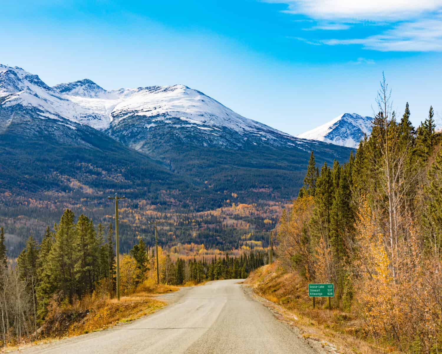
Many areas of British Columbia’s steepest highway bring you into higher altitudes, which may cause breathing difficulty.
While the highway currently connects Highway 3 and 16, it wasn’t the first in British Columbia to have this moniker—the former Highway 5 comprised Highways 97, 97A, and 97B. The local government made slow progress when the Merritt Board of Trade pushed for a new route to access nearby cities. By May 16, 1986, the first of several phases opened the path between Hope and Merritt.
The biggest risks for drivers are the sudden weather changes in British Columbia. Snow can reach 4 inches deep in an hour, and the highway is sometimes shut down when weather worsens.
Animals Along The Steepest Highway In British Columbia
Driving along the steepest highway in the province takes you through a broad assortment of sizeable wildlife. The most common animals you’ll see include black-tailed deer, northwestern moose, and black bears.
Deer
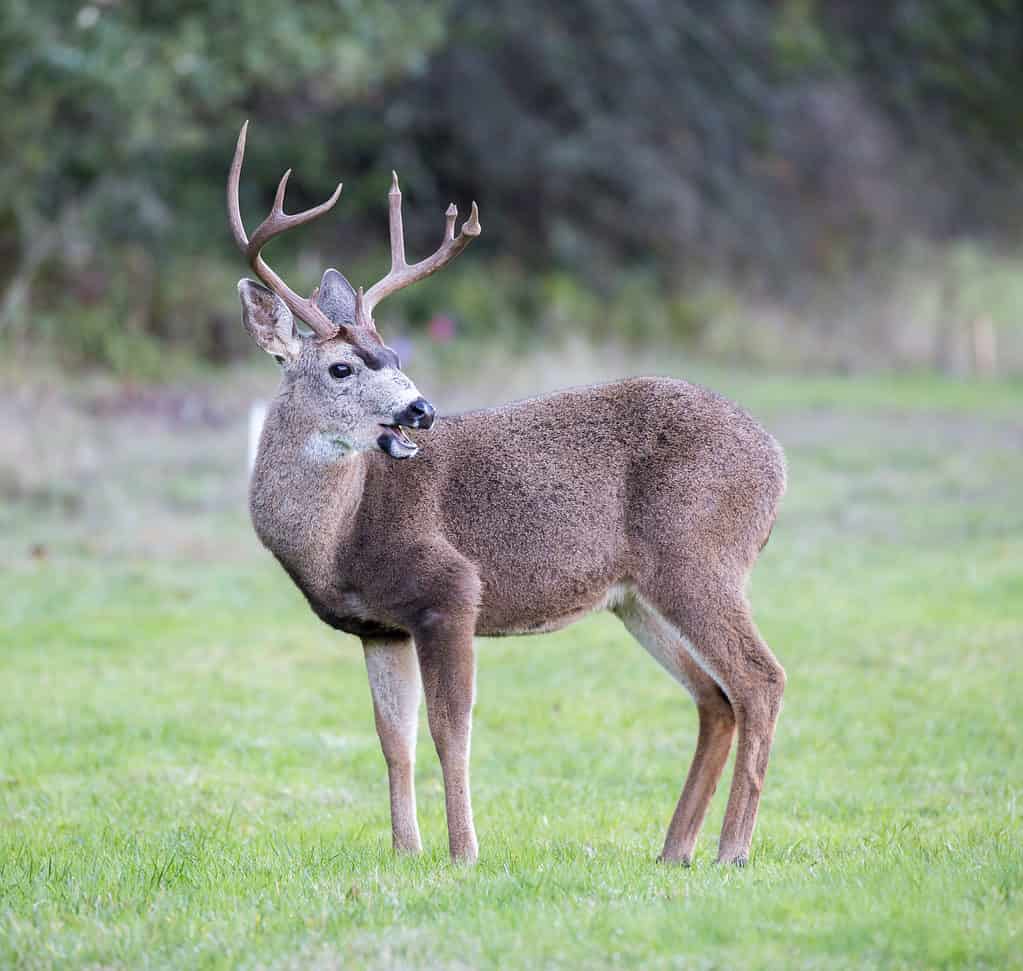
Black-tailed deer and mules are widespread throughout British Columbia.
©yhelfman/Shutterstock.com
While the United States has an abundance of white-tailed deer, the main species in British Columbia is the black-tailed deer. With over 180,000 within British Columbia, they are just as popular as mules, a close relative of this mammal. They prefer areas under 1,000-meter elevation, residing near the highway in areas as close to sea level as possible.
British Columbia’s black-tailed deer tend to live near the coastline. Unfortunately, as their numbers grow, the highway sees a lot of unfortunate collisions during the year. The provincial government manages wildlife, but they sometimes venture closer to homes to eat plants in local gardens.
Moose
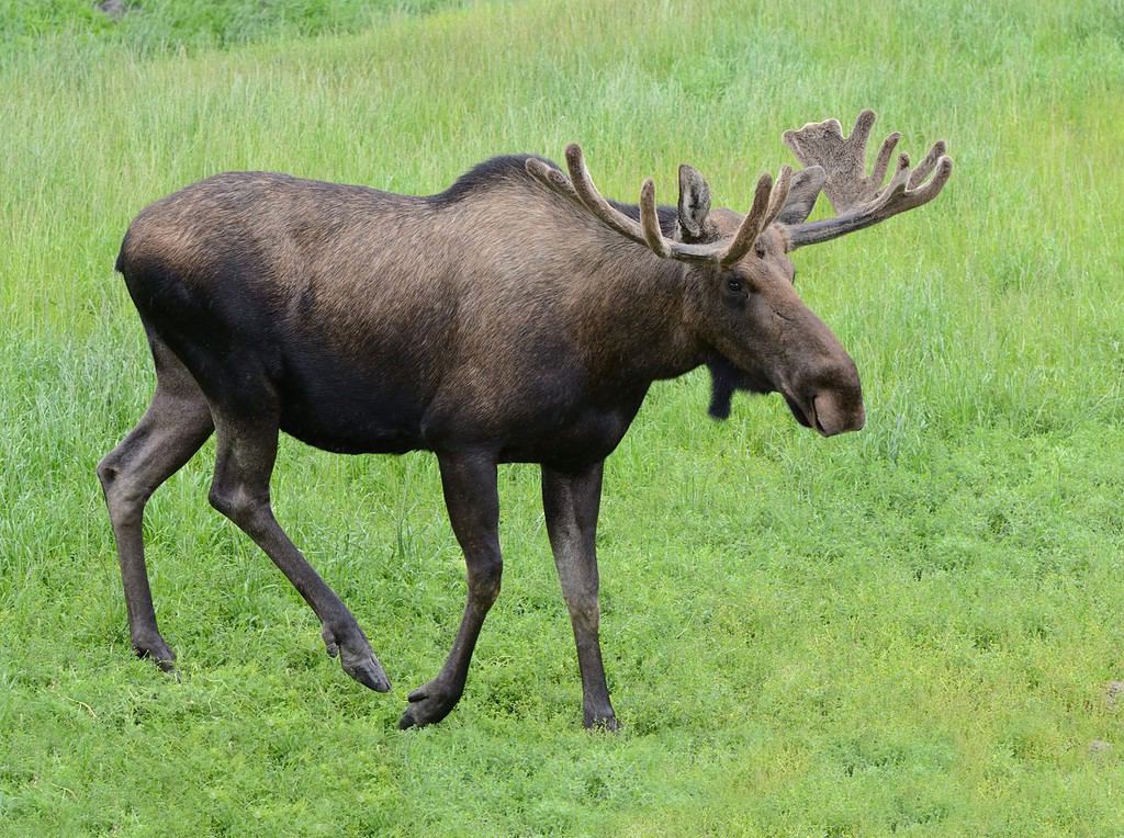
With three subspecies of moose, this mammal is one of the most common creatures to come across while driving on Highway 5.
©Michal_K/Shutterstock.com
Moose are part of the deer family and are just as abundant in British Columbia. As the largest mammals in this group, British Columbia has three main subspecies that trek the highway – Alaskan moose, Shiras’ moose, and northwestern moose. At 2 meters tall, they are pretty easy to see, but they also venture out onto the lower levels of the highway, leading to a similar number of accidents. Their small antlers allow them to fight with others in their species for mates or authority in their group, but the size varies significantly.
Black Bears
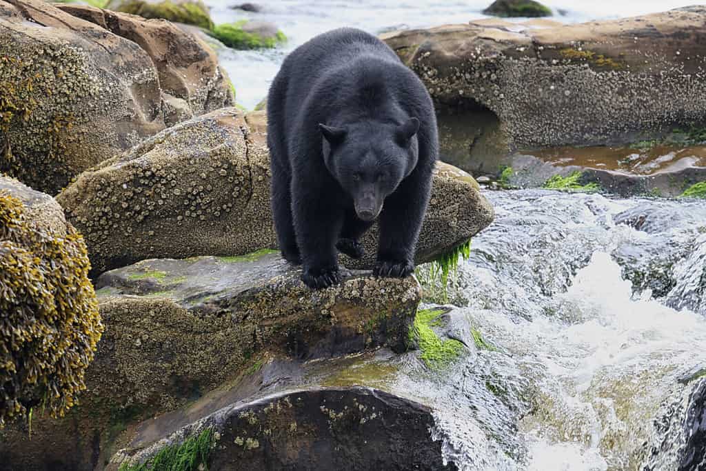
There are over 160,000 black bears in British Columbia.
©Mark Caunt/Shutterstock.com
British Columbia is just one of the many places in Canada where black bears live. Only 25% of the population is in this province, while the rest roam throughout the country. Local authorities estimate that Canada’s black bear population is over 1 million, despite the many vehicular accidents.
Where Is British Columbia Highway 5 On A Map?
Stretching 337.6 miles, the southernmost end of British Columbia Highway 5 is in Othello as an extension of Crowsnest Highway (Highway 3). The northern end of the highway connects to Highway 16 near Tête Jaune Cache.


How to Add Us to Google News


Thank you for reading! Have some feedback for us? Contact the AZ Animals editorial team.