
A National Scenic Byway, State Road A1A passes through most of the cities and towns on Florida’s Atlantic-facing coast, including the lush and exclusive Palm Springs. A1A seems to embody the spirit of Florida itself, from its swampy, pre-air-conditioned history up to the Spring Breaks of today. Let’s ease down this tropical (and subtropical) path through the history of America’s Southeasternmost state. Let’s find out where A1A Scenic and Historic Coastal Byway starts and ends.
Where Does State Road A1A Start?
A1A is a just-over-338-mile stretch of road running from North to South in the State of Florida. It passes through most of its Eastern oceanfront towns as it does, as well as the bustling Miami Beach region. It encompasses certain smaller scenic highways. These include the Ormond Scenic Loop in Volusia County and the Indian River Lagoon Scenic Highway in Cocoa, Florida.
A1A begins at the state’s Southernmost tip, Key West, and passes through the Florida Keys. These are the archipelago of small coral islands at the absolute tip of Florida’s Southeast edge. For a lot of America’s history, the Keys were totally inaccessible without a boat. This only changed with the advent of the locomotive, when a rail bridge connected these isolated islands to the mainland. These railways are in a sense the ancestors of State Road A1A, whose solitary lanes stretch out across the watery expanse in an iconic way.
Though a popular tourist destination, Key West prides itself on its sleepy-town-at-the-edge-of-the-water vibe. It’s the place where the key lime pie was invented. And, with access to the warmest climes of the Atlantic, it’s also a huge bucket-list location for deep sea recreational fishermen. No wonder, then, that the great mid-century novelist Ernest Hemingway made his home here. And easy to see how it helped inspire him to write The Old Man and The Sea.
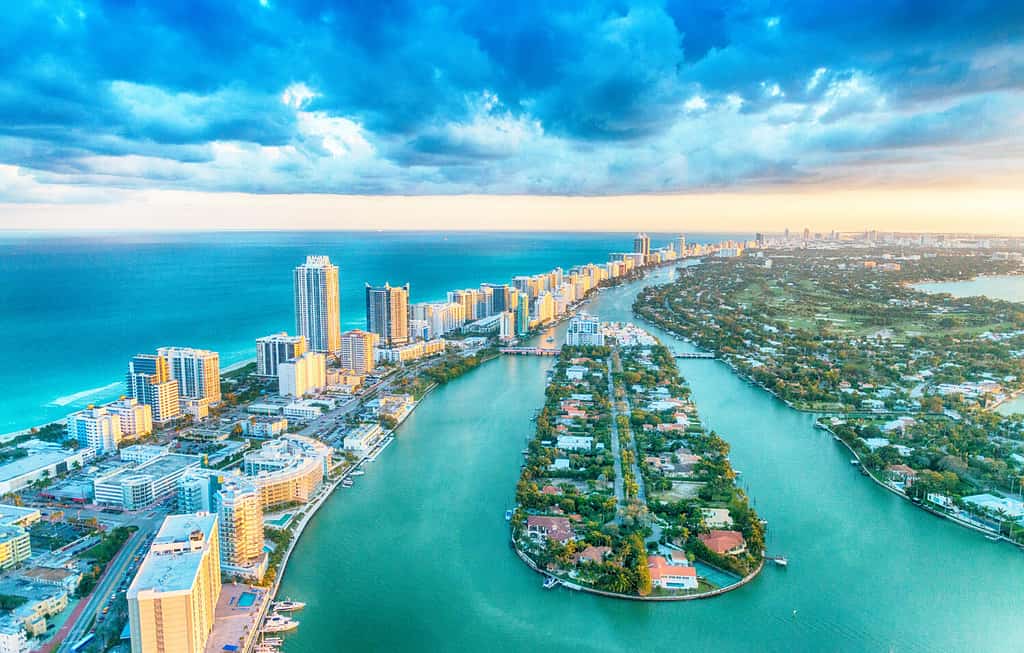
A1A reaches the iconic Miami Beach.
©pisaphotography/Shutterstock.com
Where Does State Road A1A End?
The A1A Byway, having snaked its way from the Florida Keys to the mainland, proceeds along Florida’s Eastern Corridor. It provides drivers with access to every beach town and seaside city between Key West and A1A’s terminus: Fernandina Beach. Fernandina is also on an island — Amelia Island. But this one is right at Florida’s Northeastern border with the State of Georgia.
Aside from being another stunning beach town for tourists and locals alike, Fernandina is the birthplace of America’s shrimping industry. You can attend their annual shrimping festival, a celebration of the delicious crustacean. If you’re not into shrimp, visit any time to see Fernandina’s quaint historic downtown, with artisanal shops and restaurants. For those who like a little buccaneer history with their salt and sand, exult! Fernandina dates back as far as the 1500’s. Its deep, naturally formed harbor made it ideal as a bootlegging pirate town!
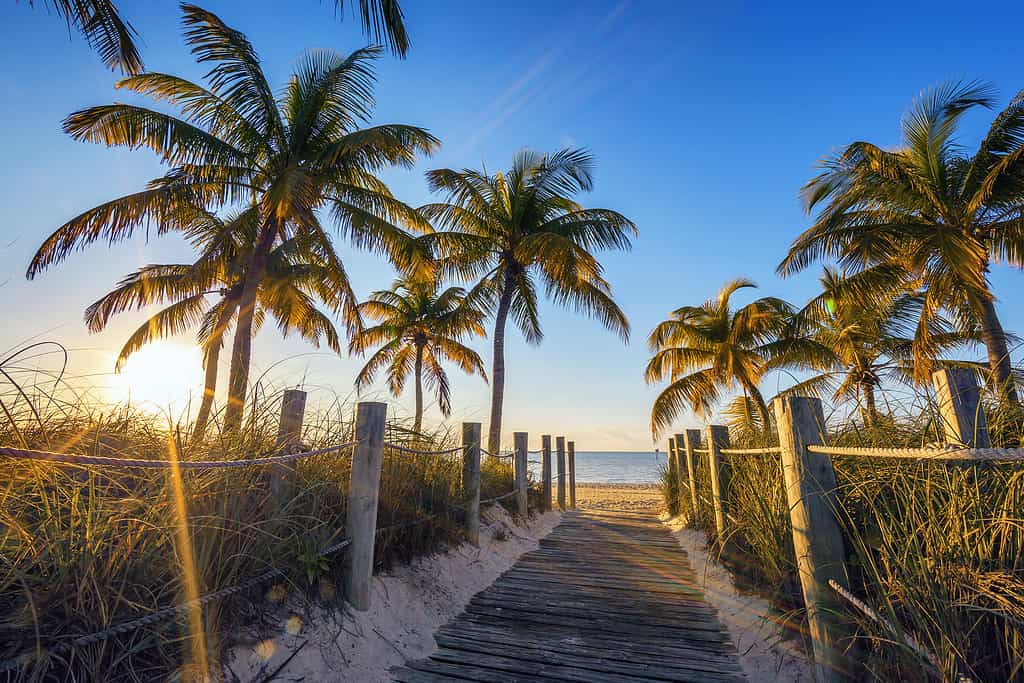
A1A starts in Key West, home of key lime pie.
©frederic prochasson/iStock via Getty Images
The Most Iconic Stop on State Road A1A
Of course, the most famous place A1A takes you is Miami Beach, a city infused with American, Cuban and Caribbean flavor. With an enormously vibrant art scene, an iconic and unique Art Deco skyline, and night life said to rank among the best in the world, there may be no area more scenic on Scenic Route A1A. Miami Beach is also located right on Florida’s Everglades — the biggest subtropical wild space in America. It’s amazing to consider that, steps from one of the most vibrant metropolises in the world, you can find a huge area of protected wetlands, home to numerous endangered species, including the American Crocodile, the Manatee, and the largest cat in North America: the Florida Panther.
More Points of Interest on State Road A1A
A1A is one of America’s most beautiful scenic byways — some people choose to drive it and take in the sights as an activity in and of itself. It frequently runs directly parallel to the Atlantic Ocean. Most of it connects the East Coast Barrier Islands.
With all that proximity to the sometimes-raging Atlantic (especially during Florida’s hurricane season, which is growing more serious due to global boiling), keep in mind: segments of SR A1A can be damaged, or even shut down, due to tropical storms and hurricanes.
A1A might be the most beloved state byway of America’s collegiate party animals: it serves as the town’s main drag in the Spring Break Meccas of Fort Lauderdale and Daytona Beach, and thus finds itself frequently bedraggled in young fun-and-sun-seekers. (That trend goes all the way back to the 1960s.)
Here’s a tip that might help you one trivia night: Scenic Route A1A is the Southernmost numbered highway in the contiguous US.
The photo featured at the top of this post is © Paiboon Chooklin/Shutterstock.com


How to Add Us to Google News


Thank you for reading! Have some feedback for us? Contact the AZ Animals editorial team.