
Located in the heart of New England, New Hampshire is known for its quaint, picturesque towns and its expansive wild beauty. It’s no wonder, then, that one of the top activities for the nearly one million tourists that visit the state each year is taking scenic drives. If you’re planning a road trip through New England, or just want to brush up on your geography, you’ll get everything you need to be road-trip-ready and New Hampshire savvy in this article.
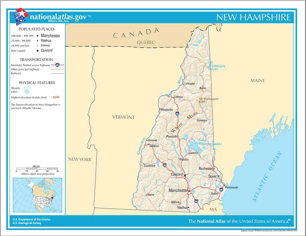
Where is New Hampshire?
New Hampshire is the 10th least populous and fifth smallest state in the United States.
America’s fifth-smallest state is almost the most northeastern state in the nation. Maine, New Hampshire’s eastern neighbor, takes that label. On a map, you see Maine to the right of New Hampshire and Vermont to the left, or east. Directly below New Hampshire is the state of Massachusetts. New Hampshire is roughly the shape of a triangle missing its top point. Across the state’s 58-mile, meandering northern border is the Canadian province of Quebec.
Where the triangle’s southeastern point should be is New Hampshire’s 18-mile Atlantic Ocean coastline sandwiched between Maine and Massachusetts. It is the shortest coastline of any U.S. state. New Hampshire’s beaches look out over the Gulf of Maine.
Latitude, Longitude, and USDA Planting Zones
The state’s latitude is 43° 24′ 38″ north. Its longitude is 71° 33′ 55″ west. Because of New Hampshire’s high latitude, it has extremely harsh winters. The planting zones assigned to the state reflect the severe cold plants must endure each season. The United States Department of Agriculture Plant Hardiness Zone map divides this northerly state into six zones: 3b, 4a, 4b, 5a, 5b, 6a, and 6b.
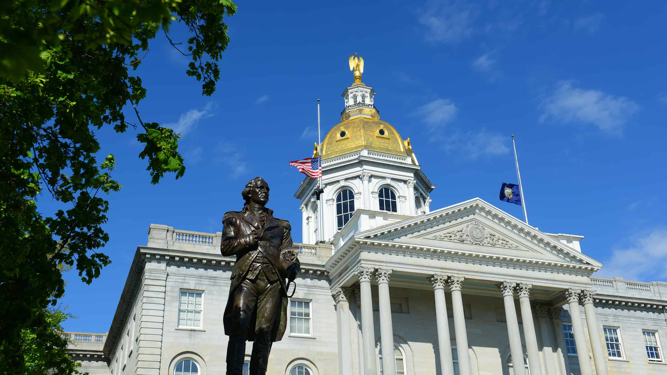
“The Granite State” Geography
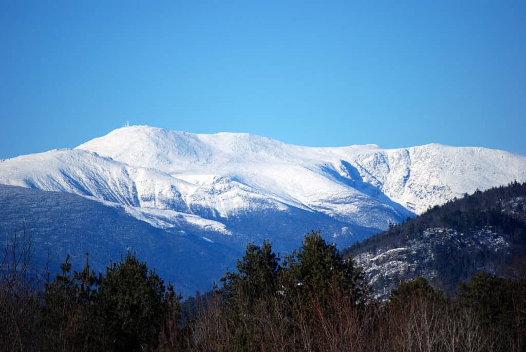
Mount Washington in the White Mountains has the highest peak in the Northeastern United States.
New Hampshire is about 180 miles long and 50 miles wide, although the extreme width is 93 miles. The state’s total area is 9,304 square miles, comprising 9,027 square miles of land and 277 square miles of inland water. Sometimes called the “Mother of Rivers,” five of the great streams of New England originate in New Hampshire’s granite hills. New Hampshire’s nickname is “The Granite State” because of its wealth of granite formations. The state has 1,300 lakes or ponds and around 40 rivers that amount to a total mileage of about 41,800 miles.
The highest peak in the Northeastern United States is in New Hampshire. Mount Washington rises 6,882 feet from the White Mountain range in the north. Eastern New England encompasses most of the southern and central areas of the state. This region is characterized by the Merrimack Valley, the Hills and Lakes Region, and the Connecticut River Valley. The state’s largest lake, Lake Winnipesaukee, is a popular tourist destination in the area.
Finally, New Hampshire’s coastal lowlands comprise the southeastern corner of the state around its short coastline. This area of the Granite State has a mixture of sandy and stony beaches and wetlands further inland.
History of New Hampshire
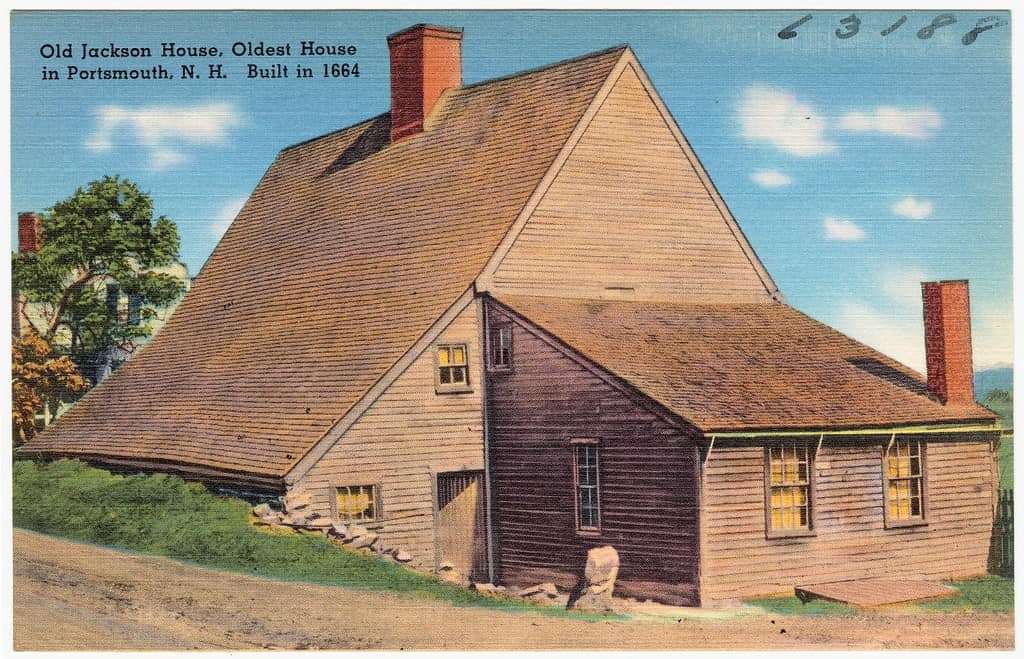
This postcard from the 1930s shows New Hampshire’s oldest surviving wood-frame house built in 1664.
©Tichnor Brothers, Publisher / Public domain – Original / License
The area that is now New Hampshire was inhabited for thousands of years by various Abenaki tribes. In 1623, three years after the Pilgrims landed at Plymouth, the first Europeans settled in the New Hampshire region. Close to 150 years later, New Hampshire became the first state to declare independence from England on January 5, 1776. This was nearly six months before the Continental Congress signed the declaration.
One of the original 13 colonies, New Hampshire became the ninth state on on June 21, 1788. New Hampshire’s motto “Live free or die,” comes from a statement written by the Revolutionary General John Stark. An active participant in the abolitionist movement, New Hampshire provided the Union with at least 37,000 troops during the U.S. Civil War between 1861 and 1865.
After the Civil War, New Hampshire saw rapid industrial and population growth. The state became a center of textile manufacturing, shoemaking, and papermaking. Since 1920, New Hampshire has been the first state in the country to hold its presidential primary election. This status is protected by a state law meant to preserve New Hampshire’s tradition of holding its primary seven days before any other state.
Check out this New Hampshire history timeline created by the New Hampshire Historical Society.
New Hampshire Today
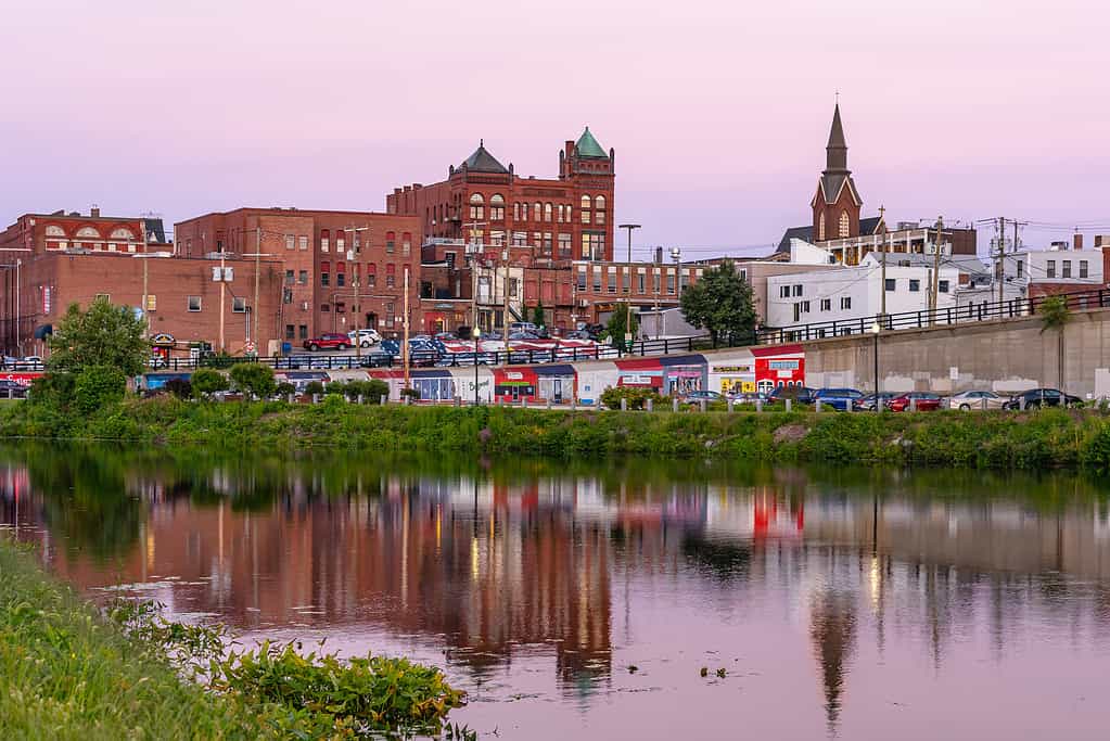
Nashua is just one of New Hampshire’s popular, historic towns.
©Sergey-AND-Marina/iStock via Getty Images
Since the first British settlers established fishing colonies at the mouth of the Piscataqua River, New Hampshire has grown to a population of 1,395,231. There are 10 counties, 13 municipalities, 221 towns, and 22 unincorporated places in the state. Today New Hampshire is the second-safest state in the nation with Maine being the only state to experience less crime.
New Hampshire boasts a thriving outdoor tourism sector thanks to its expansive wilderness, vintage towns, unspoiled lakes, and seashore scenery. Fall is the most celebrated season for road trips or even train rides through the endless sea of red, orange, and yellow leaves as nature prepares for the coming cold. This Peak Foliage Map tells you exactly when the changing leaves will reach their peak performance.
While tourists flock to New Hampshire year-round, winter attracts the most visitors to the state. Some of the best ski terrain in the east is found in New Hampshire where snow sports continue well into July and August. The state boasts some of the highest ski slopes in New England with Loon Mountain coming in at number eight.
Even New Hampshire’s tiny sea coast adds to the state’s appeal. New Hampshire’s only sea city, Portsmouth, would be a great place to end a road trip through the Granite State. Making your way from the towering, majestic White Mountains in the north, past the wooded shoreline and crystal-clear waters of Lake Winnipesaukee, through the brilliant show of colors put on by the region’s trees in autumn, and arriving at the seaside city of Portsmouth would be one of the most perfect trips in the country. Now that you know all about New Hampshire, maybe it’s time for a New England excursion!


How to Add Us to Google News


Thank you for reading! Have some feedback for us? Contact the AZ Animals editorial team.