
Sometimes, it’s just good to get away from everything. In our electronic world, the ability to turn it all off and go for a hike, surrounded by nature, can be healing. If you’ve been searching for the perfect spot to get out and breathe a little fresh air, look no further. We’ve compiled a list of five of the most remote spots in Alabama, complete with GPS coordinates. Pack your backpack, lace up your hiking boots, and grab your walking stick, because you’re going to want to check these beauties out.
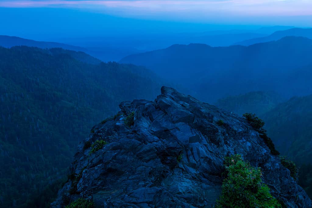
Little River Canyon Natural Preserve is a Remote Paradise
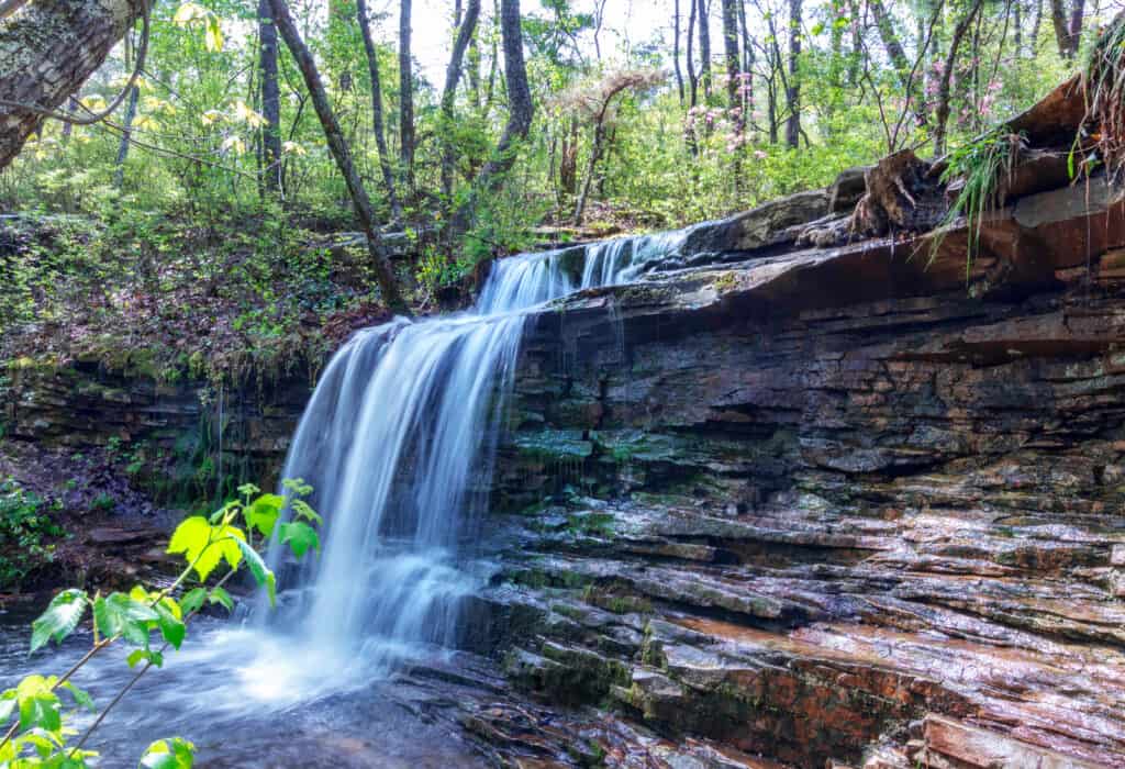
DeSoto State Park often outshines Little River Canyon, but they’re both worth the visit.
©Julie rubacha/Shutterstock.com
GPS coordinates: Latitude: 34 degrees 26′ 26.02″ North, Longitude: -85 degrees 35′ 44.02″ West.
How remote is this spot? This is one of the highest points on Lookout Mountain, located on the boundary lines of DeKalb and Cherokee County.
Where you’ll be: Adjacent to Fort Payne and DeSoto State Park. Congress designated this 15,288-acre spot as a preserve in 1992. Little River Canyon is the deepest canyon on this side of the Mississippi River, carved by the Little River through hundreds of years. Be sure to pack well, though. The closest small town is over six miles away. Today, visitors can camp, swim, fish, whitewater paddle, and hike in the preserve. Several species of endangered plants and animals have found refuge in the area, making it ecologically important. The preserve is also geographically significant as it’s part of the Cumberland Plateau and the southern Appalachian Mountains. There is a $15 cover charge for entry, though the park does offer several free admission days each year.
To reach the top of the canyon, you’ll need to drive twenty-five minutes along the rim. Once at the top, you’ll view almost the entire 700-foot gorge. In addition to hiking, the park offers unparalleled rafting. Little River Falls, DeSoto Falls, and Grace’s High Falls are all within the preserve. All of these features in one place make Little River Canyon one of the most beautiful remote spots in Alabama.
Carmichael Creek in Choctaw County is the Most Remote Spot in the State
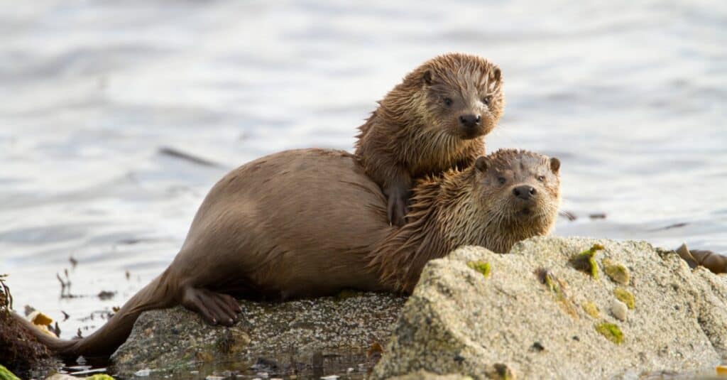
With luck, you’ll see a rare river otter while exploring Carmichael Creek.
©iStock.com/Dgwildlife
GPS coordinates to the most remote spot on the river: Latitude: 32 degrees 06’15″North, Longitude: -88 degrees 23’45: West.
How remote is the spot? Carmichael Creek is just under a three-hour drive to the next major city.
Where you’ll be: the end of Carmichael Creek, in Choctaw County, Alabama.
Why do you want to go there? There are few places with such untouched nature left in the world. Once you reach this end of the creek, there’s nothing but trees for miles. Mammals native to the area include red foxes, coyotes, river otters, beavers, wild boar, and white-tailed deer. Here, anglers can try their luck with shadow bass, while bird watchers can hope to spy a bald eagle among the songbirds and waterfowl. Of course, use caution in your exploration. Note that pygmy rattlesnakes and cottonmouth snakes are native to the area. Be sure to pack well, however, as this is the most remote spot in Alabama. Cell service may be spotty and it’s likely you won’t see another person.
The area was once heavily populated by the Choctaw native tribe. During relocation to reservations, several hundred members of the Choctaw tribe remained in the area. Today, their descendants are part of the MOWA tribe, recognized by the state.
Lakepoint State Park: Remote, With Amenities
The quaint city of Eufala has a secret. Just eight miles away, Lakepoint State Park offers acres of wilderness to explore.
GPS coordinates: Latitude: 31 degrees 59′ 16.19″ North, Longitude: -85 degrees 06′ 32.40″ West
How remote is this spot? Eufaula, Alabama is the nearest town over eight miles away.
Where you’ll be: A1,220-acre state park on the shores of a 45,000-acre lake. While Lakepoint State Park does offer cabins, lodge room rentals, and amenities such as a restaurant and a marina, it adjoins the 11,184-acre Eufaula National Wildlife Refuge. Lakepoint State Park may offer the best of remote spots in Alabama, combining convenience with quick access to wilderness. Visitors can swim in the lake or a swimming pool, while several hiking trails allow for wildlife exploration. Boaters can bring their boats or rent a boat at the marina. The lake proudly carries the slogan “Bass Capital of the World,” drawing anglers during fishing season.
In addition to coyotes, deer, rabbits, and songbirds, the lake is home to one of the largest alligator populations in the state.
Buck’s Pocket State Park: A Small, Remote Alabama Spot
The Appalachian Trail continues through Georgia and Alabama, providing hikers with majestic beauty.
©Joshua Moore/iStock via Getty Images
GPS coordinates: Latitude: 34 degrees 28′ 14.99″ North, Longitude: -86° 03′ 7.20″ West
How remote is this spot? The closest community is Grove Oak, just two miles away. Grove Oak is a small, southern town with less than 600 people in the community. Additionally, Huntsville is the closest big city at over an hour’s drive away.
Where you’ll be: On Sand Mountain, which lies in the northeast portion of the state. Buck’s Pocket is nestled in the Appalachian mountains. South Sauty Creek, a tributary of Lake Guntersville, runs through the 2,000-acre park. The ‘pocket’ in the name refers to an area of the park that’s at the bottom of a deep cavern. Buck’s Pocket State Park was initially established with a land purchase from a local farmer by the Tri-County Park Authority in the late 1960s and expanded with a donation of an additional 700 acres from the Tennessee Valley Authority.
10 miles of cultured trails for hiking as well as a scenic area on Point Rock Overlook are Buck’s Pocket’s highlights. The park was recently renovated, reopening with 23 camping spots for recreational vehicles. Many local legends exist about how the area was named. The most commonly accepted explanation is that the area was once home to hundreds of deer. Trapped by hunters from the Cherokee tribe, one deer jumped from Point Rock rather than be caught.
Bon Secour National Wildlife Refuge/ Fort Morgan
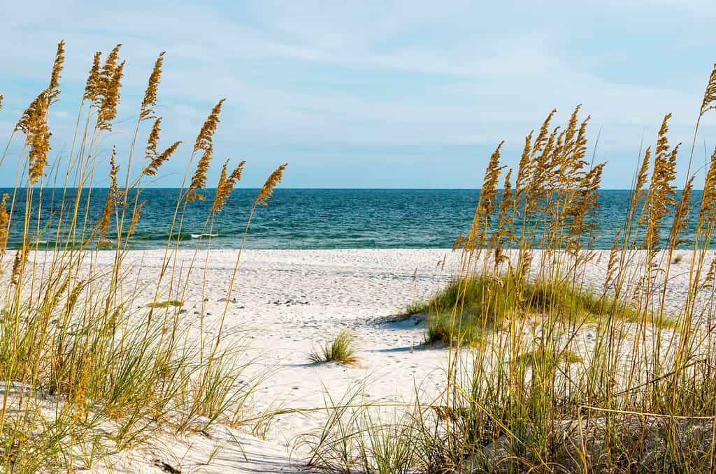
Most people don’t realize that over 7,000 acres of Alabama’s Gulf Coast are protected in a preserve.
©Darryl Vest/Shutterstock.com
GPS coordinates, Fort Morgan: Latitude: 30 degrees 13′ 25.80″ North, Longitude: -88 degrees 01′ 13.80″ West
How remote is this spot? The closest large community is Dauphin Island, seven miles away.
Where you’ll be: While not quite isolated and remote, these beaches are the place to go if you want to enjoy the Gulf Coast without joining a crowd, just 15 minutes north of Fort Morgan, Bon Secour National Wildlife Refuge offers 7,000 acres of untouched, unprotected Alabama coastal land. Established in 1980 by an act of Congress, the refuge is home to sea turtles, migratory songbirds, alligators, and bobcats. Inside the water, natural reef formations grow, protecting local sea life.
The refuge land itself varies from grassland, swamp, lagoons, forest, and dune formations. Fort Morgan was constructed on the Mobile Bay in 1834. In 1864, the fort was the center ground for a conflict in the American Civil War, in which the Union attached a Confederate fleet. The Union won the battle, securing Mobile Bay. These two landmarks are connected by beach and coastal land, giving visitors plenty of opportunity to find an isolated spot to enjoy.


How to Add Us to Google News


Thank you for reading! Have some feedback for us? Contact the AZ Animals editorial team.