
Missouri holds a special place in the hearts of music fans as the heart of jazz, ragtime, and blues. The history of this state is drenched in the memories of these artists who found their inspiration and solitude within the state’s borders. Having a moment alone with their thoughts is crucial to the creative process, and Missouri’s remote spots offer the perfect opportunities to collect them. If you need to get a moment alone, take a drive and a short walk to one of Missouri’s remote spots.
Preparing Safely to Venture Into Missouri’s Remote Spots
When walking through the wilderness to remote spots, bring a compass and a local map to know where you are and how to get back at all times.
©LanaG/Shutterstock.com
As much fun as a long hike through the wilderness, the only way to safely take any of these trips is by being prepared. The US Forest Service recommends visiting any self-registration station when starting on their trails if they plan to be overnight guests. Since some of these remote spots take you near private properties, be aware of any signs that indicate this boundary.
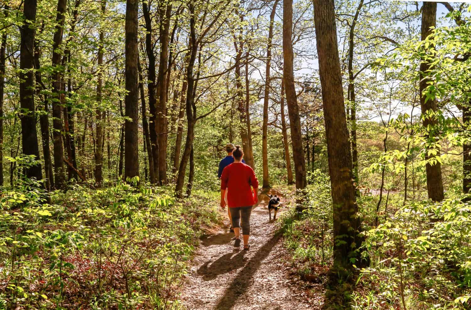
Be considerate of the space around you. These remote spots stay undisturbed and secluded because backpackers, hikers, and other outdoorspeople leave no trace of their presence behind. Treat lightly to avoid local wildlife, and bring the equipment for your whole hike to the remote spots. Travel with a partner when you can, and make sure someone knows where you are in these remote spots. Watch your environment to prevent getting lost in one of Missouri’s most remote spots.
Remote Spots and Trails in Missouri
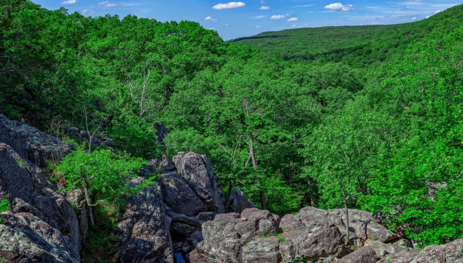
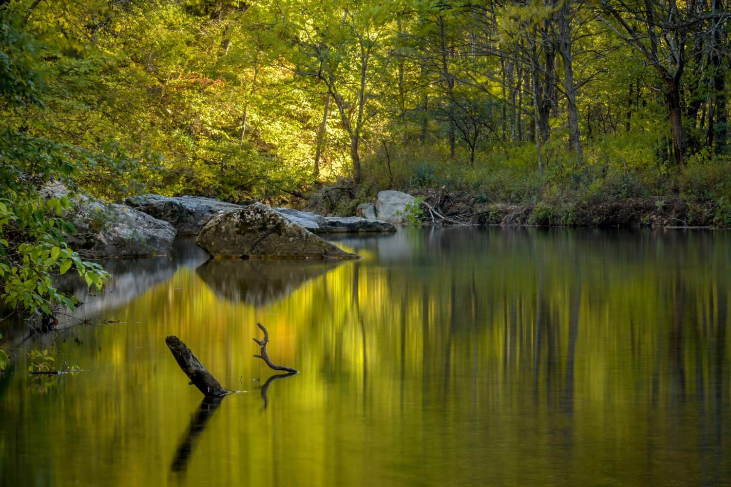
1. Take Long Creek Trail to the Most Remote Spot in the Hercules Glades Wilderness Area
Long Creek Trail takes you to the most remote spot, about 2 miles from the road.
Coordinates: 36°41’02.8″N 92°54’34.9″W
Many hikers say the Hercules Glades Trail offers Missouri’s most remote spot. Found within the Mark Twain National Forest, this area has many different hiking trails to explore the nature of Missouri. The wilderness area is over 12,000 acres; most records indicate it is Missouri’s oldest. Much of the forest consists of red cedar, oak, and hickory trees, but keep looking for poison ivy. If you manage to brush against it, the intense itchiness might derail your entire trek.
If you take one of the other hiking trails in the area, the landscape alone is enough to relax you. With granite boulders and waterfalls on bold display, as you pass, each moment looks more picturesque than the last. A creek flows next to the main trail after rain, though droughts expose the natural limestone, giving an equally unique landscape along the walk.
To reach the remote spot within this wilderness area, you will walk about 2.2 miles into it. Start on the Long Creek trail, which takes you directly to the spot. Walking to the remote spot, you’ll pass wooded forests, creeks, and open areas. For the most part, this area doesn’t see many tourists, but going off-trail gives you a little more distance from other people if you want it. Despite being relatively remote, you still have phone service access when you need it most.
2. Stroll Along Whites Creek Trail In the Irish Wilderness
The Irish Wilderness received official designation in 1984.
Coordinates: 36°44’45″N, 91°10’45″W
In Missouri, the remote spots seem to grow in popularity because of word of mouth, which is how the Whites Creek Trail got a spot on this list, too. Many hikers refer to this trail as one of Missouri’s remote spots in the Irish Wilderness area within the Mark Twain National Forest. While the many caves are enticing, look for any private property signs. Taking White Creek Trail inevitably brings you to the edge of Whites Creek Cave, which the public cannot enter.
Nestled within 16,277 acres, this wilderness area offers a mix of oak and hickory trees but has a fair share of dangers. Sinkholes, caves, and seeps add to the karst topography, and elevation ranges from 1,100 feet to over 2,000 feet. If you want a moment to yourself, take a detour along your walk to either Fiddler Springs or Bliss Springs; if you wish for a steeper path, journey closer to the Eleven Point Wild and Scenic River, where Whites Creek flows. Watch out for snakes, bears, and other wildlife natively living in the Ozarks.
Take the Brawley Pond Trailhead towards the north to the trail and into the Irish Wilderness. If you go further east, you can access the trail with the Camp Five Pond Trailhead.
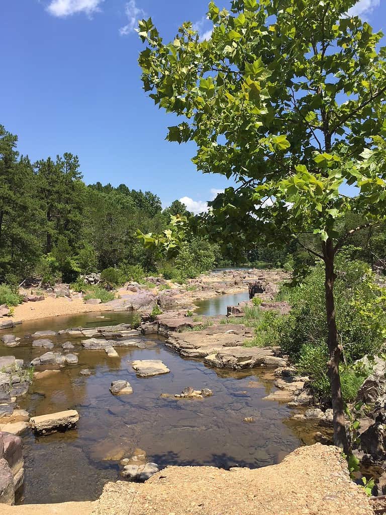
3. Take Brushy Trail Through the Roger Pryor Pioneer Backcountry
Following the natural trail, you pass by many valleys before eventually reaching the Current River.
©Michael Rolands/Shutterstock.com
Coordinates: 36°58’58.6″N 90°44’31.4″W
Brushy Trail allows you to explore the Roger Pryor Pioneer Backcountry. This natural area features Missouri’s oldest white oak trees along the trail. According to local records, some of the trees are 400+ years old. As you go up the ridge, you have many remote sights to explore, like Turkey Pen Hollow or Middle Prong Hollow. However, you can’t reach any of these areas without starting with Brushy Trail.
Accessible through Himont Trailhead, this path is a 15.9-mile loop, taking another 1.9 miles to reach Bee Bluff. It doesn’t take long to reach Brushy Creek, bringing you to a historical narrow-gauge rail line from the 1890s. If you dare to go a little further, you get a rare peek at Brushy, an abandoned town with remnants of what used to be. If you continue along the path, you can take a moment at Current River, where some people camp if they want to make their return journey in the morning.
4. Hike Through the St. Francois Mountains in Bell Mountain Wilderness
Many Bell Mountain Wilderness trails lead into remote areas by creeks and along the mountain range.
©NSC Photography/Shutterstock.com
Coordinates: 36°58’57.3″N 90°44’32.2″W
If you want to travel into the Bell Mountain Wilderness, you can see one of North America’s oldest landforms – the St. Francois Mountains. Spreading across 9,143 acres, the name of the wilderness area comes from the family that formerly hosted a farm at the drainage for Joe’s Creek. If the moving water is soothing for you, then the streams and gorges along the course of the trails offer many secluded spots.
Because of this wilderness area’s rugged and untouched nature, local officials recommend that it is not used by anyone without previous hiking experience. Once you reach the wilderness, you can take the Bell Mountain Wilderness trail to the mountains or one of the many creeks.
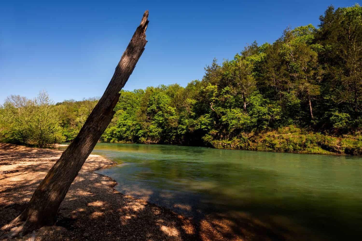
5. Trek Along the Stunning Hiking Trail in Devil’s Backbone Wilderness
The Ozark stream feeds the White River in Devil’s Backbone Wilderness.
©Brian Swanson/Shutterstock.com
Coordinates: 36°43’57.1″N 92°08’51.9″W
Experienced hikers who want a challenge might be interested in the hiking trails along Devils Backbone Wilderness. With incredible waterfalls and tall cliffs, it is just as dangerous as beautiful. There’s no cost to venture into the area, giving you a full range of the 6,687 acres of this wilderness boundary. This area is safe enough to use for day hiking or overnight adventures. If you want to venture into one of Missouri’s remote spots safely, walk along the foot trails or follow along the White River.
Your car only takes you so far to reach the miles of paths to escape it all. The paths can only be traveled by foot or horseback, and there are four trailheads to take. If you start from Dora, the McGarr Ridge Trailhead is available south of the nearby highway. If you use the Blue Spring Trailhead towards the north, following the trail on foot is your only option.
6. Walk Near Table Rock Lake in Piney Creek Wilderness
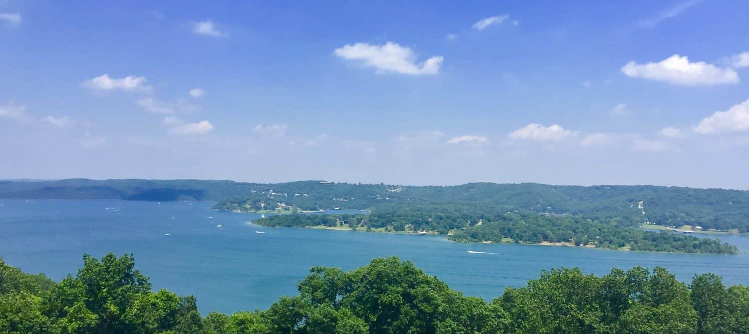
Piney Creek Wilderness covers a broad span of Missouri’s land, giving you a view of dense forests and many rivers.
©Tara Ballard/Shutterstock.com
Coordinates: 36°42’11.8″N 93°36’36.5″W
Established in 1980, Piney Creek Wilderness spans 8,178 acres, making it easy to find a spot to be alone. Table Rock Lake is on the eastern side of the wilderness area. Walking along the trails, you get a clear view of ridges that reach 400-foot elevation. While the region features several rivers and streams, Pine Creek is the main one you’ll see on your walk. If you follow it to its drainage point, you reach Table Rock Lake. Since the walk is about 5 miles, getting there takes a little time, but it is worth the trek.
If you bring the right gear, you can take this walk at any time of the year. The mildness of the Ozark climate makes the journey significantly more tolerable. However, this is one of the many remote places with a lot of private property nearby, so pay attention to any signs indicating the boundary.
7. Journey Through the Rugged Terrain of Paddy Creek Wilderness
Due to the many obstructions in the terrain, only experienced hikers should venture into Paddy Creek Wilderness.
©M.Curtis/Shutterstock.com
Coordinates: 37°31’23.4″N 92°07’28.8″W
Going through Paddy Creek Wilderness comes with a unique set of concerns and skills required. This wilderness area doesn’t have many signs or trail markings, so only experienced hikers take the journey. Since so few people are willing to give this primitive wilderness area a try, it remains primarily unaffected by people. Within the 7,032-acre space, you can check out Big Paddy or Little Paddy Creeks, which have cliffs.
While the creeks usually have plenty of water, none of the natural water sources in this area are safe enough to drink. To ensure that these secluded trails stay remote, leave no trace as you hike and protect the area from trash. With a map of the local area, your journey could take you to Roby Lake or the Paddy Creek Campground.
8. Camp Along Marble Creek in Rockpile Mountain Wilderness
The Rockpile Wilderness is one of the rougher terrains among Missouri’s remote spots.
Coordinates: 37°31’46.2″N 90°37’22.0″W
These places fit the bill if you want a remote spot with beautiful landscapes. However, Marble Creek offers a particular view that no other area in the state has. The creek runs 20 miles, and several trails, like the Ozark Trail or Crane Lake, take you near it. Nestled within the Rockpile Mountain Wilderness area, it sits within 4,238 acres in Madison County, featuring rocky slopes separate from a broken ridge.
Camping fees apply if you decide to take the trail to get away at Marble Creek. While horses can join you along the trail, only humans have permission to walk around the picnic areas and campgrounds. The easiest way to reach one of the trails to Marble Creek is to take State Highway E, traveling about 12 miles (depending on which city you come from). There are no fees if you decide to get away from Marble Creek to explore the rest of the wilderness area.
9. Go On a Hike at the Pinnacles Near Columbia
The Pinnacles Youth Park takes up 70 acres of open space, often used by local groups for youth-friendly excursions.
©Vilkas Vision/Shutterstock.com
Coordinates: 39°08’04.0″N 92°19’20.9″W
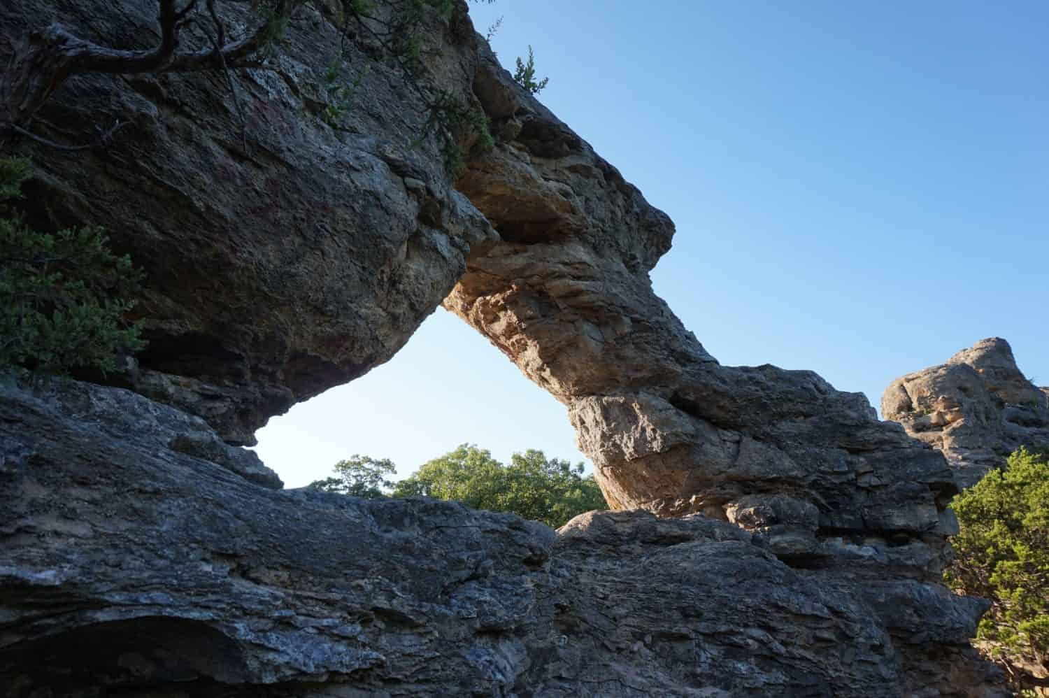
One of the best ways to explore the rich landscape in Columbia is to visit the Pinnacles. With a youth park about 14 miles away from the city, the area is a private park hosted by the Boone County Pinnacles Youth Foundation. However, it is free and open to the public. With widespread limestone and 75-foot formations, the hike is not for acrophobic outdoorspeople.
The Pinnacles are known as a local hidden gem because they offer much more than limestone. Since the 250-million-year-old rock formations that used to be underwater, some people report finding fossilized remains of sea creatures that used to live there. The path to get there is nearly impossible without a map. Luckily, a trail by the same name is accessible with a short trail northwest of Silver Fork Creek, giving you a personal look at Missouri’s archaeological history.
10. Relax at the Biggest Flowing Waterfall in Grand Falls
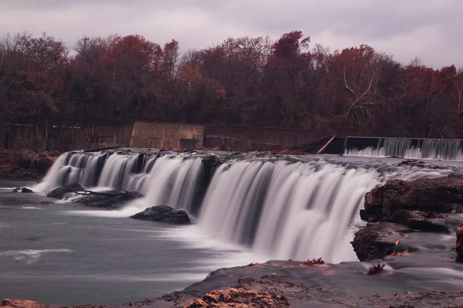
The Grand Falls waterfall is over 160 feet wide with a sharp 12-foot drop.
©Richard345/Shutterstock.com
Coordinates: 37°21’33.6″N 94°33’50.0″W
No nature walk into Missouri’s remote spots would be complete without visiting the incredible waterfall in Grand Falls. It is the largest flowing waterfall in the state, just a tiny distance from Shoal Creek and Wildcat Park. From the top of the waterfall, the drop is 12 feet. With many jagged-edged rocks, this is not a place to go swimming.
With limited signs to mark your path, keep an eye out to know which trail you stay on. Most people bring a physical map along the hiking trails to keep on track, but the sound of water indicates you’re close.
11. Check Out Century-Old Castle Ruins at Ha Ha Tonka State Park
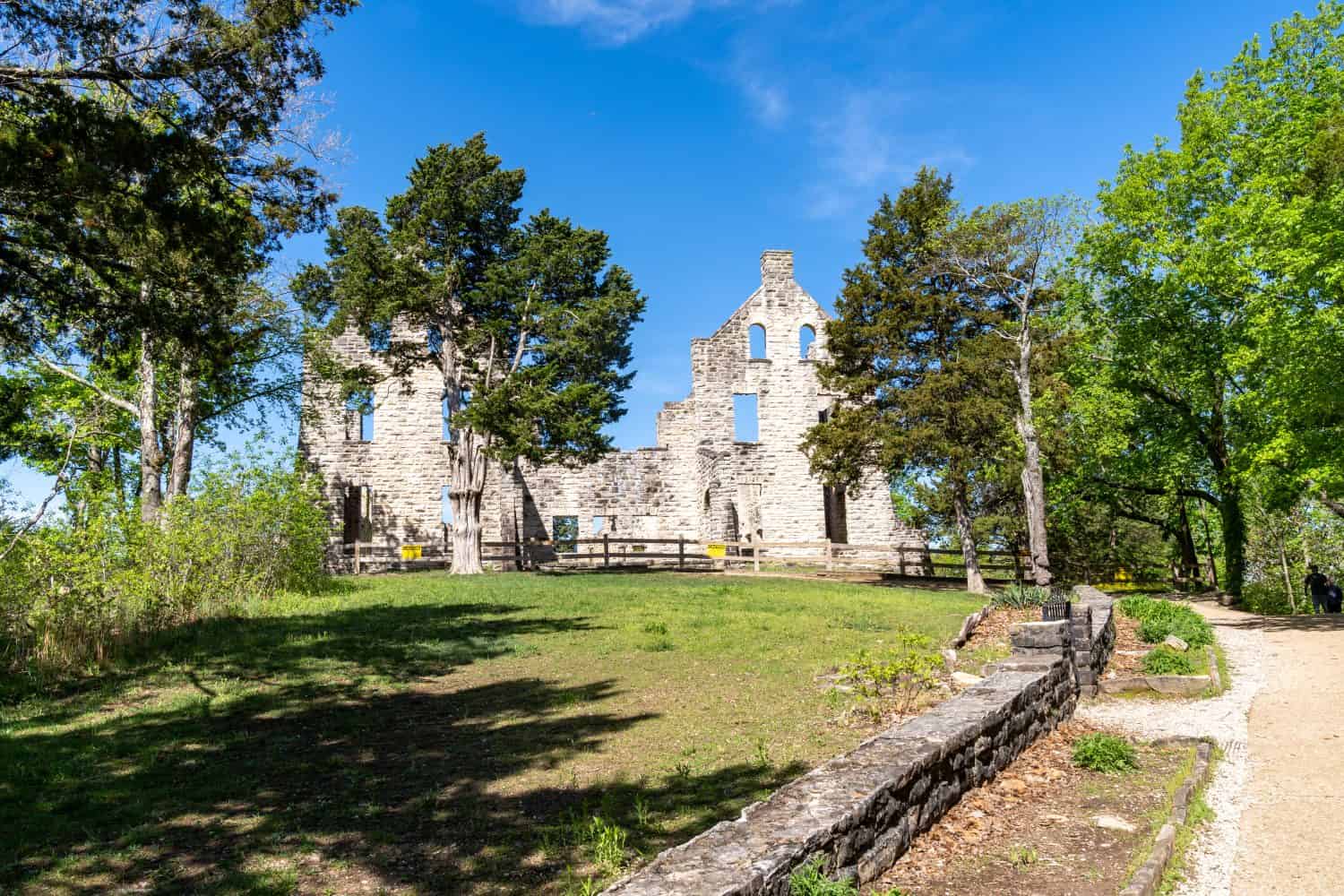
The castle ruins are over 100 years old, giving you a moment in history as you check out Missouri’s remote spot.
©melissamn/Shutterstock.com
Coordinates: 37°58’34.6″N 92°46’11.0″W
No matter how many places you visit in Missouri’s wilderness, the castle ruins of Ha Ha Tonka State Park are unlike anything else you see. Found within the 3,700-acre state park of Camdentown, the castle has stood within the park since 1905, immersed in the woodlands of Missouri. Since it is easy to get lost, this map shows exactly how to reach the castle.
As you venture through the rest of the park, you come across sinkholes, caves, and even a natural bridge. If you take the Spring Trail, you also see the 12th-largest spring in the state. Though the first half-mile of the road is paved, the rest is a dirt path, so keep an eye out for turtles, frogs, and toads in the area. If you need a spot to sit, the trail also takes you to several picnic sites.
12. Visit the Remnants of an Old Hospital Near Welch Spring
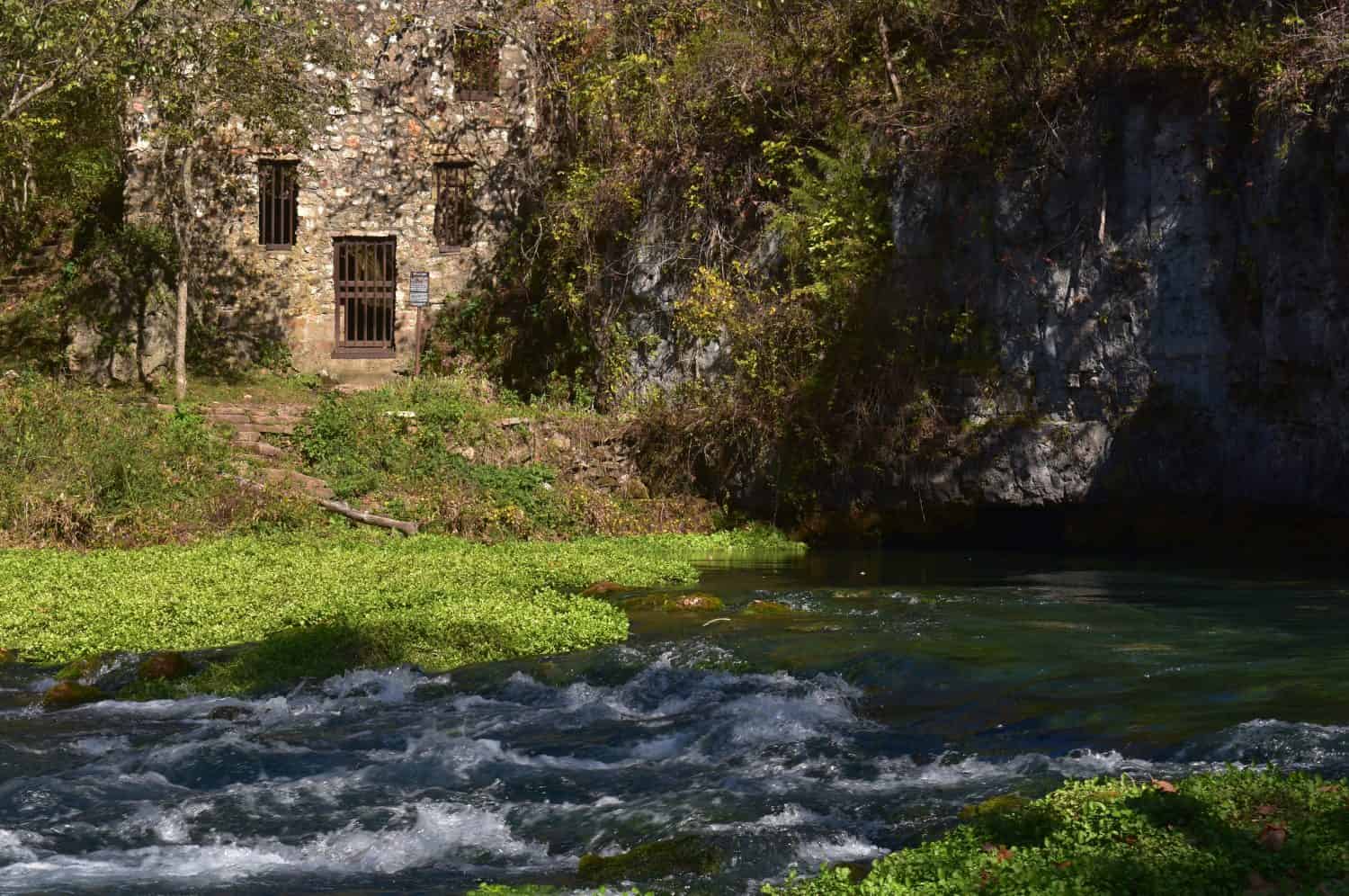
While Welch Spring doesn’t have an official address, taking a trail map and a canoe is the easiest way to reach it.
©Sandra Sapp/Shutterstock.com
Coordinates: 37°23’38.7″N 91°34’27.6″W
The Welch Spring Hospital ruins are just as strange as a sight to see as an old castle in the forest. Dr. C. H. Diehl bought Welch Spring in 1913 to establish a hospital with the healing properties of the spring water. To help treat conditions like asthma and tuberculosis, the Illinois doctor set up the hospital over a cave’s mouth on Welch Spring, where the water flowed from. While it operated as a hospital initially, the services offered with the springs would be more of a health spa in today’s industry.
Even when the hospital and subsequent resort were built, they weren’t functional then and remain that way to this day. The ruins mark a middle ground between Cedargrove and Akers on the Upper Current. The spring is unsafe to swim in, but it separates you from the hospital, so the best way to reach this area is via canoe.
Top Remote Places to Visit in Missouri
| Coordinates | Location |
| 36°41’02.8″N 92°54’34.9″W | Hercules Glade Wilderness |
| 36°41’02.8″N 92°54’34.9″W | 36°44’45″N, 91°10’45″W |
| White’s Creek Trail in Irish Wilderness | Brushy Trail in Roger Pryor Pioneer Backcountry |
| 36°58’58.6″N 90°44’31.4″W | St. Francois Bell Mountain Wilderness |
| 36°58’57.3″N 90°44’32.2″W | Multiple trails in Devils Backbone Wilderness |
| 36°43’57.1″N 92°08’51.9″W | Table Rock Lake in Piney Creek Wilderness |
| 36°42’11.8″N 93°36’36.5″W | Multiple trails in Paddy Creek Wilderness |
| 37°31’23.4″N 92°07’28.8″W | Marble Creek in Rockpile Mountain Wilderness |
| 37°31’46.2″N 90°37’22.0″W | The Pinnacles near Columbia |
| 39°08’04.0″N 92°19’20.9″W | Waterfall in Grand Falls |
| 37°21’33.6″N 94°33’50.0″W | Castle ruins at Ha Ha Tonka State Park |
| 37°58’34.6″N 92°46’11.0″W | Old hospital near Welch Spring |


How to Add Us to Google News


Thank you for reading! Have some feedback for us? Contact the AZ Animals editorial team.