
We are constantly discovering just how dynamic our home really is. Only 400 years ago, Galileo was trying to convince people that our planet didn’t sit still while the rest of the solar system rotated around us. It wasn’t until 1967 that Jason Morgan discovered plate tectonics — the idea that our continents and oceans are connected to moving puzzle pieces floating upon the molten lava of Earth’s mantle. The earth under our feet is in constant motion. The problem is, where the ground goes, we go, and so do our cities. Many U.S. cities are literally sinking into the ground.
Subsidence
Land subsidence is when an area of ground suddenly sinks or settles gradually without moving horizontally. While causes range from heavy buildings compressing the ground below them to the lingering effects of the Ice Age, the most dramatic driver of land subsidence worldwide is draining underground aquifers.
According to a study published in the journal Nature, subsidence could threaten up to eight percent of the land on Earth in the next 20 years. Much of the threatened land lies in coastal areas more prone to sinking, where 1.8 billion people live. This means coastal areas worldwide will be threatened by increased flooding from subsidence and rising sea levels.
While Asia gets a lot of attention — Indonesia is famously abandoning its capital city as 40 percent of Jakarta is now below sea level — many places in the United States are struggling with subsidence. Let’s look at six U.S. cities sinking into the ground.
Houston, TX
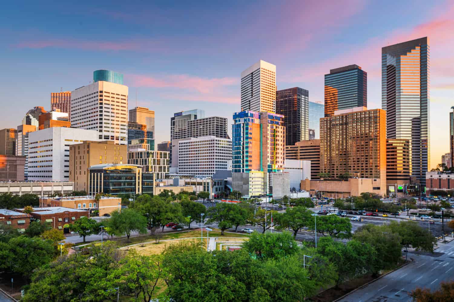
Houston is the 10th-fastest sinking city in the world, and U.S. cities sink the fastest.
©Sean Pavone/Shutterstock.com
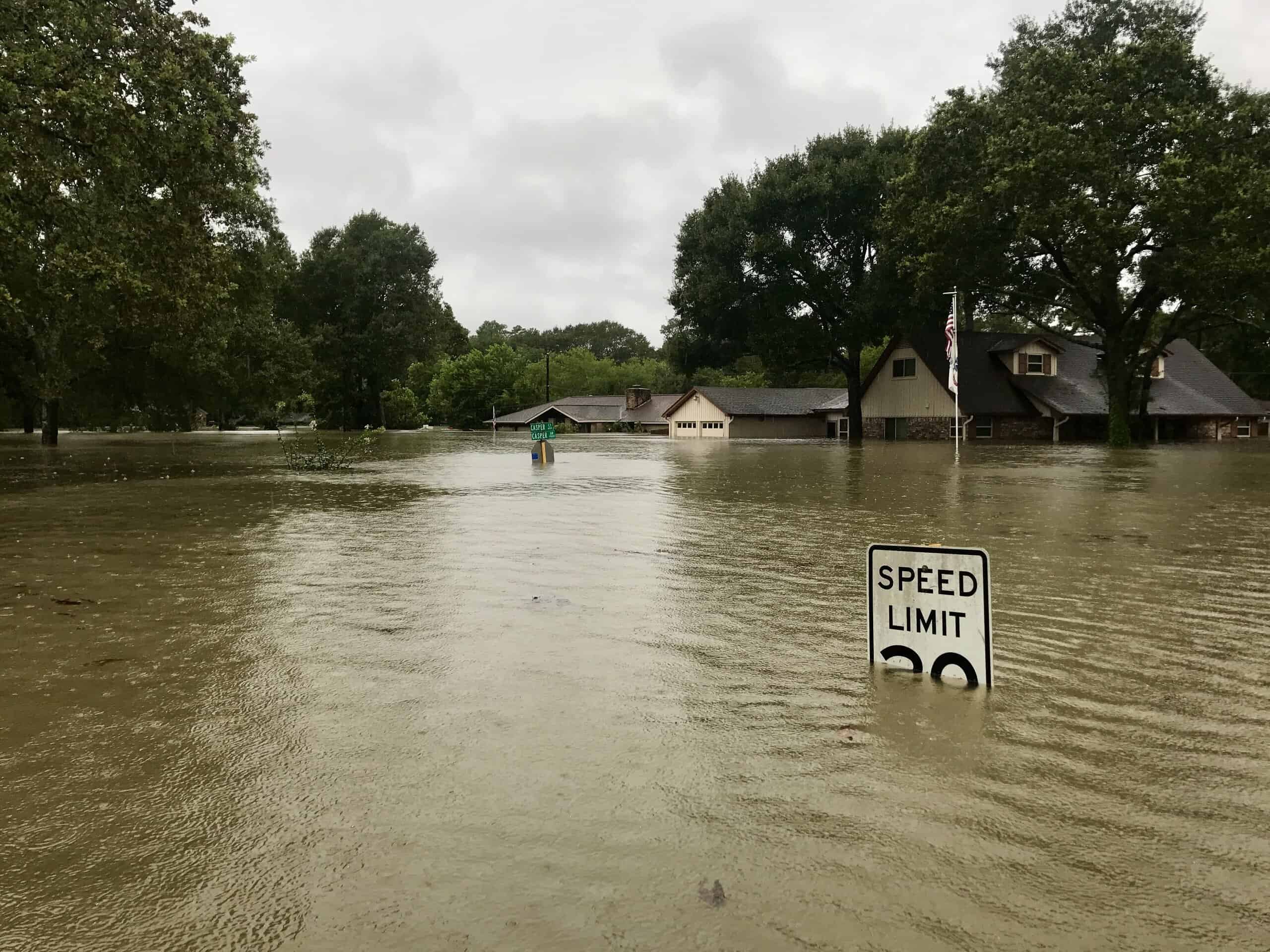
Areas of the Gulf Coast are seeing some of the fastest subsidence rates in the United States. Houston, TX, is the 10th-fastest sinking city in the world with the top fastest rate in the country. The United States Geological Survey reports that the greater Houston area has sunk more than any other U.S. metropolitan area.
From 2014-2020, Houston sunk at about 0.67 inches per year, according to research published in Nature. Certain parts of the area lost almost 10 feet since 1917.
Caused mainly by ground-water pumping but also by oil and gas extraction, subsidence has taken its toll on Houston’s infrastructure. Increased flooding and damage to industrial and transportation infrastructure have motivated the city to take action. Major investments in levees, reservoirs, and surface-water distribution facilities are priorities. Wetland habitat has also suffered substantial destruction.
With extreme weather events like hurricanes common in Houston, the city is at higher risk of damage during storms due to its high subsidence rate. Researchers found that most regions that experienced flooding during Hurricane Harvey in 2017 sank at high rates.
Arbuckle In California’s Central Valley
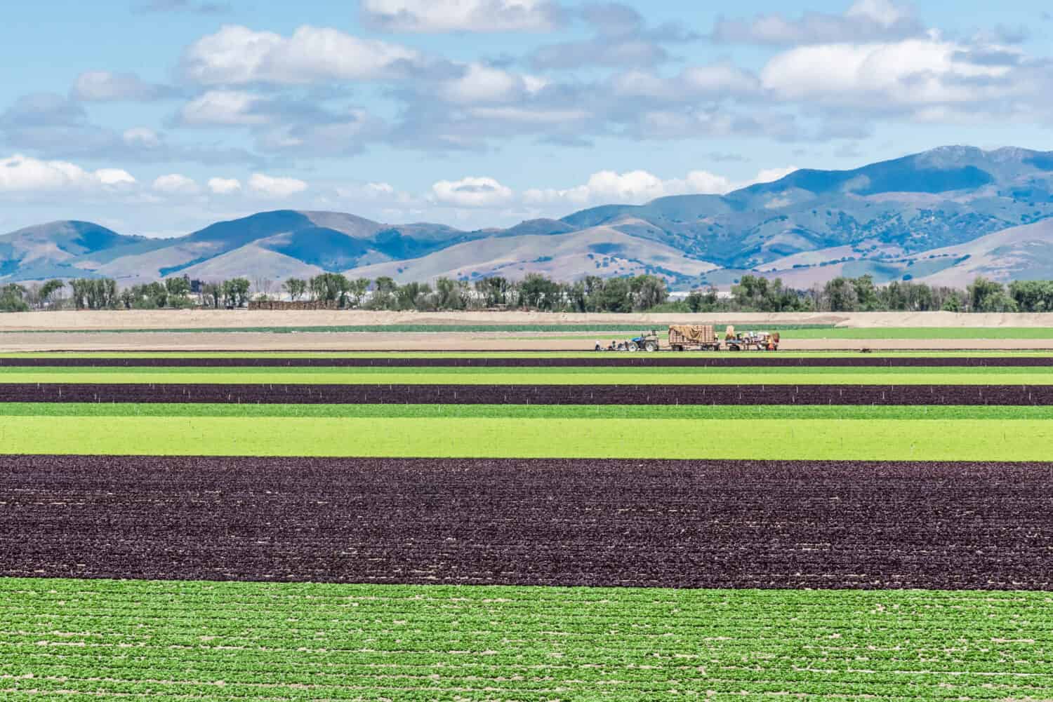
California’s Central Valley produces about 40 percent of the country’s fruits, vegetables, and nuts.
©David A Litman/Shutterstock.com
Although California‘s decades-long record-breaking drought is over, its effects are permanent in the Central Valley aquifer system. When their reservoirs went dry and the state limited water deliveries from rivers, area farmers were forced to pump water for their crops from the extensive aqueduct system below them. As water is pumped above ground, a change in pressure and volume causes the ground to sink.
“The issue is the amount of deepwater pumping below the clay. That is causing the subsidence,” a San Luis Canal water company manager told the Guardian. “The land is sinking as they extract the water below the clay; a pressure differential exists. It pulls the water out of the clay layer, and when it does, the clay collapses. And as it collapses, it brings everything with it.”
About 1,200 square miles of the Central Valley is collapsing at a rate of 2 inches a month. A survey conducted by the California Department of Water Resources found that in the decade between 2008-2018, land in the Arbuckle area of the Central Valley sunk 2.14 feet.
NASA reports even more dramatic sinking in certain areas of the Central Valley. Since the 1920s, according to NASA’s data, sections of the San Joaquin Valley have sunk by as much as 28 feet. Some spots subsided at an incredible rate of 2 feet per year.
New Orleans, LA
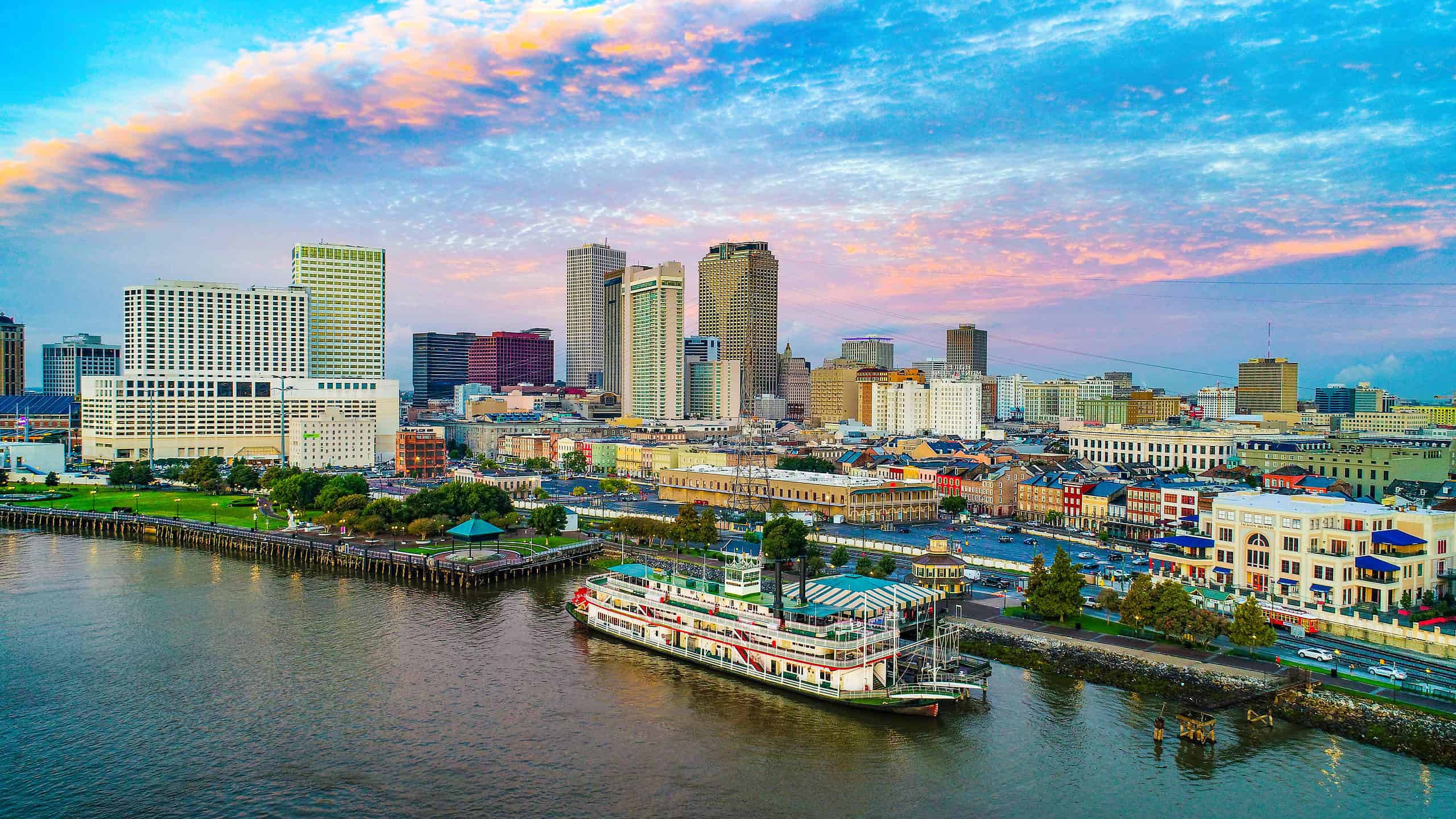
About half of New Orleans lies below sea level and is one of the U.S. cities sinking the fastest.
©Kevin Ruck/Shutterstock.com
Parts of the Big Easy are sinking due to a combination of human-induced and natural causes. One study demonstrated the variability of the subsidence rate across the greater New Orleans area. The research showed that sinking could be as low as 6 inches in some regions. Other regions saw as high as 20 inches over the past two decades.
Some of the highest rates were recorded along the Mississippi River near the industrial areas in Norco and Michoud. Researchers reported up to 2 inches of subsidence a year near the refineries. This rate would put some of these spots on track to be underwater by 2100.
Before New Orleans settled in the 1700s, the Mississippi River continuously deposited sediment throughout the delta. To expand the narrow ridge of land suitable for settlement, the French began the construction of levees. This stopped flooding but also prevented the natural build-up of the land. It also allowed air pockets to form in the soil, which allowed the land to sink with less resistance.
NASA reports that blocking sediment accumulation and pumping groundwater, natural gas, and oil exacerbates the sinking process. In New Orleans, surface water is pumped out of the area to keep the ground from staying soggy after a storm, adding another contribution to subsidence.
Chicago, IL
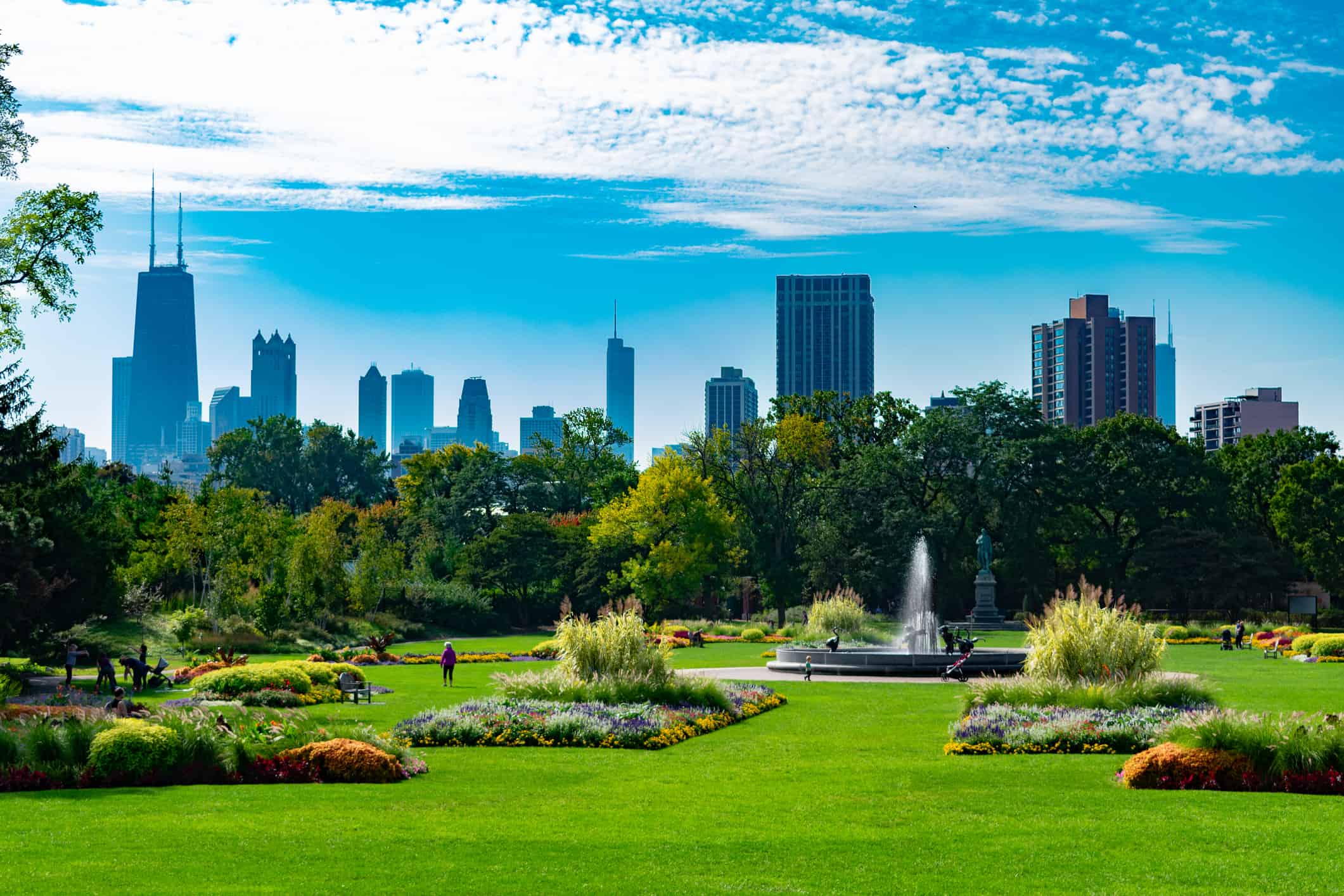
Chicago’s Loop District is the most densely populated district in the United States after Manhattan in New York.
©James Andrews/iStock via Getty Images
The Windy City is sinking, and scientists are just discovering the cause. A Northwestern University study calls underground climate change the “silent hazard.” For the first time, researchers have linked the heat created by infrastructure such as heating, cars, skyscrapers, and public transportation to land deformation.
“Underground climate change is a silent hazard,” said Northwestern’s Alessandro Rotta Loria, who led the study. “The ground is deforming due to temperature variations, and no existing civil structure or infrastructure is designed to withstand these variations. Although this phenomenon is not necessarily dangerous for people’s safety, it will affect the normal day-to-day operations of foundation systems and civil infrastructure at large.”
While Chicago’s skyscrapers are in no immediate danger from the Windy City’s slow sinking rate of 0.3 inches, discovering the effects of underground climate change is another piece of the puzzle needed to prepare for a future where U.S. cities are sinking.
New York, NY
The land beneath New York City is sinking by fractions of an inch each year largely due to a legacy of the Ice Age as well as human land usage.
©Ondrej Bucek/iStock via Getty Images
A NASA study discovered that New York is sinking at a rate of 0.06 inches per year, or about the same rate as toenails grow. The recent study used a remote sensing technique called interferometric synthetic aperture radar to analyze upward and downward vertical land motion — uplift and subsidence — across the New York metropolitan area from 2016 to 2023.
The researchers found two notable hot spots in the area with accelerated sinking rates co-located with landfills in Queens. One runway at La Guardia Airport has a subsidence rate of 0.15 inches per year. The other hot spot, Arthur Ashe Stadium, is sinking at 0.18 inches annually.
While subsidence is a dynamic process, natural and anthropogenic factors are largely responsible for the city’s sinking. The natural cause of New York’s subsidence is the weight of the glacier that once pressed down on the land just north of the city.
“About 24,000 years ago, a huge ice sheet spread across most of New England, and a wall of ice more than a mile high covered what is today Albany in upstate New York,” NASA explains. “Earth’s mantle, somewhat like a flexed mattress, has been slowly readjusting ever since. New York City, which sits on land that was raised just outside the edge of the ice sheet, is now sinking back down.”
Another study examined how the weight of New York City’s one million buildings is pressing down on the land below. Researchers estimated that the buildings’ collective 1.68 trillion pounds likely contribute to short-term subsidence.
Norfolk, VA
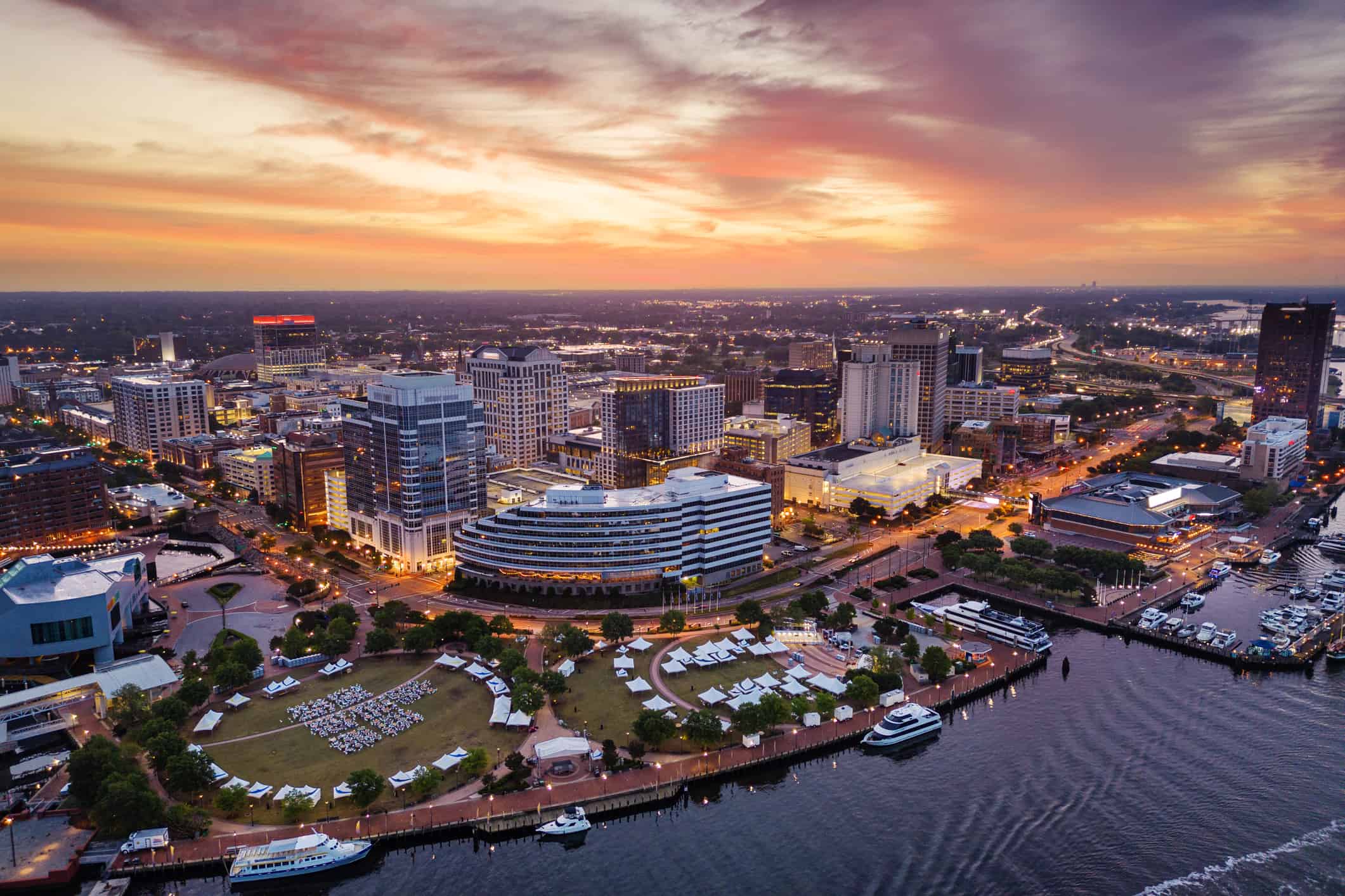
Norfolk, VA, has the highest rate of sea level rise on the East Coast.
©Sean Pavone/iStock via Getty Images
Land subsidence in Norfolk, VA, is exacerbating rising sea levels at an alarming rate. With the highest rate of sea level rise on the East Coast, Virginia’s vast Hampton Roads area is sinking around twice as fast as the waters are rising. According to a 2020 study, Norfolk is sinking at an average rate of more than 0.14 inches per year.
Groundwater pumping is one of the major culprits of the dramatic rates of subsidence, leading city officials to hope a new project could restore water in the aquifer and avert some of the worst consequences of sinking in the future.
As in New York, Ice Age processes are still at work in Norfolk, contributing to the subsidence of the land by glacial rebound. Norfolk’s sinking does have a unique contributing factor. Millions of years ago, a meteor created a vast crater filled with softer dirt. The land around the crater naturally compacts and shifts downward as time passes.
Summary of U.S. Cities Literally Sinking into the Ground
| Rank | City | Top Rate City Is Sinking |
|---|---|---|
| #1 | Arbuckle | 2.14 feet/decade |
| #2 | Houston | 0.67 inches/year |
| #3 | New Orleans | 20 inches/decade |
| #4 | New York | 0.15 inches/year |
| #5 | Norfolk | 0.14 inches/year |
| #6 | Chicago | 0.3 inches/year |


How to Add Us to Google News


Thank you for reading! Have some feedback for us? Contact the AZ Animals editorial team.