
The Pelican State is renowned for its vibrant culture, mouthwatering cuisine, and breathtaking natural landscapes. However, the state is also known for its vulnerability to flooding, with numerous towns frequently experiencing the impact of rising waters. In this article, we discover the five most flood-prone towns in Louisiana. Join us, as we shed light on the challenges faced by these communities and the resilience of their residents.
1. Baton Rouge

Due to its location on the banks of the Mississippi River, Baton Rouge has a long history of flooding.
©Felix Mizioznikov/Shutterstock.com
Baton Rouge has a long history of battling floods due to its location along the banks of the Mississippi River. Over the years, this capital city has experienced devastating floods. These massive events have left a lasting impact on its residents and infrastructure.
Historical Floods
One of the most notable floods in Baton Rouge’s history occurred in 1927. The Mississippi River swelled to record-breaking levels. The floodwaters breached levees, displacing thousands of residents and causing widespread destruction. This catastrophe prompted the construction of extensive levee systems and flood control channels to protect the city from future flooding.
In recent decades, Baton Rouge has faced several significant flood events. In 1983, heavy rainfall resulted in severe flooding, damaging homes and infrastructure across the city. Similarly, in 2016, Baton Rouge experienced a catastrophic flood after intense rainfall. The precipitation caused rivers and creeks to overflow, affecting thousands of residents and causing extensive damage.
Risk Factors for Flooding
Baton Rouge’s susceptibility to flooding stems from various risk factors. These include its low-lying areas and its proximity to the Mississippi River. The city’s flat topography makes it prone to both riverine and flash flooding during heavy rainfall events. Additionally, Baton Rouge’s urban development and increased impervious surfaces have reduced natural drainage, exacerbating the potential for flooding.
The Mississippi River, a dominant force in shaping Baton Rouge’s landscape, poses a constant threat. During periods of heavy rainfall, the river can rise rapidly, leading to increased water levels and potential breaches of levees. The city’s close proximity to the Atchafalaya Basin, a vast floodplain, further amplifies the risk of flooding.
Ongoing Flood Mitigation Efforts
Recognizing the ongoing threat of flooding, Baton Rouge has implemented innovative flood mitigation strategies to protect its residents and infrastructure. The city has invested in an extensive levee system, which stretches along the Mississippi River and its tributaries. It provides a barrier against rising waters.
Additionally, flood control channels and retention ponds manage stormwater runoff and reduce the risk of flash flooding. These efforts aim to alleviate the pressure on the city’s drainage systems during heavy rainfall events.
Baton Rouge also places a strong emphasis on effective emergency management and early warning systems. Local authorities work closely with residents to provide timely flood alerts and evacuation protocols. These warnings allow people to take necessary precautions and minimize the risks associated with flooding.
2. New Orleans
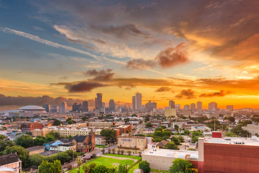
The culturally rich city of New Orleans has been devastated by countless floods throughout its history.
©Sean Pavone/Shutterstock.com
New Orleans, a city steeped in culture and resilience, has faced numerous devastating floods throughout its history. Situated below sea level and surrounded by the Mississippi River and Lake Pontchartrain, New Orleans is particularly vulnerable to flooding. Understanding the city’s past floods and ongoing risk factors is crucial to comprehending the city’s challenges.
Historical Floods
One of the most catastrophic floods in New Orleans’ history occurred in 2005 when Hurricane Katrina made landfall. The storm surge overwhelmed the city’s levee system, causing breaches that inundated approximately 80% of the city. The catastrophic flooding resulted in the loss of lives, destruction of homes, and massive displacement of residents. The aftermath of Katrina highlighted the urgent need for comprehensive flood protection measures to safeguard the city.
However, New Orleans’ battle with flooding extends beyond Katrina. Throughout the 20th century, the city experienced multiple flood events, including the Great Mississippi Flood of 1927. This natural disaster affected the entire Mississippi River basin. These historical floods have influenced the development of flood protection strategies and shaped residents’ understanding.
Risk Factors for Flooding
New Orleans faces a unique set of risk factors that contribute to its vulnerability to flooding. Its location below sea level and proximity to water makes it prone to storm surges during hurricanes and heavy rainfall. The city’s aging drainage system, originally designed to accommodate a smaller population, further adds to the risk of flooding.
Subsidence, the gradual sinking of land, is another significant risk factor. The extraction of groundwater and the natural compaction of the soil has caused parts of the city to sink over time. This subsidence increases the city’s exposure to flooding, as even minor rainfall can overwhelm the drainage system.
Ongoing Flood Mitigation Efforts
In the wake of Hurricane Katrina, New Orleans has invested heavily in flood protection measures to enhance its resilience. The city has bolstered its levee system, constructing stronger and higher levees along the Mississippi River and Lake Pontchartrain. These levees serve as a crucial barrier, reducing the risk of storm surge and limiting the potential for catastrophic flooding.
New Orleans has even improved its drainage infrastructure by upgrading and expanding its pumping stations. These pumping stations are responsible for removing excess water from the city during heavy rainfall events, helping to alleviate the strain on the drainage system and reduce the risk of flooding.
Also, the city has implemented a comprehensive stormwater management plan, which focuses on enhancing natural drainage systems, creating retention ponds, and increasing permeable surfaces to reduce runoff and mitigate the risk of flash flooding.
3. Lafitte
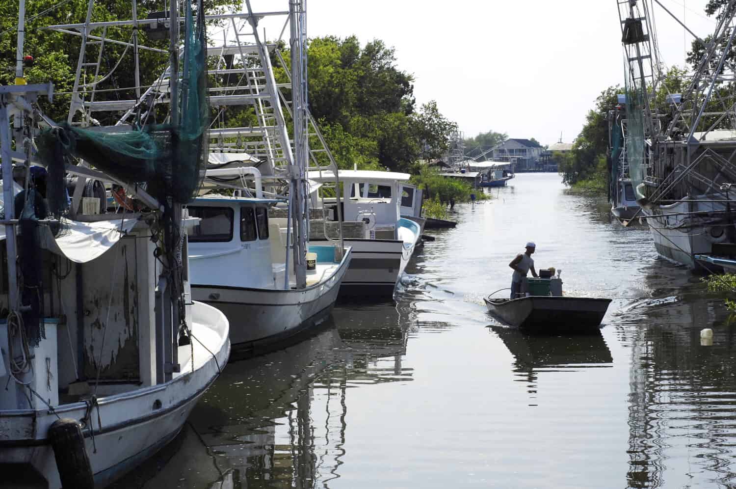
A little fishing village south of New Orleans, Lafitte, is at the forefront of vulnerability.
©Judy M Darby/Shutterstock.com
Lafitte, a small fishing village located south of New Orleans, finds itself at the forefront of the vulnerability faced by many coastal communities in Louisiana. With its tight-knit communities and reliance on the seafood industry, Lafitte is intimately connected to the surrounding waterways. However, the village is not spared from the impacts of coastal erosion and the frequent flooding brought on by tropical storms and hurricanes. Despite these challenges, the resilient residents of Lafitte are determined to protect their homes and preserve their unique way of life.
Coastal Erosion and Land Loss
Lafitte’s location along the Louisiana coast exposes it to the relentless forces of coastal erosion and land loss. Over the years, the combination of natural processes and human activities, such as oil and gas extraction, has accelerated the erosion of the coastline. As a result, Lafitte and its surrounding areas have experienced significant land loss, with marshes and wetlands disappearing at an alarming rate.
The loss of protective natural features, such as barrier islands and marshes, leaves Lafitte more susceptible to the impacts of storms and flooding. These natural barriers act as buffers, absorbing the energy of storm surges and reducing the risk of flooding. Without them, the village becomes increasingly vulnerable to the destructive forces of tropical systems.
Frequent Flooding
Lafitte faces the constant threat of flooding due to its low-lying coastal location and its proximity to bodies of water, including Barataria Bay and Bayou Barataria. Tropical storms and hurricanes that make landfall near Lafitte can result in significant storm surges, which can inundate the village and surrounding areas. Additionally, the village is prone to flash flooding during intense rainfall events, as the water has limited outlets to drain away quickly. The combination of these factors places Lafitte at high risk for frequent flooding, disrupting daily life and posing challenges to the community’s resilience.
Community Resilience
Despite the ongoing challenges, the residents of Lafitte are known for their remarkable resilience and determination to protect their homes and way of life. The tight-knit communities in Lafitte have banded together to implement various strategies to mitigate the impacts of flooding. These include elevating homes above flood levels, constructing raised roadways, and building flood-resistant structures.
Residents actively participate in coastal restoration projects and wetland preservation efforts. They recognize the importance of restoring and preserving the natural features that once provided protection against flooding and erosion. Through these collective efforts, the residents of Lafitte aim to safeguard their community’s future and maintain their connection to the surrounding waterways.
4. Morgan City
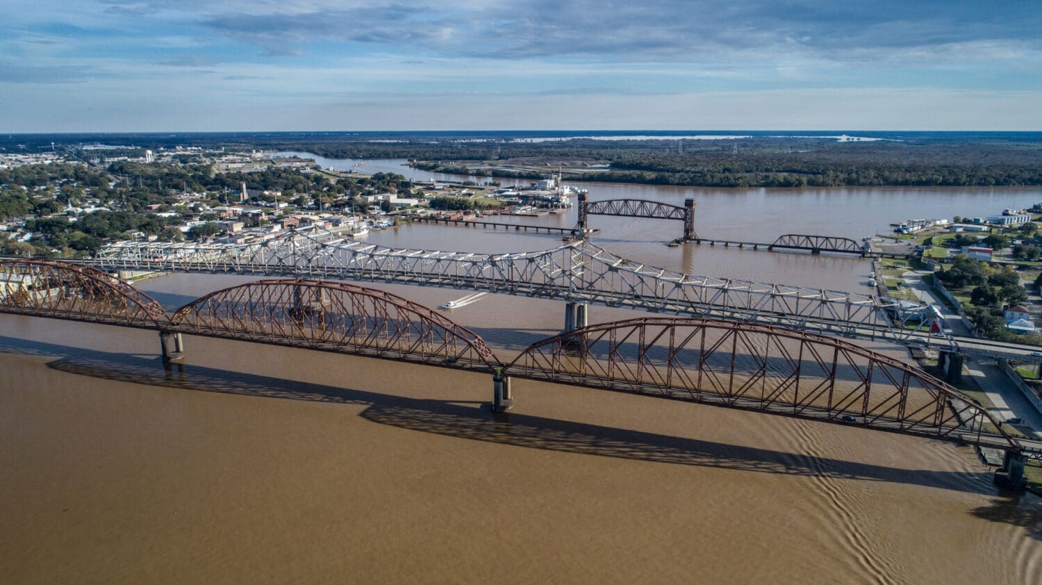
Located on the banks of the Atchafalaya River, Morgan City is constantly threatened by riverine floods.
©Charles Braun/Shutterstock.com
Morgan City, a city nestled along the banks of the Atchafalaya River, faces a persistent threat in the form of riverine flooding. Its strategic location near the convergence of the Atchafalaya and Vermilion Rivers makes it particularly vulnerable to flooding during periods of heavy rainfall and hurricane events. Despite these challenges, the resilient residents of Morgan City have embraced innovative flood mitigation measures, including flood walls and improved drainage systems, to safeguard their community.
Past Floods
Morgan City has a history of grappling with devastating floods that have left a profound impact on the community. One notable event occurred in 1957 when the combination of heavy rainfall and the rising waters of the Atchafalaya River led to a catastrophic flood. The floodwaters inundated homes, businesses, and infrastructure, causing widespread damage and displacement.
Another significant flood event occurred in 2011 when the Morganza Spillway, located upstream from Morgan City, was opened to relieve pressure on the Mississippi River. This deliberate flooding diverted water from the Mississippi River into the Atchafalaya Basin, causing the Atchafalaya River to rise to dangerous levels. As a result, Morgan City experienced severe flooding, prompting the implementation of emergency measures to protect the community.
Risk Factors for Flooding
The potential for future floods in Morgan City remains a significant concern due to various risk factors. For example, the city’s location near the convergence of the Atchafalaya and Vermilion Rivers increases its vulnerability to flooding. When these rivers experience high water levels simultaneously, the risk of flooding intensifies. In addition, the threat of storm surge from hurricanes and tropical storms poses an additional risk to the community, as the city is situated along the Gulf Coast.
Also, the low-lying topography of the area, combined with the city’s proximity to multiple bodies of water, makes it more susceptible to water intrusion during flooding events. The flat terrain limits natural drainage and increases the potential for water to accumulate, exacerbating the risk of flooding.
Moreover, the rapid urbanization and modification of the landscape in and around Morgan City have altered the natural drainage patterns. The expansion of impervious surfaces, such as roads and buildings, reduces the area’s ability to absorb rainfall, leading to increased runoff and the potential for flash flooding.
Community Resilience
Recognizing the ongoing risk of flooding, the residents of Morgan City have taken proactive measures to mitigate the impact of future flood events. The construction of flood walls and levees along the riverbanks provides a physical barrier against rising waters. These flood protection structures help minimize the potential for riverine flooding, safeguarding homes, businesses, and critical infrastructure.
Improvements in drainage systems and the implementation of stormwater management techniques have also played a crucial role in flood mitigation efforts. By enhancing the city’s ability to handle excess rainfall, these measures reduce the risk of localized flooding.
5. Cameron

Cameron, Louisiana is known for intense storms and flooding.
©SevenMaps/Shutterstock.com
Nestled in southwestern Louisiana along the Gulf of Mexico, the town of Cameron has become intimately acquainted with the destructive power of hurricanes and storm surges. This coastal community has endured the brunt of numerous storms, leading to devastating flooding and widespread destruction. However, the unwavering spirit and resilience of its residents have enabled them to rebuild their lives and homes time and time again.
Historical Floods
Cameron’s history is marked by the impact of catastrophic storms and the resultant flooding. One notable event that left an indelible mark on the community occurred in 2005 when Hurricane Rita made landfall near Cameron. The hurricane’s powerful winds and storm surge resulted in significant flooding, causing widespread damage to homes, businesses, and infrastructure. The town experienced massive devastation, with many structures rendered uninhabitable.
Another devastating flood event occurred in 2017 when Hurricane Harvey struck the Texas coast, causing heavy rainfall and intense storm surges. Cameron, situated on the border of Texas and Louisiana, was not spared from the storm’s wrath. The town experienced extensive flooding as the storm surge breached coastal defenses, inundating homes and leaving a trail of destruction in its wake.
Risk Factors for Flooding
The potential for future floods in Cameron remains a constant concern due to several risk factors. One significant factor is the town’s geographical location along the Gulf Coast, making it vulnerable to hurricanes and tropical storms. The warm waters of the Gulf serve as a breeding ground for these powerful weather systems, which can unleash torrential rainfall.
Furthermore, the town’s low-lying topography and proximity to bodies of water increase its susceptibility to flooding. Cameron is situated on a coastal plain, with minimal elevation to shield it from rising waters. Combined with the threat of storm surge, this leaves the town at a heightened risk of flooding during severe weather events.
Community Resilience
Despite the persistent threat of coastal flooding, the people of Cameron have displayed remarkable resilience in the face of adversity. Time and time again, they have come together to rebuild their lives and homes after each devastating flood event. Through collective efforts, the community has sought to strengthen its defenses against future floods.
The implementation of improved building codes and standards has played a crucial role in enhancing Cameron’s resilience. Homes and structures are now constructed to withstand the forces of hurricanes and storm surges, reducing the potential for damage and ensuring the safety of residents.
In Conclusion
Louisiana’s rich cultural heritage and natural beauty are intertwined with the challenges of flooding that its towns and communities face. These flood-prone areas have learned to coexist with the ever-present threat of rising waters. Through innovative flood mitigation strategies, resilient communities, and a deep connection to their environment, the people of Louisiana continue to adapt and rebuild, showcasing their unwavering spirit in the face of adversity. We recognize the strength and resilience of these communities, and support their ongoing efforts to protect and preserve their homes.
The photo featured at the top of this post is © Real Window Creative/Shutterstock.com


How to Add Us to Google News


Thank you for reading! Have some feedback for us? Contact the AZ Animals editorial team.