
North Dakota is the fourth least populated state in the nation. With its stretching prairies, small spread-out towns, farmland, badlands, and unique butte topography, visitors looking for peace and quiet shouldn’t have too much trouble finding it. If you’re wondering where the most remote spots in North Dakota are and how you can safely get there, read on.
1. In the Fort Berthold Reservation west of Lake Sakakawea
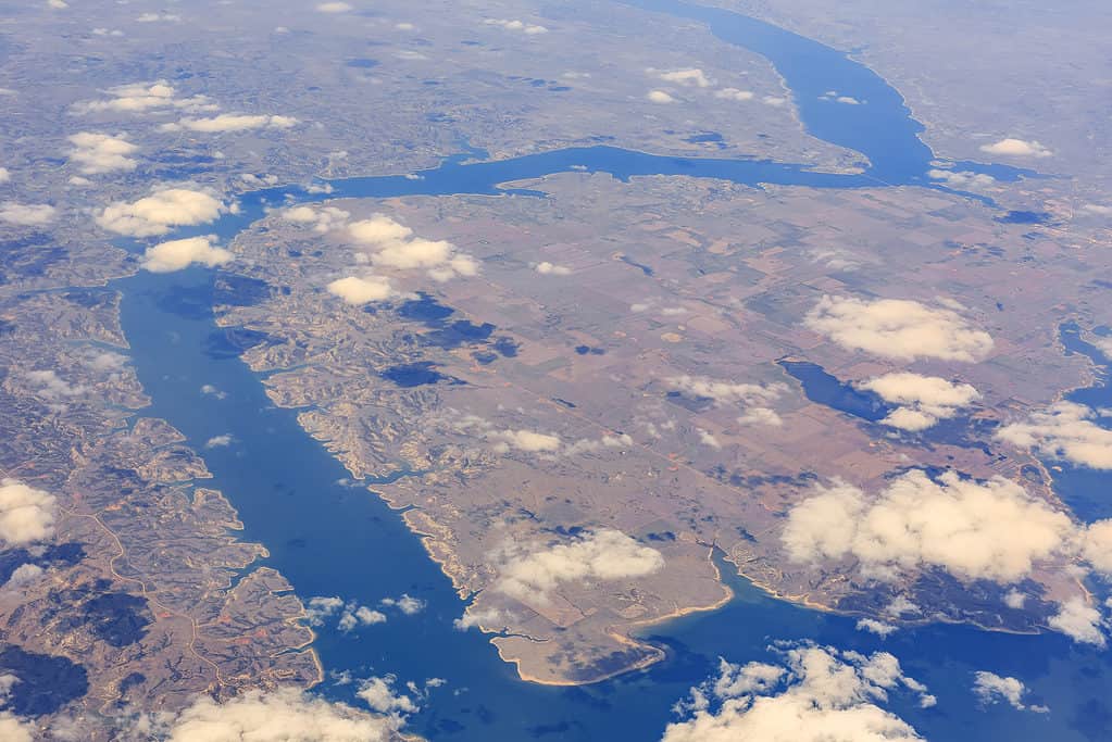
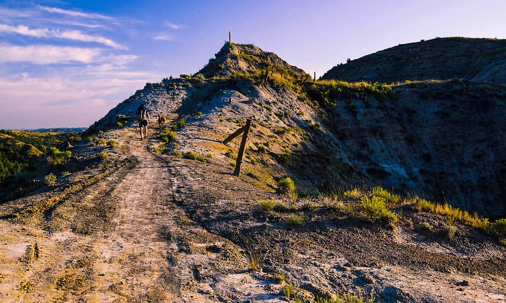
The most remote location in all of North Dakota is located to the south of Lake Sakakawea.
©Kit Leong/Shutterstock.com
According to the Remote Footprints project, a group of explorers who are seeking out the remotest location in each state, North Dakota’s most remote spot is located inside the Fort Berthold Reservation. It’s west of Lake Sakakawea and within the Mandan, Hidasta, and Arikara (MHA) Indian Nation. The land here has been shaped by erosion into colorful buttes and steep cliffs. This spot is 2.6 miles from the nearest road. It took the Remote Footprints team four hours to reach the exact spot.
How to get there? This remote location can only be reached on foot; there are no roads or marked trails. You can’t hike this area without permission from the MHA Indian Nation. Furthermore, the Remote Footprints project doesn’t identify the exact coordinates of the spot, making this location one of the most inaccessible in the country.
GPS Coordinates: Unknown
2. White Butte
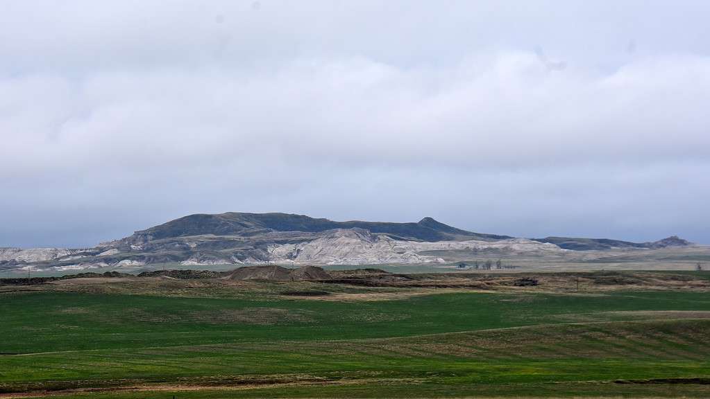
Hiking to the top of White Butte in North Dakota brings visitors to a very remote location.
©Skye Marthaler / CC BY-SA 4.0 – License
This remote location also happens to be the highest point in North Dakota. Although it’s on private property, the owners allow visitors to hike the short trail out to the state’s highest spot. At the top of the butte, visitors can enjoy the stunning view of the endless grasslands and colorful buttes.
How to get there? White Butte must be reached on foot; it’s not accessible by road. Hikers will need to drive on gravel roads to reach the parking lot at the White Butte trailhead. The nearest town is Amidon, about nine miles to the north. From the parking lot, it’s a 1.3-mile round-trip hike to the top of the summit and back.
GPS Coordinates: latitude: 46.38776888166517 and longitude: -103.29811015985078
3. Hankinson Hills Campground and Trail
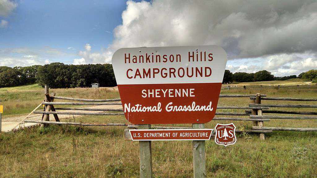
If you’re looking for a remote camping spot, Hankinson Hills Campground in the Sheyenne National Grassland is a secluded area.
©Forest Service Northern Region / Public Domain – License
You can only reach this remote park via dirt roads. The Hankinson Hills Campground is about seven miles northwest of the nearest town of Hankinson. Camping is rustic here, with just 15 tent campsites available. Located within the Sheyenne National Grassland, it’s in the southeast corner of the state. The land here is made up of sandhills covered in prairie grass. Within the campgrounds is a very remote eight-mile trail, the Hankinson Hills Trail. Along this secluded walk, hikers may encounter a variety of wildlife, including wild turkeys, coyotes, white-tail deer, raccoons, and skunks.
How to get there? From Interstate 29, take Exit 8 on Highway 11. Travel past the town of Hankinson and turn north on 165th Avenue SE. Turn west onto 91st Street SE, which will merge into 89th Street SE. From there, keep going north until you reach the campgrounds.
GPS Coordinates: Latitude: 46.120037594750244 and Longitude: -96.96781640858067
4. Pembina River Gorge
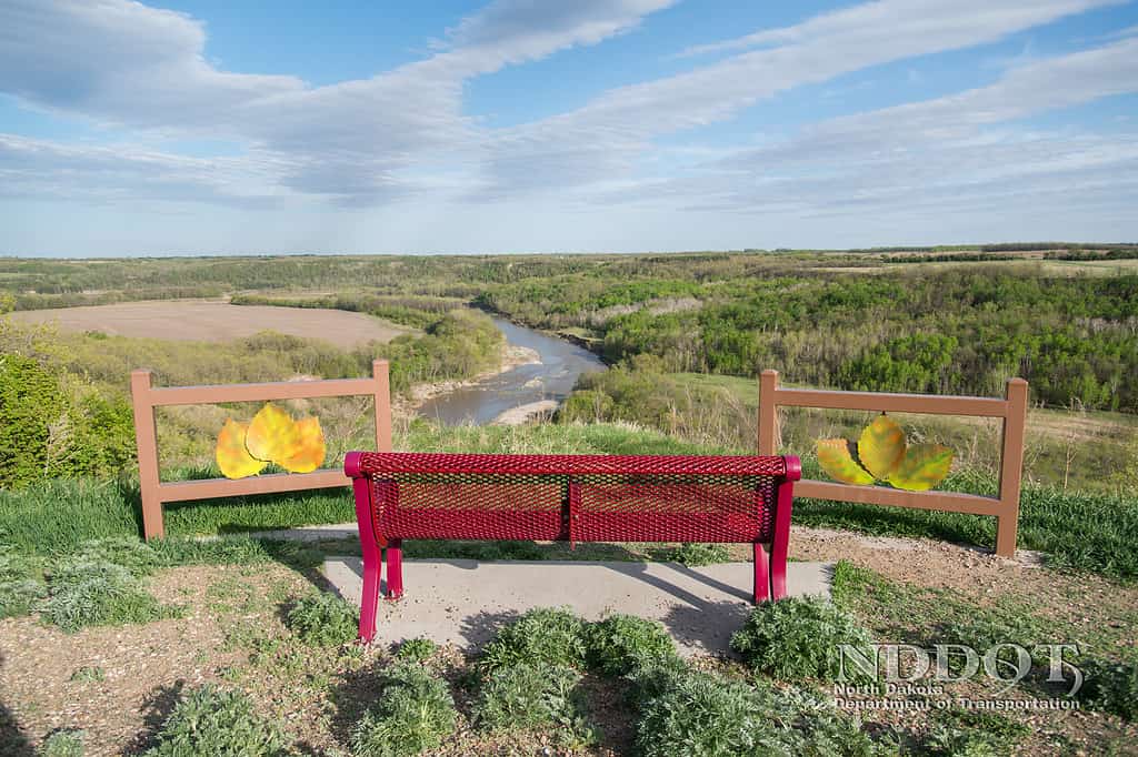
The Lookout Point over the Pembina Gorge is a beautiful and remote spot to enjoy in North Dakota.
©North Dakota Transportation / Public Domain – License
Head a little outside of the small town of Walhalla and experience the remote natural beauty of the Pembina Gorge State Recreation Area. Visitors can hike up the cliffs to reach the overlook, where they have a stunning view of the winding Pembina River, prairie lands, and woodlands. The Pembina Gorge is inside a 2,800-acre recreation area where amenities include hiking, camping, canoe and kayak access docks, and hourly kayak rentals.
How to get there? Pembina Gorge State Recreation Area is located along the Pembina River, about six miles to the west of Walhalla. It’s at the far northern border of North Dakota, not far from the Canadian border.
GPS Coordinates: Latitude: 48.91545532244029 and Longitude: -97.91840415970029
5. Maah Daah Hey Trail
The Maah Daah Hey Trail takes hikers through the remote and ruggedly beautiful countryside in North Dakota.
©Deborah Housten/Shutterstock.com
If you’re looking for a remote hike, you likely won’t run into many other hikers on the 144-mile Maah Daah Hey Trail. This trail inside of the Theodore Roosevelt National Park connects the south end of the park at the Burning Coal Vein Campground to the CCC Campground in the north. The trail is challenging, and it traverses rough badlands, rolling prairies, and two crossings of the Little Missouri River.
How to get there? To get there from the north, head to the CCC Campground (15 miles south of Watford City.) The trail will take you all the way to Burning Coal Vein Campground.
GPS Coordinates: Latitude: 46.86156469232191 and Longitude: -103.49485392654707
6. Enchanted Highway
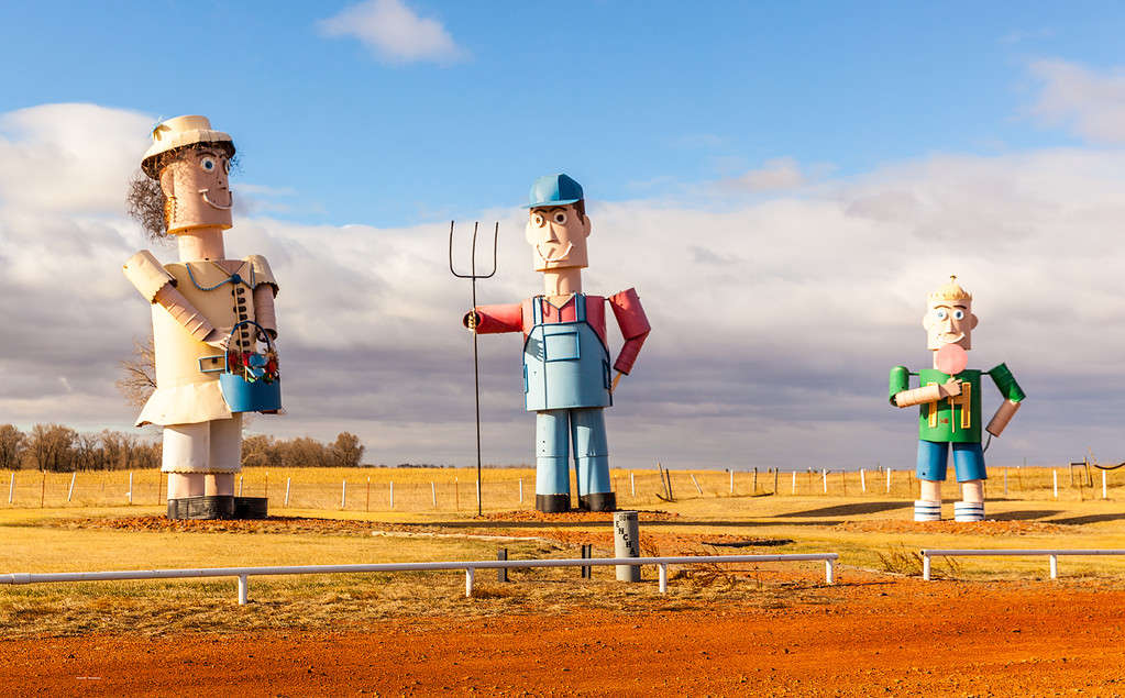
The Tin Man sculpture can be found along a remote country highway in western North Dakota.
©russellstreet / CC BY-SA 2.0 DEED – License
Although it’s a highway, it is a remote stretch of road in the western part of the state. The Enchanted Highway begins in Regent and takes you to the Gladstone exit on Interstate 94, east of Dickinson. This 32-mile stretch contains the world’s largest scrap metal sculptures lining the roadside, with the largest at 110 feet tall and 150 feet wide. The seven sculptures include:
- Geese in Flight
- Deer Crossing
- Grasshoppers
- Fisherman’s Dream
- Pheasants on the Prairie
- Teddy Roosevelt Rides Again
- Tin Family.
How to get there? Get off of I-94 at exit 72. Follow the highway to Regent to see all seven sculptures. It’s best to go north to south as the sculptures face north.
GPS Coordinates: Latitude: 46.879947362697585 and Longitude: -102.56579323328955
Summary of the 6 Most Remote Spots in North Dakota
| Remote Location | GPS Coordinates | |
|---|---|---|
| 1 | In the Fort Berthold Reservation west of Lake Sakakawea (MHA Indian Nation) | Unknown |
| 2 | White Butte (Slope County) | Latitude: 46.38776888166517 and Longitude: -103.29811015985078 |
| 3 | Hankinson Hills Campground and Trail (Sheyenne National Grassland) | Latitude: 46.120037594750244 and Longitude: -96.96781640858067 |
| 4 | Pembina River Gorge (Cavalier County) | Latitude: 48.91545532244029 and Longitude: -97.91840415970029 |
| 5 | Maah Daah Hey Trail (144 mile track through Little Missouri National Grasslands in North Dakota’s Badlands) | Latitude: 46.86156469232191 and Longitude: -103.49485392654707 |
| 6 | Enchanted Highway (County Highway 21) | Latitude: 46.879947362697585 and Longitude: -102.56579323328955 |
The photo featured at the top of this post is © Vagabond54/Shutterstock.com


How to Add Us to Google News


Thank you for reading! Have some feedback for us? Contact the AZ Animals editorial team.