
Of all the odd-shaped states in the U.S., Louisiana is one of the most distinctive. It looks sort of like a boot with a sole that’s seen better days! Just how did Louisiana get its shape? Why does a lot of its border follow the Mississippi River? And why does it take a big rectangular chunk out of the state of Mississippi? And why doesn’t it extend further north? Couldn’t it include all of Arkansas? So many mysterious questions! The answers are a combination of geology and history, both of which make fascinating stories.
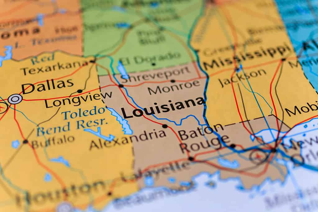
Louisiana’s unique shape is the result of geology and history.
©Alexander Lukatskiy/Shutterstock.com
How Did the United States Grow?
Before getting into the specifics of the question “how did Louisiana get its shape,” let’s summarize how the United States got its territory.
The 50 States
- East of the Mississippi: The U.S. won this territory from Britain in the Revolutionary War. Spain ceded Florida to the Americans in a process of negotiation.
- The Midwest and Great Plains: This region was part of the Louisiana Purchase, in which France sold a tract of land to the U.S. so large that it doubled the American land area.
- The Northwest: The expedition of Lewis and Clark and subsequent negotiations with Britain won the U.S. control of what are today our northwestern states.
- Texas and the Southwest: These areas belonged to Mexico but the U.S. took control of them after the Mexican War.
- Alaska: Russia sold this territory to the U.S. because it was so far away and expensive for the Russians to administer.
- Hawaii: American plantation owners and other businessmen living in Hawaii organized a coup and overthrew the Hawaiian government, then applied for annexation to the United States.
American Territories
- Guam and Puerto Rico – acquired in the peace settlement of the Spanish War.
- Northern Mariana Islands – taken from Japan at the end of World War II.
- American Samoa – seized by the U.S. after a civil war on the island.
- U.S. Virgin Islands – purchased from Denmark.
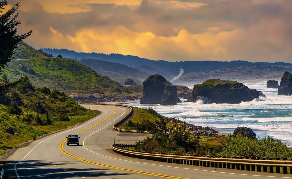
The United States acquired parts of the Pacific Northwest by virtue of the Lewis and Clark expedition.
©Bob Pool/Shutterstock.com
Louisiana’s Coastal Border
The Southern Louisiana coast grew for thousands of years as sediment washed down the Mississippi River and settled as deltas at the mouth of the river. Swamp plants grew up on the land and helped anchor it in place, and barrier islands of sand helped protect it from storms. Over time as the land built up, the mouth of the river would split into different directions and shift to new channels, leading to steady growth over a wide delta area. The shape of Louisiana along its coast that we see today is the result of eons of deposition of sediment by the Mississippi River.
In more recent years, engineers have begun carefully managing the Mississippi with levees along its banks to prevent flooding and dredging to remove silt and keep the rivers navigable. In the past, heavy logging in Southern Louisiana removed a lot of the vegetation and root networks that held the land together. Navigational canals dug mainly for the petrochemical industry have sliced through the region and disrupted the natural processes of the river. And finally, rising sea levels and more violent storms because of global warming are increasing problems that threaten barrier islands and coastal ecosystems.
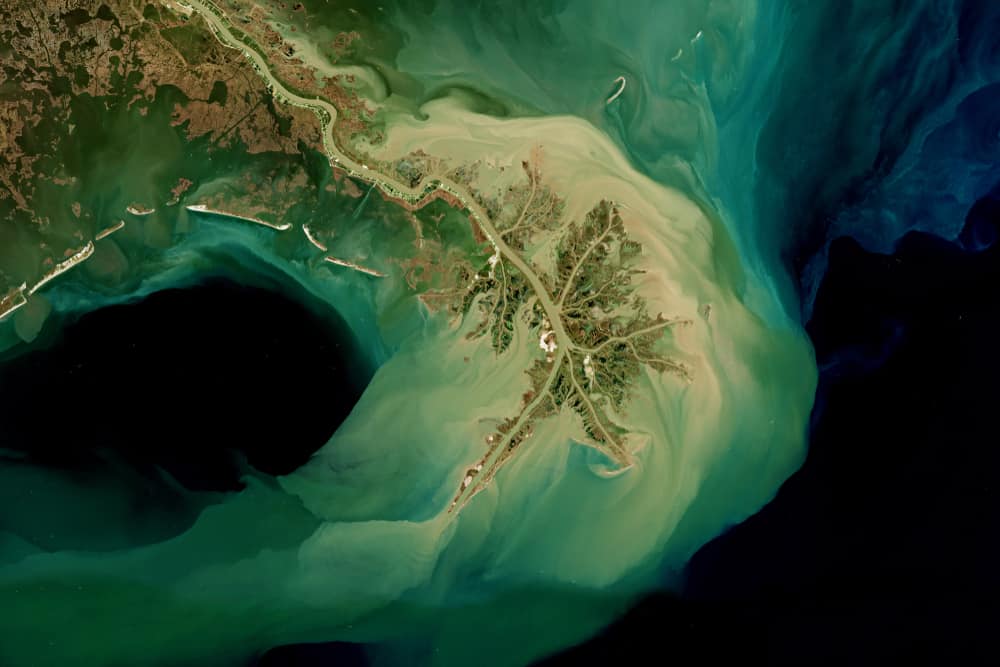
In the Mississippi River Delta, the river branches out into new channels as sediment piles up and solidifies.
©lavizzara/Shutterstock.com
French Louisiana
Louisiana’s borders on the east with Mississippi and on the west with Texas were largely the result of where the French borders of the territory already existed. In 1682 a French explorer landed near the mouth of the Mississippi River and claimed the whole river for France. The French backed this claim up in the following century with exploration and the establishment of French trading posts throughout the whole vast area that today makes up the Midwest and Great Plains regions of the United States. The French divided the area into Upper and Lower Louisiana along the Arkansas River, which flows from modern-day Colorado across Kansas, Oklahoma, and Arkansas.
After France’s defeat in the Seven Year’s War, they surrendered all the territory they had claimed between the Appalachian Mountains and the Mississippi River to Great Britain. After the American Revolution, that territory passed to the newly independent United States. Spain received the western part of the territory, but France regained control of it in 1800. Not for long, though. In 1803 the young United States under the leadership of Thomas Jefferson offered to purchase the port of New Orleans to guarantee access to the sea for American farmers in the west. To their surprise, Emperor Napoleon offered to sell the entire Louisiana territory. This deal, concluded in 1803, doubled the size of the United States.
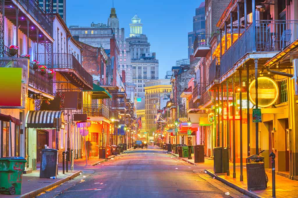
New Orleans’ French Quarter is one of the most popular places to see lingering French cultural influences.
©iStock.com/Sean Pavone
Objections to Louisiana Statehood
Statehood for Louisiana was controversial. It was the first state added outside the original borders of the country, and the first one from the Louisiana Purchase. There were questions of whether the United States had the legal right to acquire additional territory, as the Constitution had not addressed this question. There were also concerns that the purchase itself may have been illegal because the land technically belonged to Spain, which was dominated by France and not compensated by Napoleon. And there were cultural objections because the state was culturally French and Catholic, did not have British legal traditions, and had a large number of free and wealthy people of color, which was upsetting to slave-owning states. Nevertheless, these objections were sufficiently overcome that Louisiana was admitted to the Union in 1812.
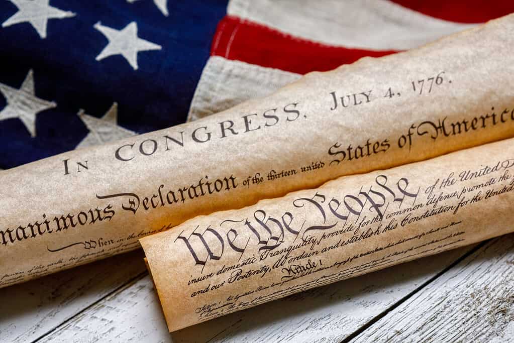
Admission of Louisiana to the Union was controversial.
©iStock.com/eurobanks
Establishing Louisiana’s Borders
The Northern Border
The northern border of Louisiana with Arkansas was established in 1804 when the U.S. Congress voted to divide the Louisiana Purchase into two parts. The southern part was called the Territory of Orleans and it included the present-day state of Louisiana. The northern part was named the District of Louisiana and later renamed the Missouri Territory. It included Arkansas and everything else north and northwest of Louisiana.
The Western Border
The western border was disputed with Spain, which controlled Texas and the rest of what is today the American southwest. The United States tried to claim territory as far west and south as the Rio Grande. However, they more seriously pressed a claim to a boundary at the Sabine River. Spain claimed territory as far east as the Arroyo Hondo Creek. The two sides almost went to war but instead came to an agreement 1806. They decided to establish a neutral zone in what is today Western Louisiana along the Sabine River. Later, a treaty in 1819 established the permanent border at the Sabine River.
The Sabine River forms the boundary between Texas and Louisiana
©Lewis Directed Films/Shutterstock.com
The Eastern Border
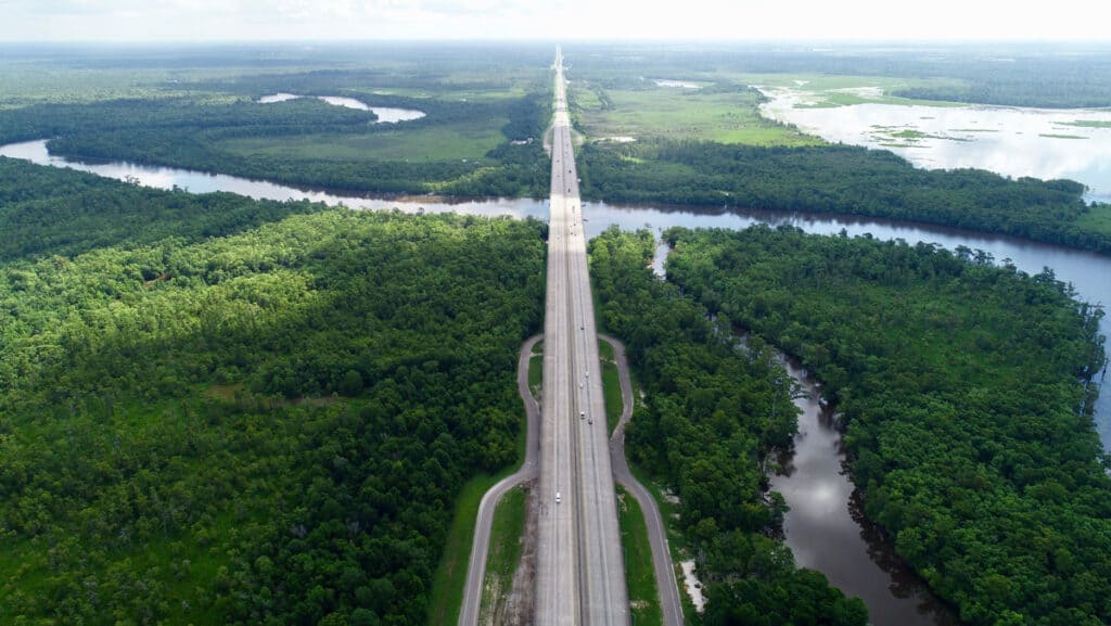
Most of Louisiana’s eastern border was easy to figure out: it’s just the Mississippi River. Of course, the river shifts course over time, so this makes it a moving target. States that use it as a border can eventually find themselves owning loops of land across the river, or not owning crescents of it on their own side. Louisiana’s original border just followed the Mississippi all the way down to Lake Pontchartrain and the Gulf of Mexico.
As we know from the modern map of Louisiana, though, the southeastern part of the state crosses the Mississippi and appears to cut a big roughly rectangular corner out of the state of Mississippi. That area was disputed territory with Spain, which controlled Florida and the Gulf Coast areas of Alabama and Mississippi. With Napoleon creating havoc in Europe, the westernmost part of this region staged a rebellion and declared itself the Republic of West Florida. President Madison sent in troops to take control of the area, adding it to Louisiana as the “Florida Parishes.”
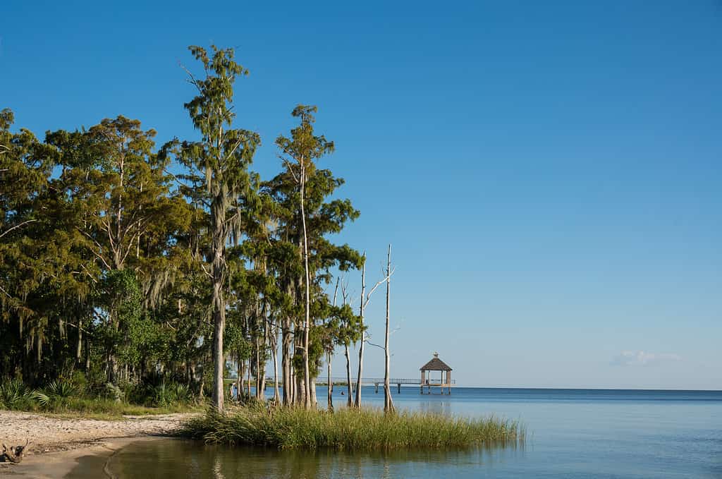
This is part of the northern shoreline of Lake Pontchartrain, an area known as the Florida Parishes.
©iStock.com/Entropyd
A Model for Future States?
It’s unclear whether the United States will ever add any more territories and states beyond the 50 we already have. Several times in history the U.S. has attempted to purchase Greenland from Denmark. There is a statehood movement in Guyana, South America, a country that enjoys close ties with the United States. The most serious potential candidate for statehood, though, is Puerto Rico. It has been a U.S. territory for over a century. Up to half the population has expressed interest in the territory becoming a state. However, it has faced many of the same objections and prejudices Louisiana faced in its own statehood bid. These include fears that cultural, religious, and linguistic differences would be too great for the new state to remain tightly bound to the rest of the country.
Louisiana did indeed try to secede from the Union in the Civil War. However, this was not due to differences. It was because it was too similar to its neighbors in adopting the immoral practice of slavery. As far as its culture is concerned, Louisiana has unquestionably enriched American life. Its unique fusion of French, West African, Native American, and Caribbean influences has made its mark. Louisiana is thus an excellent example of how the United States can comfortably assimilate new states politically without requiring that they assimilate culturally.
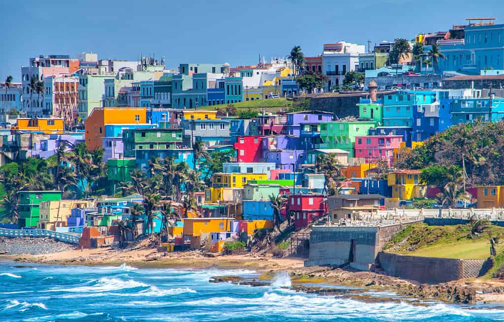
If Puerto Rico applies for statehood, Louisiana is a potential model of how a state can retain its culture.
©Martin Wheeler III/Shutterstock.com
The photo featured at the top of this post is © Alexander Lukatskiy/Shutterstock.com


How to Add Us to Google News


Thank you for reading! Have some feedback for us? Contact the AZ Animals editorial team.