
The Great Lakes aren’t the only massive bodies of water in the USA! Lake of the Woods is a lesser-known lake located in Northern Minnesota on the border with Canada.
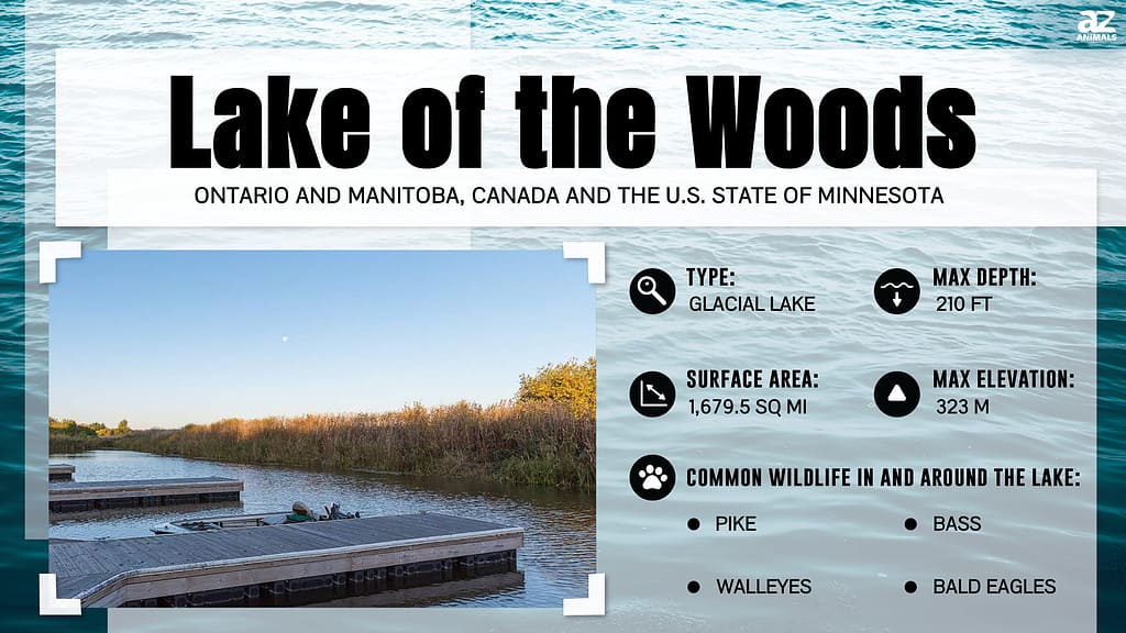
Lake of the Woods is the 36th largest lake in the world and sixth largest in the U.S. It is home to hundreds of islands and has a rich ecosystem with countless plant and animal species.
The abundant fish population and breathtaking scenery make Lake of the Woods a beloved destination for anglers, nature enthusiasts, and adventurers in Minnesota.
Location
While the Lake of the Woods is somewhat isolated, there are several small communities located within a short distance.
©Copernicus Sentinel-2, ESA / CC BY-SA 3.0 IGO – Original / License
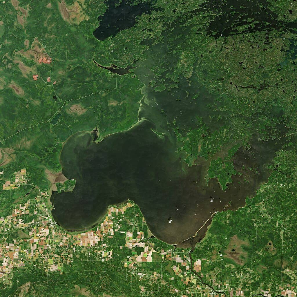
Lake of the Woods is located in the most northern area of Minnesota on the border with Canada. This region is very remote and sparsely populated. The closest major cities, Minneapolis and St. Paul, are located about 270 miles to the southeast. The closest major Canadian city is Winnipeg, at a distance of 134 miles.
While the lake itself is somewhat isolated, there are several small towns and communities located within a short distance. Some of the closest towns include Baudette, Warroad, and Angle Inlet.
The main commercial hub and largest U.S. town near the Lake of the Woods is Baudette. It has a population of just under 1,000 residents.
Despite being located far away from major cities, Lake of the Woods is easily accessible by car. It is connected by several state highways. Visitors can also fly into regional airports in Baudette, Warroad, and International Falls. Connecting flights are available from larger cities like Duluth, Minneapolis, and Chicago.
Interestingly, this large lake separates a small region of Minnesota from the rest of the state, and the country. The region of Northwest Angle is a sparsely populated area of Minnesota. It can be accessed only by taking a boat or driving through Canada.
History
Lake of the Woods was formed after the glaciers withdrew from Minnesota, creating Glacial Lake Agassiz. This body of water eventually shrank and became Lake of the Woods.
Native Americans have lived in this region for several thousands of years. Some evidence even indicates that tribes thrived in this region as early as 8,000 years ago!
The Ojibwe community became the primary inhabitants of the Lake of the Woods area in the 18th century. They established small settlements and asserted their authority over hunting and gathering territories. The Ojibwe relied heavily on the lake’s wild rice and abundant sturgeon population.
In the 18th century, the arrival of Europeans saw the establishment of forts and fur trade posts in the area. Initially, the French fur traders were the first to use the Lake of the Woods as a waterway. The North West Company and the Hudson’s Bay Company followed. These companies used the lake as a vital route from Lake Superior to the interior of Northwestern North America. This activity cemented its importance as a transportation hub.
In the late 1800s, many wealthy Americans and Canadians flocked to Lake of the Woods to build summer homes. During this time, the lake was essentially put on the map in terms of tourism.
Size and Depth
Imagine standing at the edge of this sprawling body of water spanning over 1,700 square miles. It would be easy to think you are at the sea, even though this lake is nowhere near the coast.
Lake of the Woods is a huge lake. In fact, the lake is larger than the state of Rhode Island.
Its average depth is approximately 26 feet, while its deepest point at Whitefish Bay measures up to 310 feet.
The lake is also known for the over 14,000 islands scattered across its shores. When accounting for the shorelines of all the islands, the total shoreline stretches to an impressive 65,000 miles.
It is fed by the Rainy River and drains into Lake Winnipeg. It has a shallow and irregular shape that stretches over 70 miles in length and about 60 miles in width.
The Lake of the Woods covers an area of approximately 950,400 acres. Only 307,000 acres are in the United States.
Water Levels
Lake of the Woods has experienced fluctuations in water levels throughout history, with the 1980s and ’90s having less variation. The 1950s, ’60s, and ’70s had more variation in water level.
The increased variability since the year 2000 could signify a shift back to the water level variation of the past. This is due to a return to more typical weather patterns. It could also mark the beginning of a trend towards even more significant variability attributed to climate change.
Average Water Level
The average water level of the Lake of the Woods is 1,056 feet above sea level. However, the water level can vary depending on factors such as rainfall, snowmelt, evaporation, and dam operations.
Historical Water Level
The most significant high water period occurred in the mid-1950s, when it peaked at 1,064 feet above sea level. Just last year, the lake also reached the second-highest water level at 1,063 feet above sea level.
Geology
Lake of the Woods naturally divides into two parts, the northern part and the southern part. Each has distinct geological features. The southern part of the lake is situated on the Laurentian strata. These old, stratified rocks are made up mostly of gneiss rocks that have been transformed by metamorphic activity. Additionally, beds of sand are found lining the lake shore.
On the other hand, the northern division is composed of softer rocks. These have been cut up into countless islands that belong to the Huronian geological period. The Huronian rocks are mineral-rich and contain various veins, including gold and other valuable minerals.
The Huronian strata, which overlays the Laurentian, is recognized as a shoreline formation that spreads out over long stretches. It has been highly deformed and disrupted. It is thought to have been impacted by the intrusion of large masses of granite rock. Additionally, it has been affected by the natural folding or crumpling of the earth’s surface, which is still occurring. The eastern section of Lake of the Woods, referred to as Whitefish Bay, is mainly located within the Laurentian basin. Its northern and eastern coastlines are composed of Huronian strata that contain significant mineral deposits.
Running through the Huronian strata between the western and northern peninsulas is Ptarmigan Bay. This strait is lengthy and narrow and ultimately connects to Shoal Lake. This lake is slightly elevated compared to the Lake of the Woods and is well-known for its abundant mineral reserves.
Fishing
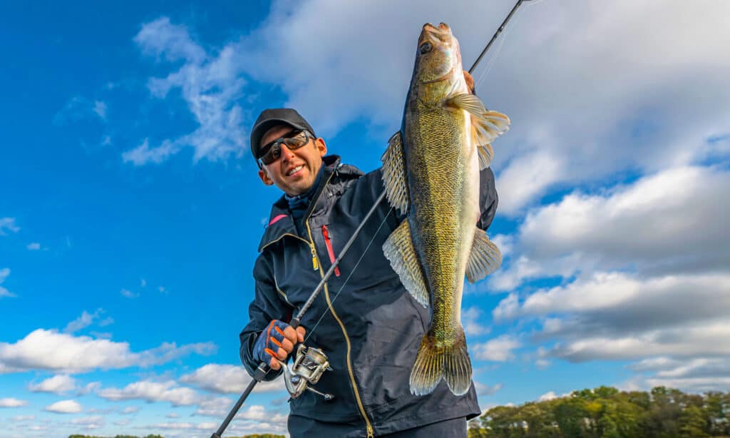
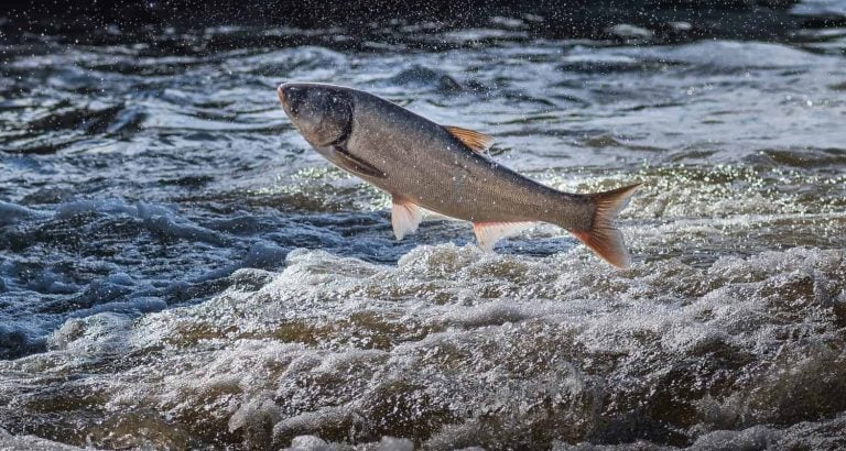
Walleyes are the most popular fish species in the lake and can be found in large numbers throughout the year.
©FedBul/Shutterstock.com
Lake of the Woods offers a plethora of fishing opportunities, with many highly sought-after fish species living in its waters. This lake is so vast that exploring every corner of the fishable areas would be impossible in a single lifetime.
Anglers in the Lake of the Woods can catch walleye, northern pike, muskie, sauger, perch, and several species of panfish. Walleyes are the most popular fish species in the lake and can be found in large numbers throughout the year. That said, the lake’s clear waters also provide excellent opportunities for muskie and northern pike fishing.
Fishing on Lake of the Woods is open year-round. Anglers can fish from a boat or from shore during the spring, fall, and summer, as well as on ice during the winter. Minnesota has frigid winters, and Lake of the Woods freezes over almost every year with a thick layer of ice. This ice is almost 2 feet thick in some parts!
Walleye are most active during summer, while you are most likely to catch muskie and northern pike during the fall.
The lake is dotted with several resorts, lodges, and campsites that offer fishing packages and equipment rentals. Some popular resorts include Angle Outpost Resort, Ballard’s Resort, and River Bend Resort. Anglers can also hire local guides who are familiar with the lake’s fishing hotspots.
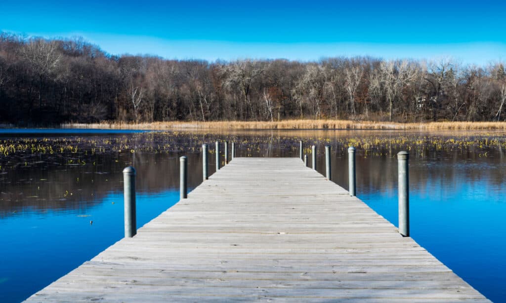
Boating
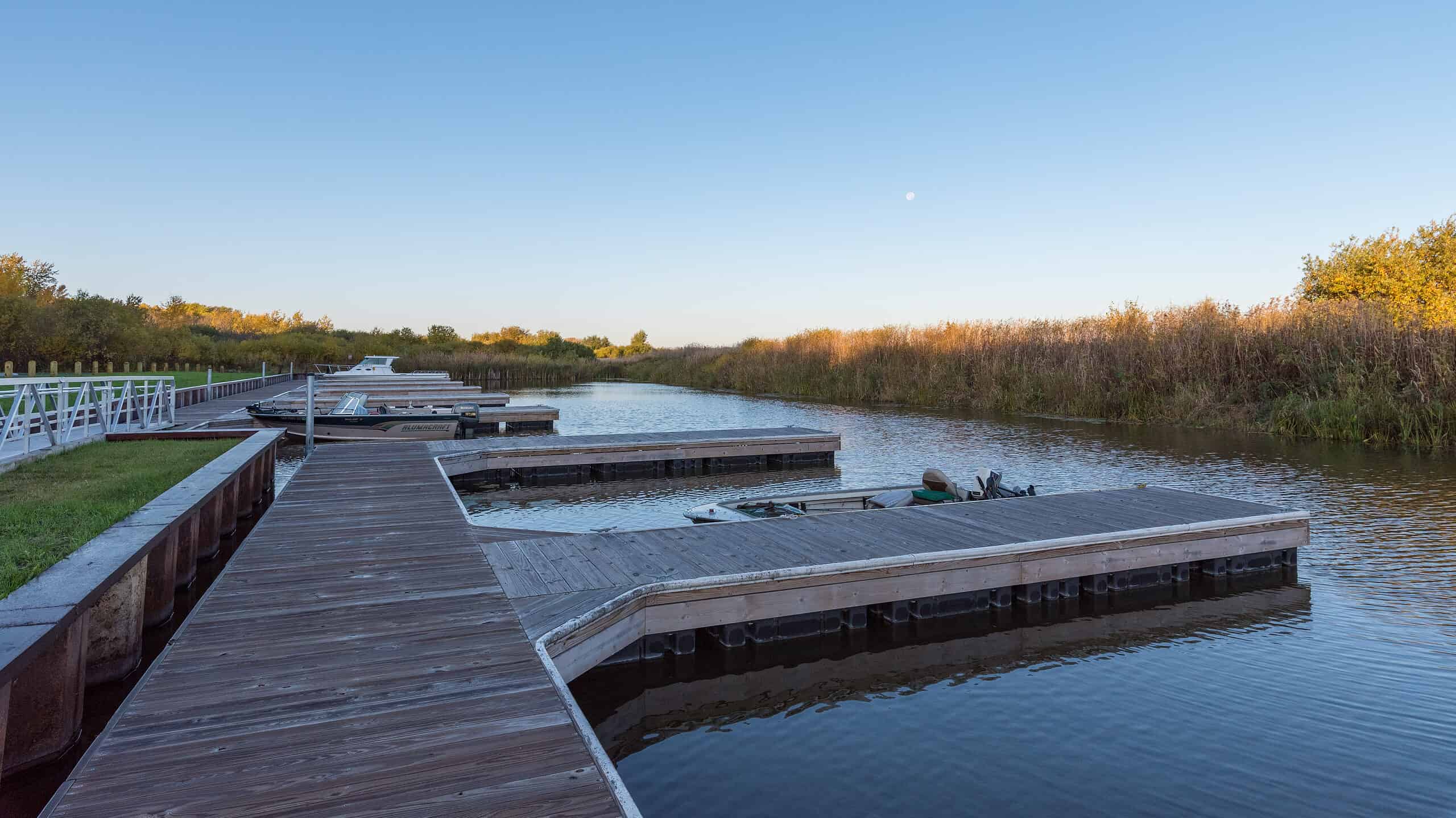
The lake has exceptionally clear water, which makes for excellent snorkeling and scuba diving conditions.
©iStock.com/milendm
During the summer, visitors and locals are out on boats cruising the beautiful waters of Lake of the Woods. Some of the most popular boats on the lake are pontoon boats, canoes, and speedboats.
The lake has several marinas that offer boat rentals, boat launches, and other amenities. Some of the most popular marinas include the Rainy River Marina, Arnesen’s Rocky Point Resort, and Zippel Bay Resort.
Lake of the Woods is known for its many islands; boaters can explore them, alongside their beaches. Many of the islands are uninhabited and offer a unique wilderness experience. Boaters can also visit several historic sites on the lake, such as the Old Oak Island Lighthouse, which dates back to the early 1900s.
Boating in Lake of the Woods is popular during the late spring, summer, and early fall. But, unfortunately, during most of the winter, the lake is frozen over, making boating dangerous and nearly impossible.
The lake has exceptionally clear water, which makes for excellent snorkeling and scuba diving conditions.
Camping
Camping is a wonderful way to escape the comforts of the city and appreciate what nature has to offer. Here are some of the camping options available in the region.
Public Campgrounds
The area has several public campgrounds, such as Zippel Bay State Park and Lake of the Woods County Park.
These campgrounds offer tent and RV camping, but there are also cabins for rent for those that want more comfort. The campsites are well equipped with picnic tables, fire pits, and restrooms with showers. These public campgrounds are often busy during the peak summer season, and reservations are recommended.
Private Campgrounds
There are also several private campgrounds in the Lake of the Woods region. Private campgrounds are better suited for families and individuals who want a taste of nature with better facilities. Some extra facilities you can find at private campgrounds are swimming pools, playgrounds, and laundry facilities. Some private campgrounds in the region are Arnesen’s Rocky Point Resort, Borderview Lodge, and Sportsman’s Lodge.
Backcountry Camping
For those who prefer a more rugged camping experience, backcountry camping is also available in the Lake of the Woods region. Visitors can camp on many of the lake’s islands or remote shorelines, but permits might be required.
Snowmobiling
Lake of the woods is most popular as a summer destination. However, in the winter, the lake becomes a winter wonderland. Residents and visitors can enjoy many different winter activities.
Snowmobiling, in particular, has gained popularity among many enthusiasts. Well-groomed trails wind through the forests and even over the frozen lake during the coldest months.
The snowmobile trails in this region are continuously maintained by experienced groomers. The network of trails is expansive, stretching from the Northwest Angle in the north to International Falls in the south and from Warroad in the west to Big Falls in the east.
Lake of the Woods is not one of the most popular snowmobiling destinations in the country, but it should be! The region boasts consistent snowfall, which lasts longer due to the cold weather. The area also offers breathtaking scenery, an array of resorts, and attractions such as the Igloo Bar.
The vast woods and expansive lake create a diverse and thrilling snowmobiling experience. Additionally, the strong snowmobile clubs in the area ensure the trails are maintained and safe for riders.
Where Is Lake of the Woods Located on a Map?
It’s really interesting the way the border between Canada and the United States doesn’t follow an obvious path across the corner of Lake of the Woods and continues with the land border of Minnesota. Instead, the borderline turns straight up, cuts out the piece that is the Angle Inlet, and then angles down to Wheeler’s Point, giving Minnesota a bigger piece of the lake.