

California has been in the news recently as a state experiencing a huge exodus of people, but is that actually true? Today, we are going to take a look at California as a whole and its counties within to learn a little more about the state’s changing population. Here are the 10 fastest shrinking counties in California, plus some important background information on each. Let’s get started!
California’s Population Trends Right Now
A lot of conversation focuses on California’s population, and much of it is politicized. Let’s look at data to see what we can learn about the state overall.
From 2010 to 2021, California had an increase in overall population for 10 out of the 11 years. The largest year shows an overall growth rate of 0.9% across the state (between 2013 and 2014). The year with the largest population decline was between 2020 and 2021, when the state saw a decline of 0.77% (with some sources citing a higher figure of around 0.91%). Is this a larger trend across the state as a whole? Well, it could be the start, but it’s hard to say for certain. California has a long history of population growth. Moreover, it’s going to take more than a few years to change that, especially when those years of decline can be directly linked to a worldwide pandemic. When Covid hit, people with the ability fled urban areas, with California and New York facing the brunt of this flight.
Let’s take a deeper look into California’s population at the county level.
The 10 Fastest-Shrinking Counties in California
Before we start, it’s important to note that our data is compiled from 2010 to 2023, which gives us a number that reflects over a decade of population movement. Additionally, our data is going to represent percentage change, not raw population changes. If the data only showed raw population numbers, the highest population counties would always be on top for both the increases and decreases seen over the years due to their higher densities. Looking at populations relative to percentage growth is more helpful.
1. Modoc County
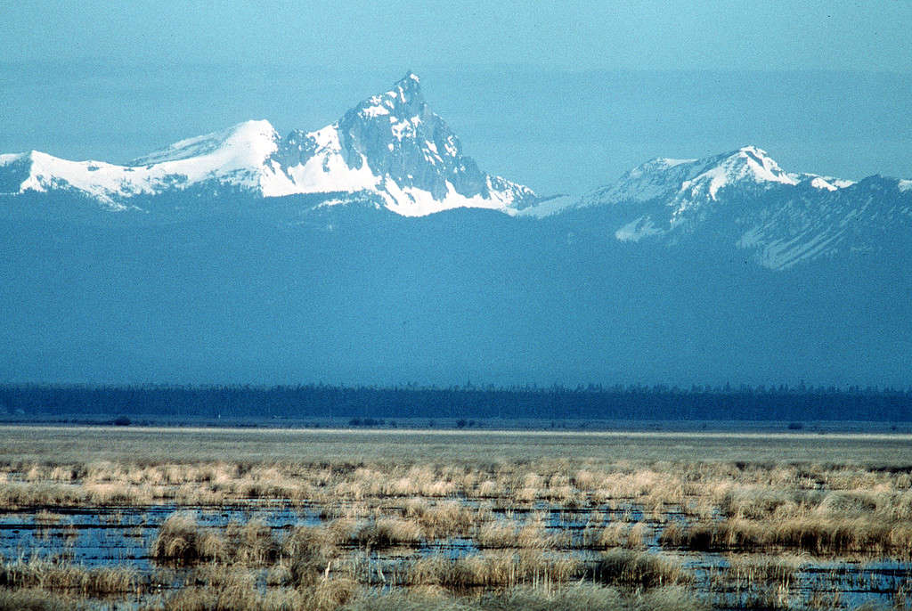
Most of Modoc County is sparsely populated and is full of iconic “Western” imagery.
Modoc County is the fastest-shrinking county in California, with a population decrease of 13.25% since 2010 and a current population of 8,403 people total. Modoc has a land area of 4,203 square miles, which gives it a rather sparse population density of two people per square mile. The county is located in the most northwestern corner of the state, right on the border of Oregon and Nevada. Currently, Modoc is the third-least populous county in the state and only has a single incorporated city, Alturas.
Modoc doesn’t have a large population due to most of its land being federally owned. In fact, many of the workers in the region come from the United States Forest Service, Bureau of Land Management, National Park Service, Bureau of Indian Affairs, and the United States Fish and Wildlife Service and make up a large portion of the region’s population and economy. The slogan of the county is rather fitting: “The last best place” and “Where the West still lives.”
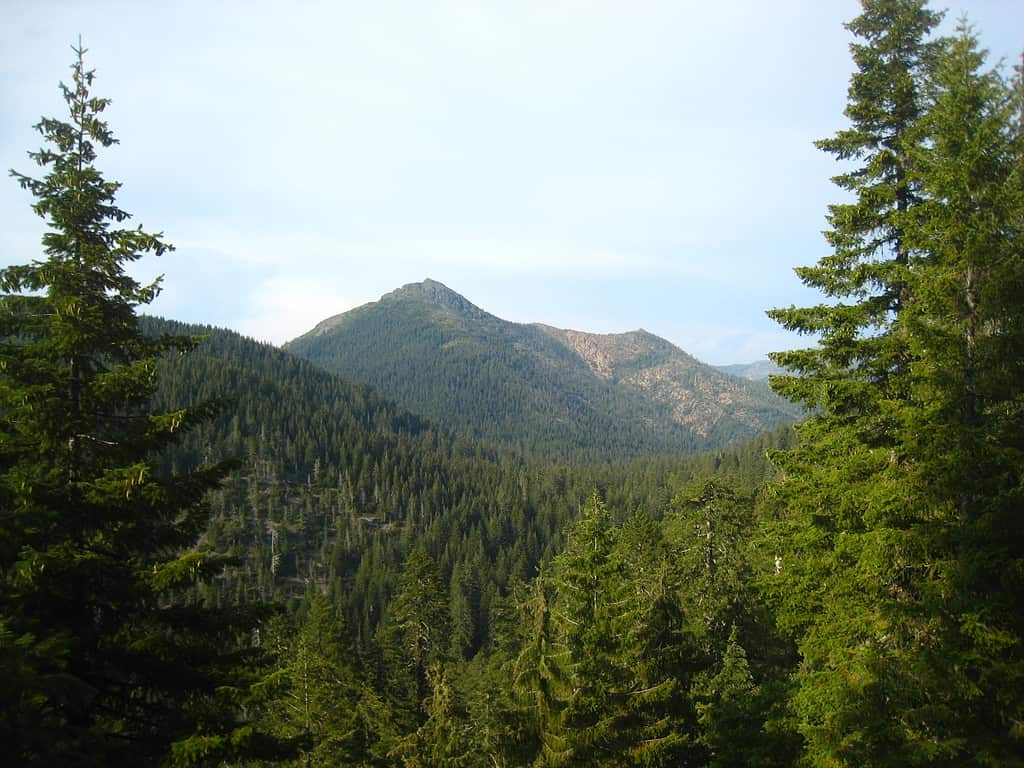
2. Mono County
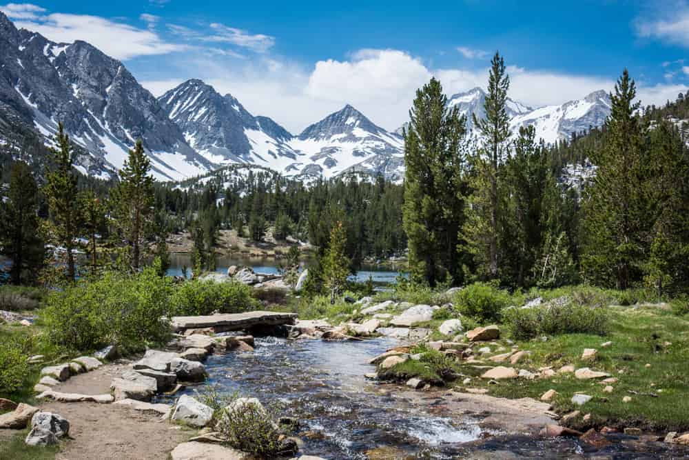
The Sierra Nevadas are the dominant features of the eastern California landscape, especially in Mono County.
©melissamn/Shutterstock.com
Mono County is the second-fastest shrinking county in California, with a population decrease of 9.22% since 2010 and a current population of 12,892 people in total. Mono has a land area of 3,132 square miles, giving it a population density of four people per square mile. The county is located in the eastern part of the state, bordering Nevada. Mono is the fourth-least populous county in the state and has a few cities, including Mammoth Lakes, Benton, and its county seat, Bridgeport.
Mono has a lot of natural attractions, mostly centered around tourism and recreation. The area is east of the Sierra Nevadas and is famous for its fishing, skiing, resorts, and natural beauty. The region’s most notable feature is probably Mono Lake, a soda lake that provides one of the most unique ecosystems in the area for two million migratory birds that stop here to eat the fly larvae that breed in the saline water.
3. Lassen County
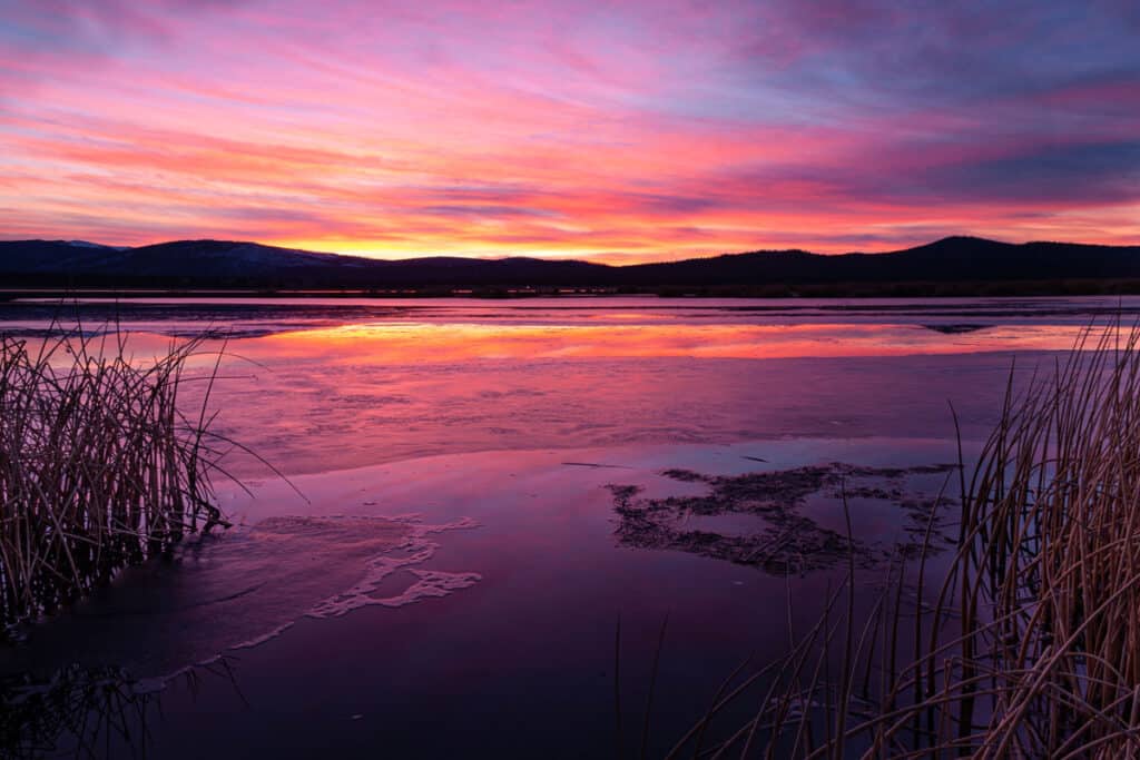
One of the larger lakes in Lassen County is Eagle Lake, home to a special subspecies of rainbow trout.
©Micheal Lee/Shutterstock.com
Lassen County is the third-fastest shrinking county in California, with a population decrease of 8.06% since 2010 and a current population of 32,082 people total. Lassen has a land area of 4,720 square miles, giving it a population density of seven people per square mile. The county is located in the northeastern part of the state, bordering Nevada, directly under Modoc County. The county has one incorporated city within it, Susanville.
The region was historically a farming, mining, and lumber hub but has since changed and is primarily the home of two state and one federal prison. According to some sources, half of the population of Susanville works in one of the prisons as it’s one of the only job opportunities once the lumber industry faltered. The county’s namesake is Peter Lassen, one of the guides who helped John C. Fremont, a famous trapper from the 19th century.
4. Mariposa County

This county has the rare honor of having no traffic signals anywhere within its borders.
©Whitelion61/Shutterstock.com
Mariposa County is the fourth-fastest shrinking county in California, with a population decrease of 7.98% since 2010 and a current population of 16,795 people total. Mariposa has a land area of 1,463 square miles, giving it a population density of 12 people per square mile. The county is located in the foothills of the Sierra Nevadas, north of Fresno. The county’s eastern section is the central portion of Yosemite National Park. Mariposa is the sixth-least populous county in the state, and it’s also famous for its complete lack of traffic signals anywhere in the county.
Mariposa was one of the original counties of California, created when the region was coming into statehood around 1850. It was once the largest county in the state, but over time it gave up land to form twelve other counties. It is known as the “Mother of Counties” as the first county and one that “birthed” other counties from itself.
5. Butte County
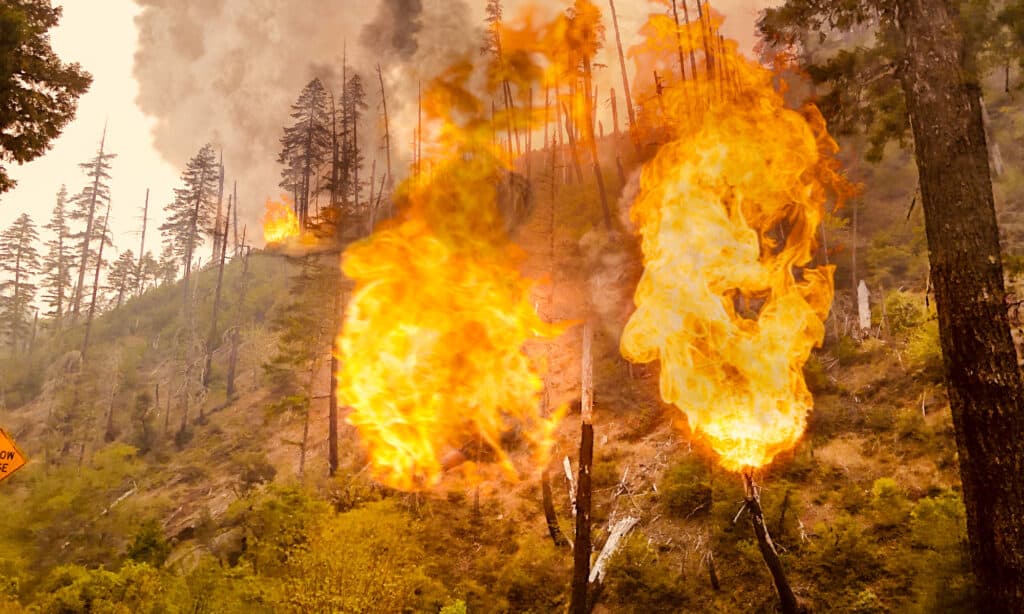
Unfortunately, Butte County was the epicenter of one of the most devastating wildfires in California’s history.
©iStock.com/MichaelPenhallow
Butte County is the fifth-fastest shrinking county in California, with a population decrease of 4.94% since 2010 and a current population of 209,121 people in total. Butte has a land area of 1,636 square miles, giving it a population density of 127 people per square mile. The county is located in the northern part of the state, north of the state capital of Sacramento. The county’s western border is the Sacramento River. Butte is the 29th largest county in the state and has four incorporated cities: Chico, Oroville, Gridley, and Biggs.
Butte is in a region known as the California Central Valley, a region heavily influenced by the Sacramento River. The region got its name from “buttes” in Sutter Buttes in the adjacent Sutter County, with buttes meaning “small hills”. Recently, Butte County experienced a massive wildfire that killed 80 people, displaced 50,000, and destroyed 150,000 acres of land. The fire is a major contributor to the population reduction in the region.
6. Del Norte County
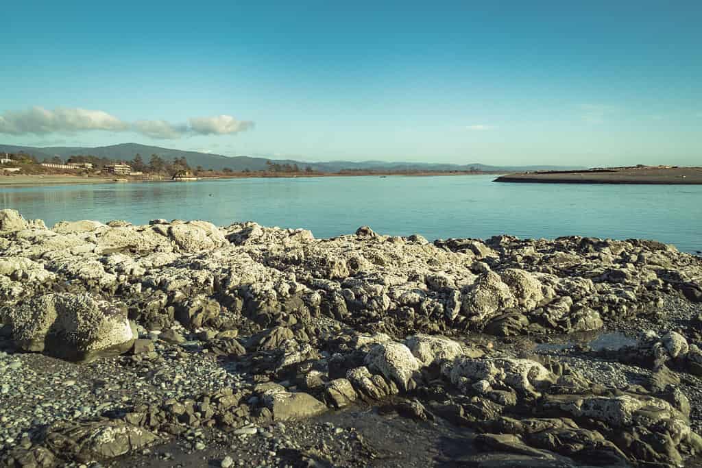
Crescent City is the only incorporated city in Del Norte County, although the area offers a lot of exploring potential.
©Manuela Durson/Shutterstock.com
Del Norte County is the sixth-fastest shrinking county in California, with a population decrease of 3.94% since 2010 and a current population of 27,482 people in total. Del Norte has a land area of 1,008 square miles, giving it a population density of 27 people per square mile. The county is located in the northwestern corner of the state, right on the border of Oregon and the Pacific Ocean. The county has only one incorporated city in the county, Crescent City.
Native American groups were the original settlers, and it still has residents from the Yurok and Tolowa Nations. Today, the area is most known for its massive redwood forests and coastal climate. The whole region is pretty rural and somewhat isolated from the larger population centers to the south of the state.
7. Siskiyou County
The Siskiyou Mountains are where Siskiyou County gets its name from.
Siskiyou County is the seventh-fastest shrinking county in California, with a population decrease of 2.38% since 2010 and a current population of 43,830 people total. Siskiyou has a land area of 6,278 square miles, giving it a population density of seven people per square mile. The county is located in the northernmost part of the state, to the east of Del Norte Siskiyou and bordering Oregon to the north. It’s the tenth-least populous county in the state.
Siskiyou County is named after the Siskiyou Mountains, which are located on the Oregon border. The name “Siskiyou” comes from a Native American word meaning “ridge of mountains,” which makes sense considering the county is on the border of a ridge of mountains. The region has strong ties to the gold rush era and used to be a major mining region in California. The county’s motto is “Where California Begins.”
8. Plumas County
The Feather River is an important regional river that flows through Plumas County.
©Radu Sava/Shutterstock.com
Plumas County is the eighth-fastest shrinking county in California, with a population decrease of 1.41% since 2010 and a current population of 19,724 people in total. Plumas has a land area of 2,554 square miles, giving it a population density of eight people per square mile. The county is located in the northeastern part of the state, although it’s not actually touching the borders of Nevada or Oregon. Plumas is the ninth-least populous county in the state and has one incorporated city, Portola.
Plumas County’s name comes from the Feather River, a major river that flows through the county, as well as a native moth species. The area within Plumas grew rapidly during the gold rush after settler Thomas Soddard reportedly found gold nuggets lining a lake. He made this discovery while lost in the forest, and his claim caused a massive influx of people. Gold-seekers never found the lake, but the region later became a railroad stop and grew due to the new arrivals.
9. Calaveras County
Calaveras County is home to old mines, tunnels, and caves.
©Sarah Argo/Shutterstock.com
Calaveras County is the ninth-fastest shrinking county in California, with a population decrease of 0.82% since 2010 and a current population of 45,205 people total. Calaveras has a land area of 1,037 square miles, giving it a population density of 43 people per square mile. The county is located in the central part of the state, south of Sacramento. Calaveras only has one incorporated city, Angels Camp.
The name of the county comes from the Spanish word “calaveras,” which means skulls, reportedly because of Native American skulls found in the area. Like many of the rural counties on our list, the region saw an influx of people during the gold rush period. After the discovery of a new gold mineral, calaverite, the people named the mineral after the county.
10. Kings County

Before its drainage, Tulare Lake was once the largest freshwater lake west of the Great Lakes.
Kings County is the tenth-fastest shrinking county in California, with a population decrease of 0.42% since 2010 and a current population of 152,336 people total. It has a land area of 1,391 square miles, giving it a population density of 106 people per square mile. Kings County is in the central part of the state.
The river located within Kings County was originally discovered and given the name the River of the Holy Kings; the name was a reference to the Bible’s wise men. Later, it was named Kings River, and the county became Kings County. Historically, Tulare Lake, located in the county, was the largest body of fresh water in the U.S. west of the Great Lakes, but farming and other processes changed the area quite a bit.
Summary of 10 Fastest-Shrinking Counties in California
Here’s a recap of the top 10 California counties with rapidly shrinking populations.
| Number | County | Population Decrease Since 2010 | Population | Population Density |
|---|---|---|---|---|
| 1 | Modoc County | 13.25% | 8,403 | 2 people per square mile |
| 2 | Mono County | 9.22% | 12,892 | 4 people per square mile |
| 3 | Lassen County | 8.06% | 32,082 | 7 people per square mile |
| 4 | Mariposa County | 7.98% | 16,795 | 12 people per square mile |
| 5 | Butte County | 4.94% | 209,121 | 127 people per square mile |
| 6 | Del Norte County | 3.94% | 27,482 | 27 people per square mile |
| 7 | Siskiyou County | 2.38% | 43,830 | 7 people per square mile |
| 8 | Plumas County | 1.41% | 19,724 | 8 people per square mile |
| 9 | Calaveras County | 0.82% | 45,205 | 43 people per square mile |
| 10 | Kings County | 0.42% | 152,336 | 106 people per square mile |
Conclusion: Is California’s Population Leaving?
California is the most populous state in the nation, but it has experienced a slight population decline in the last two years. Looking at the U.S. Census data, California’s population decreased by 0.91% from 2020 to 2021 and by 0.29% from 2021 to 2022.
However, that said, not all counties in California are shrinking at the same rate or for the same reasons. As we see in our list, the counties with the largest percentage decrease in population are mostly rural, such as Modoc, Lassen, Mono, Mariposa, and Del Norte. These counties have low population densities, remote locations, and limited economic opportunities. They also face other challenges like wildfires and a changing landscape.
On the other hand, the urban counties in California, such as Los Angeles, San Diego, Orange, and Santa Clara, have not seen a significant population decline. These counties have high population densities, diverse economies, and a huge influx of immigration, both domestic and international.
The next few years will be a big tell in how the future of California looks, but it doesn’t seem to be an issue to the level that the media is portraying it as.


How to Add Us to Google News


Thank you for reading! Have some feedback for us? Contact the AZ Animals editorial team.