
If current trends continue, by the year 2100 the average global temperature will be about 6.5 °F (3.6 °C) higher than it was in pre-industrial times. As global ice cover melts, some countries are forecast to disappear entirely, while others will face severe coastal flooding. The United States will be one of those hard-hit countries. So which U.S. states will experience flooding, and where? Let’s find out.
Our Data Parameters
Scientists agree the climate is warming but disagree on the reasons why and how fast.
©lamyai/iStock via Getty Images
For this article, we consulted the Coastal Risk Screening Tool provided by Climate Central, a policy-neutral group of scientists that provides climate data for media and academia. On the interactive map provided, we set the parameters at the provided defaults. These include moderate sea level rise and annual flooding events, global warming remaining on the current trajectory, and “medium luck” when it comes to the effects of global warming (in case things aren’t as dire as some scientists predict).
We also excluded any areas below sea level with sea walls, levees, or natural features that provide protection. Finally, among the five possible data sources, we chose the leading consensus option. This data set comes from the Intergovernmental Panel on Climate Change (IPCC) and relies on data that a broad consensus of researchers holds with “medium confidence” or better. Here are some of the states that will have the most problems with flooding due to climate change.
1. Alabama
Alabama’s delta region will be inundated by 2050.
©George Dodd III/Shutterstock.com
Most of Alabama‘s coast west of Mobile Bay will flood as well as substantial parts of the offshore barrier islands. Mobile will experience some flooding. By far, the largest flooded area will be the entire Delta Wildlife Management Area nearly as far north as the juncture of the Alabama and Mobile Rivers.
2. California
San Pablo Bay is one of the areas of California that will be submerged by 2050.
©Buckmanart/Shutterstock.com
Despite all the hype about California “falling into the sea,” you’ll have to wait for an earthquake, not global warming, to cause that. In the Los Angeles area, there will be flooding in Belmont Park, Naples, and an industrial area west of Long Beach. Most of the flooding issues will happen in the Bay area. North San Jose, Stockton, Sacramento, San Rafael, and San Pablo are some of the urban areas that may suffer. The low-lying wildlife refuges north of San Pablo Bay and Grizzly Bay will be inundated.
3. Florida
The low-lying coastal areas of the Everglades are likely to be underwater by 2050.
©ocudrone/Shutterstock.com
Rising seawater will be a big problem for Florida. Many of the Keys and the coastal Everglades from Naples in the west to Miami will sink. Low-lying coastal areas of Tampa, Fort Myers, and Jacksonville as well as the whole coast from Apalachee Bay in the Panhandle to just north of Tampa will flood. The St. John’s River will back up, creating flooding as far south as the Lake Jesup Conservation Area near Geneva.
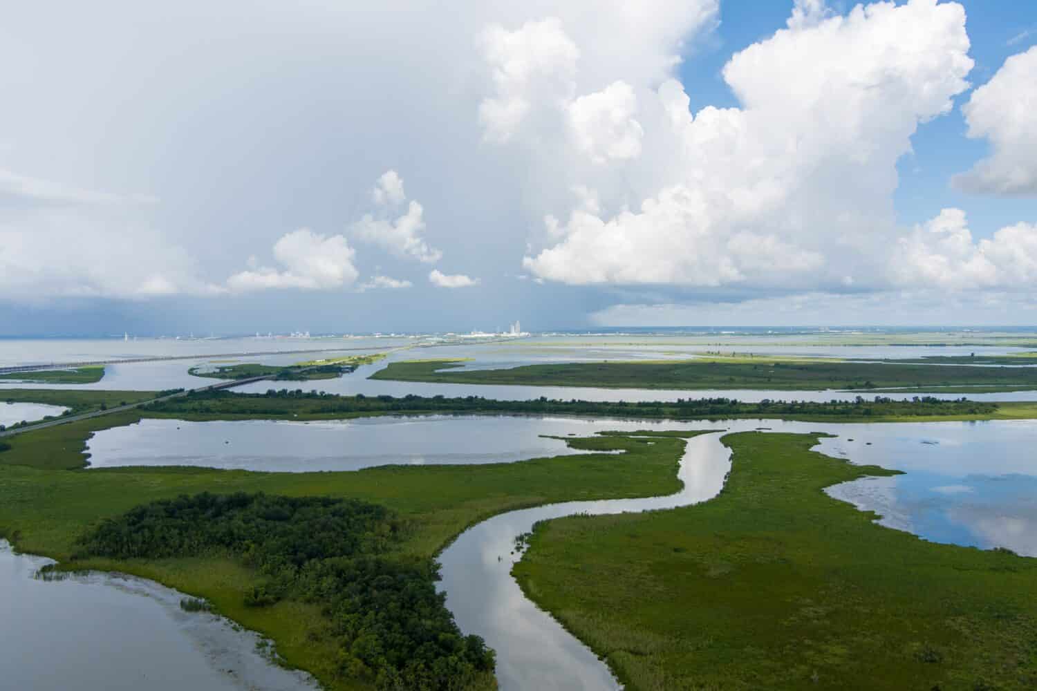
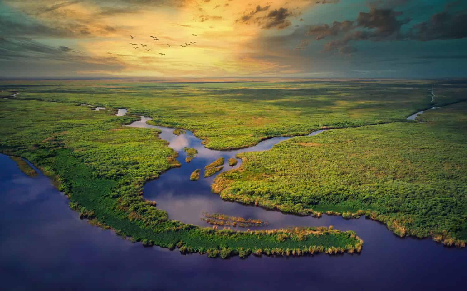
4. Louisiana
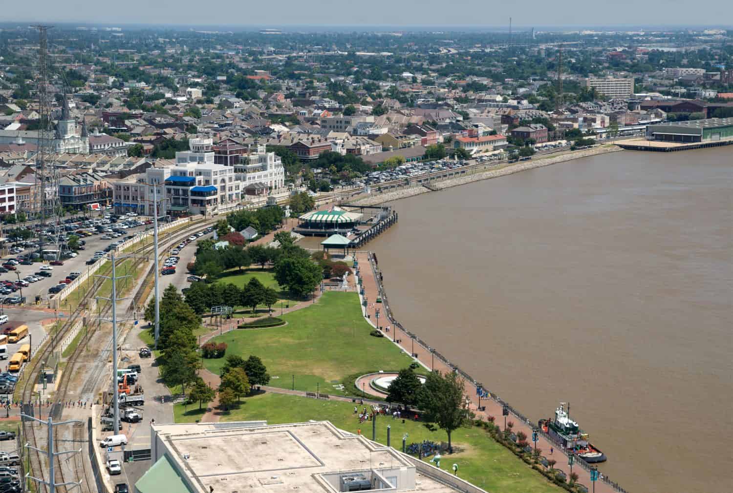
Levees protect New Orleans from Mississippi River and the Gulf of Mexico flood waters.
©Pattie Steib/Shutterstock.com
Floodwaters may cover large tracts of the Louisiana coast far inland. Devastated areas will include the Sabine National Wildlife Refuge, Rockefeller Wildlife Refuge, Atchafalaya Delta, and most of the southern Mississippi Delta. As long as its levees hold, the city of New Orleans will survive as virtually an island.
5. Maryland
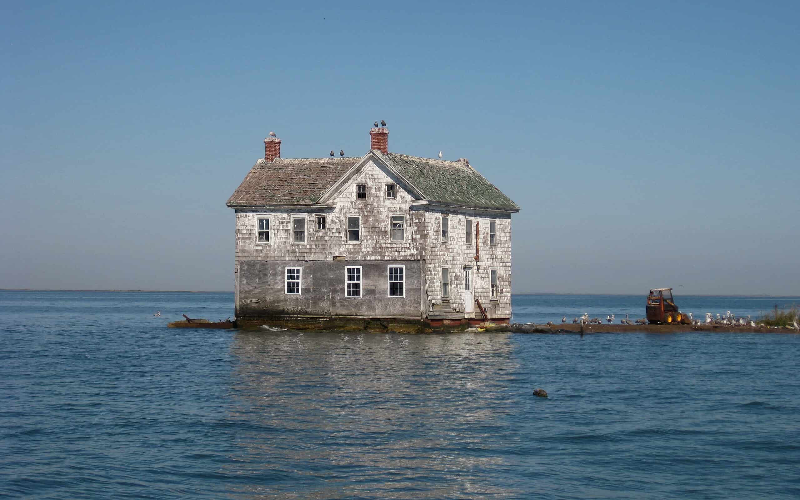
This 1888 house was the last on Holland Island in the Chesapeake Bay. It collapsed in 2010.
Most of Maryland’s losses to the sea will happen on its eastern shore, particularly in the Blackwater Wildlife Refuge and the area around Pocomoke Sound. Flooding will wipe out most of Assateague Island and the whole coast of Chincoteague Bay.
6. New Jersey

Surprisingly, Atlantic City’s boardwalk could survive sea level rise, but most of the city will not.
©Checubus/Shutterstock.com
The southern coasts of New Jersey will be at greatest risk of catastrophic flooding by 2050. Floodwaters may inundate low-lying areas along the Delaware River as far north as Trenton as well as the entire Delaware Bay coast. Nearly all of the state’s Atlantic barrier islands will disappear. The boardwalk and resort hotels in Atlantic City will still be above water, but most of the inland areas of the city will be flooded. Great Bay and the Mullica River will flood far inland. The Atlantic coast as far north as Manasquan Beach will be in trouble. In northern New Jersey, riverfront areas of New Brunswick and East Brunswick could be hard hit in addition to low-lying parts of Rutherford.
7. New York
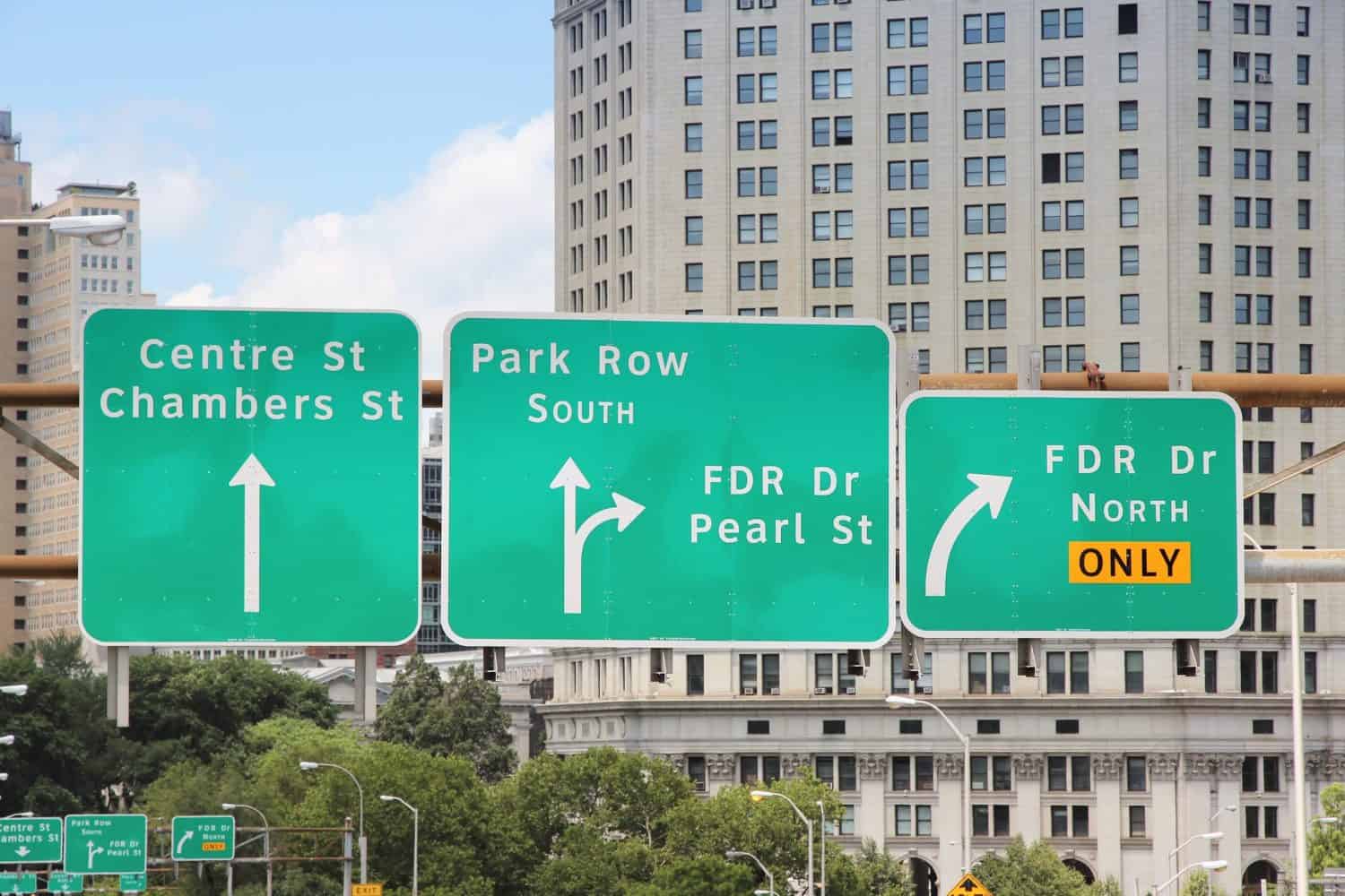
FDR Drive in lower Manhattan is one of the areas that will need to be reinforced or rebuilt.
©Tupungato/Shutterstock.com
New York will lose coastal areas and offshore islands along both coasts of Great South Bay. Most of LaGuardia Airport will be submerged if nothing is done to protect it. Most of the Hudson River Greenway and FDR Drive between Brooklyn Bridge and Jefferson Street will be below sea level as well. Riverbank State Park in Upper Manhattan will also be lost.
8. South Carolina
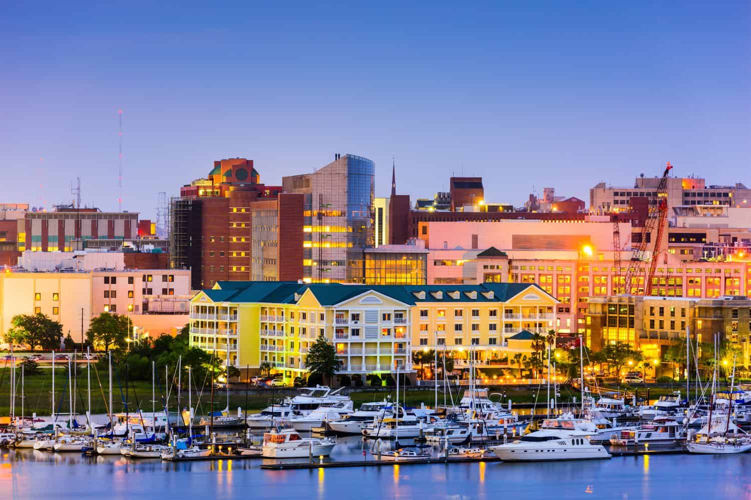
By 2050, large areas of coastal and riverfront property in Charlston will go underwater.
©Sean Pavone/Shutterstock.com
South Carolina’s beaches, resorts, and wildlife refuges could be devastated by rising floodwaters. Hilton Head, Parris Island, most of Edisto Island, and the community of Cherry Grove will be mostly submerged. The major rivers emptying at the coast, including the Great Pee Dee, Waccamaw, and North and South Santee Rivers will all back up and flood extensively inland. The greater Charleston metro will be one of the hardest-hit urban areas in the country, with extensive coastal and riverfront flooding. The city is working steadily on ways to mitigate the flooding danger.
9. Virginia

A great loss of rising sea levels for Virginia will be Chincoteague Island, a home to wild ponies.
©Vicky Faye Aquino/Shutterstock.com
Researchers have tracked sea level rise in Virginia for many years. The state is predicted to lose all of the small barrier islands on the Atlantic side of the eastern shore. Low-lying areas along the James River will flood up to Richmond. The same will happen along the Rappahannock almost to Fredericksburg and along the York River and its tributaries, all the way to their sources just east of Richmond. Virginia’s historic Tangier Island in the Chesapeake Bay will be uninhabitable. Sadly, we will have to say goodbye to most of Chincoteague Island, home of the famous wild ponies of Chincoteague. The cities of Chesapeake and Suffolk in the southeast will also deal with extensive riverfront flooding.
Is Your State Safe?

The effects of climate-related flooding will be felt across the U.S. economy.
©FOTOGRIN/Shutterstock.com
Even if you don’t live, work, or vacation in one of the areas forecast for climate change flooding, the spillover effects will touch us all. New freshwater wetlands may form on farmland further up rivers. Local, state, and federal governments will spend tax money to protect or relocate valuable infrastructure, such as airports, military bases, and piers. Insurance rates will go up as private landowners and corporations file claims for flooded properties. By all accounts, this kind of flooding is no longer a matter of “if” but “when” and “how much.”