
Waterfalls are beautiful works of art in nature – water tumbling down steep inclines, trickling down a rock bed, or cascading from great heights and over a precipice to fall into a waiting plunge pool below. According to the Northwest Waterfalls Survey, there are over 1600 waterfalls in the state of Oregon. Aside from Washington, this is more waterfalls than any other state. Of these 1600+ falls, over 140 of them are over 100 feet tall. It isn’t just height that makes a waterfall great, but it’s what we’ll focus on as we take a look at the tallest waterfall in Oregon.
Tallest Waterfall in Oregon
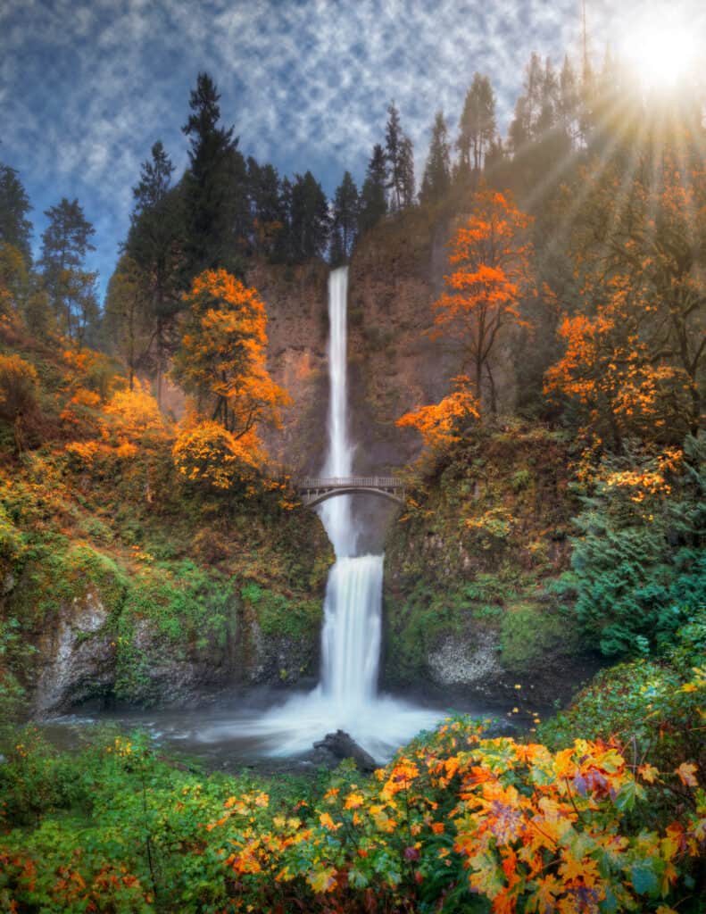
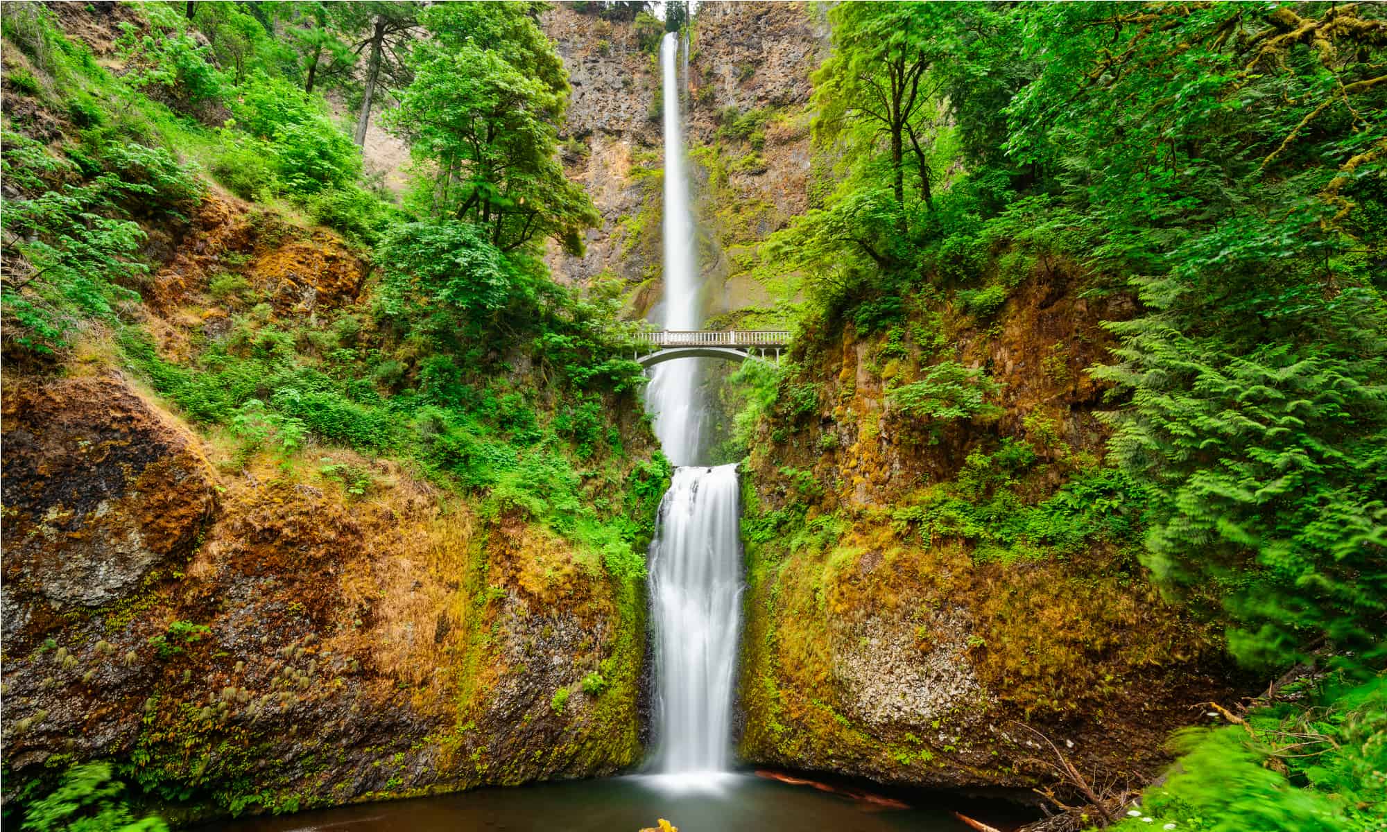
Multnomah Falls is the tallest waterfall in Oregon.
©iStock.com/Freebilly
Multnomah Falls is the tallest waterfall in Oregon and the 154th tallest waterfall in the United States. The falls plunge 620 feet down into the Columbia River Gorge, and most of the water falling rushes swiftly from underground springs. These springs exist as a result of the Missoula Floods over 15,000 years ago, giving extra life to Multnomah Creek and the gorge below. This incredible outpouring is one of the most popular tourist destinations in the northwest portion of the country, drawing over 2 million visitors a year to see its incredible height and hear its monstrous roar.
There are two large drops for the falls – the upper falls and the lower falls. The upper falls have a 542-foot drop onto a 9-foot gradual slope before falling another 69 feet straight into the plunge pool at the bottom.
Visiting the Falls
You can visit Multnomah Falls all year round, but you may need a permit to access it. The site gets so busy during the tourism season that visitors must acquire a timed pass to see the falls. This ensures that everyone gets a chance to bask in the wonder of it. The site requires passes from May 26th to September 4th, 9 a.m.-6 p.m. and you can get them at the Gateway to the Gorge Visitor Center, which also contains a gift shop, restaurant, snack bar, and restrooms.
A limited number of permits are available at the center, and guests can save time by obtaining one on the Rec.gov website for 2 dollars. Online permits are available up to two weeks in advance. A timed permit dictates the hour slot in which you can enter the falls area, but there is no limit to how long you can stay. Please keep in mind that a permit does not guarantee a parking spot.
There’s a great number of amenities at the falls and visitor center. Flush toilets, running water, and accessible parking and trails are all available. There is plenty of parking on most days, and the site has 5 picnic sites available, as well.
Where is Multnomah Falls Located on a Map?
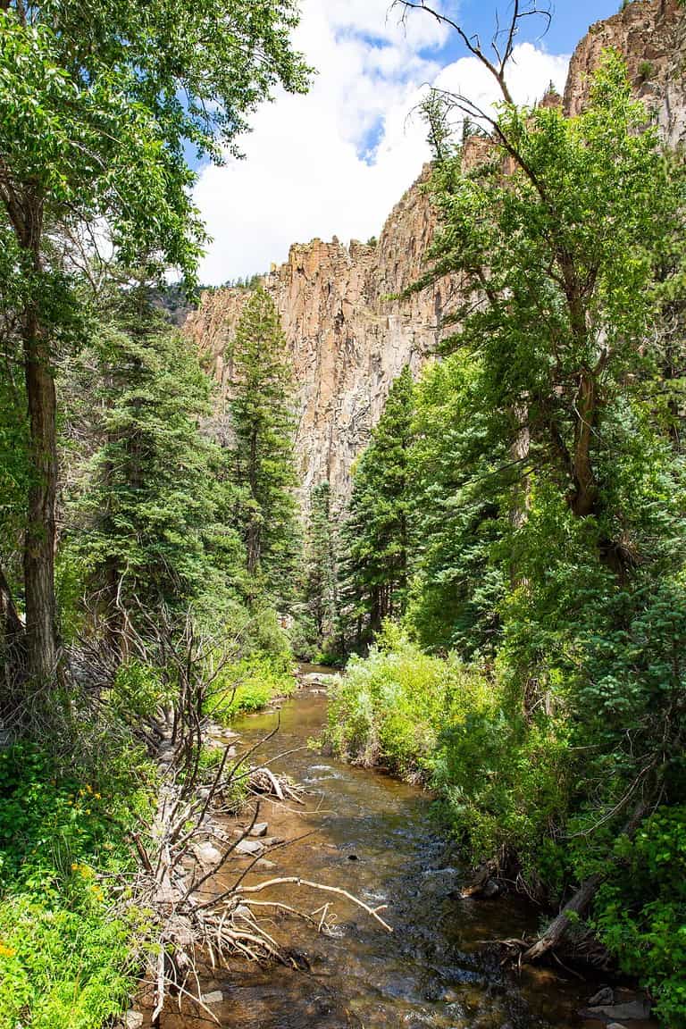
Multnomah Falls is right on the border of Washington and Oregon – the Columbia River Gorge separates the two states. It’s a 30-mile drive from Portland heading east on Interstate 84. Without traffic, it takes 36 minutes to drive from downtown Portland to the falls. The city of Portland is located in the northwestern region of Oregon where the Willamette and Columbia Rivers join.
Hikes and Viewpoints
There is a great amount of hiking at and around the falls. The main hike is a 2.4 miles round trip hike that is family-friendly. A paved trail leads you to the falls, with an overall elevation change of about 800 feet. The trail climbs steeply at first but then levels out as you reach Benson Bridge to see the falls. Stop at several overlooks along the way, including the Benson Bridge crossing. Reaching the bridge requires a steep climb, but it’s worth it. Visitors cross the bridge directly in front of the falls and get an unobscured view of the plunging water.
Avid adventurers can continue to ascend after the bridge. A small viewing area rests at the top of the falls at the end of a short spur trail.
Several other hikes branch off the Multnomah Falls trail.
- Multnomah to Devil’s Rest: a strenuous 8.4-mile out-and-back hike. This hike takes you to the Devil’s Rest summit after a tricky 2,368-foot elevation change. Several beautiful sites along the trail, including a series of other waterfalls.
- Multnomah to Franklin Ridge: an expert-level hike with a distance of 11 miles. This loop trail challenges determined hikers – 3,400 feet of elevation change as you pass multiple waterfalls along Oneonta Creek.
- Wahkeena Falls Loop: A moderate hike with a 1,700-foot elevation change. Hikers will follow this 4.6-mile loop from Multnomah Falls to Wahkeena Falls – a 242-foot beauty.
As you get further from Multnomah Falls, the trails get quieter. You’ll likely not find perfect solitude along the trails, but there are plenty of quiet and peaceful spots to stop for a moment alone with nature. Remember to pack hiking essentials, especially for the longer hikes. It’s also always wise to check weather conditions and acquire trail maps before tackling any of the longer hikes. Don’t forget to be respectful! Take all of your trash with you and don’t disturb nature or vandalize the trails. We are all responsible for keeping nature safe and pristine.
Best Time to Visit
We’ve considered a couple of factors when offering our recommendations for when to visit. First, we looked at what season brings peak water flow for the falls. Next, we looked at what times of year had the most visitors. Based on these two metrics, we recommend visiting in the late winter or early spring. Peak water flow for Multnomah Falls occurs during snow-melt and the rainy season. Conditions will be more wet and rainy, but the waterfall will be at peak flow and incredibly impressive. Further, you’re less likely to run into other visitors on the trails. For some quiet and privacy while visiting, make the trek out on a weekday sometime in March or April. You may not get the whole place to yourself, but you’ll likely beat the teeming crowds that show up as summer arrives.
Wildlife Around Multnomah Falls
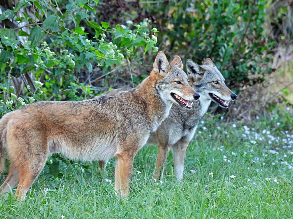
You are unlikely to see the elusive coyote on your visit to Multnomah Falls.
©iStock.com/passion4nature
You can see an abundance of wildlife at and around the falls. The area is rich in natural resources for many animals, including black bears, elk, beavers, weasels, skunks, deer, and coyotes. Don’t worry, practicing safe wildlife viewing and being respectful and aware of your surrounding will usually protect you from any danger. Don’t ever approach wildlife – even friendly-seeming animals. Even if wildlife is not a risk to you, you are a risk to it. Teaching wild animals that contact with humans is safe disrupts their natural environments and puts their lives in danger. Make sure to view all animals with care and respect. Don’t feed them, touch them, or take them home. Be mindful about trail use – straying off trails can cause unwanted damage.
Other Notable Waterfalls in Oregon
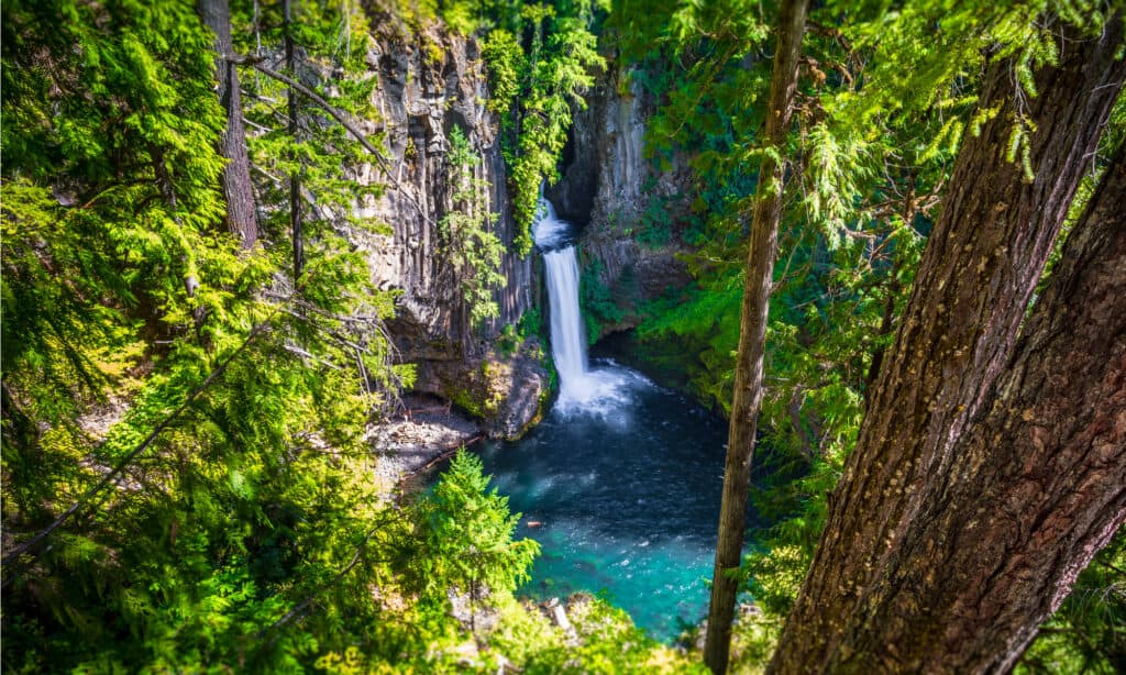
Another picturesque Oregon waterfall is Toketee Falls with a height of 89 feet.
©Stephen Moehle/Shutterstock.com
Multnomah Falls isn’t the only gorgeous waterfall to see in Oregon. In Southern Oregon, Highway 138 runs east of Roseburg past over 17 waterfalls. This highway gets a fitting nickname – “Highway of Waterfalls”. In order to give you an idea of just how many waterfalls you can see when you visit Oregon, we’ve included a table with just a few of them!
| Name of Waterfall | Location of Waterfall | Height of Waterfall | Length and Type of Hike |
|---|---|---|---|
| Susan Creek Falls | Highway 138, 29 miles east of Roseburg, Oregon | 50 feet | 1.6 miles, out and back |
| Toketee Falls | Highway 138, 59 miles east of Roseburg, Oregon | 89 feet | 0.9 miles, out and back |
| Silver Falls | Silver Falls State Park, 24 miles southeast of Salem | 259 feet | 2.6 miles, loop trail |
| South Falls | Silver Falls State Park, 24 miles southeast of Salem | 177 feet | 0.9 miles, loop trail |
| Latourell Falls | Columbia River Gorge, 30 miles east of Portland, Oregon | 249 feet | 2.4 miles, loop trail |
| Coquille River Falls | Powers, Oregon | 115 feet | 0.7 miles out and back |
| Drift Creek Falls | Otis, Oregon | 66 feet | 3.7 miles, out and back |
| Sweet Creek Falls | Mapleton, Oregon | 70 feet | 1.8 miles, out and back |
| Youngs River Falls | Astoria, Oregon | 54 feet | 0.3 miles, out and back |