
Virginia is a state on the Atlantic Coast that spans 42,774 square miles and is known for its beautiful topography. Although Virginia is bordered by the Chesapeake Bay and the Atlantic Ocean, it is also bordered by five states. Virginia has a large portion of stunning coastline, but its land borders feature a variety of terrains, including mountain ridges. So, let’s discover the five states that border Virginia!
States That Border Virginia
Virginia currently shares a border with Kentucky, Maryland, North Carolina, Tennessee, and West Virginia. Also, although officially a territory, Virginia shares a border with Washington D.C., with the two being separated by the Potomac River.
Kentucky
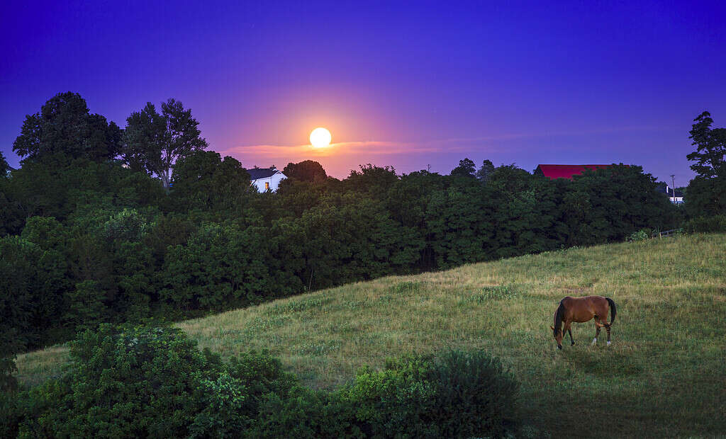
Kentucky is famous for its
horse
racing.
©alexeys/iStock via Getty Images
Border length: Approximately 121 miles
Kentucky is located on Virginia’s southeastern side, and the border between the two is approximately 121 miles long. The southernmost end of the border runs through the Cumberland Gap National Historical Park, which features the Cumberland Gap. This is a pass through the Appalachian Mountains close to the point where the borders between Kentucky, Tennessee, and Virginia meet.
The Cumberland Gap has an elevation of 1,631 feet and has long served as a gateway to the west. Also along the border between Kentucky and Virginia is the Birch Knob Observation Tower, which offers visitors the chance to see four (sometimes five) states on a clear day. Away from the border, Kentucky is particularly famous for its horse racing, annually hosting the Kentucky Derby at Churchill Downs in Louisville, which is also one of the most visited cities in the state.
Maryland
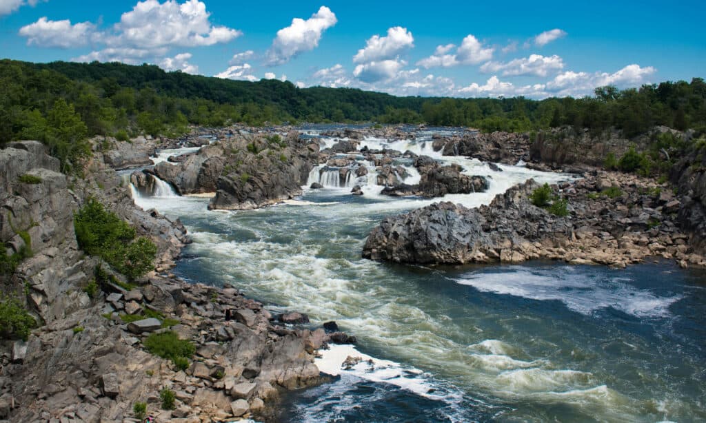
The Great Falls Park features a series of waterfalls that drop 76 feet over approximately one mile of river.
©iStock.com/Douglas Rissing
Border length: Approximately 195 miles
Virginia and Maryland share a border of approximately 195 miles. The majority of the border is marked by the Potomac River, although, unlike many other water boundaries, Virginia doesn’t own half of the river. Instead, the state border is located on Virginia’s side, near the low tide mark.
One of the most scenic areas along the border is Great Falls Park, which features approximately 15 miles of hiking trails as well as the Great Falls themselves. The Great Falls are a series of waterfalls that drop 76 feet over less than one mile.
Maryland spans 12,407 square miles and its capital is Annapolis, but one of the largest and most popular cities is Baltimore. Maryland is also particularly famous for its crabs, particularly blue crabs, which thrive in the Chesapeake Bay.
North Carolina

The largest city in North Carolina is Charlotte.
©Sean Pavone/Shutterstock.com
Border length: Approximately 316 miles
Also bordering Virginia is North Carolina, with a state line of approximately 316 miles. Located close to the border on the North Carolina side is Fall Creek Falls, which is located in the Mayo River State Park.
Located along the border you will also find the Great Dismal Swamp, which is a huge swamp that spans around 750 miles. Although it is only a fraction of its original size, the area is still a rich and diverse ecosystem that is home to hundreds of different species. It’s considered to be a safe haven for numerous species of birds and is located on the Atlantic Flyway, an important migration route for birds.
North Carolina is a beautiful state that features several mountain ranges. These include the Black Mountains, which are the highest in the eastern region of the US. The largest city in the state is Charlotte, which is located in the Piedmont region and has a current population of approximately 885,663.
Tennessee

Nashville, Tennessee, is the seventh most populated capital city in the U.S., with a population of around 669,053 people.
©Kaldari / public domain. – License
Border length: Approximately 140 miles
Tennessee spans around 41,227 square miles and was formerly part of North Carolina until North Carolina relinquished it in 1790. The capital city of Tennessee is Nashville, which is widely regarded as the home of country music. However, Tennessee is also known for its beautiful landscape and particularly its rugged mountains.
The border between Tennessee and Virginia is approximately 140 miles long, and much of it is located in the Blue Ridge Mountains. However, the city of Bristol is also located right on the border, with the center of State Street marking the dividing line.
West Virginia

West Virginia is well-known for its scenic landscape and abundance of outdoor activity opportunities.
©Andriy Blokhin/Shutterstock.com
Border length: Approximately 400 miles
The state that shares the longest border with Virginia is West Virginia. The border is approximately 400 miles long. A large portion of the state line runs through the Appalachian Mountains. This includes a section along the ridge of the Alleghany Mountain.
Also located on the state line is the High Knob Fire Tower in the George Washington National Forest. This scenic spot offers a stunning 360° view across both Virginia and West Virginia and the surrounding mountains. It’s accessed via a moderately difficult hiking trail, which is just 30 minutes from Harrisonburg.
West Virginia separated from Virginia in 1861 and officially became a state in 1863. The capital and the most populated city is Charleston, with an estimated population of 46,692. The state is best known for its rugged beauty and excellent range of outdoor activities.
The photo featured at the top of this post is © AppalachianViews/iStock via Getty Images


How to Add Us to Google News


Thank you for reading! Have some feedback for us? Contact the AZ Animals editorial team.