
California is home to many beautiful state parks with a variety of geographical features and wildlife. In the early 20th century a preservation movement saved many of the parks for future generations to enjoy. In this article, we will review the top 12 biggest state parks in California by acreage highlighting what there is to do, interesting historical information, and location.
Anza-Borrego Desert State Park
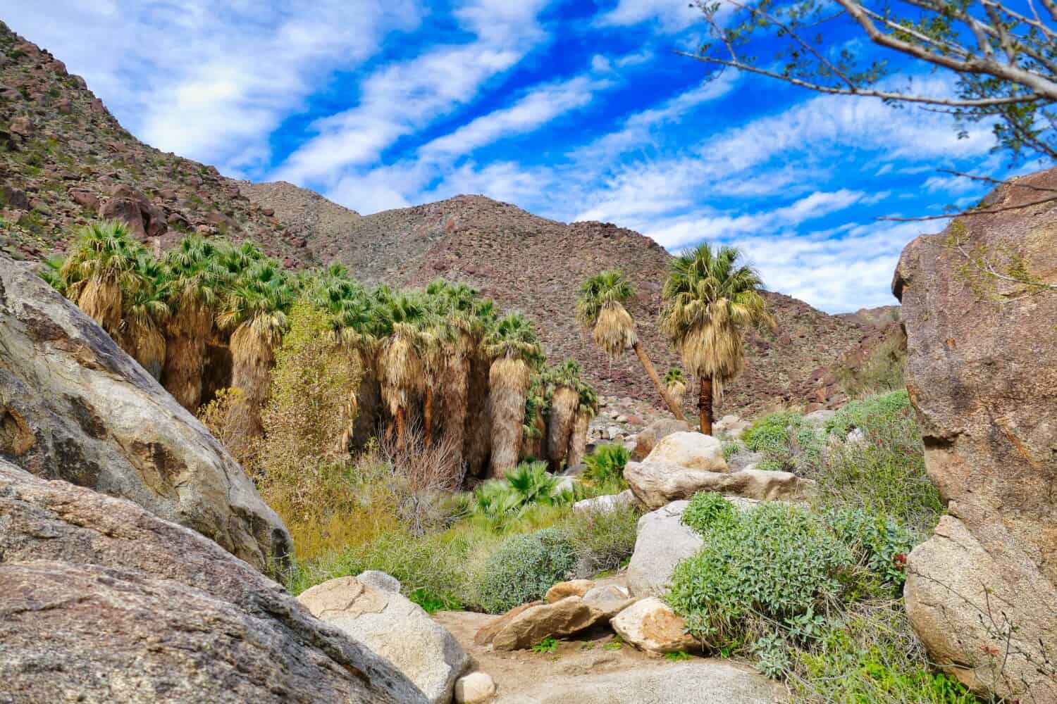
California Fan Palms grow 49 to 66 feet tall in Anzo-Borrego Park.
©Hans Wismeijer/Shutterstock.com
Two hours northeast of San Diego off Highway 78 and south of Palm Springs is Anza-Borrego Desert State Park. In 1774, the Spanish explorer Juan Bautista de Anza visited the lands where the park is now. As a result, the park was named for him and the resident bighorn sheep, Borrego in Spanish.
There is a lot to discover in this part of the Colorado Desert located atop two tectonic plates near the town of Borrego Springs. Declared a state park in 1933, it is the largest state park in California at 585,930 acres. Additionally, the park is an International Dark Sky Park, making it an ideal place for stargazing.
Much of the park is wild and remote, only accessible by primitive roads or on foot. Therefore, a four-wheel-drive vehicle with high clearance is recommended. Likewise, jeep tours are available. Activities in the park include camping, hiking, biking, horseback riding, stargazing, and art appreciation.
Carry plenty of water when visiting the park since it is one of the hottest destinations in the U.S. with average temperatures of 107 degrees that can climb to 125 degrees Fahrenheit. Over 550 types of fossils have been found here. They include the giant tortoise, mammoth, the largest flying bird in the Northern Hemisphere, camel, and ground sloths. Additionally, fossilized seashells have been discovered proving the area was underwater at one time. It was a blend of saltwater from the Gulf of California and freshwater from the Colorado River and has left 450-million-year-old metamorphic rock.
Several self-guided trails and a 21-mile tour are available for vehicles. In addition, the Pacific Crest Trail, which spans 2,650 miles from Mexico to Canada and crosses three western states goes through this park including California State Parks Castle Crags, McArthur-Burney Falls, Silverwood Lake, and Mt. San Jacinto.
Desert Art
Explore the free-standing Sky Art exhibit created by artist Ricardo Breceda with 130 large-scale metal sculptures spread across 1,500 acres. Connect to nature and art with sculptures of a saber-tooth cat, giant tortoises, mammoths, serpents, sloths, historic figures as well as mythical creatures, including a 350-foot-long serpent.
Henry W. Coe State Park
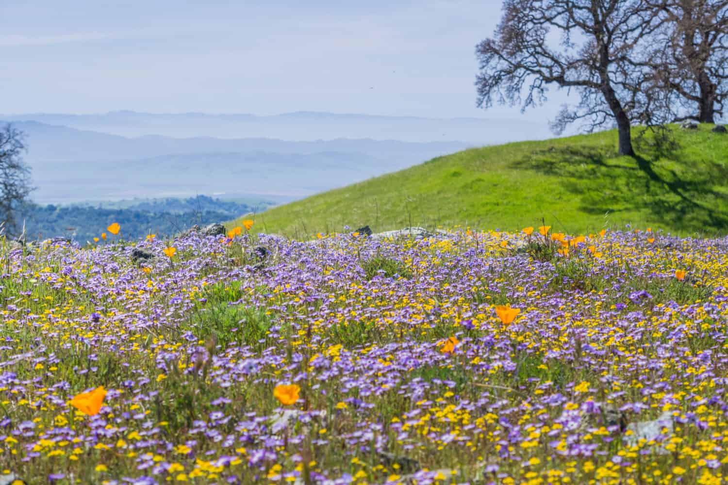
Spring wildflowers in Henry W. Coe State Park include white milkmaids, blue hound tongues, and yellow buttercups.
©Sundry Photography/Shutterstock.com
Located near Morgan Hill, Henry W. Coe State Park preserves a large area of the Diablo Range. Established as a state park in 1959, this 89,164-acre park is the second-largest state park in California and the largest in Northern California.
Once home to the Ohlone Indians, it is a beautiful place to enjoy nature, and see a variety of native plants, and animals. Activities include day hiking, fishing, mountain biking, horseback riding, and backpacking.
History
Henry Coe and his brother purchased 500 acres in 1892 in the hills east of Morgan Hill naming their homestead Pine Ridge. As a result, it became a summer range for their cattle. However, by 1907 Henry and his brother ended their partnership, but Henry continued to purchase land until the ranch grew to nearly 13,000 acres. In 1943 Henry passed away and the family sold Pine Ridge. Shortly thereafter, Henry’s daughter Sada repurchased the property in 1949, and in August 1953, she gave Pine Ridge to Santa Clara County Parks. Finally, Santa Clara County deeded the park to California State Parks in 1958.
Mono Lake Tufa State Natural Reserve
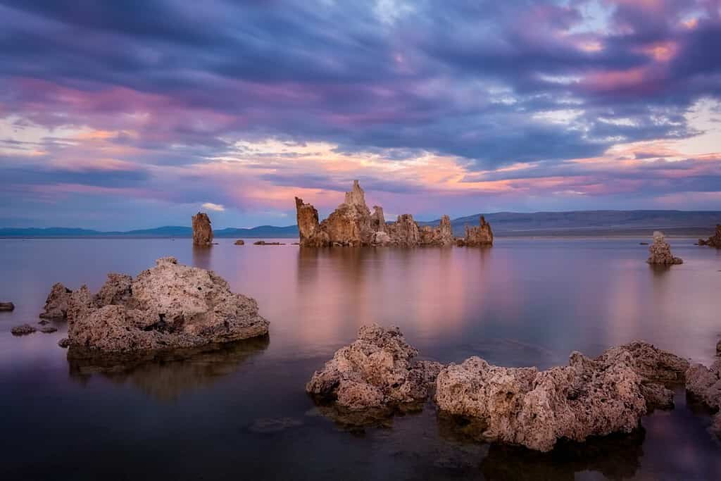
Tufa towers rise from the lake at sunset in Mono Lake Tufa State Natural Reserve creating an artistic photo opportunity.
©Luc Rousseau/Shutterstock.com
The park is located along Highway 395 near the town of Lee Vining. Established in 1982, it is 13 miles east of Yosemite National Park’s Tioga Pass. It covers 65 square miles, is 55,300 acres, and is the third largest state park in California. Activities include hiking, cross-country skiing, bird watching, boating, photography, and swimming. Additionally, the nearby town of Lee Vining provides lodging.
Rising from the lake are the tufa towers. They are made up of calcium carbonate and formed by the interaction of alkaline lake water and freshwater springs. In addition, the lake serves as protection for around one to two million migrating birds that pass through the area. It is two and a half times as salty as the ocean with high alkaline levels giving it a pH value of 10. As a result, is known as California’s Dead Sea.
This is a terminal lake; in other words, it has no outlet. Additionally, it has no fish. However, it is teeming with brine shrimp, algae, and alkali flies, which the migrating birds feed on. Snowy Plovers and California Gulls nest here. As a result, the stark beauty of the surroundings attracts artists from around the world.
History
A volcanic eruption caused the formation of Mono Lake, which left a depression known as the Long Valley Caldera. Consequently, the area has many hot springs and earthquakes. The lake is part of the Mono Craters Chain of plug-dome volcanos, which form when lava hardens and caps over volcanic vents. It is one of the oldest lakes in North America, believed to be 750,000 to three million years old.
Humboldt Redwoods State Park
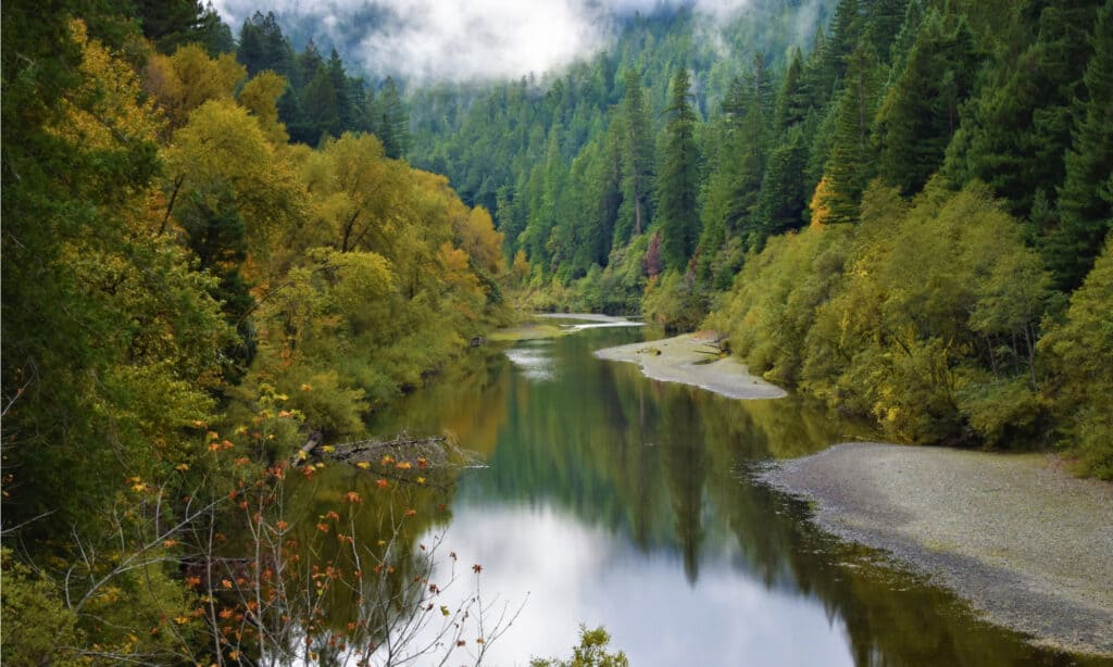
The Eel River flows through Humboldt Redwoods State Park.
©Anna Westman/Shutterstock.com
Humboldt Redwoods State Park is 51,651 acres. It is located between Weott and Myers Flat along the Eel River. Established in 1921, it is the fourth-largest state park in California. Some fun things to do here include camping with 250 campsites, 100 miles of hiking, riding, and biking trails, and the popular 32-mile scenic drive of the Avenue of the Giants. Day-use areas include swimming, picnicking, or just enjoying the majesty of the woods.
Rockefeller Forest, the world’s largest contiguous old-growth forest of coastal redwoods resides within this park. In addition, the Stratosphere Giant grows here, the fourth-tallest known tree in the world at 372 feet. The Hearthstone structure, a four-sided fireplace, is in the California Federation of Women’s Clubs Grove. Designed by famed architect Julia Morgan, it is a tribute to the women who worked to preserve the redwoods.
History
It is thought that the last Ice Age limited coastal redwoods to their present range. Consequently, a narrow 450-mile strip along the Pacific Ocean from central California to southern Oregon provides the climate these trees require.
The Sinkyone Indians lived here for thousands of years. Loggers arrived afterward to log the ancient redwoods in the early 1900s. Therefore, about a third, or 17,000 acres, of the park remains old-growth redwood forest—the largest area of ancient redwoods left on the planet.
In 1917 three San Franciscans, John C. Merriam, Madison Grant, and Henry Fairfield Osborn, visited what is now called the Rockefeller Forest to witness the logging aftermath in the redwoods of Northern California. As a result, they were inspired to save the remaining stands creating Save the Redwoods League.
Less than a year later, John D. Rockefeller presented Save the Redwoods League with a check for one million dollars to purchase the grove. After that, the State of California matched with another million-dollar donation in 1929. Additionally, 9,335 acres of Dyerville Flats were purchased from the Pacific Lumber Company in 1931. However, J.D. Rockefeller did not want the forest named after his family, and until 1951 it was called Bull Creek-Dyerville Forest. Today, it is known as the Rockefeller Forest in his honor and is the heart of Humboldt Redwoods State Park.
Wildlife
Native animals include raccoons, rare ringtail cats, skunks, weasels, black bears, porcupines, Roosevelt elk, mink, deer, squirrels, and bobcats. In addition, the banana slug lives here and can get up to eight inches in length. Native to California’s redwood forests, they range in color from bright yellow to greenish or brownish. However, some banana slugs have dark brown spots that they use as camouflage when on the forest floor. They are the largest slugs in North America, and the second largest slugs in the world.
Ocotillo Wells State Vehicular Recreation Area
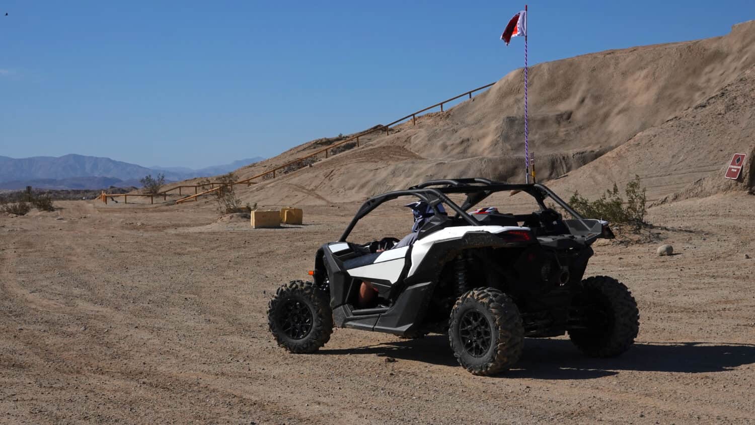
Enjoy the landscape in an off-road vehicle at Ocotillo Wells State Vehicular Recreation Area.
©Simone Hogan/Shutterstock.com
This off-road park in Borrego Springs is adjacent to Anza-Borrego Desert State Park and is 50,553 acres. Located 35 miles east of Julian on Highway 78 and 20 miles west of Highway 86, it was established in 1976 and is the fifth-largest state park in California. Accordingly, all that is needed to enjoy this park is a four-wheel drive vehicle with high clearance to begin the adventure at several designated areas. The park is open 24/7 between October 1 and May 31, and camping is also available. Additionally, day showers, fire rings, shade ramadas, and picnic tables are available for use.
Geothermal Power and Lithium Production
Just an hour east of the park is the Salton Sea, which is the largest producer of lithium in North America. Lithium is essential for future electric demands from batteries and electric cars, to computers and solar power storage. In fact, it is thought that the area can produce around 600,000 tons of lithium per year.
Auburn State Recreation Area
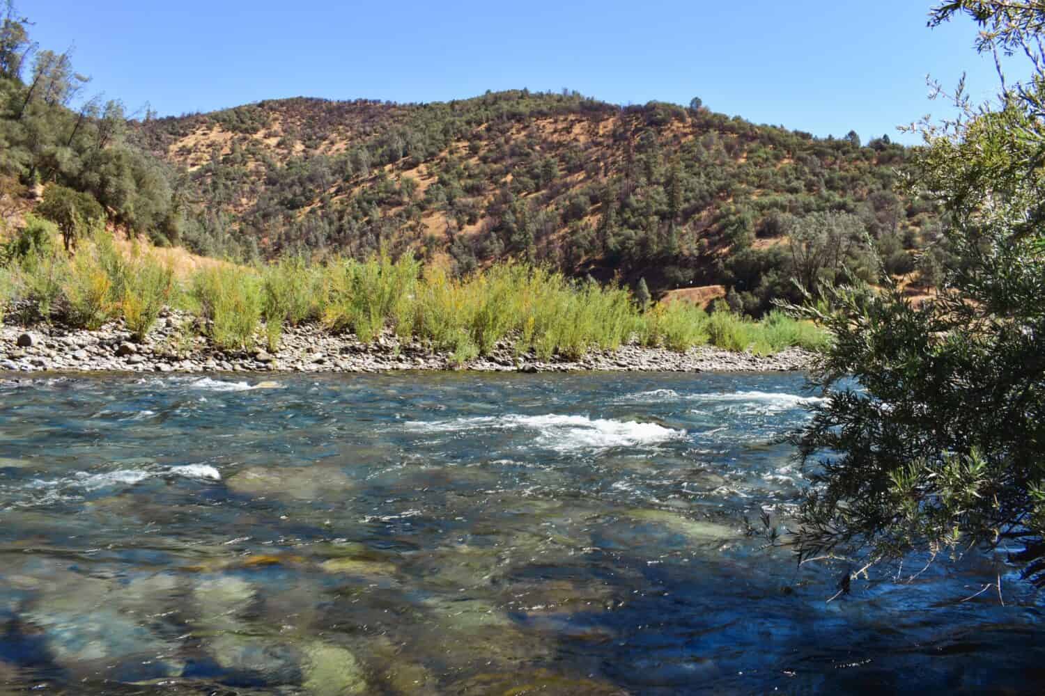
The American River is 30 miles long and runs through Auburn State Recreation Center.
©Angela Feltes/Shutterstock.com
South of Highway 80 near Auburn on Highway 49 in Gold Country is Auburn State Recreation Area. This area was once teeming with gold miners and in fact, one can still pan for gold using the “hands and pans” method. Established as California’s sixth-largest state park in 1966, it is 42,377 acres. There are plenty of fun activities to enjoy here such as camping, hiking with over 100 miles of trails, mountain biking, fishing, and river access with whitewater rafting on the American River. Additionally, limited hunting is allowed. Enjoy horseback riding with over 100 miles of trails, boating, gold panning, and off-road motorcycle riding.
History
The predominant native residents of the area for thousands of years were the Southern Maidu or Nisenan people. In 1848, gold was discovered in nearby Coloma and soon the land was overrun with fortune hunters. As a result, early mining caused extensive environmental damage but has since diminished by natural processes. Another feature is California’s highest bridge, the Forestville Bridge, which is 730 feet. Additionally, the earliest rock tunnels in California were built.
Native Plants
Plants native to the park include dogwood, Fremont cottonwood, willow, white alder, madrone, California black oak, Douglas-fir, and ponderosa pine. In addition, in the spring there are acres of flowers including monkey flowers, fiddleneck, Indian paintbrush, larkspur, lupine, and brodiaea.
Wildlife
A variety of wildlife can be found in the park such as black-tailed deer, rabbit, raccoon, opossum, gray fox, coyote, black bear, rattlesnake, mountain lion, bobcat, California quail, canyon wren, red-tailed hawk, and bald eagle. Additionally, there are kangaroo rats, scorpions, badgers, sidewinders, burrowing owls, and roadrunners.
Del Norte Coast Redwoods State Park
Del Norte Coast Redwoods State Park was established in 1925.
©Danita Delimont/Shutterstock.com
Far up the California coast is Del Norte Coast Redwoods State Park, one of three state parks in the Redwood National and State Parks system. Located seven miles south of Crescent City and established in 1925, and is California’s seventh-largest state park. It ranges in elevation from sea level to 1,277 feet and is 31,261 acres.
Half of the park is old-growth redwood forests bordering the coastline of the Pacific Ocean. The other half contains California bay, tanoak, big-leaf maple, madrone, and red alder trees. Orchids, azaleas, and ferns grow on the forest floor. Additionally, rhododendrons can grow here to a height of 30 feet.
Activities include camping from May through September at 145 campsites, hiking, biking, and fishing. In addition, birdwatchers can enjoy cormorants and pelicans in the ocean. Nearby False Klamath Cove, or Wilson Beach, is a sandy expanse excellent for tide pooling. Swimming is prohibited.
History
Beneath the forest lies 20 million years of Franciscan complex made up of greenstone, chert, serpentine, shale, and sandstone. As a result, this is the junction of the Gorda, Pacific, and North American tectonic plates, which repeatedly collided off Eureka at the Mendocino Triple Junction. The Yurok and Tolowa Indians inhabited this land that once contained the world’s oldest and tallest trees until logging became the biggest industry in the 1850s. Unfortunately, by the 1930s many of the redwoods had been cut down.
Wildlife
Great blue herons feed on chum, chinook, and coho salmon in the Rock and Mills creeks that flow through the park. In addition, other native inhabitants include Steller’s jays, hawks, Roosevelt elk, mountain lions, bobcats, coyotes, black bears, banana slugs, snakes, lizards, and salamanders.
Lake Oroville State Recreation Area
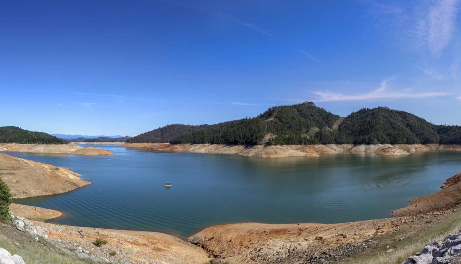
There are 167 miles of shoreline to explore at Lake Oroville State Recreation Area.
©Stock for you/Shutterstock.com
Surrounding Lake Oroville reservoir is the Lake Oroville State Recreation Area. It is north of the mother-lode country near the city of Oroville on the Feather River. Established in 1967, it is 29,447 acres and is California’s eighth largest state park. Activities include camping, boat-in camping, floating campsites, horse camping, fishing, horseback riding, boating (sailing and power boating), hiking, mountain biking, water skiing, swimming, and picnicking. Additionally, guided and self-guided tours are available.
The lake is man-made, created by its 900-foot dam, the tallest of its kind in the nation, which is 770 feet above the Feather River bed. The dam was completed in 1967. As a result, it provides water for the San Francisco Bay Area, Southern California, and the San Joaquin Valley.
History
The Maidu Indians were inhabitants for thousands of years in this area. In 1820, Captain Luis Arguello named the river Rio del las Plumas, or Feather River as the reflecting sunlight on its surface looked like floating feathers. Gold miners took over the Feather River after finding gold in 1848, pushing out the Maidu from their ancestral home. Many of the settler’s towns are underwater now, however, one of the cities named Ophir, or “gold” in Hebrew, later became the town of Oroville.
Wildlife
The Department of Fish and Wildlife runs a salmon and steelhead hatchery here with an observation deck to view the fish ladder during spawning. Additionally, the varied native wildlife includes mountain lions, raccoons, turkeys, opossums, coyotes, tree and ground squirrels, rabbits, deer, skunks, ringtails, bears, and many types of birds.
San Luis Reservoir State Recreation Area
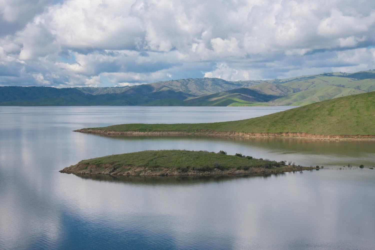
Fish for largemouth black bass, perch, crappie, striped bass, shad, salmon, and
sturgeon
at San Luis Reservoir State Recreation Area.
©David A Litman/Shutterstock.com
San Luis Reservoir State Recreation Area is located in western San Joaquin Valley near Pacheco Pass. This grassy expanse is 26,036 acres. Established in 1969, it is California’s ninth-largest state park. The closest city is Gilroy, which is 33 miles west on Highway 101. Additionally, it is seven miles west of Interstate 5 on Highway 152. It provides the bread basket of California with the water it needs to grow produce. It captures water flowing from the Delta through the California Aqueduct and the Delta-Mendota Canal. Activities include boating, camping, hiking, horseback riding, picnicking, fishing, off-roading, swimming, windsurfing, surfing, and geocaching.
History
The area was home to the Yokut Indians who lived along the San Joaquin River. However, around 1805 Spanish explorers arrived and they relocated many of the Indians to nearby missions. Pacheco Pass was named after Francisco Perez Pacheco who lived here in the 1840s. Afterward, Andrew Firebaugh improved the pass in 1856 making it into a toll road used as the route from San Francisco to Missouri. Farmers built canals that spanned 180 miles in 1871 to irrigate crops.
The San Luis Project was built in 1962 providing water for the current reservoirs where farmers grow their crops. Some of their crops include alfalfa, grapes, tomatoes, melons, corn, cotton, beans, sugar, beets, and a variety of fruits and nuts. Additionally, there are beef and dairy cattle ranches.
Red Rock Canyon State Park
Paleontologists have discovered fossils of saber-tooth cats at Red Rock Canyon State Park.
©iStock.com/Pengcheng Zhu
The badlands, known as Red Rock Canyon State Park, are at the southernmost tip of the Sierras. This range is around 12 million years old. Scenic rock formations, buttes, and desert cliffs fill the park. It is 25 miles northeast of Mojave on Highway 14 near the town of Cantil. Los Angeles is 120 miles to the south via Highway 14 and Interstate 5. The park is 25,325 acres and is California’s 10th largest state park. Established in 1970, it offers activities including camping, hiking, horseback riding, and off-roading. After a wet winter, the desert is abloom with cactus flowers. Therefore, the best time to visit is in the spring during the wildflower season.
History
Petroglyphs exist in the El Paso mountains, which were home to the Kawaiisu Indians. Miocene terrestrial sedimentary rocks, interbedded basalt volcanic flows, and ash beds make up the landscape. As a result, a variety of fossils have been discovered in the park including horses, camel, antelope, saber-tooth cats, bone-crushing dogs, rodents, rabbits, insectivores, and plants. Colorful rock formations in the 1870s served as landmarks for the 20-mule-team freight wagons that stopped in the area for water. Remnants of 1890s mining operations are still in the area. Additionally, this park has been a backdrop for movie production.
Wildlife
Some of the wildlife in the area include roadrunners, hawks, lizards, mice, and squirrels.
Cuyamaca Rancho State Park
Cuyamaca Rancho State Park has tall pine trees, lush oak forests, and sweeping meadows with rushing streams.
©iStock.com/AutumnSkyPhotography
Located 40 miles east of San Diego in the Laguna and Cuyamaca Mountains of the Peninsular Range is Cuyamaca Rancho State Park, California’s 11th largest state park established in 1933. It is 24,693 acres and preserves an expansive tract of forests and meadows above 5,000 feet on the former Rancho Cuyamaca. The park is located east of San Diego on Highway 79 and 5 miles north of I-8. Activities include hiking with over 100 miles of trails, camping, picnicking, biking, and horseback riding. Park elevation is 6,512 feet making it the second highest point in San Diego County. To the east is Anza-Borrego Desert State Park and to the west the Pacific Ocean.
History
Ancestors of the Kumeyaay Indians lived in these mountains. In 1782, Spanish Lieutenant Colonel Pedro Fages mentioned their existence. Augustin Olvera obtained the Rancho Cuyamaca grant in 1845 with the intention to harvest timber. However, his contractor feared the Indians and abandoned him. In 1857 James Lassator bought 160 acres in Green Valley from the last remaining Indian chief. He used the land as a way station, to grow hay, and where he built his home and lived until he died in 1865.
In 1869, the discovery of gold in the mountains near the town of Julian triggered a rush to the area. From 1886-1891 the Stonewall mine produced over 7,000 pounds of gold. Ralph M. Dyre bought the rancho in 1923. The state of California bought it in 1933 which later became a state park.
A lost hunter caused one of the biggest wildfires in California history. He lit a signal fire, which burned out of control in 2003 and took two weeks to contain. As a result, it burned nearly 280,278 acres including 90% of the park’s lands. A reforestation project using grants and private donations replanted portions of the park, which is slowly returning to its original splendor.
Wildlife
Some of the native wildlife includes gray fox, badger, bobcat, mountain lion, pacific and canyon tree frogs, mountain king snake, striped racer, and rattlesnake. Additionally, there are more than 100 bird species including acorn woodpeckers, northern flickers, red-tailed hawks, and sage sparrows.
Mount Diablo State Park
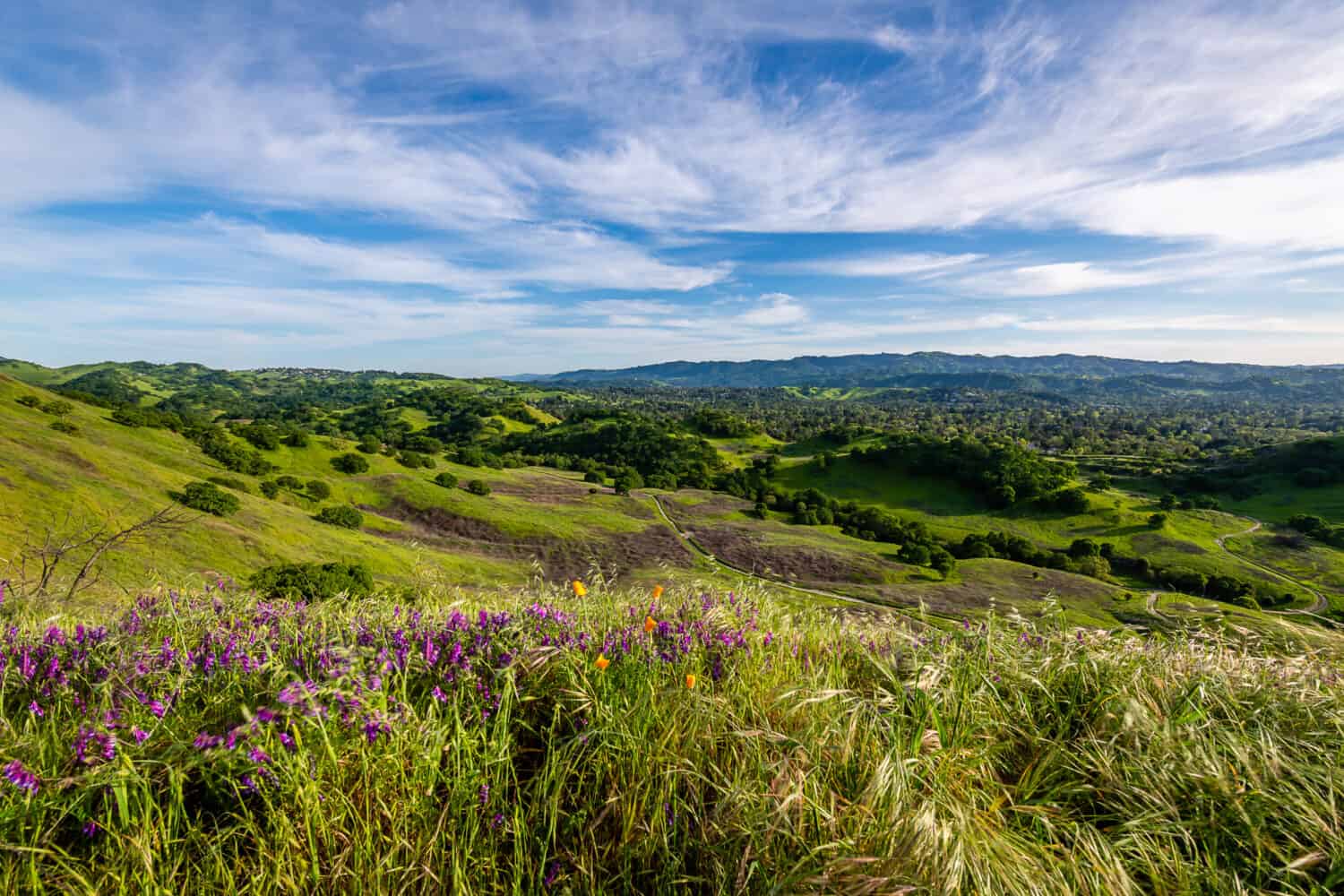
According to Miwok and Ohlone mythology, Mount Diablo State Park was the point of creation.
©Chris LaBasco/Shutterstock.com
Located near Danville, Mount Diablo State Park is southeast of San Francisco and northeast of San Jose. This mountain park is 3,849 feet in elevation and 20,124 acres making it California’s 12th largest state park established in 1931. Activities include camping, hiking, biking, cycling, picnicking, and viewing the entire Bay Area from the observation deck. To reach the summit, either drive or hike. On a clear day, you can see 38 counties. Additionally, the park sees a dusting of snow two to three times a year in the winter.
Things to Do
Bird watching is a favorite pastime here to see acorn woodpeckers, red-tailed hawks, and western bluebirds. In addition, the park is a mountain bikers paradise with over 50 miles of trails. At night the skies are a stargazer’s paradise whether lying on a blanket or taking part in the Mount Diablo Observatory Associate astronomy programs.
History
Miwok, Nisenan, and Ohlone Indians inhabited the area for thousands of years. The remains of their lives exist at Rock City. In the late 1700s and early 1800s, Spaniards arrived with missionaries. Mount Diablo, named by the Spanish military, referred to the area as “the thicket of the Devil” after losing track of the Indians they were trying to capture.
The area became part of the United States with the Treaty of Guadalupe Hildago in 1848. As a result, the homesteading cost was one dollar an acre. Built in the late 1800s, the Mountain House Hotel provided comfortable lodging for those disinterested in camping.
Unique Plant Life
Indigenous to only Mount Diablo are the Mount Diablo sunflower, Mount Diablo fairy-lantern, Mount Diablo manzanita, and Mount Diablo bird’s beak.
Wildlife
Native wildlife includes coastal black-tailed deer, raccoon, California ground squirrel, eastern fox, squirrel, gray fox, skunk, bobcat, mountain lion, badger, coyote, rabbit, and hare.
| State Park Name | Size in Acres |
|---|---|
| Anza-Borrego Desert State Park | 585,930 |
| Henry W. Coe State Park | 89,164 |
| Mono Lake Tufa State Natural Reserve | 55,300 |
| Humboldt Redwoods State Park | 51,651 |
| Ocotillo Wells State Vehicular Recreation Area | 50,553 |
| Auburn State Recreation Area | 42,377 |
| Del Norte Coast Redwoods State Park | 31,261 |
| Lake Oroville State Recreation Area | 29,447 |
| San Luis Reservoir State Recreation Area | 26,036 |
| Red Rock Canyon State Park | 25,325 |
| Cuyamaca Rancho State Park | 24,693 |
| Mount Diablo State Park | 20,124 |

How to Add Us to Google News


Thank you for reading! Have some feedback for us? Contact the AZ Animals editorial team.