
The Buckeye Trail traverses countless natural hidden gems in the Ohio landscape – from the farmland to the hills of Appalachia and the Black Hand Sandstone cliffs in Hocking Hills to humble historic towns and beyond. There are so many unexpected sights to see; you have to complete the hike to believe them. But where does the circular Buckeye Trail start and end? Find the answer below and learn more about the underrated long-distance trail.
Where Does the Buckeye Trail Start and End?

The Northeast Terminus of Buckeye Trail is in Headlands Beach State Park.
©Showcase Imaging/Shutterstock.com
So, where does the Buckeye Trail start and end? The Buckeye Trail takes hikers on a 1,444-mile mile-loop around Ohio, stretching into every corner. Hikers who complete the expedition travel through 49 of the state’s 88 counties. But the official starting point is the landmark destination in Cincinnati that overlooks the Ohio River – Sawyer’s Point, while the Northeast Terminus of the trail is at Headlands Beach State Park – Ohio’s largest natural beach.
Traveling from one end of the state to the other allows hikers to experience a little bit of everything Ohio has to offer. However, the circular shape means you can start and end your trip wherever you please. Nevertheless, many people complete the trek through ‘end-to-end’ hike installments over several years.
To celebrate the impressive accomplishment, anyone who completes the Buckeye Trail from start to end gets a patch. You earn it regardless of the order you finish the trail segments or how long it took you to complete the journey.
Route Details
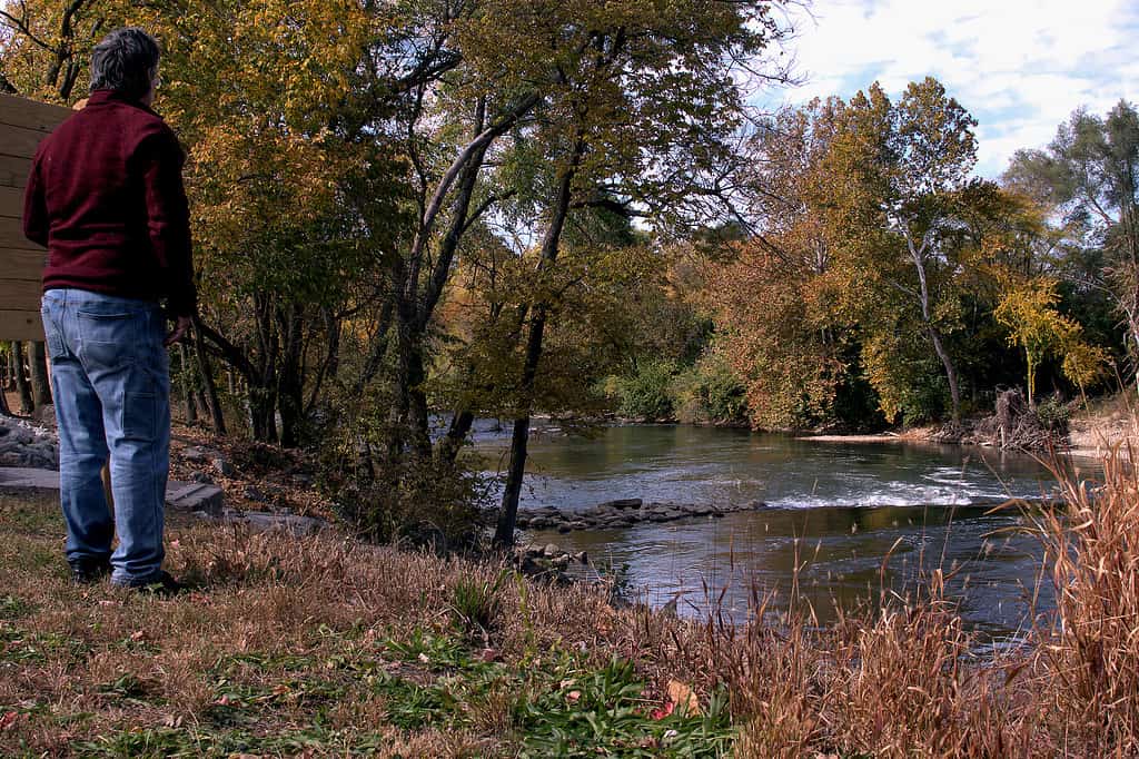
Get a glimpse of the colorful fall foliage by hiking the Buckeye Trail in fall.
©Ray Geiger/iStock via Getty Images
The Buckeye Trail comprises 26 sections, all named for a town or unique feature in that section. In fact, it’s the longest circular loop trail in the United States. Wilderness Adventurer Andy “Captain Blue” Niekamp was the first to complete the hike solo at its current length. Most impressively, he thru-hiked the trail within three months in 2011, then wrote a book about the journey to share his experience.
Since the Buckeye Trail is a circuit hike along the inner perimeter of Ohio, segments of other hiking trails make up its route. For example, the Cuyahoga Valley National Park makes up 37 miles of the Buckeye Trail. However, the hiking trails are further divided into segments that vary in difficulty and length.
Trail segments are identified by blue blaze markers. These markers are 2 inches wide by six inches high. You can find them on trees and poles at eye level. Single blazes mean the current route is relatively straight and easy to follow, while double blazes with an offset marker indicate the route is taking a new direction. On the other hand, the double blaze without an offset marker cautions hikers to pay attention because the path of the upcoming route isn’t obvious to follow.
Additionally, the Buckeye Trails hosts two long-distance national trails. The North Country National Scenic Trail and the cross-country Discovery Trail.
History of the Buckeye Trail

Merrill Gilfillan’s idea led to the creation of the Buckeye Trail.
©RyanDunn/Shutterstock.com
Merrill Gilfillan presented the idea for a walking trail from Cincinnati to Lake Erie in an article published by the Columbus Dispatch in 1958. He was inspired to help people connect with nature to improve their health and learn more about the land around them. By June 1959, Gilfillan and a handful of other nature enthusiasts formed the Buckeye Trail Association (BTA).
The first 20 miles of the Buckeye Trail were established in Hocking County in September 1959. Several members of the BTA were the first to complete the hike, including the inspiring Emma “Grandma” Gatewood, who was the first woman to thru-hike the Appalachian Trail alone.
The Buckeye Trail’s start and end points were first mapped out in the 1950s. Over time, what began as a humble trail grew into an impressive 1,144 miles due to the dedication of the BTA. Today, the Buckeye Trail Association continues to maintain the trail, but they also host public events and workshops throughout the year.
Animals You Can Encounter Along the Buckeye Trail

Over 300 animals live along the Buckeye Trail.
©Vizz Effect/Shutterstock.com
You have the answer to the question, “Where does the Buckeye Trail start and end?” But what animals can you run into on your hike? The Buckeye Trail crosses the habitat of over 40 amphibians, 200 birds, 50 mammals, and almost 40 reptiles. Below are a few of the most common animals you can encounter along the trail.
- American bullfrog
- American toad
- Red-headed woodpecker
- Sharp-shinned hawk
- Tufted titmouse
- Eastern chipmunk
- Eastern small-footed myotis
- Racoon
- Southern flying squirrel
- Striped Skunk
- White-tailed deer
- Gray ratsnake
Points of Interest Along the Buckeye Trail

Cuyahoga Valley National Park constitutes 37 miles of the Buckeye Trail.
©Kenneth Keifer/Shutterstock.com
Sawyer’s Point: Cincinnati has preserved rocks that provide evidence of the marine ecosystem that once existed in the region 450 million years ago. Sawyer’s Point is the official starting point of the Buckeye Trail and offers a cliffside view of the Ohio River.
Cuyahoga Valley National Park: The Cuyahoga Valley National Park is unique because it features the joining of two distinct geographic regions – the Appalachian Plateau and the Central Lowlands. Hikers can trek 37 miles of the Buckeye Trail and see hundreds of native plant and animal species.
Hocking Hills State Park: The internationally acclaimed State Park is famous for its towering cliffs, majestic waterfalls, rocky gorges, and vivid foliage. Don’t forget to check out Ash Cave, Old Man’s Cave, and Conkles Hollow. They’re a few of the most visited caves in the state. The 6-mile route from Old Man’s Cave to Cedar Falls, then Ash Cave, is named after Grandma Gatewood.
Fort Hill Earthworks: Along the Buckeye Trail is the short hike to the Fort Hill Earthworks. Here, you can see man-made earthen walls in the shale cliff above the Rocky River. As a matter of fact, the region’s Hopewell Culture created the impressive walls over 2,000 years ago.
Headlands Beach State Park: The endpoint of the Buckeye Trail is in Headlands Beach State Park. The shore hugs Lake Erie, offering an incredible sunset view. Moreover, the nearby Mentor Marsh in the city of Mentor is a popular stop for migratory birds in spring and fall.
The photo featured at the top of this post is © PapaBear/iStock via Getty Images


How to Add Us to Google News


Thank you for reading! Have some feedback for us? Contact the AZ Animals editorial team.