
The Euphrates River is an incredibly important river in the history of mankind. It carries a large amount of cultural importance for the people who live along its banks, and its historical implications are wide. Today, the Euphrates River is drying up. Due to low amounts of rainfall and climate change, this river is disappearing. This is a hazardous event for current residents and for biblical history. The river promoted new opportunities for civilization when the first people who found it settled by its waters. We’ll talk about all of that in later sections, as we take a look at where the Euphrates River flows.
Where is the Euphrates River on a Map?
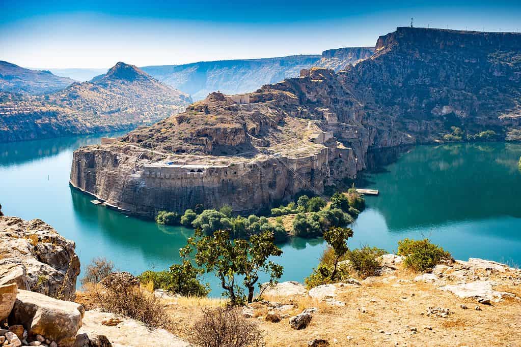
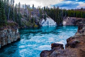
The Euphrates River is one of the oldest and most important rivers in the world.
©yunus_oz/Shutterstock.com
The Euphrates begins its journey in northeastern Turkey, where the Karasu and Murat Rivers converge. It then flows through Syria and Iraq to eventually empty into the Persian Gulf. It meets many other rivers along the way, including the Tigris River. This river was once the separating barrier between the empires of Rome and Persia. The Euphrates River basin also briefly touches Saudi Arabia and Jordan.
We’ve included an interactive map that shows where the Euphrates River begins. Our pin is dropped on Akyurt, a village nestled in the Turkish Highlands. You can see on the map where the Tuzla Stream and the Karasu Stream converge to create the Euphrates River right next to this village.
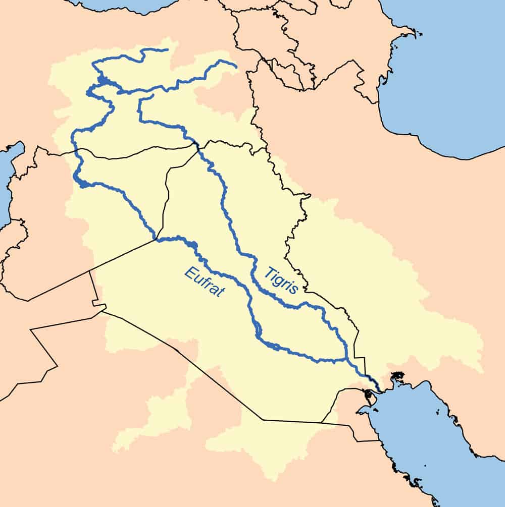
As shown in the map below, the Euphrates River (labeled ‘Eufrat’) runs nearly parallel with the Tigris River and through three countries. The top country, where both rivers begin, is Turkey. The middle country is Syria and the bottom is Iraq.
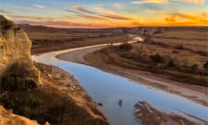
The Euphrates River flows through one of the harshest climates in the world.
©Karl Musser, translated labels by User:Mathias-S, CC BY-SA 2.5, via Wikimedia Commons – License
How Far is the Euphrates from Major Cities in the Middle East?
The Euphrates River runs through the west side Al-Fallujah in Iraq, which is around 40 miles from Baghdad. In Syria, Aleppo is less than 80 miles from the river, where it becomes Lake Assad. Gaziantep, a southern city in Turkey, is less than 35 miles from the banks of the river. A plethora of villages, towns, and cities rest along the banks of the river in every one of the three countries it flows through.
Geography of the Euphrates River
The Euphrates River is the longest river in all of Western Asia. It has a total length of 1,730 miles. This also makes it the 15th-longest river in all of Asia. The river begins in the high-elevation eastern highlands of Turkey, which are ripe with historic volcanic activity. These highlands contain mountainous regions, large lakes, and rolling hills and prairies of the highlands. Up in these highlands, the river sits at more than 10,000 feet above sea level. As we continue down the river toward Syria, the landscape and geography change. In Syria, the mountains have made way for rolling plains surrounding the river. The terrain around the river becomes rocky as it flows again through mountains and then through floodplains as it nears Iraq. After passing Iraq’s flood plains, it enters rocky terrain surrounded by valleys and deserts.
It continues crossing valleys and plains with rocky banks for a long time until it becomes marshland near the small village of Suq Al-Shiyoukh in the southeastern corner of Iraq.
The river is rich in mineral resources, including uranium and phosphate.
Euphrates River Climate
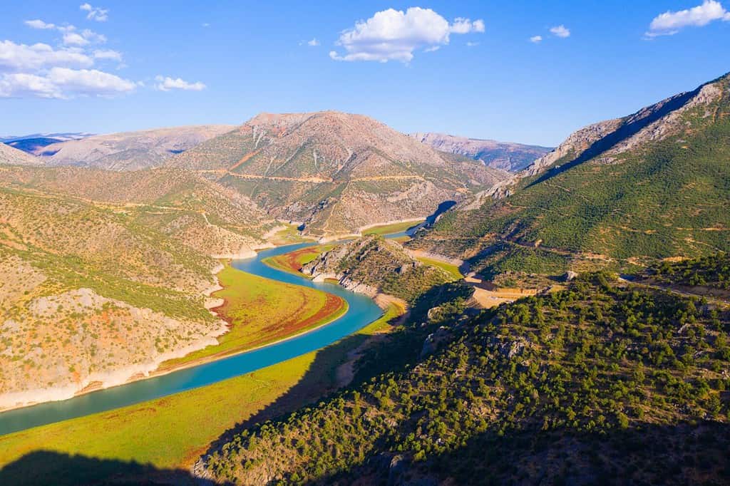
The Euphrates River is the longest river in all of Western Asia with a total length of 1,730 miles.
©bodrumsurf/Shutterstock.com
The Euphrates River flows through one of the harshest climates in the world softening the landscape with its waters and making areas that would be uninhabitable perfectly livable and pleasant. The regions around the river are dominantly subtropical in climate. This climate averages temperatures of more than 90 degrees Fahrenheit in the summer and reaches lows of 50 degrees Fahrenheit in the winter. The summers are very dry and the winters are incredibly moist. Only in the mountainous regions from which it flows does the water see cold and snow. The winters still get cold enough at those high elevations to make the water ice-cold and even freeze in some of the slower-moving portions of the river.
Significance of the Euphrates River
The Euphrates River carries great significance. In Biblical terms, this river may help signal the end of the world. A prophet in the bible claimed that the day this river dried up, it would be a sign of the end of times. While we cannot verify biblical predictions, we can say that the river drying up would be a catastrophic event for many people who rely on its waters.
The Euphrates River is a massive oasis that runs through harsh and unforgiving terrain. The towns and cities along its shores rely on it for several things, including a reprieve from the surrounding environments. Water is necessary for human life. We drink it, we use it on our crops, and we give it to our pets and livestock. This is why so many humans settled by the Euphrates so many thousands of years ago.
Do you remember learning about Ancient Mesopotamia? The word translates to ‘between rivers’ in Greek. Mesopotamia is called the “cradle of civilization”, and for good reason. The land between the Tigris and Euphrates Rivers is historically some of the most fertile soil in the world and it is where Mesopotamia existed. This area, a part of what is known as the fertile crescent, had the perfect growing climate and soil. Because of this, these are the lands that housed history’s first farmers.
This area is also where the world’s first writers and city-builders made their homes, all the way back in 10,000-3,000 BCE. If not for the Euphrates and Tigris Rivers, this fertile land would not have existed. Who knows what course human history would have taken without the waters that fed this fertile land?
Threats to the Euphrates River
Unfortunately, the waters of the Euphrates are not as clear and rich as they once were. The same humans who found an oasis by its waters are responsible for some of the worst damage done to the area. Towns and cities along the entirety of the river have diminished local habitats and ecosystems as they have spread. Since most resources necessary for survival in the area only extend so far from the river, they are limited. Human progress uses a lot of natural resources, and nature has been thrown off balance by growing populations.
For example, a growing population has a growing need for clean drinking water. This, combined with a continued need for water for irrigation and agriculture, puts a great strain on the river.
More than the use of resources in and around the river, pollutants entering the water are a huge problem. A lot of industry exists near the river, which means that many factories create run-off and wastewater that empty into the water. Agricultural drainage, overly rich in minerals such as phosphorus and nitrogen, contributes to the declining health of the river. Additionally, some towns and cities dump untreated sewage directly into the river. Even sustainable energy sources, such as hydroelectric dams, impact the river. Dams block water flow, containing larger amounts of water to man-made basins. This has a lot of benefits for humans, but it impacts the drainage rate of the river.
All of these factors deeply impact the Euphrates River, and some of them contribute to climate change. Climate change is a risk for all bodies of water, especially in areas that are prone to drought. Diminished rainfall and increasing use of the remaining water have put the Euphrates in danger. Shorter wet seasons in the winter do not help replenish the water supply or nourish the riparian zones around it the way they used to. Increases in temperatures paired with decreases in precipitation are causing the water levels to consistently decline. If the river levels continue to drop, the river could be nothing but a dry basin by as early as 2040.
The photo featured at the top of this post is © Funtay/Shutterstock.com

How to Add Us to Google News


Thank you for reading! Have some feedback for us? Contact the AZ Animals editorial team.