
Winter can be brutal in Wisconsin as any Cheesehead can relate. All you need to do is go to a late-season Packers game at Lambeau Field in Green Bay and see the bulky winter garb fans wear. Tales about Wisconsin’s notorious winters are legion. One storm in 2012, days before Christmas, turned the state into a winter wonderland as did another one 10 years later. Before we get into all the gnarly weather, it is important to understand what makes Wisconsin winters so wild.
Weather Variables
For one thing, Wisconsin is devoid of mountains to its north and its south. As a consequence, cold Arctic air often rushes into the state. When that happens, winters in southern Wisconsin can get cold, but in the northern part of the state, it can get Jack-Frost frigid. Wisconsin’s location along Lake Superior and Lake Michigan moderates temperatures along the shore.
It’s not uncommon for temperatures to dive into the single digits. Consider that between 1900 and 1910, the average winter temperature from December to February in Wisconsin hovered around 16.1 degrees. But climate change has started to take its toll. From 2010 to 2014, the average winter temperature jumped to around 19 degrees.
Other variables that dictate Wisconsin’s winter weather are the phenomena of El Nino and La Nina. An El Nino occurs when the surface of the southern Pacific Ocean warms. During a La Nina winter, the opposite happens. Each can impact weather patterns in the United States. In El Nino seasons, winters in Wisconsin, especially the southern part of the state, tend to be warmer, or near average. Consequently, it snows less, although there have been El Nino winters with temperatures below average and precipitation above average.
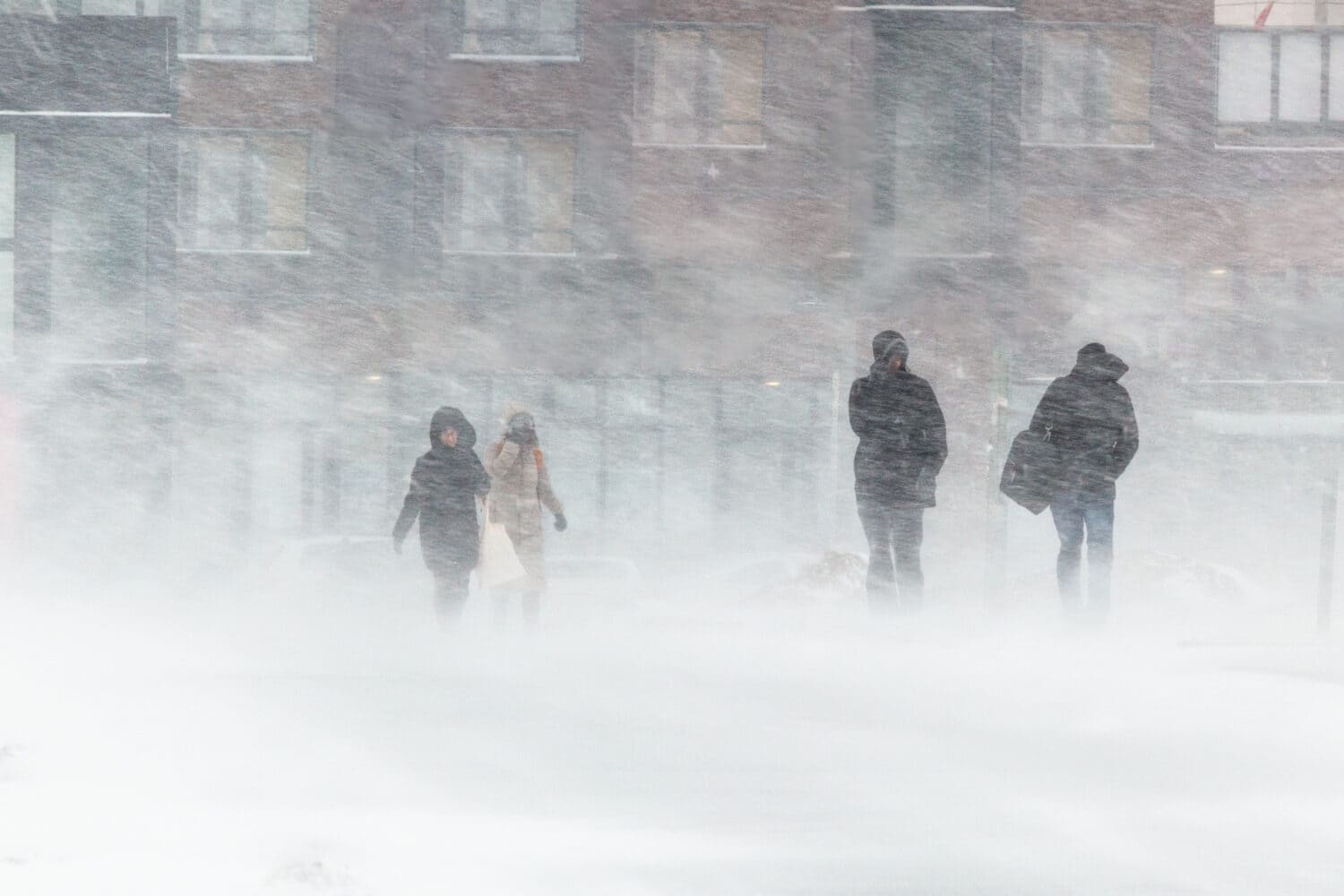
Wisconsin’s winters can be beautiful as well as dangerous.
©Michael Tatman/Shutterstock.com
La Nina (2012)
In 2012, when the Christmas week blizzard blanketed the Midwest, La Nina dominated Wisconsin’s weather patterns. According to the National Weather Service, during La Nina winters, temperatures across most of the northern portion of the United States including Wisconsin can become colder and wetter. The 2012 storm began as an upper-level disturbance south of the Gulf of Alaska. It quickly moved across the ocean and by December 17 had reached the continental United States in the Pacific Northwest.
As the disturbance crawled east, a trough of low pressure dipped over the Rocky Mountains growing stronger each day, ultimately intensifying into a low-pressure system. By the morning of December 19, a surface low developed over eastern Colorado, blanketing the region with a foot of snow.
State of Emergency
The storm continued moving east and then turned northeast over Kansas, taking direct aim at Michigan, Illinois, Iowa, and Wisconsin. As the storm made its trek, it pounded the region, leaving tens of thousands in the dark as powerlines snapped. Roads in many areas were impassable. The snow was so thick and blinding that it caused a 30-car pileup on Interstate 35 in Iowa. Two people died in that wreck.
At the time, Wisconsin’s Gov. Scott Walker declared a state of emergency before the storm arrived. He called out the National Guard, the state police, and other agencies. Officials urged people to keep off the roads as snowfall totals were expected to reach more than a foot in several counties. Meteorologists predicted between 2 to 3 inches of snow would fall an hour. Schools closed in anticipation of the storm, including at the University of Wisconsin where students were in the middle of taking their final exams.
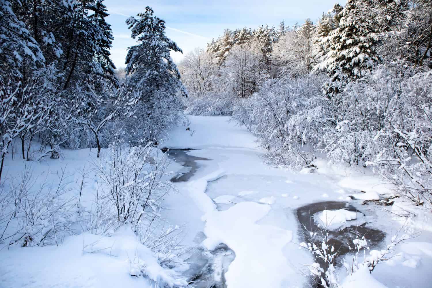
The snow can pile up when it storms in Wisconsin.
©Helene Woodbine/Shutterstock.com
Slamming into the State
The storm slammed southern Wisconsin the hardest. Over two days, snow totals ranged from less than an inch along the shore of Lake Michigan to 22 inches in Dane County. Green Bay got about a foot. The greatest amount fell in Cottage Grove (21.5 inches); Mount Horeb, (21.1 inches), and 15.2 inches in Madison.
The wind also whipped, with gusts ranging from 48 miles per hour in Monroe; 44 in Milwaukee, and 28 in West Bend. The storm took down trees and power lines, leaving thousands without heat or power. The wind, which raged from the northwest, was so strong that it blew snow across roadways, especially in Rock County where the state Department of Transportation reported most roads and highways were impassible. Rain was also a problem, with some areas seeing 2 inches. Residents of Milwaukee were drenched with 2.16 inches of rain, breaking the previous record of 1.48 inches, set in 1977.
Once it passed Wisconsin, the storm continued to churn eastward as Christmas approached. By December 21, Buffalo, Cleveland, and Erie, Pennsylvania, among other cities, were in the storm’s cross-hairs.
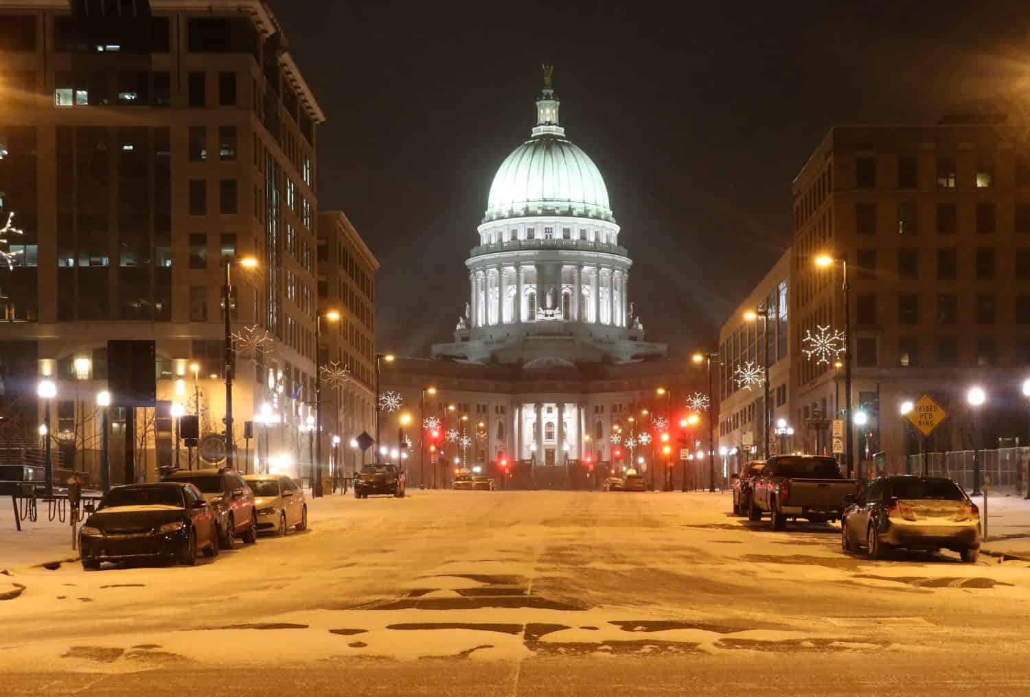
Wisconsin’s capitol building in Madison is often shrouded in snow.
©MarynaG/Shutterstock.com
2022 Christmas Storm
The storm made it a white Christmas and turned the state into that proverbial winter wonderland people are always wishing for. Yet, it was not the only storm to hit on the Christmas holiday. Three days before Christmas in 2022, another storm roared across Wisconsin with high winds and single-digit temperatures. The storm formed on December 21 and picked up in intensity as it moved through the Northern Plains.
When it hit the Great Lakes, the storm developed into what meteorologists call a “bomb cyclone.” Known technically as bombogenesis, the storm had all the right ingredients for a major weathermaker. The storm developed quickly as atmospheric pressure dropped suddenly while a cold wall of air slammed into a warmer air mass. The result was a major blizzard that left more than a foot of snow in Minnesota, Missouri, and Wisconsin.
While Wisconsin, Minnesota, Michigan, and other states got slammed, it was the city of Buffalo in New York that got hammered the worst. As the storm moved east, its cold winds blew across the warm water of Lake Erie. Rain quickly turned to snow which fell at a rapid clip, with some areas near Buffalo reporting more than 56 inches over 5 days. Some 23 inches fell at the Buffalo Niagara International Airport just on December 23, with nearly 18 inches the following day. The snow kept coming for the next several days, totaling nearly 52 inches at the airport. Forty-seven people died.

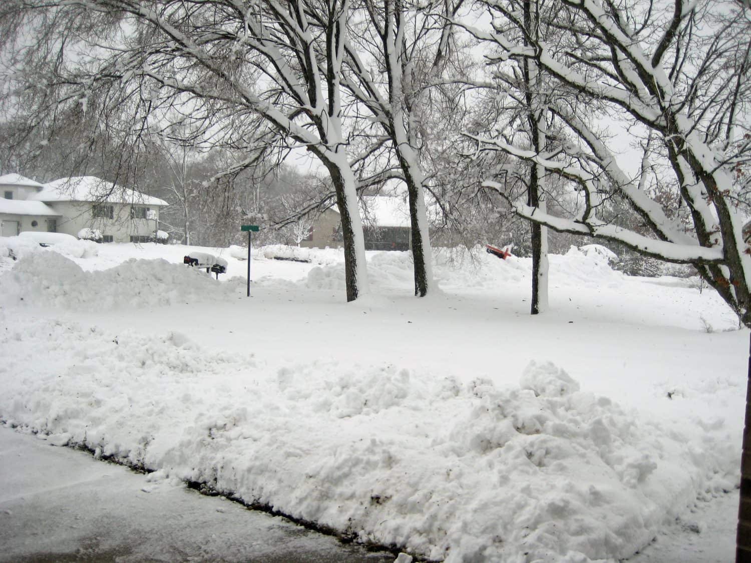
Winter on a Milwaukee street.
©Henryk Sadura/Shutterstock.com
Armistice Day Storm of 1940
While both the 2012 and 2022 storms had a profound impact on Wisconsin life, the most intense holiday storm did not occur at Christmas time. Instead, it took place on Armistice Day in 1940.
Autumn across the Midwest that year was beyond mild as temperatures soared into the 50s. Chicago was a balmy 55 degrees, while the mercury in Davenport, Iowa rocketed to an almost shirt-sleeve-wearing 54. That all changed on November 11 when a massive storm originating from the Pacific Northwest struck the Midwest. The storm had earlier taken down the third-longest suspension bridge in Tacoma, Washington. By November 10 the system had moved across the Rocky Mountains, which wasn’t good news for Wisconsin and the rest of the Midwest.
On November 11, Armistice Day (known today as Veterans Day), the storm ripped through the Heartland with blinding snow as winds howled upwards of 80 miles an hour. Such ferocity piled the falling snow into 20-foot drifts. The storm slammed into Milwaukee with such cruelty that it buried parked cars and shut down the city’s streetcar system.
Frightful Weather
The Armistice Day storm is still one of the deadliest blizzards to strike the Midwest. Still, that and the Christmas week storms of 2012 and 2020 do not compare to what happened in March 1881. That storm (actually it was two) shut down train traffic and piled drifts 40 feet high. One newspaper reported that “Reports from all telegraphic points in Wisconsin show the snow to be from three to six feet deep on a level, and the drifts are reported as covering houses, telegraph poles, trains, etc.”
Another reported, “All communication with the outside world has been entirely cut off. Rubber boots and shoes are not to be had in the city, all shoe dealers having sold out… Masses of snow are everywhere, some of it in piles ten to sixteen feet high, thirty feet wide, and sometimes one to two hundred feet long which the wind has blown together.”


How to Add Us to Google News


Thank you for reading! Have some feedback for us? Contact the AZ Animals editorial team.