
New Hampshire boasts a total area of 9,304 square miles, which equates to 5,954,560 acres. Some of that space is covered by 1,300 lakes or ponds and more than three dozen rivers stretching out for 41,800 miles. The U.S. federal government is the largest landowner in New Hampshire and owns 805,472 acres.
From the stunning coastline, which happens to be the smallest coastline in the U.S., to the picturesque mountain peaks, New Hampshire is the perfect blend of mountain towns, coastal cities, and historic cities, towns, and villages. Meet New Hampshire’s largest landowner and the parcels the government owns.

The U.S. federal government owns the most land in New Hampshire.
©Vacclav/iStock via Getty Images
The Largest Landowner in New Hampshire: The Federal Government
The Federal Land Management Agency partners with several agencies to manage federally-owned lands across the U.S. Those agencies are:
- Bureau of Indian Affairs and Tribal Governments
- Bureau of Land Management
- Bureau of Reclamation
- Department of Defense
- National Park Service
- U.S. Army Corps of Engineers
- USDA Forest Service
- U.S. Fish and Wildlife Service
In addition to those agencies, the Eastern Federal Lands Highway Division works hand in hand with towns and cities in New Hampshire to ensure highways and bridges are built correctly, inspected regularly, and maintained. Federal lands must be reachable through properly designed and constructed roads and bridges, but the natural beauty of the area must be maintained.
From rivers to mountains and wetlands to beaches, the federal government owns and manages 805,472 acres in New Hampshire. This includes national forests, wildlife refuges, and national historic sites. Between 1998 and 2018, the federal government added 71,309 acres
The number of federal land in New Hampshire does fluctuate slightly. The U.S. General Services Administration auctions off buildings and acreage that are no longer critical for the federal government to own, and New Hampshire properties occasionally appear on that list.
What Does New Hampshire’s Largest Landowner Own?
What does the federal government own in New Hampshire? The government-owned property is found in five areas around the state.
1. Appalachian Trail Corridor
The Appalachian Trail’s Franconia Ridge features protected alpine tundra that hikers must stay off.
©Jaminnbenji/Shutterstock.com
New Hampshire’s Appalachian Trail corridor stretches 160.9 miles and rises from 400 to 6,288 feet in elevation. After crossing the Connecticut River from Vermont, the New Hampshire stretch of the corridor starts in Hanover. It continues heading northeast along the White Mountains to the Maine border near Shelburne, NH.
The White Mountains contain alpine tundra with protected areas. Make sure you refer to the USDA’s forest protection areas map when hiking along the Appalachian Trail corridor to avoid stepping on the delicate plants and staying out of peat moss bogs.
The Appalachian Trail is managed by the National Park Service and the U.S. Forest Service on a federal level. Plus, there are state agencies, volunteers, and the non-profit Appalachian Trail Conservancy working hard to keep the trails in good condition.
2. Lake Umbagog National Wildlife Refuge
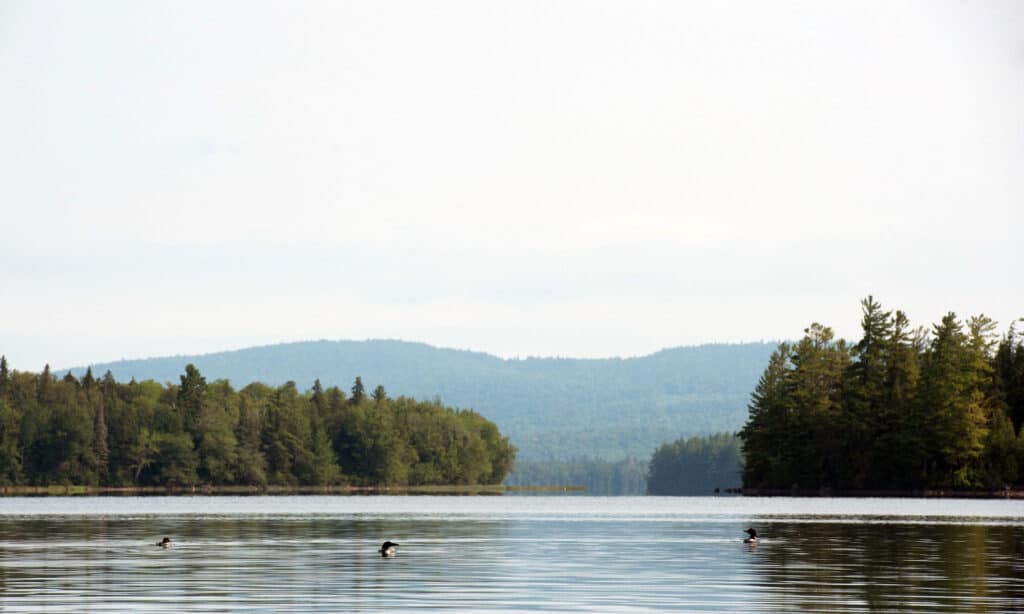
The common loon makes its home in the quiet lakes and ponds in Lake Umbagog National Wildlife Refuge.
©iStock.com/EJJohnsonPhotography
Lake Umbagog National Wildlife Refuge spreads across northern New Hampshire and into Maine. It covers approximately 17,956 acres of forests, lakes, rivers, and wetlands in New Hampshire that are home to the bald eagle, common loon, and moose.
A branch of the Abenaki Native American tribe known as the Anasagunticooks settled the Umbagog area along the banks of the Androscoggin River. When European settlers came in, they established dams for timber mills. It became a refuge in 1992.
The refuge allows boating, fishing, hiking, and hunting. It’s also available for camping if visitors reserve a shoreline campsite in advance from the State of New Hampshire.
3. Saint-Gaudens National Historic Site
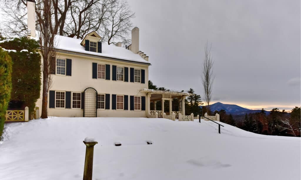
Theodore Roosevelt commissioned Augustus Saint-Gaudens to create a new coin for the U.S., which resulted in the rare double eagle going that proved difficult to mint.
©Felix Lipov/Shutterstock.com
Born in Ireland, Augustus Saint-Gaudens grew up in New York City. With Irish-French heritage, he returned to Europe to study art in Paris and Rome. before returning to New York. His time in New York City led to his famous Diana, designed for the Madison Square Garden building and was the highest point in the city until 1925.
Theodore Roosevelt asked him to create a new coin for the country, which led to a gold double eagle coin. It had to be redesigned, and the redesign was only minted about 12,000 times. This would be one of his largest projects before his health changed. After a cancer diagnosis, he moved his family to Cornish, NH, where cancer slowed him down but didn’t stop his art. He’s one of the nation’s best-known bronze sculptors. His house and gardens became the Saint-Gaudens National Historic Site.
Of the estate’s 370 acres, the federal government owns 175 acres. The main estate, sheds, reflecting pool, and gardens cover a lot of that space, but there are more than 100 acres of forest with three trails.
- The Blow-Me-Down Trail: Travels two miles from the temple to the mill pond.
- The Ravine Trail: Travels a quarter mile from the Ravine studio to the temple.
- The Sycamore Trails: Travels a quarter mile from the Blow-Me-Down Trail to the mill and beaver pond.
The property is managed and maintained by the National Park Service. The park’s entrance and rental fees help cover the costs.
4. Silvio O. Conte National Wildlife Refuge
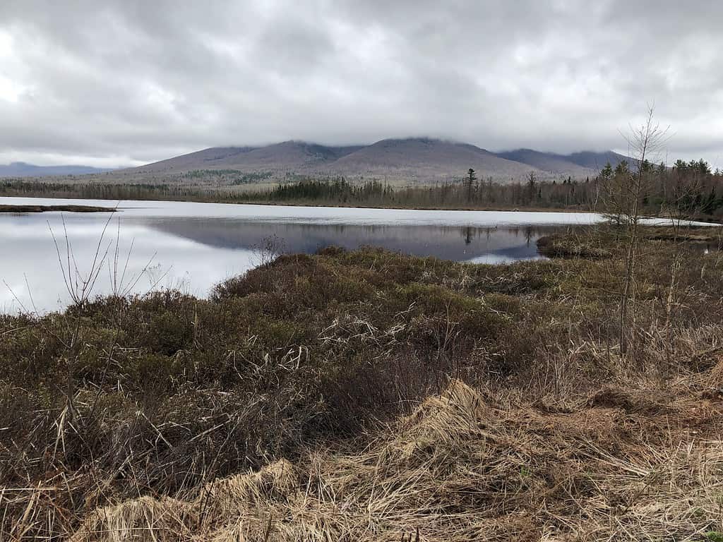
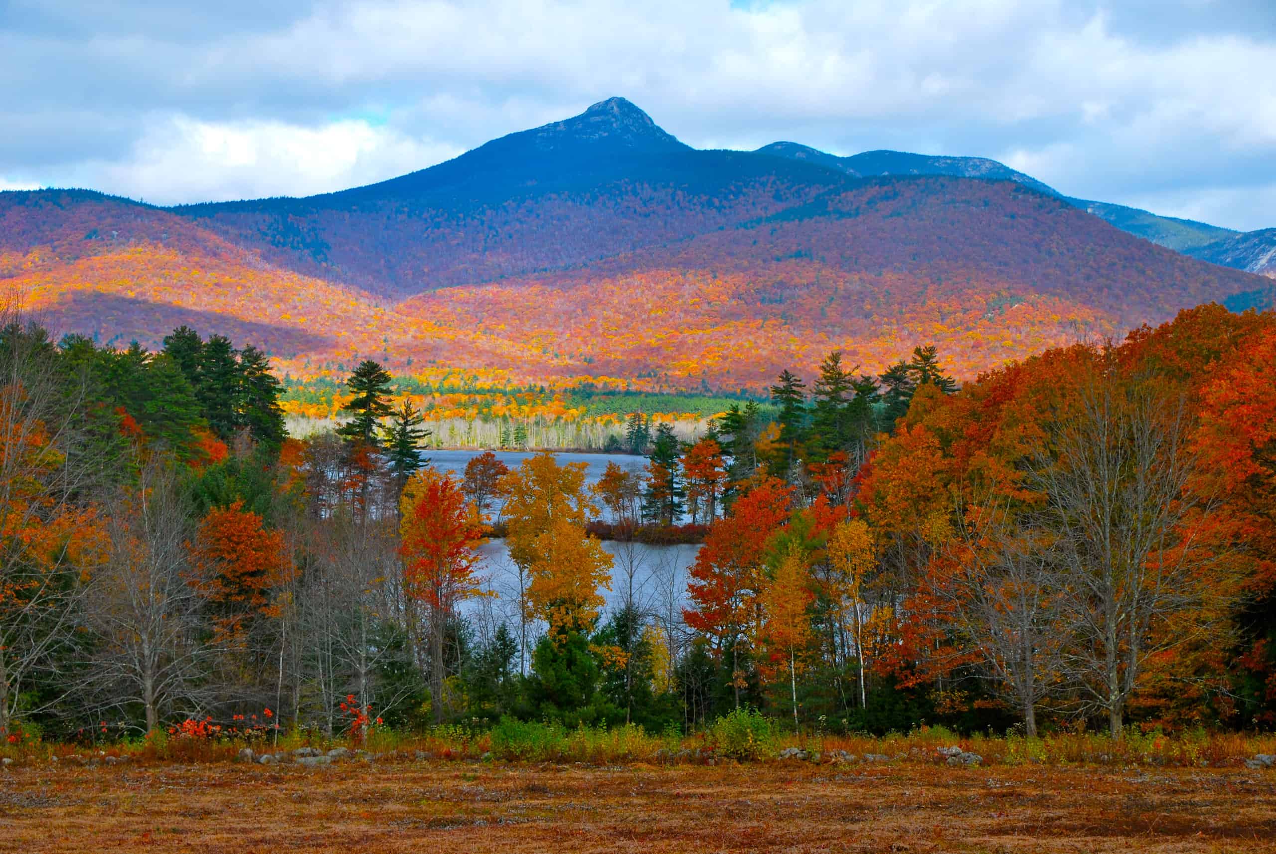
Cherry Mountain is part of Pondicherry, one of New Hampshire’s three sections of the federally-owned Silvio O. Conte National Fish and Wildlife Refuge.
Established back in 1997, the Silvio O. Conte National Wildlife Refuge stretches 7.2 million acres along the Connecticut River. Connecticut, Massachusetts, Vermont, and New Hampshire all have portions of this refuge. The sections within New Hampshire include:
- Blueberry Swamp (1,023 acres)
- Mascoma River (761 acres)
- Pondicherry (6,405 acres)
Pondicherry is both the biggest and a National Natural Landmark. It’s framed by Cherry Mountain, Cherry Pond, Little Cherry Pond, and Mud Pond. Little Cherry Pond Trail and Mud Pond Trail, a wheelchair-friendly option, are National Recreation Trails.
In all, there are 22 locations in those four states that are open from 30 minutes before sunrise to 30 minutes after sunset. The U.S. Fish and Wildlife Service manages the refuge, and that includes the conservation of fish, plants, and wildlife.
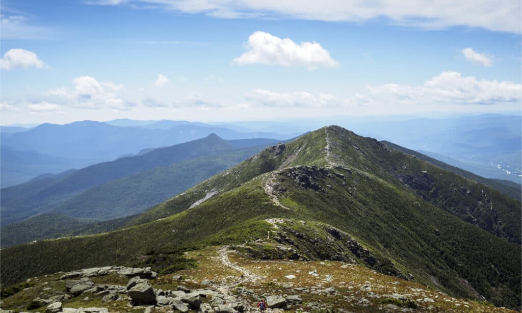
5. White Mountain National Forest
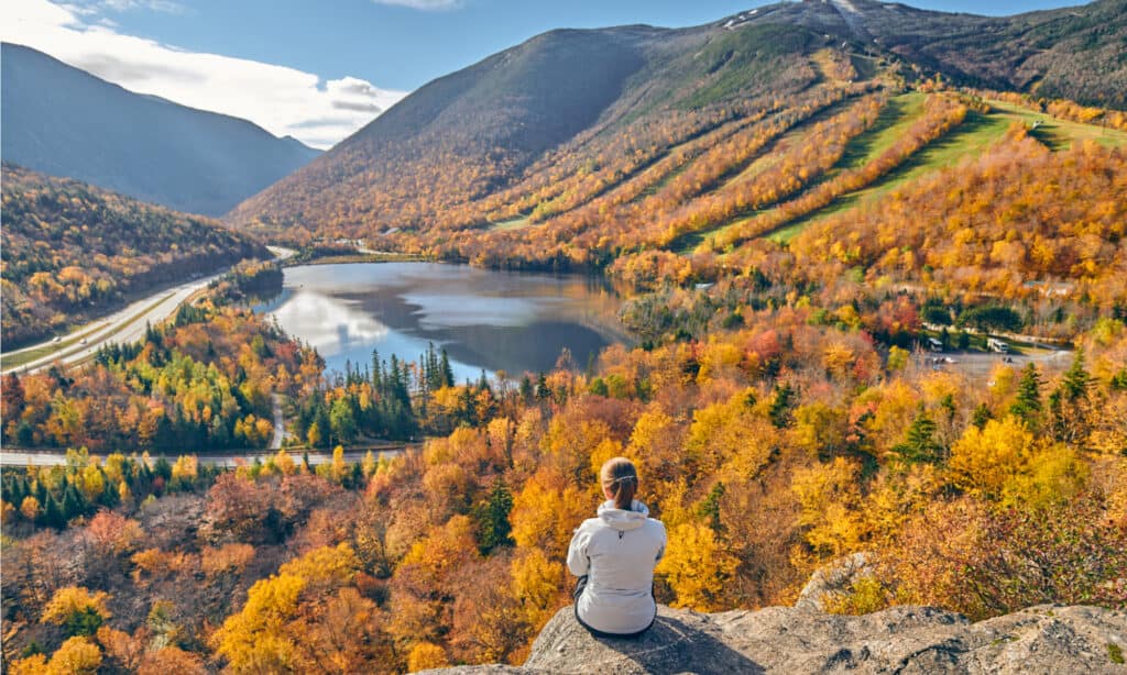
The White Mountain National Forest forms the majority of the federal government’s portfolio.
©haveseen/Shutterstock.com
An estimated six million visitors go to the White Mountain National Forest every year. This federally owned land covers close to 800,000 acres in New Hampshire and Maine. Alpine tundra covers eight square miles of the forest. Five congressionally-designated wilderness areas are found in the White Mountain National Forest.
- The Great Gulf (5,552 acres)
- The Caribou-Speckled Wilderness (12,000 acres)
- The Sandwich Range (25,000 acres)
- The Presidential Range and Dry River Wilderness (27,380 acres)
- The Pemigewasset Wilderness (45,000 acres)
Within all of those areas are 12,000 acres of wetlands, 4,750 miles of rivers and streams, and 67 lakes. It also has two National Registers of Historic Places sites with the Brickett Place on Route 113 and Russell Colbath House on the Kancamagus Highway. The USDA Forest Service manages all of this national forest.
How Much Does the Federal Government Own in the U.S.?
In the entire nation, the U.S. federal government owns 615,311,596 acres. Alaska tops the list of states with the most federal land, as the government owns 222,666,580 acres. Nevada is in second place with 56,262,610 federally owned acres.
While the federal government owns the most land in New Hampshire, who else is on the list? Read Meet the 9 Largest Landowners in New Hampshire to find out.