
Quick Take
- Several of America's most famous waterfall heights are widely wrong, and the inflated numbers keep spreading. The article identifies which celebrated cascades carry the most misleading stats.
- One waterfall on this list drains into a hole in the ground, and where the water goes remains unknown.
- A moonbow sounds like a myth, but one waterfall on this list actually produces one. The catch is that it is nearly impossible to plan around.
- At least one iconic entry on this list isn't a single waterfall at all, and calling it one has distorted how visitors experience it for decades.
America’s most unforgettable waterfalls do far more than drop from a cliff. Some thunder through volcanic gorges, others spill into turquoise desert pools, and a few appear only after rain or snowmelt. This cross-country tour highlights 50 cascades worth knowing, from road-accessible landmarks to backcountry prizes. Along the way, it corrects several often-repeated height claims and explains what makes each setting special. Conditions, permits, and access rules can change quickly, so treat this as inspiration and confirm current guidance with the park, forest, or tribal authority before traveling.
What Actually Counts as a Waterfall?
There is no single national rule that says flowing water must drop a certain number of feet before it becomes a waterfall. Geographers generally use the term for water descending abruptly over a steep rock face or a series of ledges, while “cascade” often describes a more broken, sloping descent. Published waterfall totals vary because databases count seasonal flows, unnamed drops, and multi-tier systems differently. That is why confident claims about one state having the most waterfalls—or another having none—depend heavily on the source and its definitions. What matters to visitors is whether the flow, geology, setting, and access combine to create a memorable experience.
1. Bridalveil Fall, California
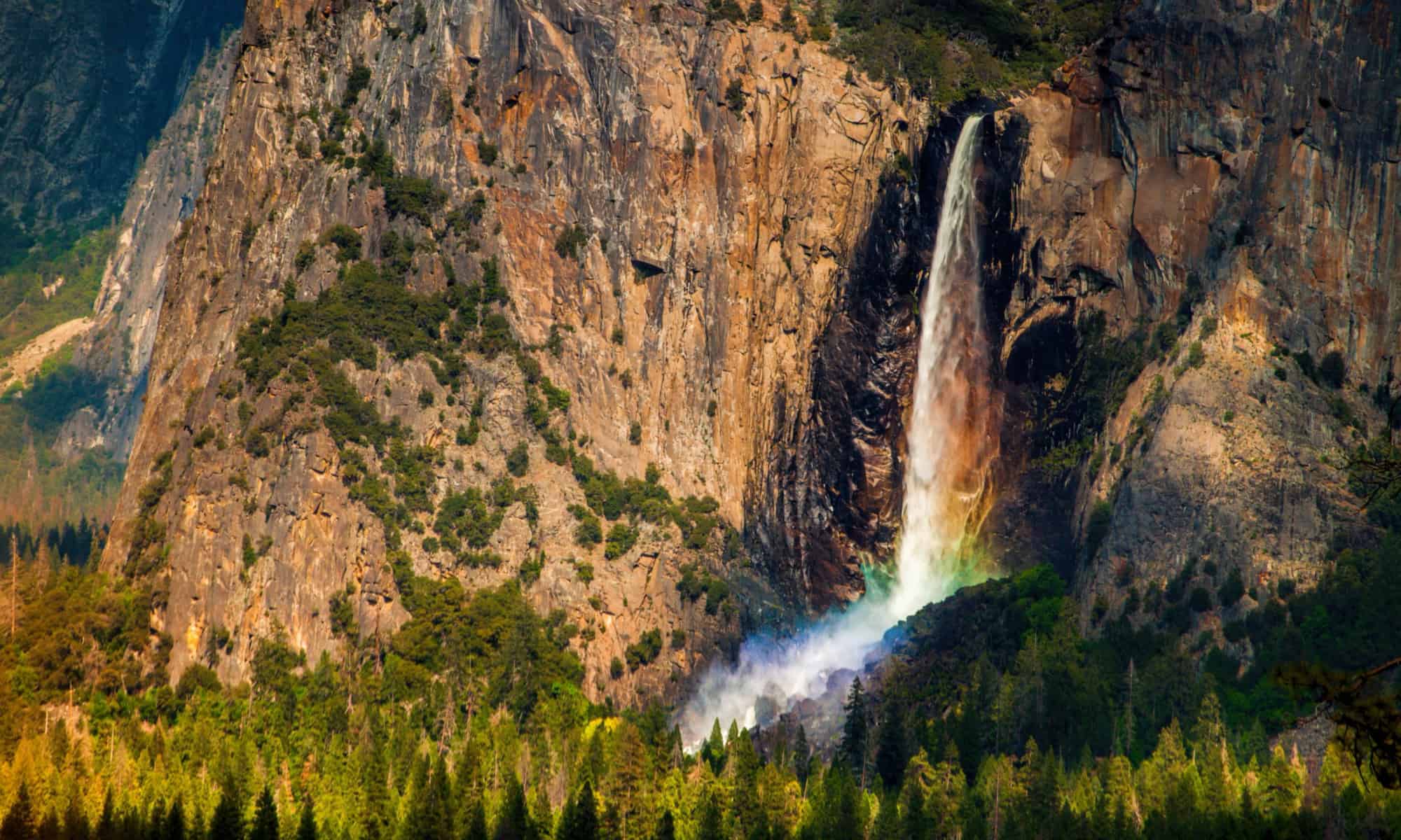
Bridalveil Fall is often the first major waterfall visitors notice as they enter Yosemite Valley, and the National Park Service lists its drop at 620 feet. Water pours from a hanging valley left high above the glacially carved main canyon, then wind catches the narrow column and sweeps it sideways like a veil. The fall flows year-round, although spring snowmelt usually gives it the greatest force and late-season water can look much lighter. Short trails lead toward the base, including an accessible route, but the surrounding rocks remain dangerously slick even when they appear dry. Wider roadside viewpoints reveal the waterfall’s full scale against the granite wall.
2. South Falls, Oregon
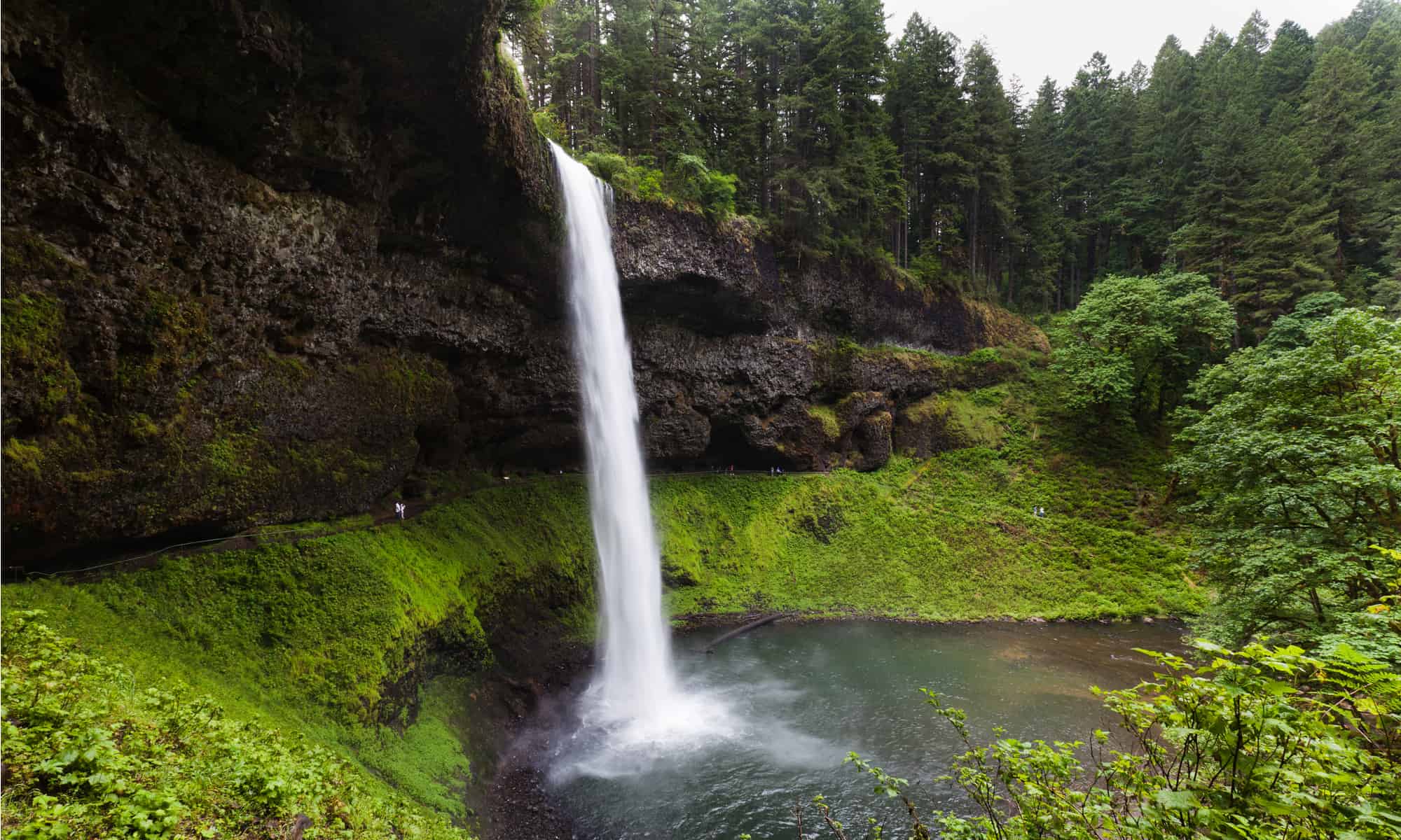
South Falls anchors Oregon’s Silver Falls State Park with a 177-foot curtain of water, not the 259-foot figure sometimes repeated online. Its signature feature is the broad rock amphitheater behind the cascade, where the Canyon Trail lets hikers look outward through the falling water. South Falls is also part of the 7.2-mile Trail of Ten Falls, a moderate loop that links a remarkable chain of cascades in a fern-filled canyon. Four of the route’s waterfalls have walk-behind passages. Pets are not permitted on the Canyon Trail, and wet rock, winter ice, and high water can complicate the hike, so shorter connecting routes are useful when conditions or time rule out the full loop.
3. Tahquamenon Falls, Michigan
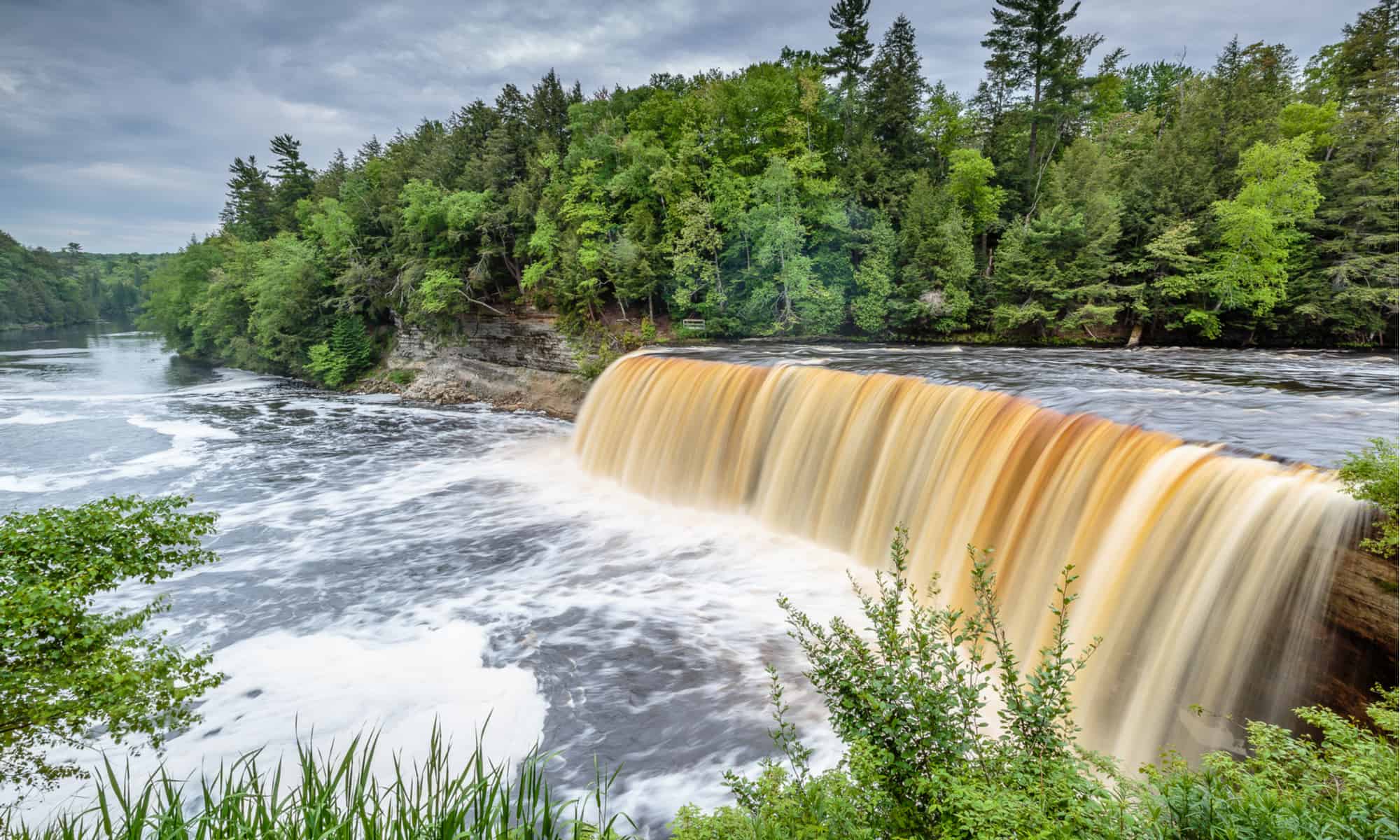
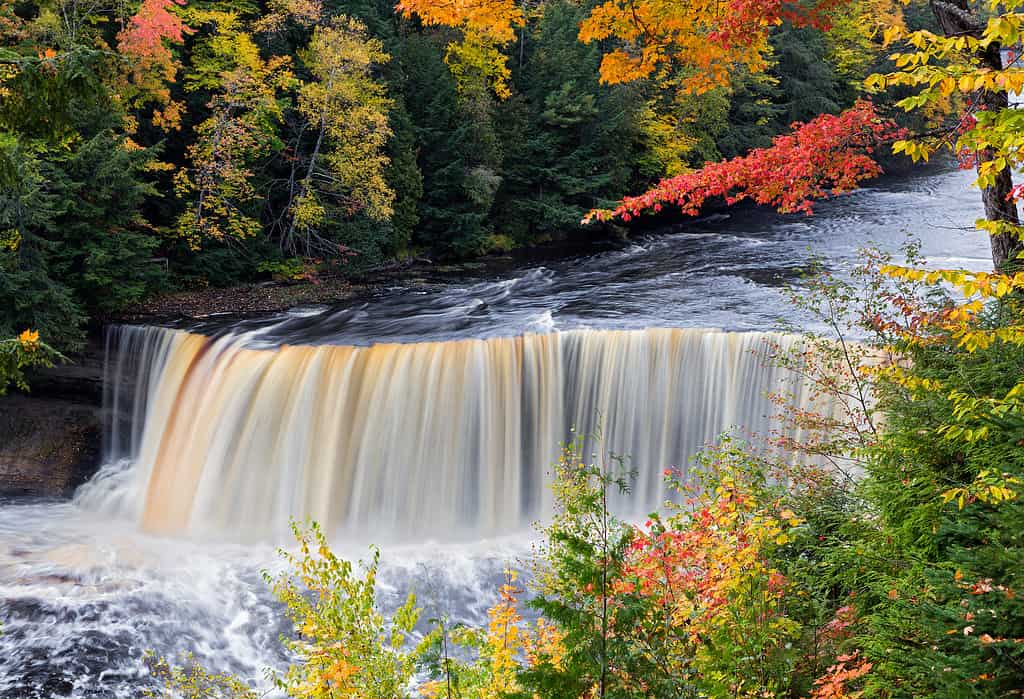
Michigan’s Upper Tahquamenon Falls drops about 48 feet and stretches roughly 200 feet across, making breadth and volume as important as height. The water’s distinctive amber-brown color comes from tannins leached from cedar, spruce, and hemlock wetlands upstream, not from mud or pollution. In peak flow, tens of thousands of gallons can surge over the sandstone ledge each second, filling the forest with a deep roar. Tahquamenon Falls State Park also protects the smaller Lower Falls several miles downstream, where channels weave around an island. Autumn foliage creates the classic postcard view, while winter turns spray into dramatic ice formations along the river.
4. Waimoku Falls, Hawaii
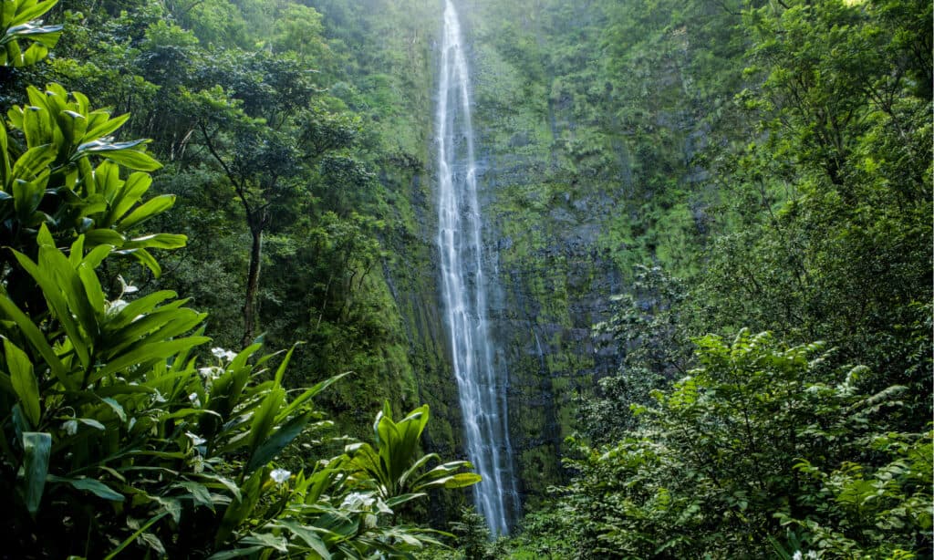
Waimoku Falls plunges roughly 400 feet down a sheer wall in the Kipahulu District of Haleakala National Park on Maui. Reaching it typically means following the Pipiwai Trail through a humid landscape that includes stream crossings, banyan roots, and a famous bamboo grove. The tall ribbon can look delicate from a distance, but falling rocks and sudden surges make the base hazardous; visitors should obey closures and remain on the maintained route. Tropical downpours can cause streams to rise quickly even when rain is falling miles away. The journey is as memorable as the final view, moving from coastal forest into a cathedral-like canyon where the waterfall appears almost suspended above the greenery.
5. Cumberland Falls, Kentucky
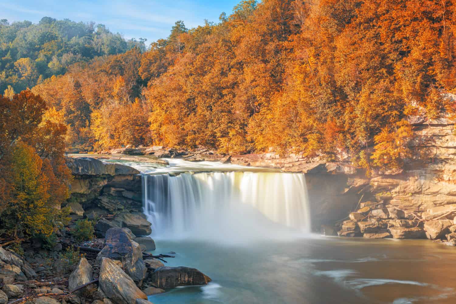
Cumberland Falls spans the Cumberland River near Corbin, Kentucky, dropping about 68 feet across a wide sandstone ledge. Its nickname, the “Niagara of the South,” reflects the broad wall of water rather than a comparable height. The rare attraction arrives after dark: under the right combination of a bright moon, clear sky, mist, and water volume, visitors may see a pale moonbow arching through the spray. Cumberland Falls State Resort Park publishes viewing dates, but the phenomenon is never guaranteed. Daytime overlooks are easier to reach and show the horseshoe-shaped brink clearly, while downstream trails reveal how quickly the river narrows after its dramatic fall.
6. Nugget Falls, Alaska
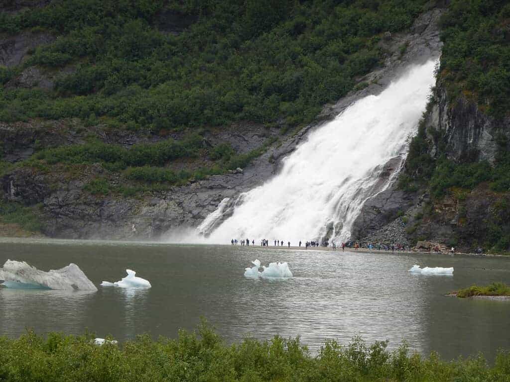
Nugget Falls drops roughly 377 feet beside Mendenhall Glacier near Juneau, creating one of Alaska’s most striking pairings of ice and moving water. Nugget Creek spills down the mountainside into Mendenhall Lake, and a generally easy trail from the visitor area leads to a beach with a close view of the cascade. The glacier has retreated substantially, changing the landscape and the relationship between the falls, lake, and ice over time. Bears, including black bears, use the surrounding forest and streams, so food rules and posted wildlife guidance matter. Wind off the lake, cold spray, and fast-changing weather make warm, waterproof layers valuable even on a summer outing.
7. Akaka Falls, Hawaii
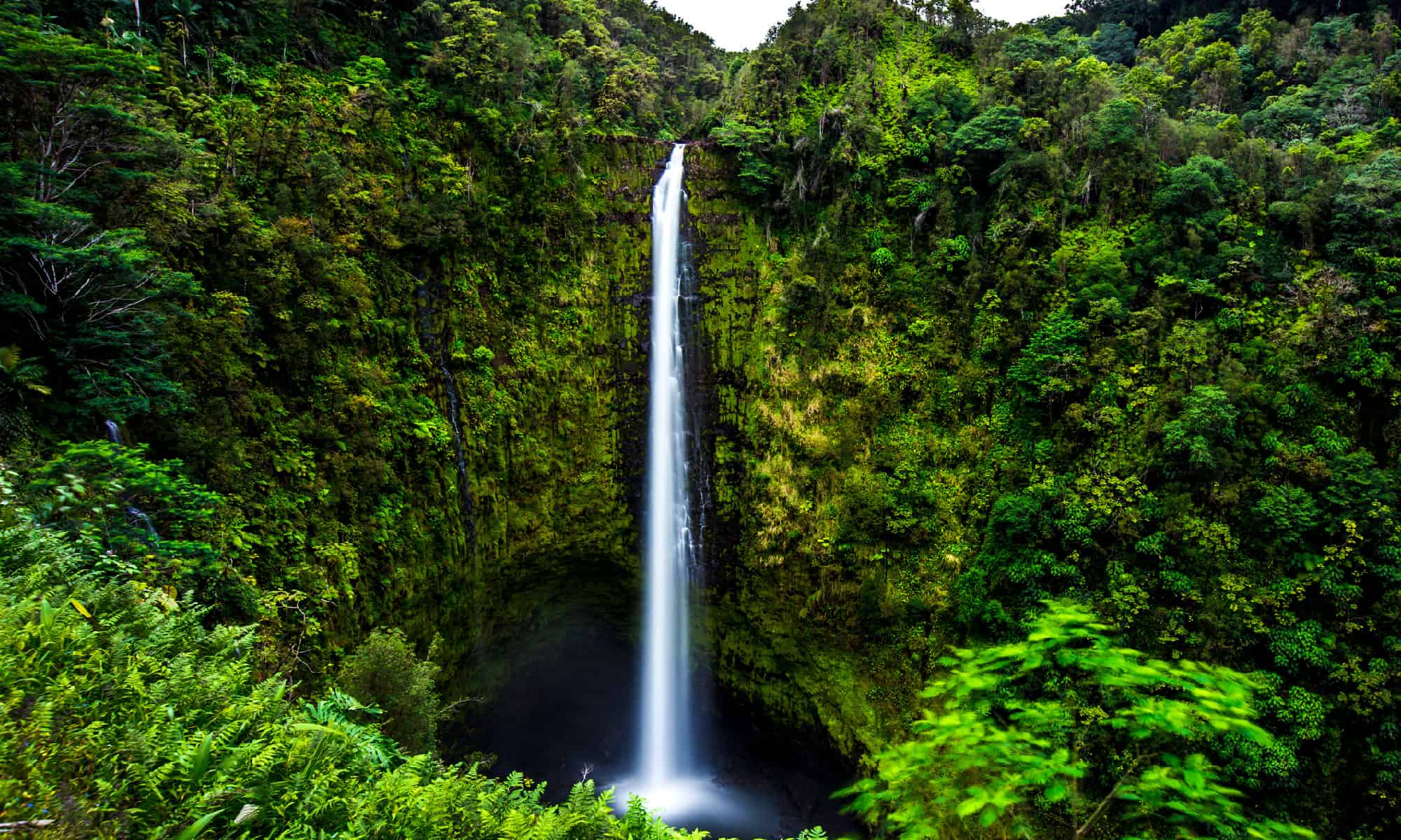
Akaka Falls drops 442 feet into a lush gorge on Hawaii Island’s Hamakua Coast. The nearly free-falling column is fed by Kolekole Stream and framed by bamboo, ferns, and broad tropical leaves, giving the overlook a scale that photographs rarely capture. A paved loop in Akaka Falls State Park also passes smaller Kahuna Falls, although grades and stairs can make portions challenging for some visitors. Rain is common in this part of the island and keeps the vegetation vivid, but it can also leave the path slick. Early visits may bring softer light and fewer people, while recent rainfall usually makes the main waterfall fuller and louder.
8. Niagara Falls, New York
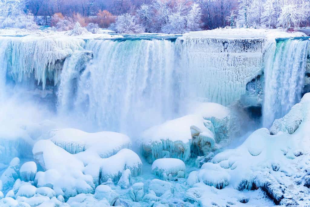
Niagara Falls is not one waterfall but a complex of three: Horseshoe Falls, American Falls, and Bridal Veil Falls, divided between the United States and Canada. Quoted heights vary because measurements may refer to the brink, river level, or rock debris at the base; Horseshoe Falls has a drop of roughly 167 feet, while the American side’s visible free fall is shortened by boulders below. What truly sets Niagara apart is volume. Immense quantities of water from four upper Great Lakes funnel through the Niagara River, powering the constant thunder, mist, and hydroelectric systems. New York overlooks, trails, and boat tours reveal dramatically different perspectives.
9. McWay Falls, California
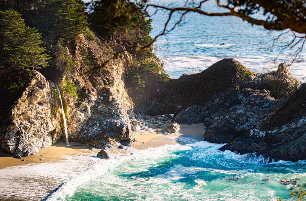
McWay Falls spills about 80 feet from the Big Sur cliffs into a secluded cove at Julia Pfeiffer Burns State Park. It is widely called a tidefall because the water reaches the beach or ocean depending on tide and shifting sand, although visitors view it from above rather than walking to the shore. The overlook trail is short, but closures caused by storms, erosion, or infrastructure damage can affect access along this fragile coast. McWay Creek flows throughout the year, with winter rain usually adding volume. The turquoise water and rocky headlands make the scene famous, yet its protected beach is habitat, not a swimming destination, and entering the cove is prohibited.
10. Wailua Falls, Hawaii
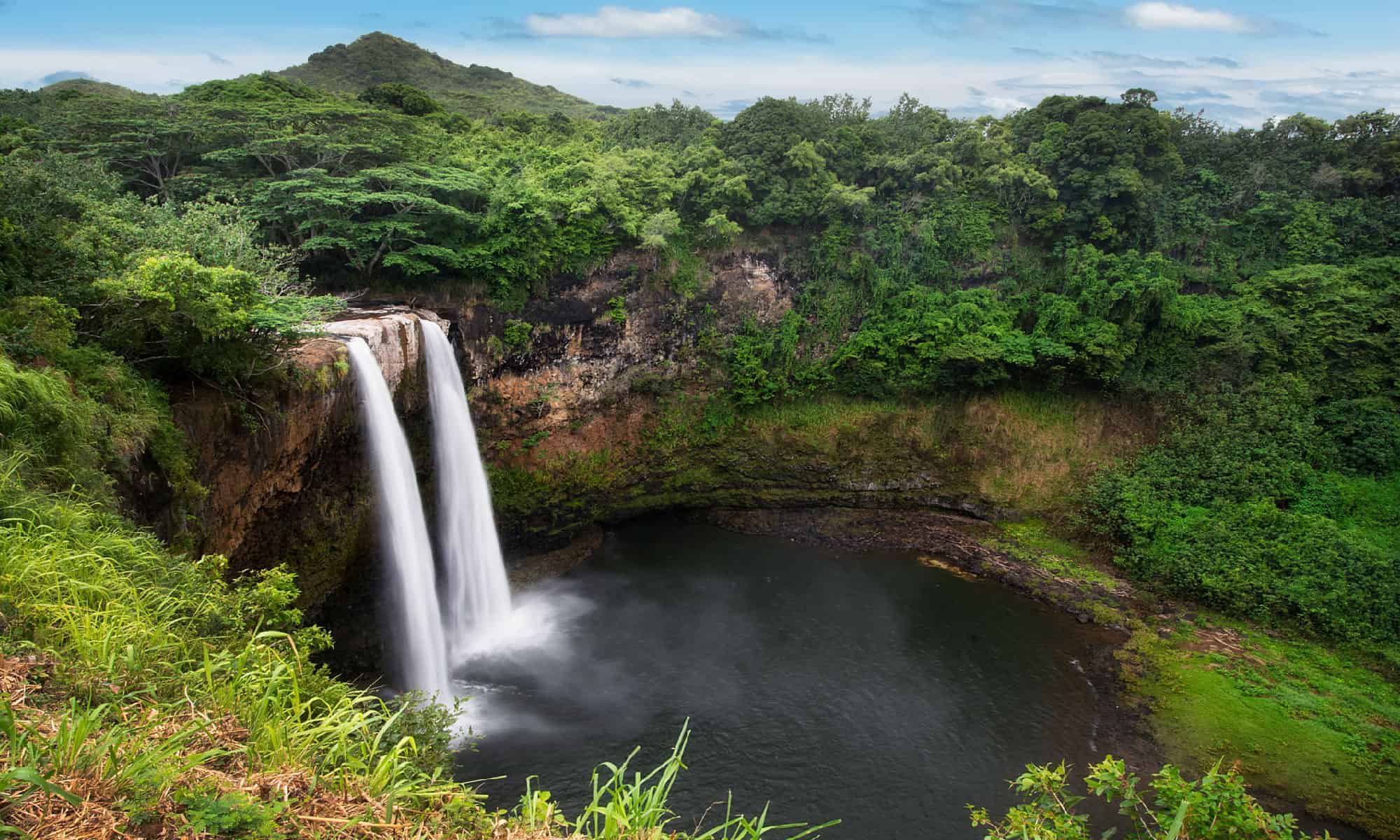
Wailua Falls drops into a deep pool near Lihue on Kauai, splitting into two main ribbons when water levels allow. Its height is surprisingly disputed: many modern visitor sources describe a fall of roughly 80 feet, while older signs and some databases publish much larger figures. The safest description is that measurements vary according to what part of the gorge is included. A roadside overlook makes this one of Kauai’s easiest major waterfalls to see, especially after rain. Trails down the steep, muddy walls are unsafe and may be closed or prohibited, so the official viewpoint is the place to appreciate the full basin, rainbows in the spray, and changing flow.
11. Upper Whitewater Falls, North Carolina
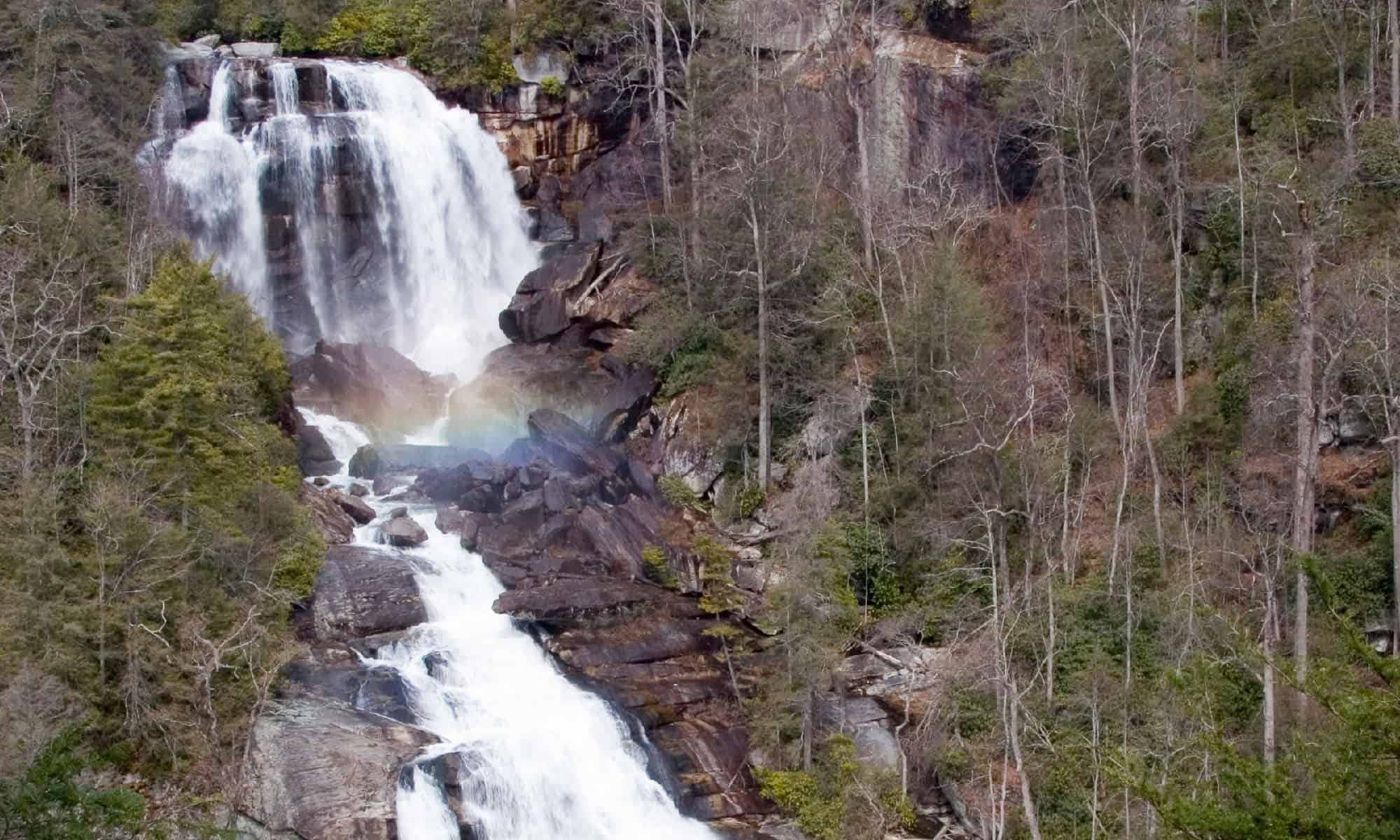
Upper Whitewater Falls plunges about 411 feet near Sapphire, North Carolina, before the Whitewater River continues through a rugged gorge toward additional cascades downstream. The forested escarpment makes the waterfall seem to appear from nowhere, especially in autumn when the surrounding hardwoods turn red and gold. A paved path reaches the main overlook, while a stairway descends to a lower platform with a different angle; continuing trails become more strenuous. The often-cited 811-foot figure refers to the broader Upper and Lower Whitewater Falls system, not one uninterrupted drop. Fog, rain, and seasonal foliage can transform the view within hours.
12. Havasu Falls, Arizona
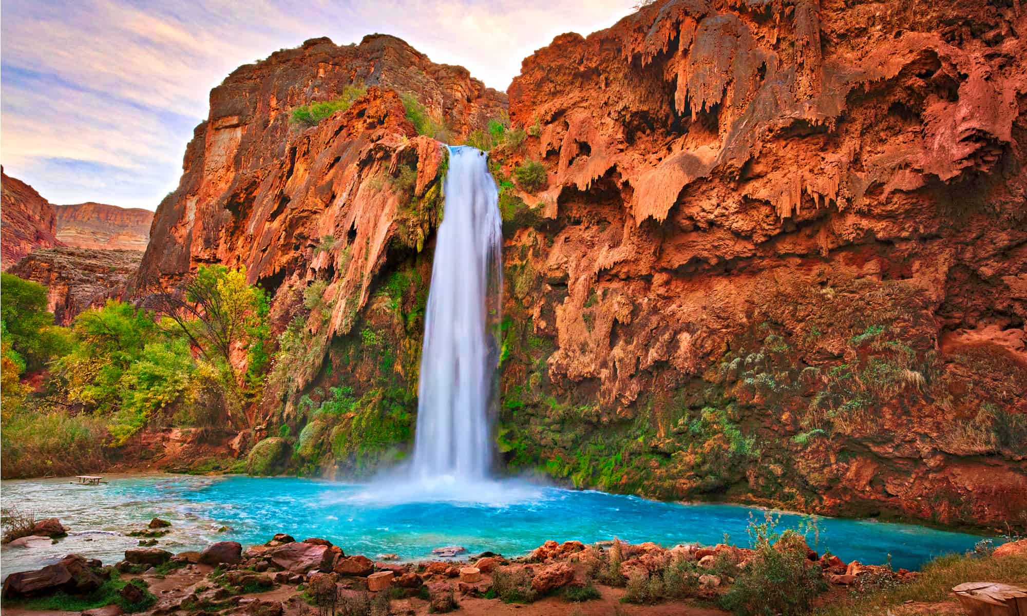
Havasu Falls drops about 100 feet into brilliant blue-green water on the Havasupai Reservation within the Grand Canyon. Dissolved calcium carbonate helps create the creek’s color and continually reshapes the pale travertine around the pools. This is not a casual roadside stop: the Havasupai Tribe controls access, requires reservations and permits, and does not allow visitors to treat the canyon as an open day-hiking destination. The trip involves a long desert hike to Supai and the campground, with no water available along much of the approach. Flash floods can arrive with little warning, and tribal rules prohibit climbing or jumping from the falls.
13. Palouse Falls, Washington
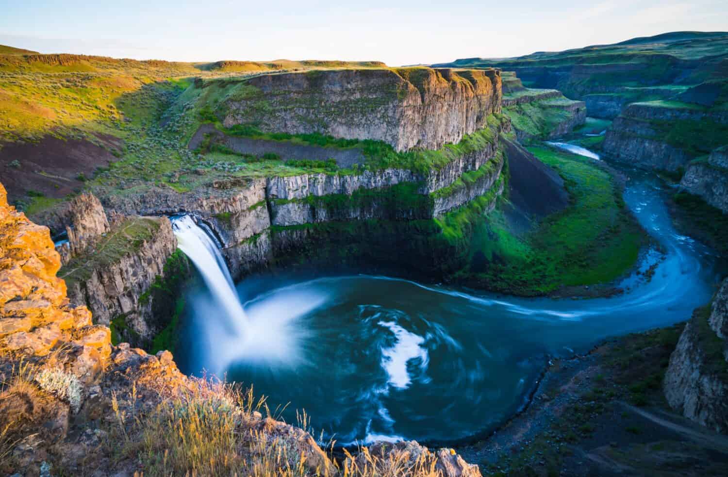
Palouse Falls makes a nearly 200-foot plunge into a dark basalt bowl in southeastern Washington, where the river has carved a dramatic canyon through layers of ancient lava. The landscape feels unexpectedly arid for a state better known for evergreen forests, and spring runoff often gives the waterfall its strongest performance. Washington designated Palouse Falls as the official state waterfall in 2014. Established overlooks at Palouse Falls State Park provide the safest views; unofficial routes near the cliffs have loose rock, extreme exposure, and a history of fatal falls. Summer heat can be severe, and the limited shade makes water, sun protection, and current park alerts essential.
14. Multnomah Falls, Oregon
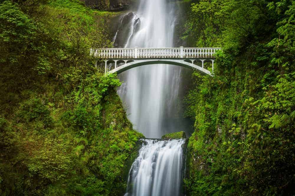
Multnomah Falls descends 620 feet in two main tiers along Oregon’s Columbia River Gorge, with the arched Benson Bridge crossing above the lower drop. The upper fall accounts for most of the height, while the lower tier adds a compact finale beneath the bridge. Because the landmark sits just off Interstate 84, it can draw intense crowds, and timed-use permits or parking controls may apply during busy periods. Winter ice, wildfire recovery, and rockfall can also affect trails. The lower viewpoint delivers the familiar straight-on composition, but hikers who continue upward gain changing views of the gorge and a better sense of the steep volcanic terrain.
15. Virginia Falls, Montana
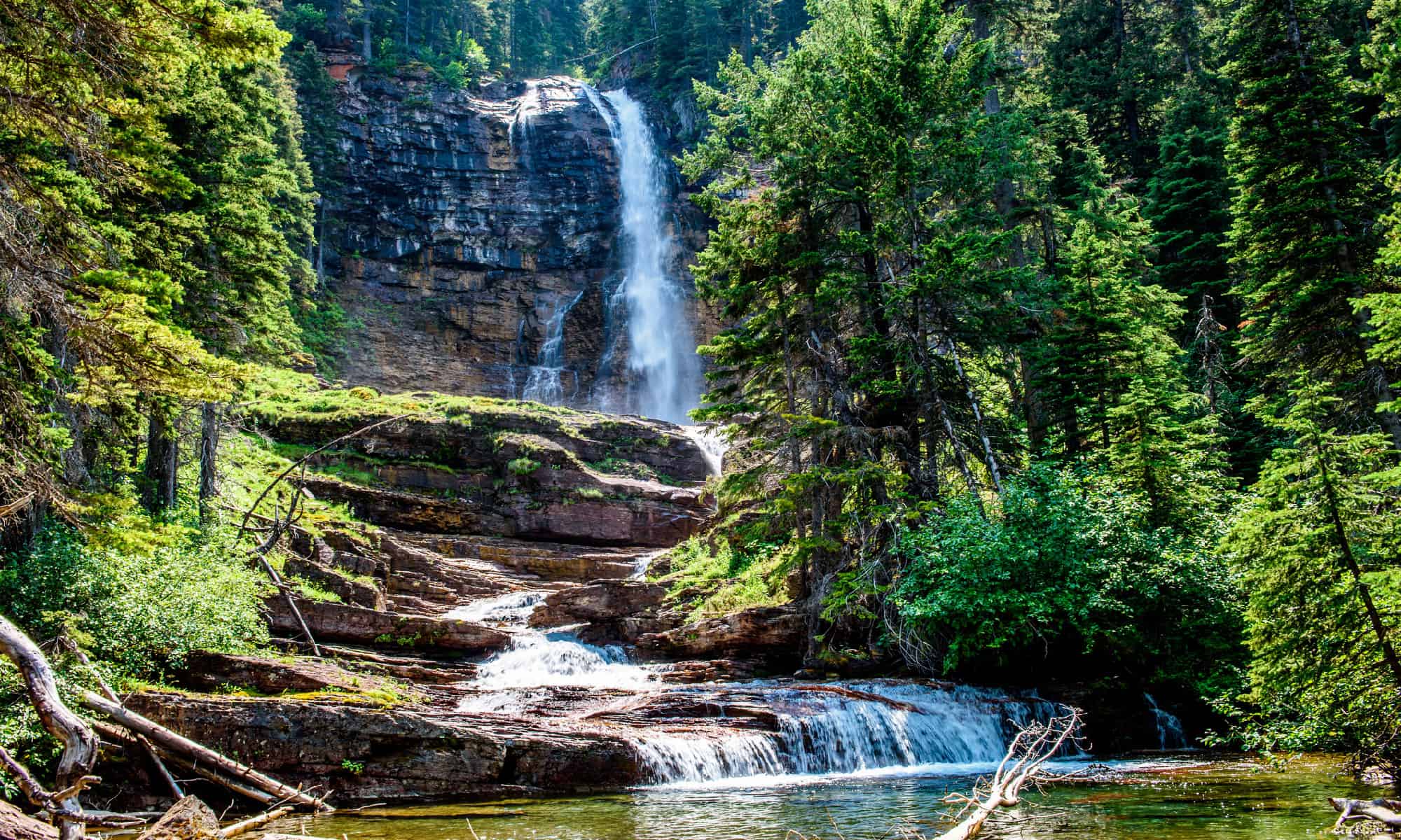
Virginia Falls is a powerful multi-step cascade in Glacier National Park’s St. Mary Valley. The 4,825-foot number sometimes attached to it is an elevation, not the waterfall’s height; the main visible drop is commonly described at roughly 50 feet. Most visitors reach it by hiking past St. Mary Falls, continuing through a fire-shaped landscape where new vegetation, mountain views, and smaller cascades fill the route. Spray can soak the rocks near the viewpoint, while snow and bridge or trail conditions may affect early-season access. The combination of turquoise water and pale bedrock makes Virginia Falls feel much larger than a simple height statistic suggests.
16. Lower Mesa Falls, Idaho
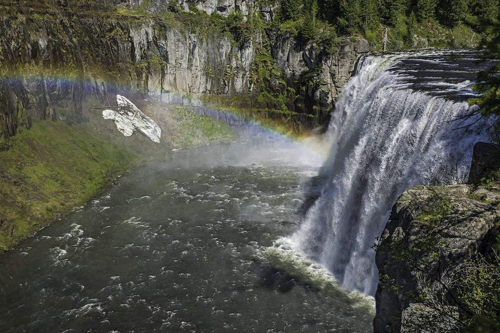
Lower Mesa Falls crashes through a narrow volcanic canyon on Henrys Fork of the Snake River near Ashton, Idaho. It is the less visited companion to Upper Mesa Falls and drops roughly 65 feet, although the constricted river and dark basalt make it look especially forceful. The best established perspective is from Grandview Overlook along the Mesa Falls Scenic Byway, not from attempting to reach the dangerous river edge. Snow can close or limit parts of the byway in winter, and summer brings the easiest driving conditions. From the viewpoint, visitors can trace the forested canyon downstream and see how lava flows helped shape the river’s abrupt descent.
17. Bushkill Falls, Pennsylvania
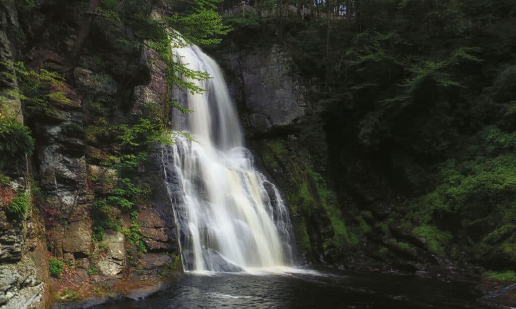
Bushkill Falls is a privately managed series of eight waterfalls in Pennsylvania’s Pocono Mountains, rather than a single 300-foot plunge. Main Falls makes the complex’s biggest individual drop at about 100 feet, while wooden walkways and trails connect the other cascades through a shaded ravine. Several color-coded routes offer different distances and difficulty levels, so visitors can choose a short overlook trip or a longer circuit with many stairs. Admission fees, hours, and seasonal operations apply. Spring runoff usually produces the boldest water, while fall adds vivid hardwood color. The constructed paths improve access, but wet boards and stone steps still demand careful footing.
18. Union Falls, Wyoming
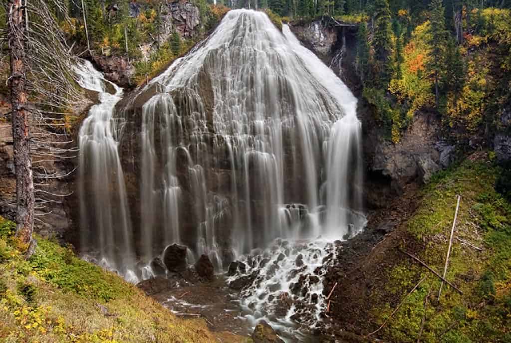
Union Falls fans out across a broad rock face in Yellowstone’s remote southwest corner, dropping roughly 250 feet where two branches of Mountain Ash Creek meet. Its unusual shape explains the name: converging streams create a wide, ribbed curtain that looks unlike Yellowstone’s better-known canyon falls. Reaching it requires a long backcountry hike, commonly approached from the Grassy Lake area, with river crossings and bear habitat along the way. This is a trip for prepared hikers, not a quick park-road stop. Backcountry rules, permits for overnight travel, weather, stream depth, and trail conditions should all be checked before departure, and proper bear precautions are essential.
19. Lower Calf Creek Falls, Utah
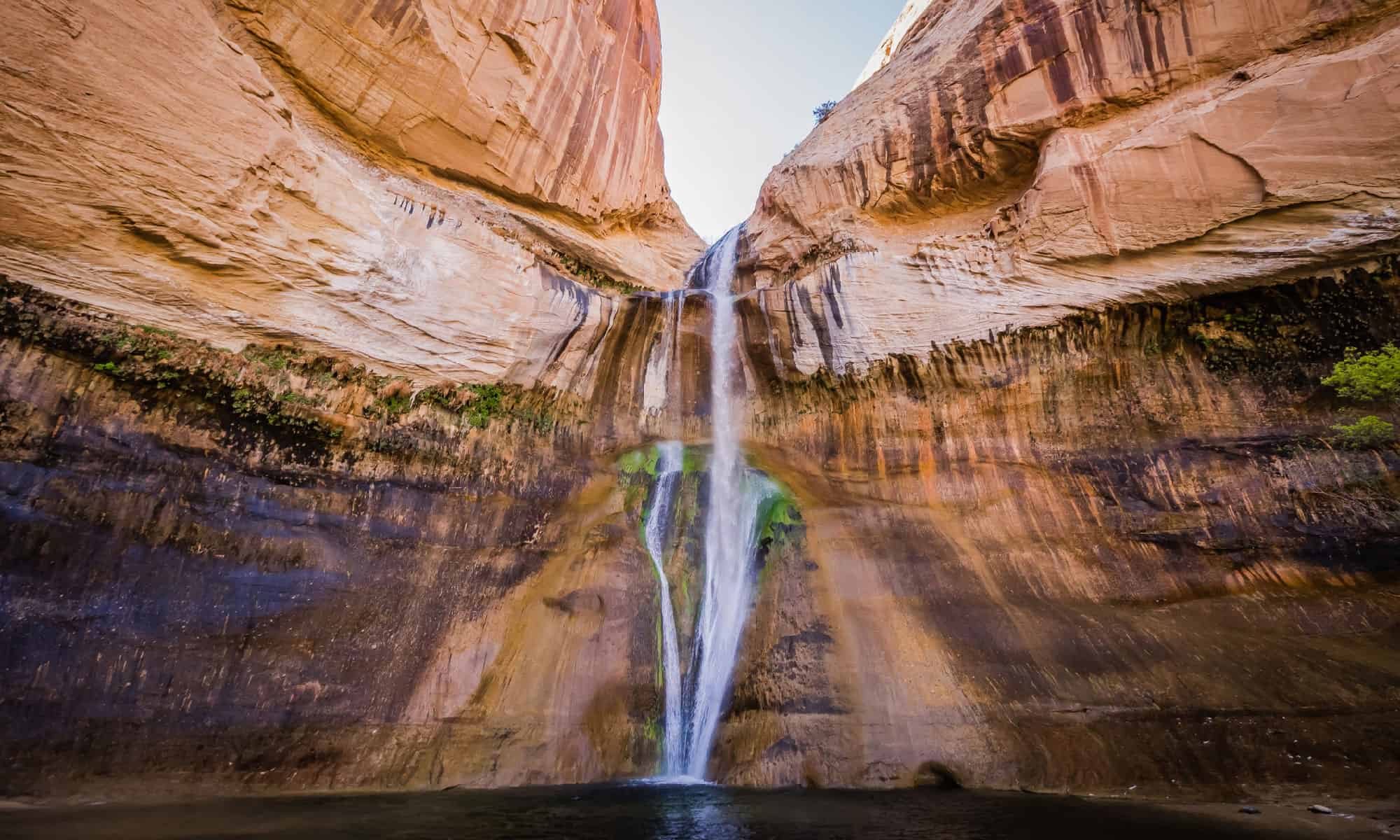
Lower Calf Creek Falls drops 126 feet into a cool green pool inside Grand Staircase-Escalante National Monument. The roughly six-mile round-trip hike follows a canyon lined with sandstone walls, desert vegetation, archaeological features, and traces of beaver activity before the waterfall suddenly appears. Because much of the route is sandy and exposed, the walk can feel harder in summer heat than its modest elevation change suggests. The pool is tempting, but the water stays cold and there is no lifeguard. Flash-flood forecasts, drinking water, and sun protection matter in this remote terrain, while spring and fall generally offer more comfortable hiking temperatures.
20. Snoqualmie Falls, Washington
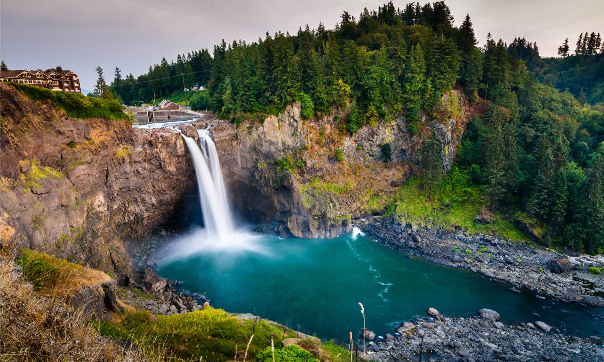
Snoqualmie Falls drops 268 feet on the Snoqualmie River east of Seattle, sending up a plume of mist that can rise above the forest during high flow. The waterfall is also a place of deep spiritual and cultural importance to the Snoqualmie Tribe, whose history is inseparable from the river. An upper observation area offers a broad, accessible view, and a trail descends toward lower viewpoints near the hydroelectric facilities. Rain and snowmelt can transform the cascade from a segmented curtain into a massive wall of water. Visitors should remain behind barriers, as the river, cliffs, and wet ledges are far more dangerous than the polished park setting may suggest.
21. Burney Falls, California
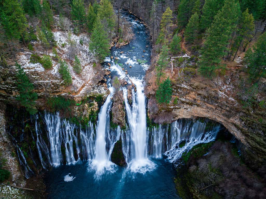
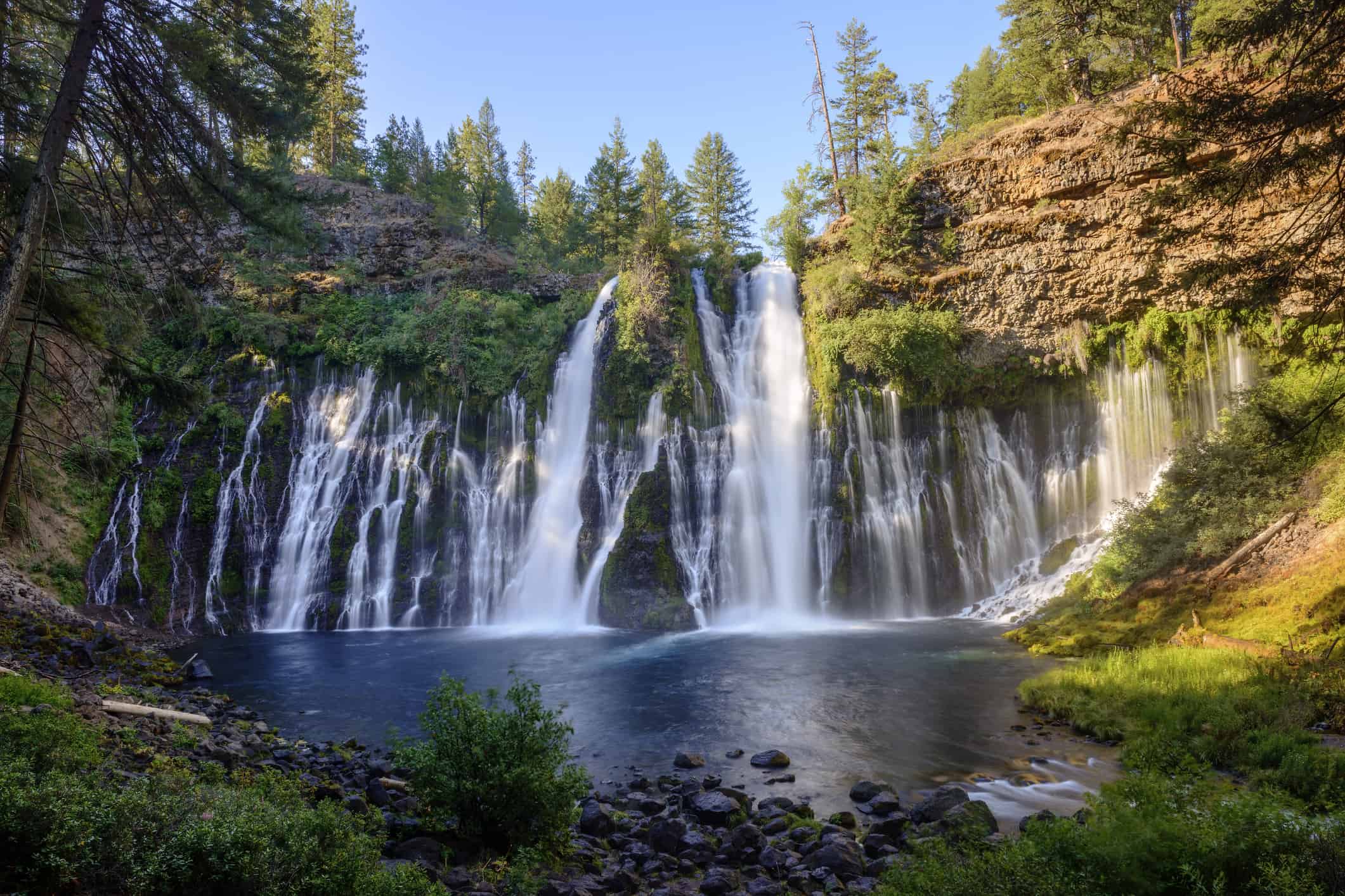
Burney Falls drops 129 feet in McArthur-Burney Falls Memorial State Park in Northern California. Its beauty comes not only from Burney Creek pouring over the rim but also from springs seeping through the volcanic rock across the entire cliff face, creating dozens of smaller ribbons. That groundwater supply keeps the waterfall remarkably consistent even when many California cascades shrink in late summer. A short trail reaches the base, while a longer loop explores the creek and forest. The spray can make temperatures noticeably cooler below the overlook. Trail repairs, crowd controls, and seasonal conditions can change access, so visitors should review California State Parks updates before arriving.
22. Lower Falls of the Yellowstone, Wyoming
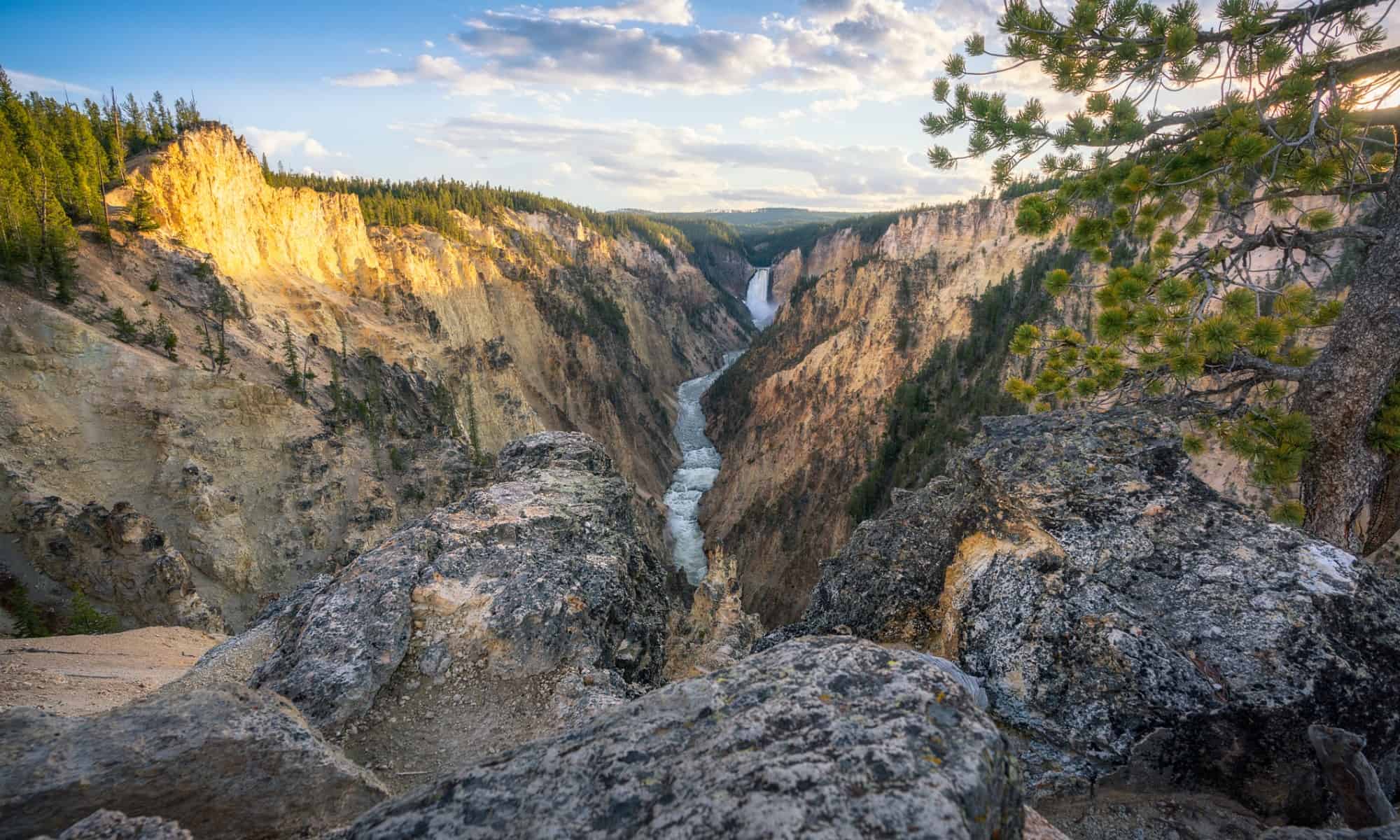
Lower Falls sends the Yellowstone River 308 feet into the Grand Canyon of the Yellowstone, making it the park’s tallest major waterfall. Its force is magnified by canyon walls stained yellow, orange, pink, and white by hydrothermal alteration and oxidation. Artist Point provides the classic distant view, while overlooks on both rims reveal the brink and the river far below; some routes involve steep grades and many switchbacks. Snow and ice can linger well into the shoulder seasons. Although the canyon’s name helped inspire Yellowstone’s, the colorful rock is not simply yellow sulfur, and the waterfall should not be confused with smaller Upper Falls upstream.
23. Yosemite Falls, California
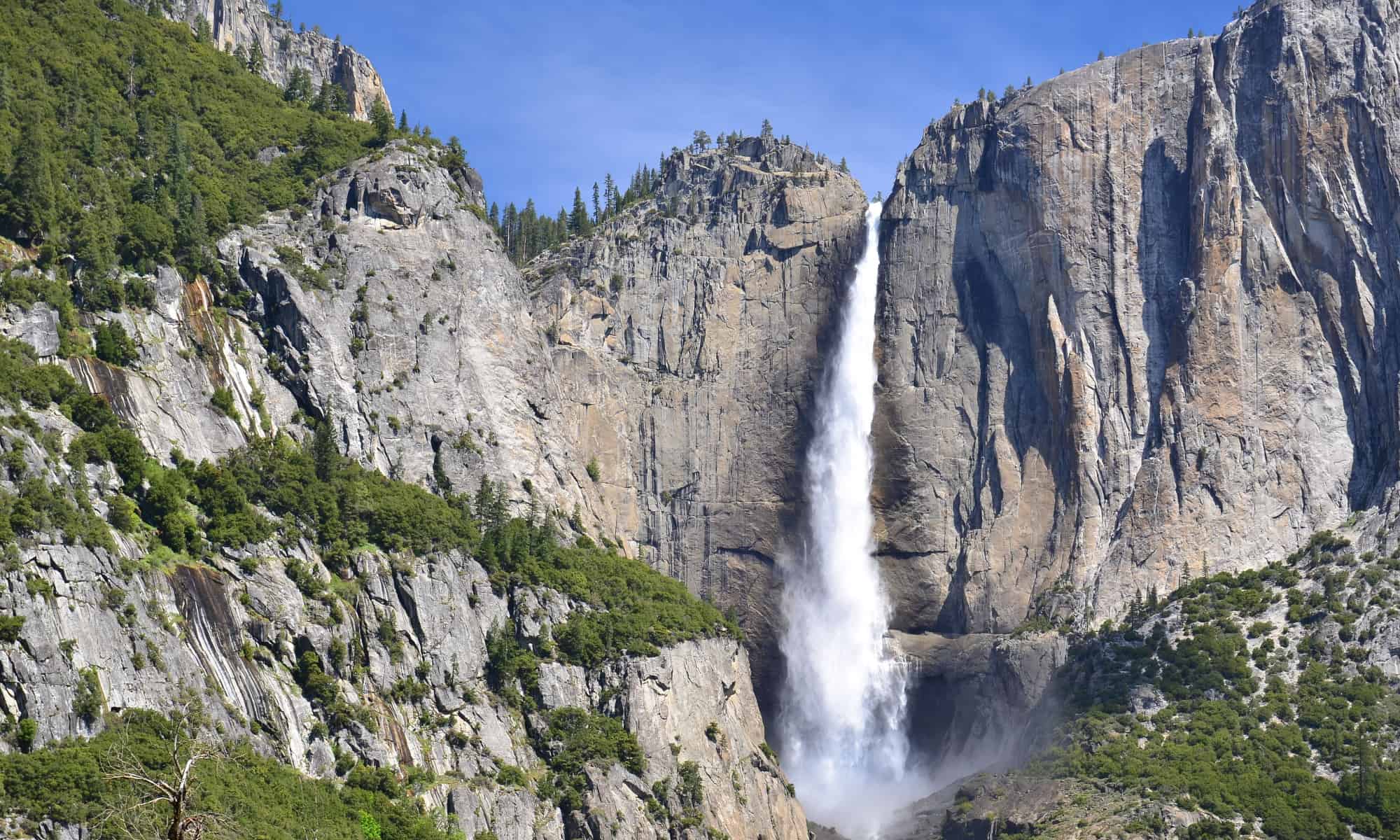
Yosemite Falls measures 2,425 feet from top to bottom, not 5,404 feet. The National Park Service divides that total among Upper Yosemite Fall at 1,430 feet, the middle cascades at 675 feet, and Lower Yosemite Fall at 320 feet. Together they form one of the world’s tallest waterfall systems and dominate views around Yosemite Village during spring runoff. Flow usually peaks in May and can fade to a trickle or stop by late summer in dry years. A one-mile loop reaches the base of Lower Fall, while the trail toward the top is a strenuous all-day climb. Ice, spray, and powerful currents make staying on marked routes essential.
24. Hamilton Pool Preserve Waterfall, Texas
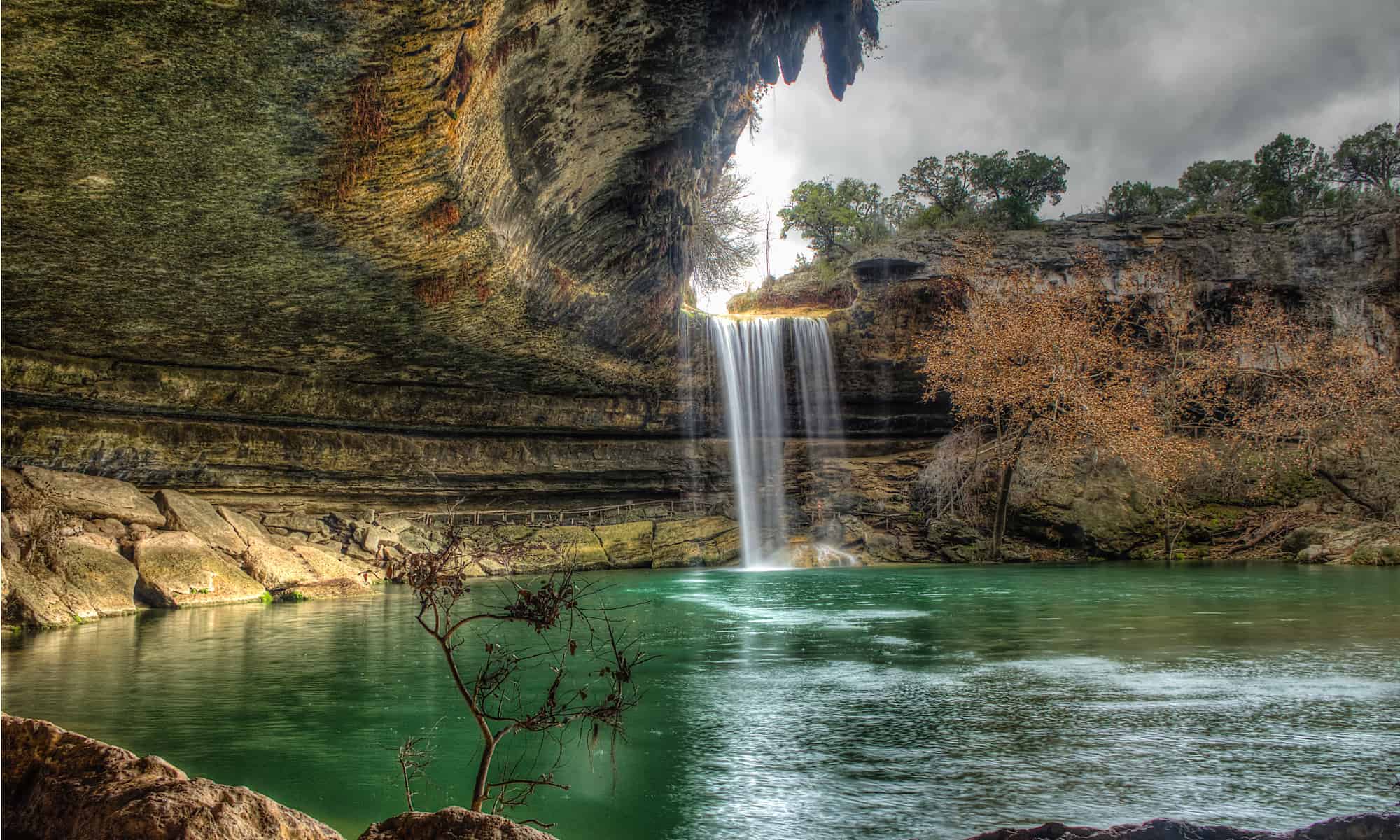
Hamilton Creek pours about 50 feet over a limestone overhang into a collapsed grotto west of Austin, creating the centerpiece of Hamilton Pool Preserve. The waterfall may slow dramatically during drought, but the spring-fed pool and fern-lined canyon retain their otherworldly appearance. Travis County requires reservations every day, and a booking never guarantees swimming: bacteria, rainfall, falling-rock hazards, or other safety concerns can close the water and parts of the trail. The route from the parking area is short but steep and uneven. Pets are prohibited, and there is no drinking water at the preserve, so current alerts and preparation matter even for this compact outing.
25. Yellow Dog Falls, Michigan
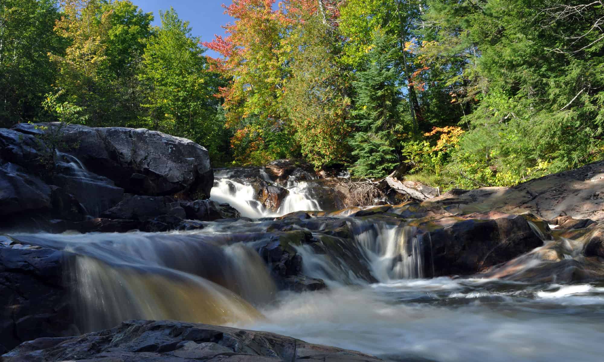
Yellow Dog Falls sits on the Yellow Dog River in Michigan’s Upper Peninsula, in a forested area northwest of Marquette rather than at Thomas Rock Scenic Overlook. The main cascade is commonly described at about 30 feet, with additional rapids and smaller drops nearby. Reaching it involves unpaved roads and a woodland hike, so navigation and road conditions deserve more attention than the modest distance might imply. Spring snowmelt delivers the strongest flow, while autumn turns the hardwoods above the dark rock vivid orange and gold. This is a wild setting with limited facilities; visitors should pack out waste, avoid trampling streamside plants, and keep clear of slippery ledges.
26. Upper Mesa Falls, Idaho
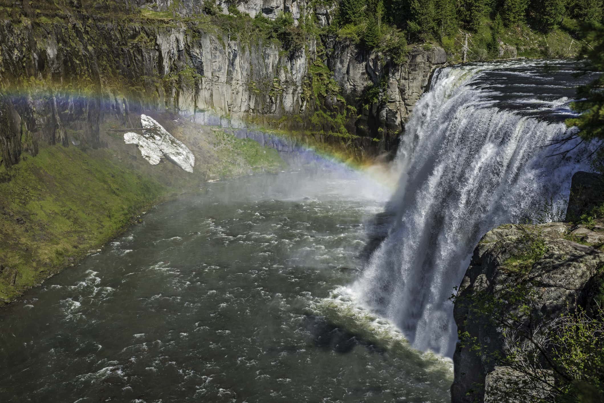
Upper Mesa Falls drops 114 feet across a broad ledge on Henrys Fork of the Snake River in Caribou-Targhee National Forest. The river remains largely undammed in this section, allowing seasonal water levels to shape the waterfall’s changing character. Boardwalks and overlooks along the Mesa Falls Scenic Byway reveal both the brink and the churning canyon below, while a nearby historic inn serves as a seasonal visitor center. Dark volcanic rock and thick conifer forest give the scene a distinctly northern Rockies feel. Snow often limits road access outside the main season, and mist can make walkways slick, so visitors should check byway and facility status before the drive.
27. Grand Falls, Arizona
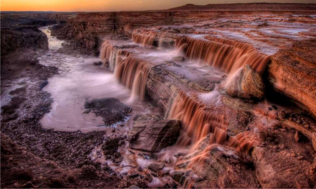
Grand Falls, sometimes called Chocolate Falls, drops about 185 feet on the Little Colorado River within the Navajo Nation. Its muddy brown color comes from sediment carried through the high desert, and the waterfall may be nearly dry for long stretches before snowmelt or heavy rain turns it into a thundering sheet. That unpredictability is part of its appeal, but access is not something travelers should assume. The site is on sovereign tribal land, and closures, permits, road conditions, and visitor rules are controlled by Navajo authorities and local chapters. Anyone considering a trip must confirm current official guidance and should never enter simply because an old map or blog shows a route.
28. Reedy River Falls, South Carolina
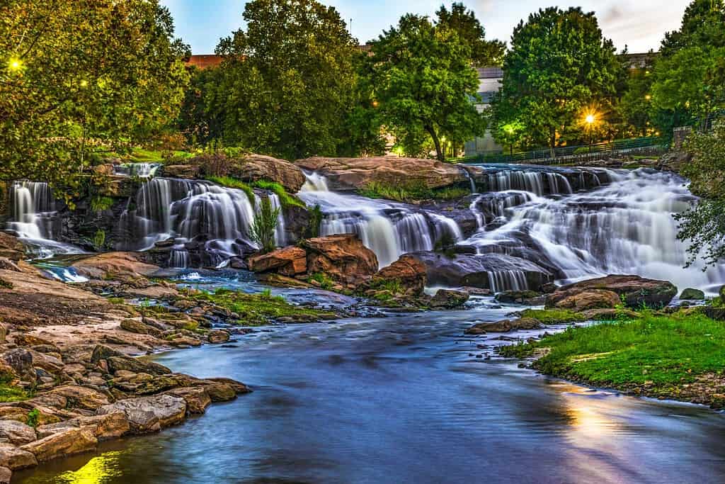
Reedy River Falls drops about 28 feet through the heart of downtown Greenville, South Carolina, proving a memorable waterfall does not require a wilderness expedition. Falls Park on the Reedy frames the cascade with gardens, walking paths, and the curved Liberty Bridge, a pedestrian span designed to keep its support structure away from the central view. The river once powered mills and later suffered from urban neglect before restoration transformed the area into a civic centerpiece. After rain, the water spreads across the stepped rock and grows noticeably louder. The surrounding paths make viewing easy, but smooth stones near the river remain slick and should not be treated as an informal trail.
29. South Fork Mineral Creek Falls, Colorado
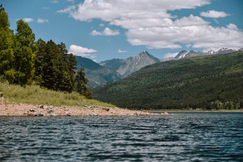
South Fork Mineral Creek tumbles through a bright turquoise channel near Silverton in Colorado’s San Juan Mountains. The feature is better understood as a short series of cascades—roughly 55 feet in total, with a prominent drop around 35 feet—than as one perfectly vertical waterfall. Mineral-rich geology and fine sediment help give the water its striking color, especially under clear summer light. Pullouts and informal paths along the highway can make the area look simple to explore, but traffic, unstable edges, and cold swift water demand care. Snow, runoff, and high-elevation weather change quickly, and visitors should avoid blocking the road or damaging fragile streamside ground.
30. Crabtree Falls, Virginia
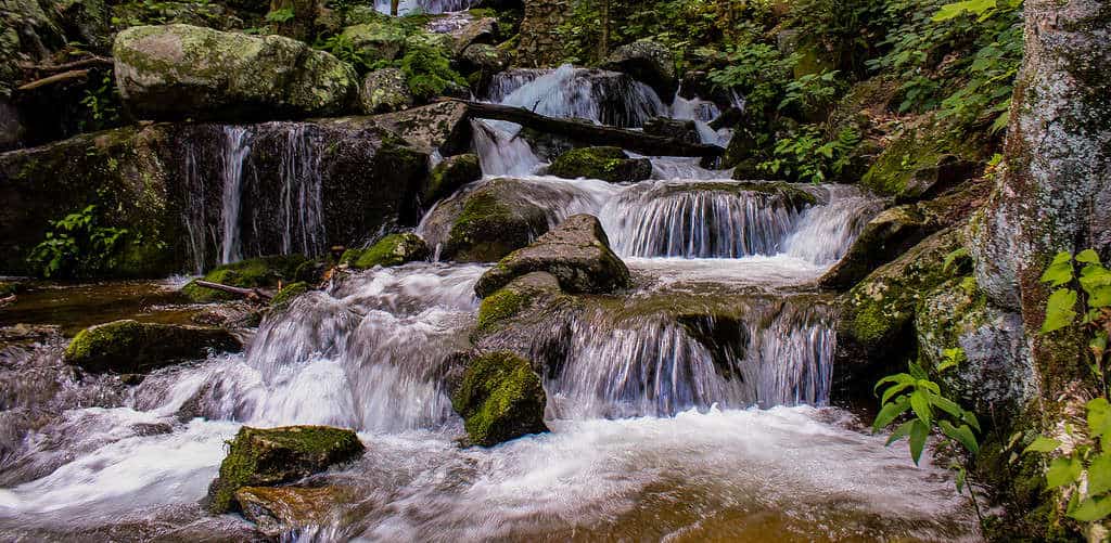
Crabtree Falls in Virginia’s Blue Ridge is a long sequence of cascades, not one unbroken vertical fall. The stream descends roughly 1,200 feet through the forest, and a trail with several overlooks reveals different sections of the system. Promotional claims sometimes call it the tallest waterfall east of the Mississippi, but rankings depend on whether a multi-tier cascade is compared with a single drop, so the wording should be treated cautiously. The lower overlook is relatively close to the parking area, while the full climb is strenuous. Fatal accidents have occurred when visitors left the trail for wet rock, making the fences and warnings here especially important.
31. Toketee Falls, Oregon
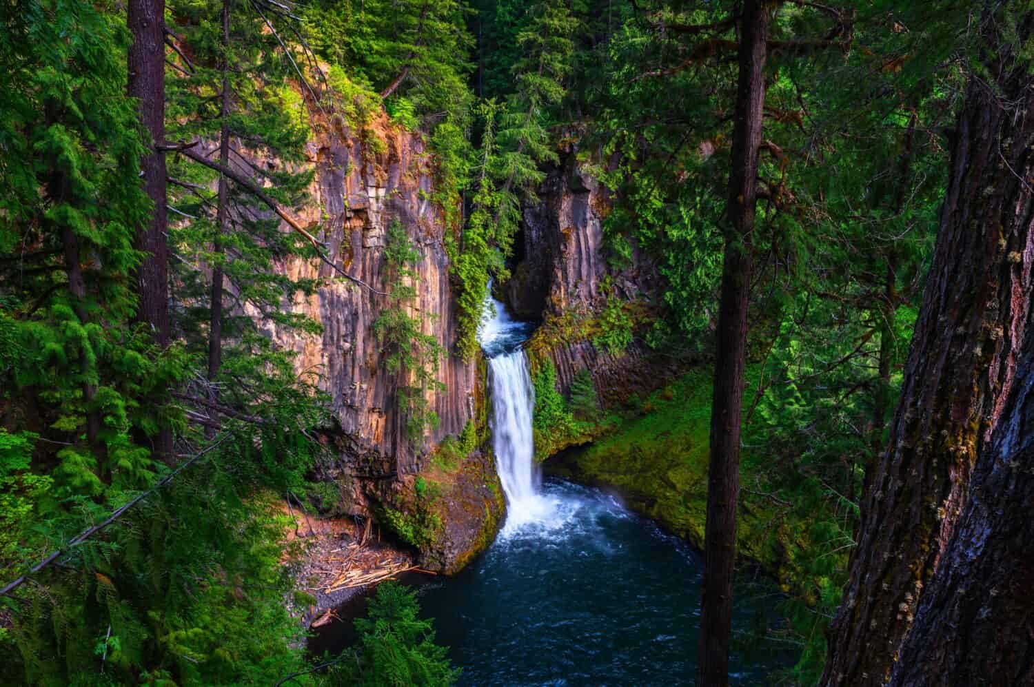
Toketee Falls drops 113 feet in two tiers on Oregon’s North Umpqua River, framed by a wall of remarkably regular basalt columns. The upper tier is partly hidden, while the lower 85-foot plunge fans into a deep blue pool, creating the view most visitors recognize. A short forest trail reaches a fenced platform above the canyon and includes numerous stairs. The name “Toketee” is often translated as “graceful,” a fitting description for the river’s smooth white ribbon against dark volcanic rock. Unofficial routes toward the pool are steep, eroded, and dangerous, and closures may be used to protect visitors or habitat. The established overlook supplies the safest complete view.
32. Dry Falls, North Carolina
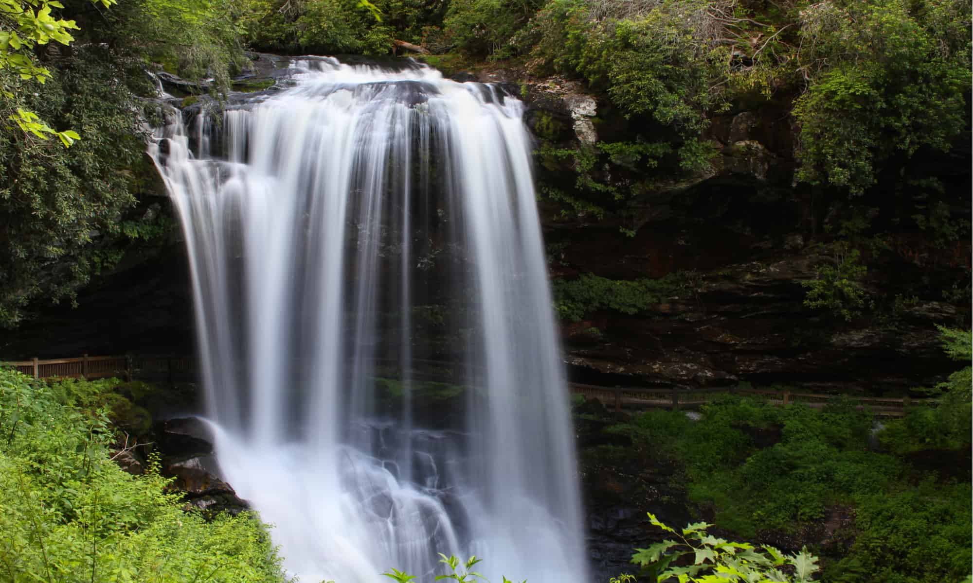
Dry Falls is a roughly 75-foot cascade on the Cullasaja River near Highlands, North Carolina—not in South Carolina. A short paved path and stairway lead behind the falling water, where a recessed rock ledge usually keeps visitors relatively dry and explains the name. “Dry” is only relative: wind and high flow can send spray across the walkway, and winter ice may make the route unsafe or trigger closures. The roadside setting on the Mountain Waters Scenic Byway makes the fall popular, especially during autumn color. Limited parking can fill quickly, and the twisting mountain highway requires patience. Visitors should use the formal trail instead of scrambling beside the gorge.
33. Kaaterskill Falls, New York
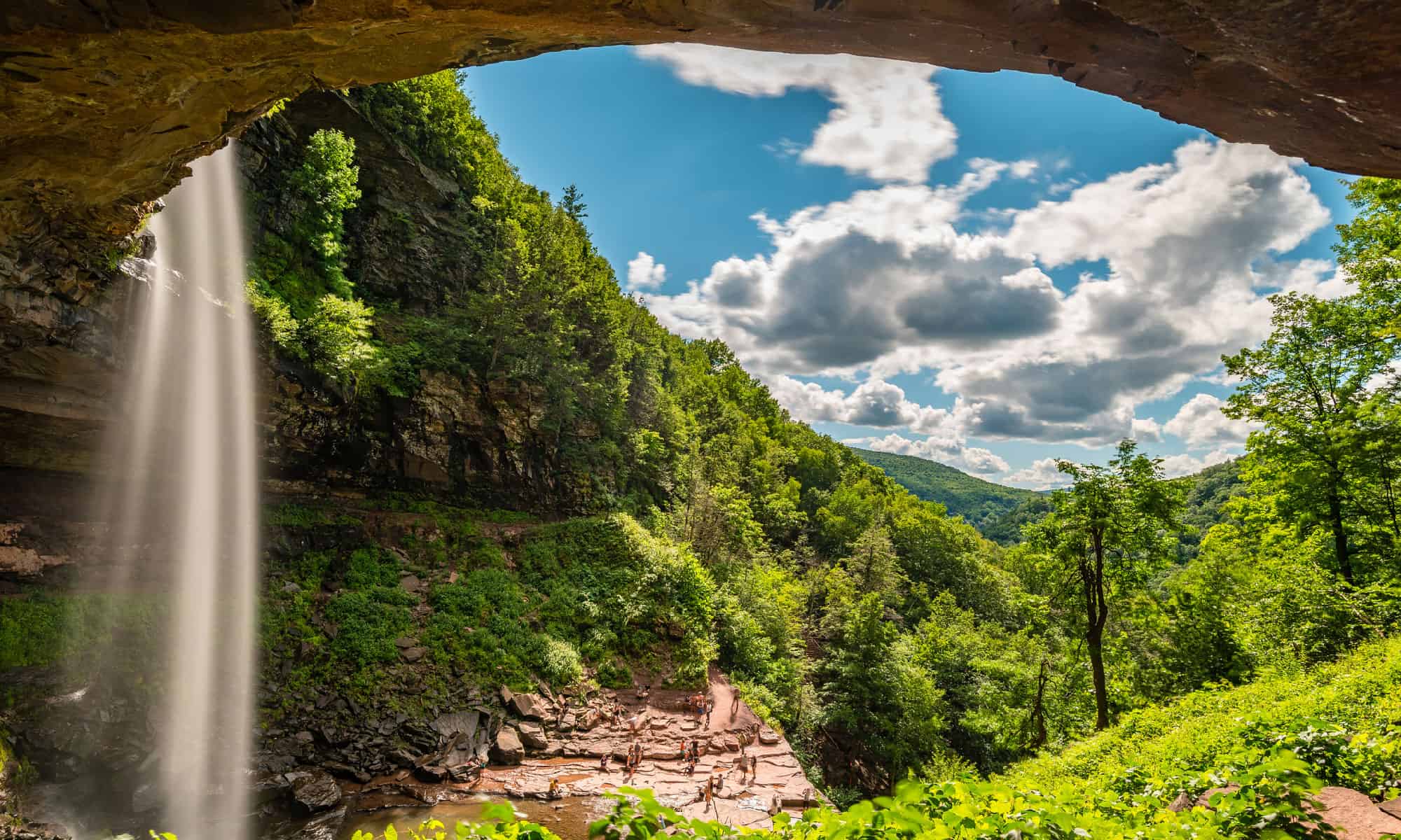
Kaaterskill Falls descends about 260 feet in two main tiers in New York’s Catskill Mountains, making it one of the state’s tallest waterfall systems. The dramatic amphitheater inspired generations of painters and writers, including artists associated with the Hudson River School. Modern viewing platforms and marked trails offer safer perspectives than the old practice of scrambling near the cliff edges. Several fatal falls prompted major access and safety improvements, but wet rock, winter ice, and steep terrain remain serious hazards. Water volume varies widely, with spring runoff and rain creating the fullest display. Parking and trail rules can change, so the state’s latest guidance should shape any visit.
34. Rainbow Falls, North Carolina
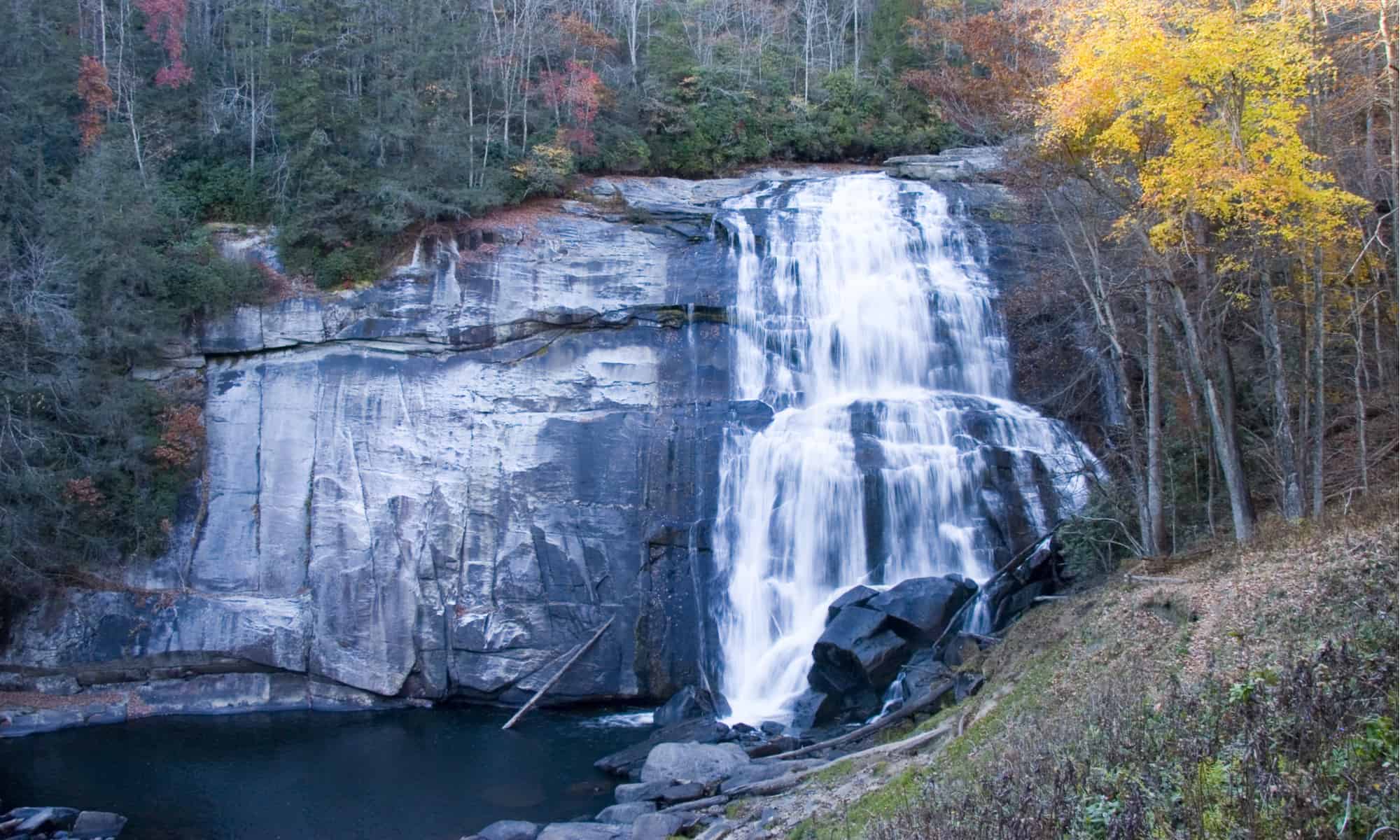
Rainbow Falls plunges about 150 feet on the Horsepasture River in western North Carolina, not 80 feet as some older summaries report. Sunlight often catches the heavy mist below the drop, producing the rainbow that gave the waterfall its name. Most visitors approach from Gorges State Park and continue onto adjoining forest land, following a rugged trail with sustained climbing and roots or mud after rain. High water makes the falls spectacular but also increases danger along the river. Swimming above the brink or climbing slick rock can be fatal. The overlook and established trail provide the right perspective, especially in morning or late-afternoon light when the spray glows.
35. Bridal Veil Falls, Colorado
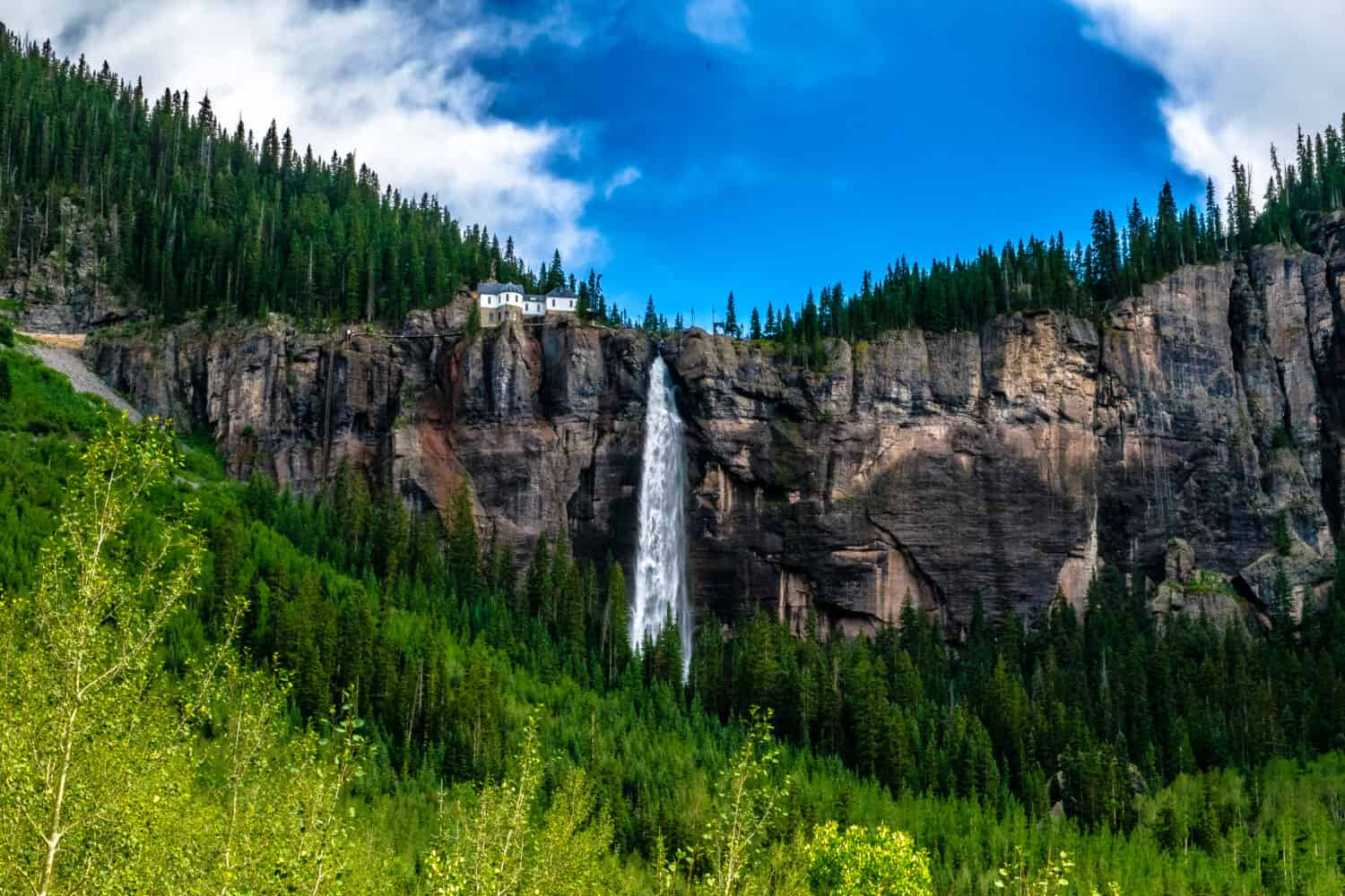
Bridal Veil Falls drops 365 feet at the head of Telluride’s box canyon, making it Colorado’s tallest free-falling waterfall by commonly used measurements. A historic power station perches above the brink, adding an unexpected industrial silhouette to the alpine setting. Visitors can see the cascade from the valley road or travel closer on a steep route used by hikers, cyclists, and high-clearance vehicles, subject to current restrictions. Spring and early summer snowmelt usually bring the strongest flow, while winter transforms the cliff into a famed ice-climbing area. Rockfall, avalanche conditions, traffic, and rapidly changing mountain weather make local access reports essential.
36. Horsetail Falls, Alaska
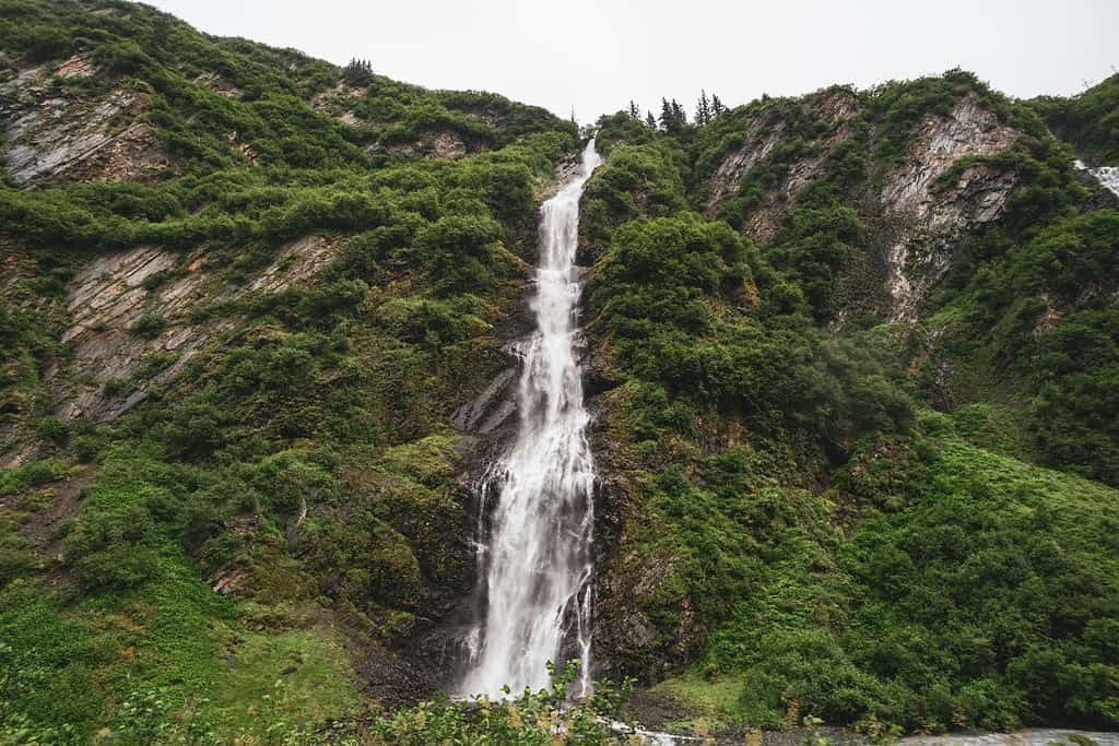
Horsetail Falls streams down the wall of Keystone Canyon along the Richardson Highway near Valdez, Alaska. The 2,130-foot figure sometimes attached to it appears to confuse surrounding elevation or a broader drainage with the visible waterfall; commonly published estimates put the roadside cascade at a few hundred feet. Snowmelt and rain feed the narrow white ribbons, and the dark canyon walls make them easy to spot from designated pullouts. Nearby Bridal Veil Falls adds another dramatic cascade to the drive. Winter brings ice climbing but also avalanche and falling-ice hazards, while summer traffic and limited shoulder space make stopping only in established areas the safest choice.
37. Little River Falls, Alabama
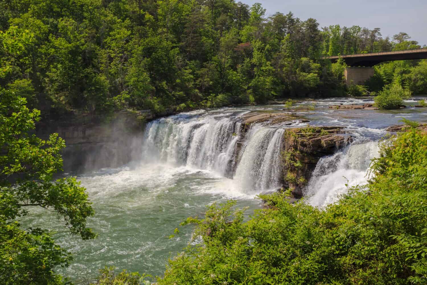
Little River Falls drops about 45 feet at the beginning of Little River Canyon in northeastern Alabama. The river is unusual because it flows for much of its course atop Lookout Mountain before carving into the sandstone plateau. Water volume changes dramatically: after wet weather the fall becomes a broad, roaring curtain, while dry summer periods can expose much of the ledge. Overlooks near Little River Canyon National Preserve make the main view easy to reach, and trails connect to additional canyon scenery. Strong currents, submerged rocks, and sudden rises create real danger near the brink, so swimming and wading should follow posted conditions rather than appearances.
38. Graces High Falls, Alabama
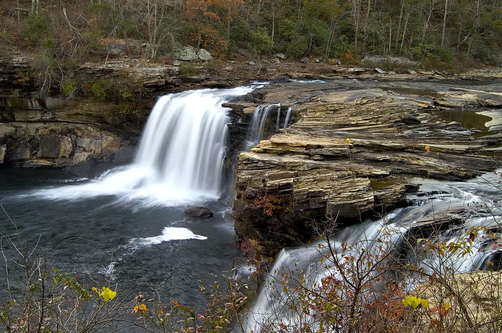
Graces High Falls is a seasonal cascade in Little River Canyon National Preserve, commonly measured at 133 feet. That makes it one of Alabama’s tallest waterfalls, but only when it is actually flowing. The thin ribbon appears on the canyon wall after sustained rain and may vanish during dry weather, so timing matters far more here than at spring-fed sites. Canyon Rim Parkway overlooks can provide a distant view without a difficult descent, though trees and mist may partly obscure it. Because the waterfall is ephemeral, visitors should pair the search with the preserve’s overlooks, trails, and Little River Falls rather than plan an entire trip around guaranteed water.
39. Proxy Falls, Oregon
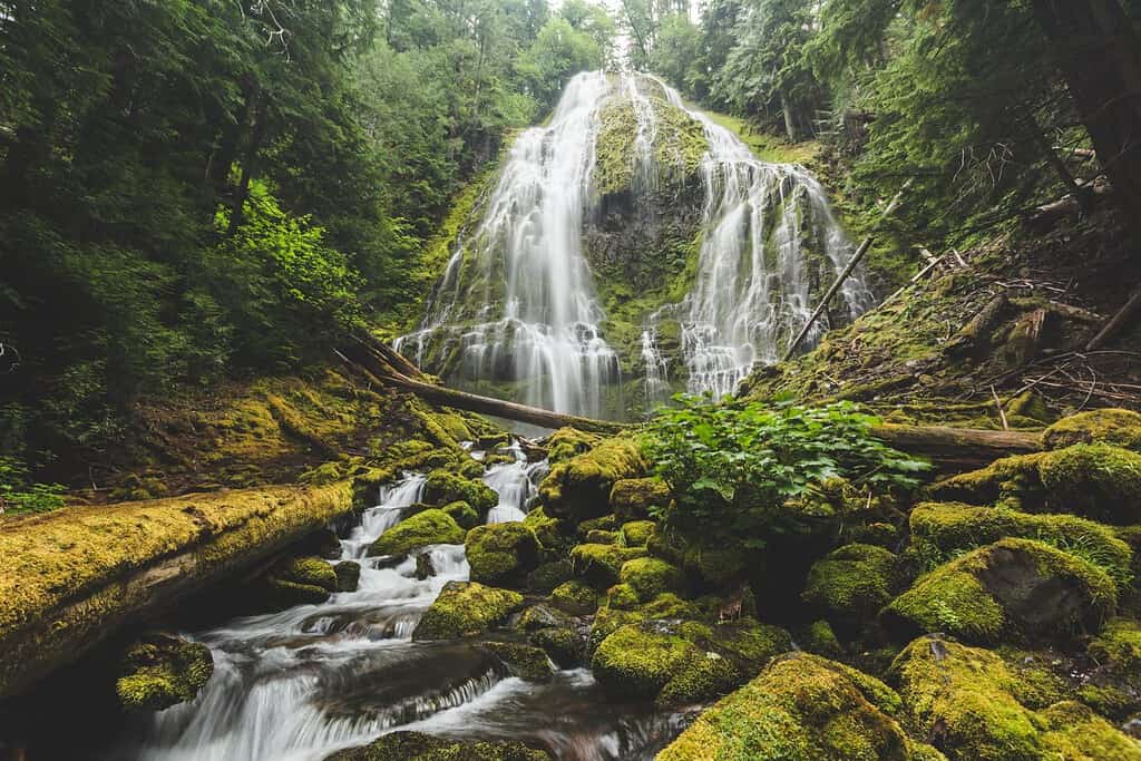
Proxy Falls spreads into a lace-like veil across moss-covered basalt in Oregon’s Three Sisters Wilderness. The main lower cascade is commonly listed at about 226 feet, though its many branching channels make a single measurement less intuitive than the scene itself. A loop trail from McKenzie Pass leads through lava fields and old-growth forest before reaching viewpoints near the falls. Much of the water disappears into porous volcanic rock instead of forming a large surface stream below. Highway access is seasonal because snow closes McKenzie Pass, and the trail can remain muddy or snowbound after reopening. Visitors should stay on durable paths to protect the fragile mossy slope.
40. Mooney Falls, Arizona
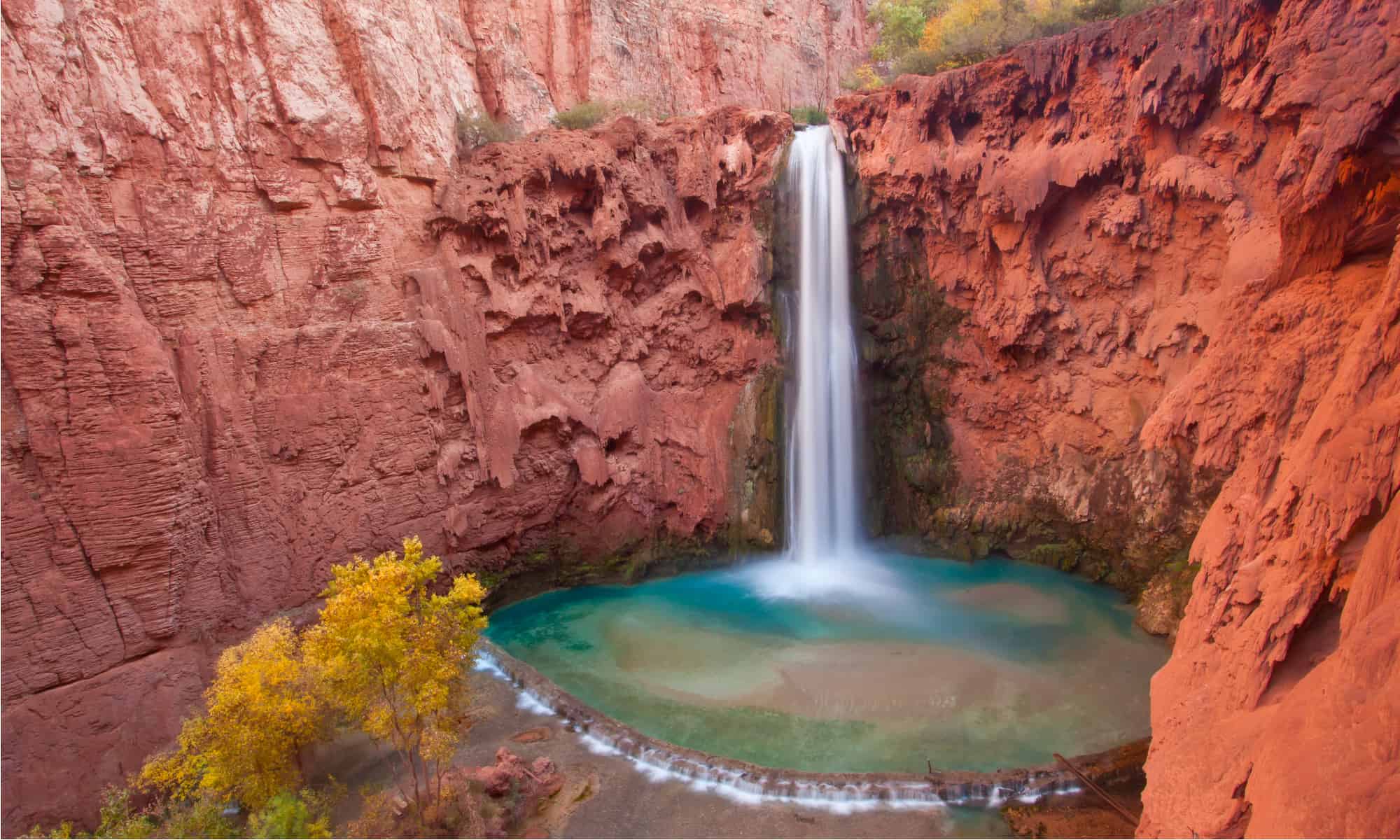
Mooney Falls plunges about 190 feet through a red-rock amphitheater downstream from Havasu Falls on the Havasupai Reservation. Reaching the base requires descending a steep route through tunnels and down chains and ladders coated by spray, a passage the Tribe describes as extremely treacherous and unsuitable for some visitors. The turquoise water and towering canyon walls create one of the Southwest’s most dramatic waterfall scenes, but beauty does not reduce the risk. Tribal permits and rules govern all access, and jumping, climbing the falls, and ignoring restricted areas are prohibited. Flash floods, heat, and limited emergency services make preparation indispensable.
41. High Falls, New York
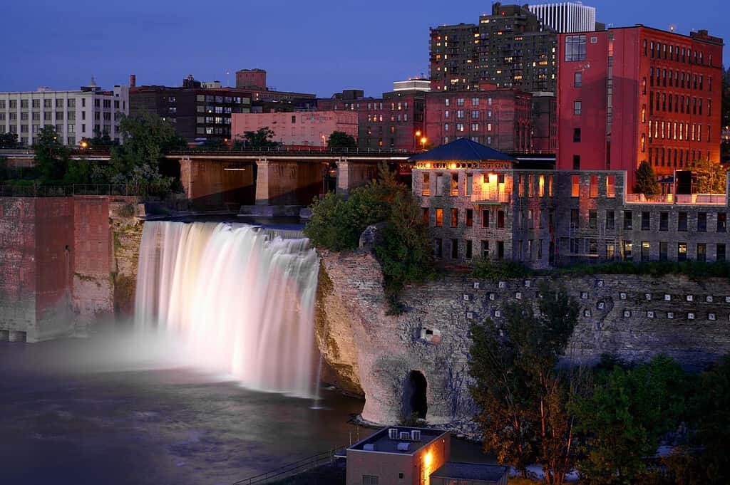
High Falls drops about 96 feet on the Genesee River in downtown Rochester, New York. The waterfall sits within a deep gorge surrounded by bridges, historic mill buildings, rail infrastructure, and modern city towers, producing a rare collision of geology and industrial history. The Genesee powered flour mills that helped Rochester grow, and the district’s surviving structures still frame the view. Water volume varies with weather and river management, but the fall is especially forceful during spring runoff. Public overlooks and the Pont de Rennes pedestrian bridge offer broad perspectives without entering the gorge. Night lighting can turn the urban waterfall into an entirely different scene.
42. Falling Waters Sink, Florida
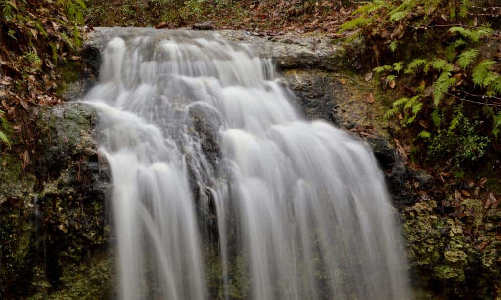
At Falling Waters State Park near Chipley, a small stream drops 73 feet into a cylindrical limestone sinkhole, creating Florida’s tallest natural waterfall by the usual state-park description. Unlike a mountain cascade, the water disappears underground, and its final route through the porous karst remains part of the site’s mystery. Flow depends heavily on rainfall, so the waterfall can range from a lively plunge to barely a trickle. A boardwalk and stair system leads to viewing platforms surrounded by hardwood forest and ferns. Thunderstorms, wet steps, and summer heat can shape the experience, making recent rain both the best reason to visit and a reason to tread carefully.
43. Minnehaha Falls, Minnesota
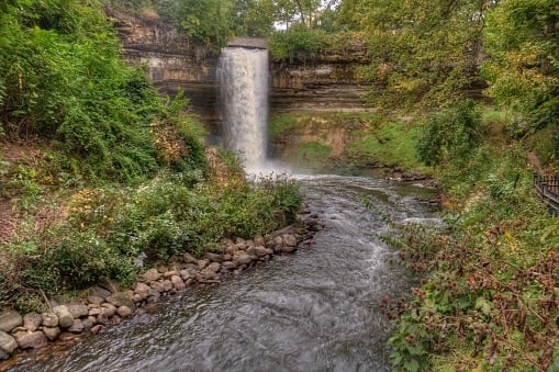
Minnehaha Falls drops 53 feet over a limestone ledge in Minneapolis, only a short distance from city streets and the Mississippi River. Minnehaha Creek cuts through a wooded gorge below the cascade, and a network of park paths reveals bridges, stone walls, and changing views through the seasons. Spring runoff usually creates the broadest curtain, while drought can reduce the flow sharply. In winter, ice builds a spectacular frozen façade, but unstable formations and restricted areas should be respected. Henry Wadsworth Longfellow made the name famous in “The Song of Hiawatha,” even though he had not seen the Minnesota waterfall when he wrote the poem.
44. Cedar Falls, Arkansas
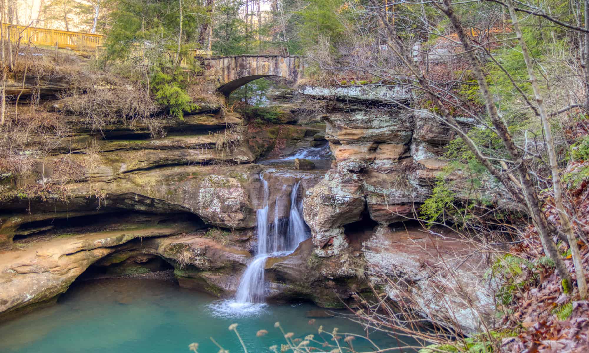
Cedar Falls plunges about 95 feet into Cedar Creek Canyon at Petit Jean State Park in Arkansas. The classic view comes after a forest hike into the canyon, where the waterfall drops from a sandstone ledge into a boulder-ringed pool. Rainfall controls the display, so wet seasons bring a powerful column while extended dry weather may leave only a thin stream. The route includes uneven rock, roots, and elevation change, and the hike out requires regaining the descent. Swimming is prohibited at the falls, and slick ledges should be avoided. Even when water is modest, the canyon’s layered cliffs and hardwood forest make the trail worthwhile.
45. Spouting Rock and Bridal Veil Falls at Hanging Lake, Colorado
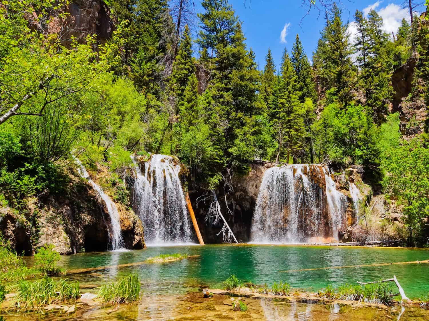
Hanging Lake near Glenwood Springs is fed by delicate cascades that spill over a travertine rim, while nearby Spouting Rock sends water from an opening in the cliff. The often-cited 1,200-foot number refers to the steep trail’s elevation gain, not the height of either waterfall. The lake’s fragile mineral deposits and clear water are protected, so visitors may not swim, walk on the fallen log, or leave designated paths. A permit and reservation system controls access, and the climb is short but strenuous. Wildfire, mudslides, winter conditions, or restoration work can alter operations, making official White River National Forest guidance essential before traveling.
46. Kent Falls, Connecticut
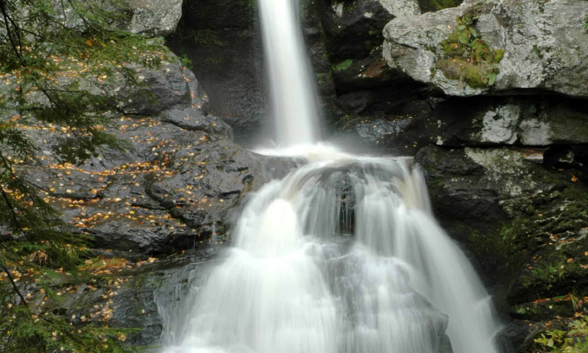
Kent Falls is a staircase of cascades on Falls Brook in northwestern Connecticut. The water descends roughly 250 feet over about a quarter mile, while the largest individual drop is much shorter—often estimated near 70 feet. A covered bridge and picnic lawn introduce the state park, and a steep trail with overlooks follows the stream uphill through hemlock and hardwood forest. Spring snowmelt and rain create the strongest flow; summer can be quieter, and autumn brings intense color. Sections of trail may close because of erosion, ice, or high water. Visitors should view from designated platforms and avoid the smooth, wet rock beside the cascades.
47. Amicalola Falls, Georgia
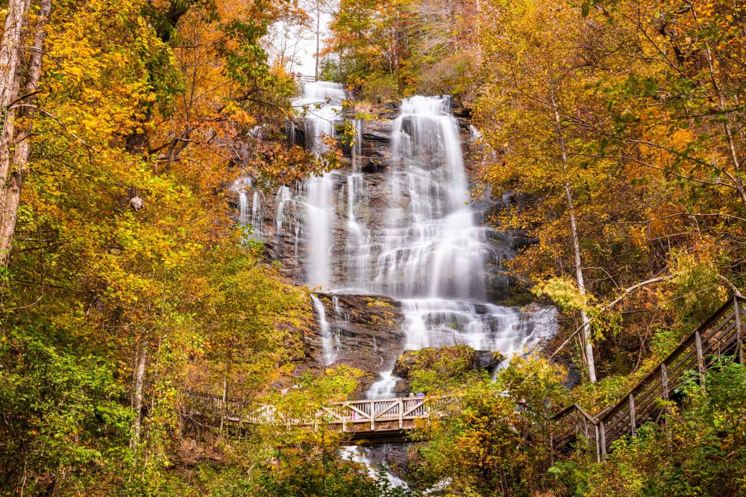
Amicalola Falls descends 729 feet in a long series of cascades through the southern Appalachian forest of north Georgia. It is routinely described as one of the tallest cascading waterfalls east of the Mississippi, wording that is more defensible than an exact national rank because lists define and measure multi-tier falls differently. Amicalola Falls State Park offers several perspectives, from accessible roadside areas to stair-heavy routes that climb beside the water. The park also serves as a gateway for hikers heading toward the Appalachian Trail’s southern terminus. Spring flow and autumn color are especially popular, and the long stair system can be strenuous or slick.
48. Screw Auger Falls, Maine
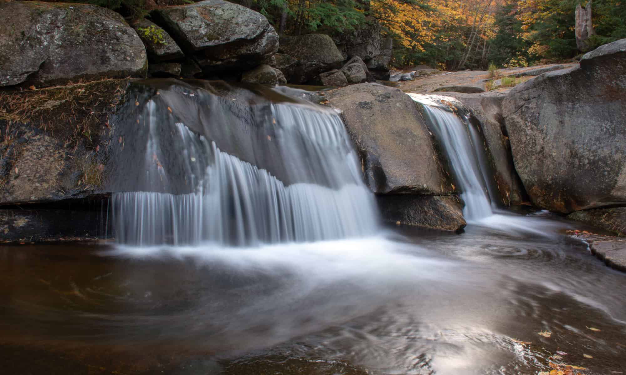
Screw Auger Falls drops about 23 feet through a narrow granite gorge in Maine’s Grafton Notch State Park. The Bear River has carved potholes, channels, and smooth-sided pools into the rock, creating a compact landscape that rewards close observation more than raw height. A short path from the parking area reaches the main viewpoints, which makes the site an easy stop along Route 26. High water can turn the confined channel violent, while autumn foliage adds color above the gray stone. The polished rock is exceptionally slippery and swimming near the falls is unsafe. Winter access and facilities may be limited, so seasonal park information is worth checking.
49. Kilgore Falls, Maryland
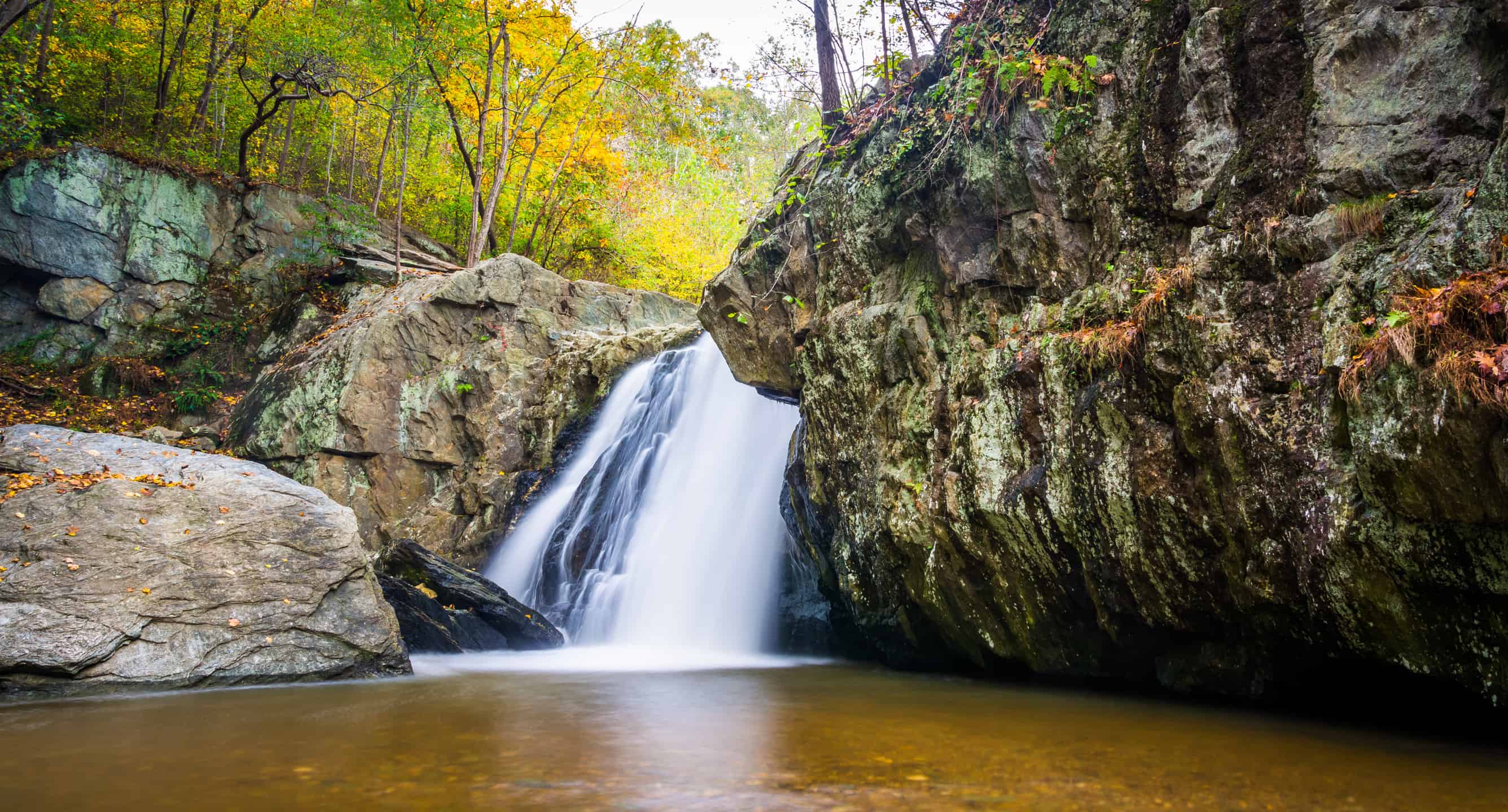
Kilgore Falls drops about 17 feet on Falling Branch in Rocks State Park, making it one of Maryland’s notable free-falling waterfalls despite its modest height. The secluded pool and forest appeared in the Disney film “Tuck Everlasting,” helping turn a once-quiet site into a popular warm-weather destination. Access rules have changed over time to manage crowds, parking, and resource damage, and reservations may be required during busy periods. The trail is short but can be muddy, while the pool has uneven footing and no lifeguard. Visitors should verify the latest Maryland park guidance, pack out trash, and avoid climbing the wet rock face.
50. Bash Bish Falls, Massachusetts
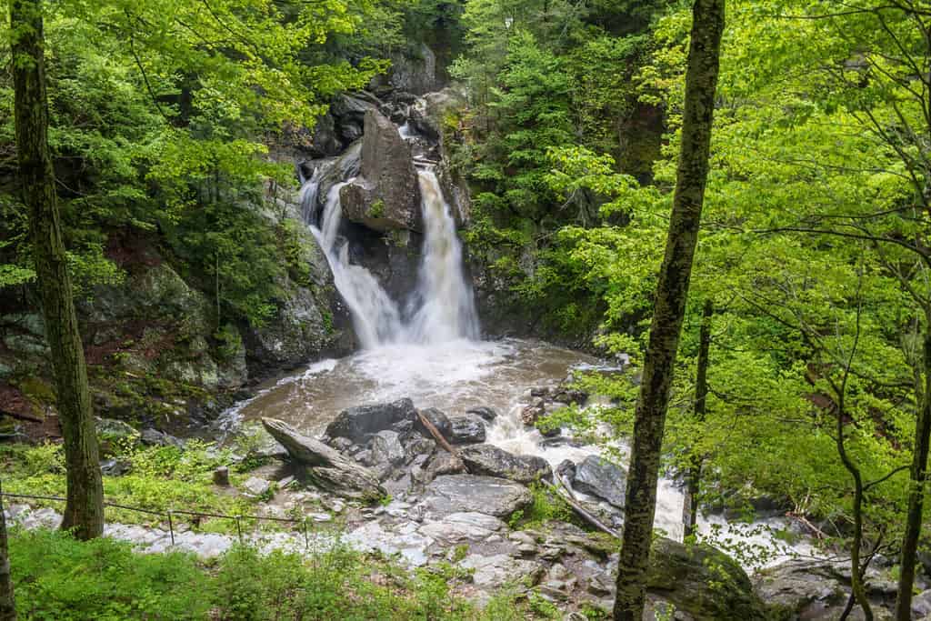
Bash Bish Falls tumbles about 60 feet through a rugged gorge in the southwestern corner of Massachusetts, near the New York line. A large boulder divides the upper flow before the water drops into a deep pool, giving the cascade its distinctive split appearance. Trails from Massachusetts and neighboring New York have historically offered different approaches, but closures and access restrictions can change because of safety concerns and trail conditions. Swimming and entering restricted areas are prohibited, and the steep, wet gorge has seen serious accidents. Visitors should consult both Massachusetts and New York park agencies before choosing a route rather than relying on old directions.