
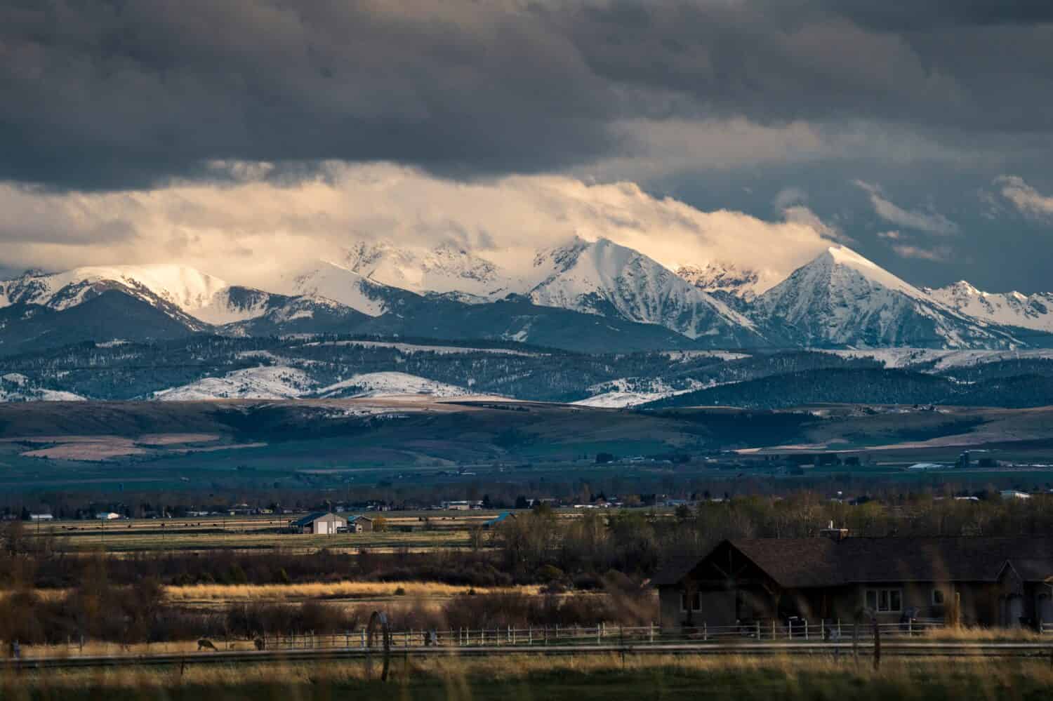
Forget the idea of a singular, unbroken path—Montana’s Continental Divide Trail (CDT) defies expectations with its intricate labyrinth of 800 miles within the state’s borders. Part of the larger 3,100-mile thru-hike, the CDT in Big Sky Country offers a bounty of experiences. These cater to historians, adventure seekers, and nature enthusiasts alike. From the remote northern Rocky Mountains to the icy grandeur of Glacier National Park, we explore the lesser-known aspects of the CDT in Montana.
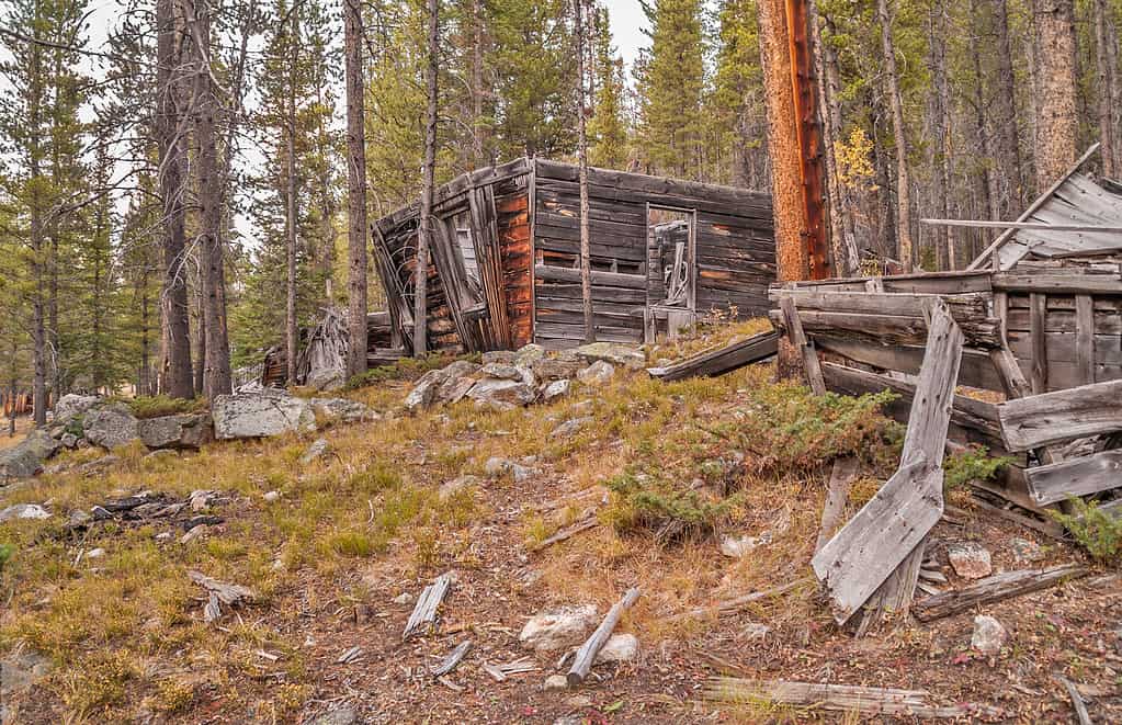
Built deep in the woods, mining ghost towns are never too far from the CDT in Montana.
©iStock.com/
1. Trail of Ghost of Towns Mining Past
The CDT in Montana is a journey through layers of history. As you walk between MacDonald Pass and Butte, you’ll traverse a landscape rich in Montana’s mining history. The area is punctuated by the ghostly remnants of the town of Rimini.
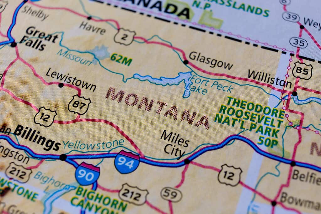
The CDT runs about 270 miles along the Montana Idaho border. The Divide itself played a vital role in setting state boundary lines.
©Leo_nik/Shutterstock.com
2. The Trail Where Montana Took Shape
The Divide itself played a pivotal role in the territorial politics of 1863. It was then that officials carved out the state of Montana out from the Idaho Territory.
©ChrisBoswell/iStock via Getty Images
3. On the Trail of Historical Footsteps
In the solitude of the CDT in Montana, you’re never far from American history. Consider that Captain Lewis of the Lewis and Clark Expedition followed a similar path in 1806. Native Americans had long known the route as “the river of the road to the buffalo.
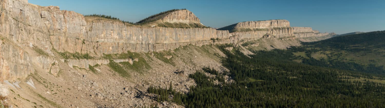
The Chinese Wall, a limestone escarpment, runs 22 miles across and rises to 1,000.
©Michelle Holihan/Shutterstock.com
4. Natural Landmark and Racial Politics Along the Trail
Most hikers will at least have heard of the so-called Chinese Wall in the Bob Marshall Wilderness Complex. The 22-mile-long limestone escarpment reaches heights of 1,000 feet. It’s a sight to behold. Hikers dubbed it the Chinese Wall due to reminding them of the Great Wall of China. But what most people don’t know is how this natural landmark became entangled in racial politics.
At the onset of the COVID-19 pandemic, a group of Montana citizens, led by a former member of the Montana House of representatives, petitioned to rename the escarpment due to “the Wuhan virus,” as the group’s leader put it. However, soon after the petition went live on Change.org, Montanans started a counterpetition. This quickly garnered more than double the name-change one in just a 24-hour period. While almost no one calls the coronavirus “the Wuhan virus” anymore, all outdoor enthusiasts still call Montana’s stunning limestone escarpment the Chinese Wall.
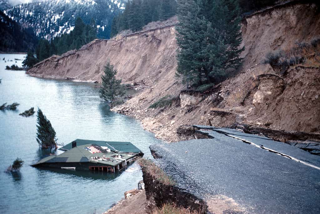
A 1959 earthquake caused the Hebgen Lake Basin to slump 22 feet, in addition to triggering mudslides that dammed the Madison River and flooded the area.
©I.J. Witkind., Public domain, via Wikimedia Commons – License
5. Earthquakes Along the CDT in Montana
As you traverse the CDT in Montana, the ground beneath your feet holds a volatile secret. Earthquakes are nature’s chilling reminders that our planet is ever-changing, sometimes violently and without warning. They occur when accumulated stress surpasses the frictional forces along a fault. At that point, a fracture allows rock blocks to glide past one another, triggering the sudden release of stored energy. This energy radiates as seismic waves, manifesting as the shaking we feel during an earthquake.
While hiking the CDT, you are traversing the Intermountain Seismic Belt, an 800-mile-long zone of frequent seismic activity. It stretches from northwest Montana through Yellowstone National Park and as far south as southwestern Utah. Interestingly, a branch of this seismic belt extends 300 miles westward to the Idaho-Oregon border. This belt is the outcome of the gradual stretching of the North American tectonic plate as it interacts with the Pacific plate.
But it’s not just abstract theory. On August 17, 1959, a magnitude 7.3 earthquake rattled Hebgen Lake. This occurred just 12 miles northeast from the US Highway 287 at MP 1—a marked point on the trail. This quake ruptured both the Hebgen Lake and the Red Canyon faults, causing parts of the Hebgen Lake basin to plummet by up to 22 feet. The seismic event set off a seiche, or a colossal wave, that oscillated across Hebgen Lake. Ultimately, it overtopped the dam and demolished shoreline cabins. It even triggered a landslide, a massive 37-million-cubic-yard flow in Madison Canyon. This dammed the Madison River to form Earthquake Lake, burying a portion of a campground and taking 26 lives.
One of the highlights of the Big Sky Variant is getting to trek the Tobacco Root Mountains.
©Cavan-Images/Shutterstock.com
6. Beyond the Horizon: CDT’s Scenic Detours and Variants
In Montana alone, the CDT branches off into over a dozen variants, scenic loops, and other worthwhile detours. If a conventional trail experience isn’t enough, Montana’s CDT offers intriguing offshoots. The Big Sky Variant, for instance, diverges from the main trail to showcase the Tobacco Root Mountains. It provides convenient resupply points in towns like Lincoln and Helena. For those visiting Glacier National Park, the Quartz Lake Loop promises breathtaking views and adds another gem to your Montana adventure.
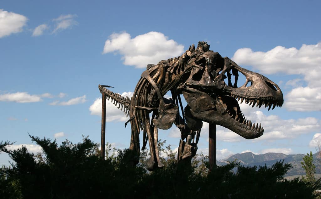
A long, long time ago, dinosaurs roamed what is now Montana, where a vast inland seaway flowed.
©Edgloris Marys/Shutterstock.com
7. Ancient Seaway and Subcontinent on the Trail
When hiking the CDT in Montana, you’re not just crossing a modern geographic boundary, you’re traversing the remnants of an ancient subcontinent. About 70 million years ago, the area just to the east thrived as an inland seaway. This inland sea stretched from the Gulf of Mexico all the way to the Arctic Ocean, splitting North America into two separate subcontinents. In this forgotten world, dinosaurs roamed the nearby lands, while alligators and turtles made their homes in streams and rivers. Even more awe-inspiring is the Deinosuchus, a behemoth 40-foot-long crocodile that once lurked in these ancient coastal waters.

While most long bike trails stretch for hundreds of miles, the Great Divide Mountain Bike Route says, Why stop at three digits?
©iStock.com/Nastco
8. Cycling the Great Divide Mountain Bike Route (GDMBR)
Wheels, dirt, and the open road—the Great Divide Mountain Bike Route (GDMBR) is a mountain biking pilgrimage that redefines adventure. Designed in 1997 by the Adventure Cycling Association, the GDMBR is a 2,700-mile challenge, weaving from Banff, Alberta in Canada to Antelope Wells, New Mexico at the US/Mexico border. The GDMBR has come to symbolize the birthplace of bikepacking as a sport. While the route primarily consists of high-quality dirt and gravel roads, making it accessible for riders with intermediate off-road skills, it’s the cumulative 200,000 feet of elevation gain and loss that truly tests one’s mettle.
The Tour Divide
In this solitude comes camaraderie, especially if you participate in the Tour Divide, an annual self-supported race that has made the GDMBR famous worldwide. The event shuns the commercial aspects of sport—no entry fees, sponsorships, or prizes. The race pushes every participant’s boundaries, with the clock ticking round-the-clock from the grand departure until the finish line.
In 2016, the late Mike Hall completed the Tour Divide in a record-setting 13 days, 22 hours, and 51 minutes. It wasn’t until this year’s Tour Divide did Hall’s record fall. Lachlan Morton completed the race in an astonishing 12 days, 12 hours, and 21 minutes (angel numbers, anyone?)! Morton’s average pace hovered at 20 percent faster than Hall’s.

Less exhausting than the GDMBR, but still demanding, is the Great Continental Divide Motorcycle Route.
©Sergey Nemirovsky/Shutterstock.com
9. CDT Motorcycle Expedition
For motorbike enthusiasts, the Great Continental Divide Motorcycle Route offers an equally stimulating experience, albeit with the growl of engines replacing the whirr of bicycle chains. Spanning 2,767 miles, the route is no less demanding and calls for an extensive skill set in off-highway riding and self-sufficiency.
While the route embraces the same natural wonders, it also presents its set of challenges. Travel is best planned between July and September to dodge weather hazards.
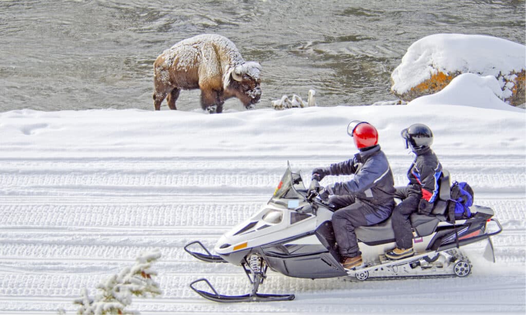
There are hidden wintry gems on and off the CDT in Montana, including not-so-hidden ones like Yellowstone National Park pictured here.
©Carolina K. Smith MD/Shutterstock.com
10. The 4×4 and Snowmobile Frontier
But wheels on the CDT in Montana aren’t limited to bikes and motorcycles. For those who prefer the comfort and power of four-wheelers, the trail accommodates 4×4 pickups and recreational vehicles. Families and groups find it particularly alluring for its picture-perfect views and the chances to spot elusive wildlife.
Need to shake off those wintertime blues? Well, snowmobile fans, here’s your hidden gem. The CDT in Montana morphs into a winter wonderland, offering an experience that is as serene as it is adventurous.
Conclusion
In the end, the Continental Divide Trail in Montana defies easy categorization. It’s brimming with human history, geological secrets that quaver underfoot or are fossilized in the rocks, and scenic trail forks aplenty. Beyond the standard thru-hike, an amazing bike race cuts through it. People straddle their hogs, rev up their trucks or snowmobiles, to venture into the wild. Under Montana’s big sky, there’s part of a big trail. And like that sky, it seems to go on forever, if you really want it to.
The photo featured at the top of this post is © Danita Delimont/Shutterstock.com


How to Add Us to Google News


Thank you for reading! Have some feedback for us? Contact the AZ Animals editorial team.