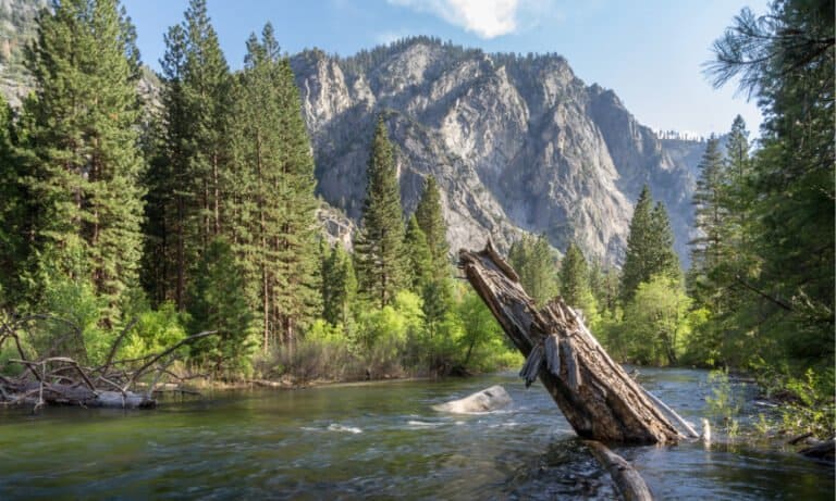

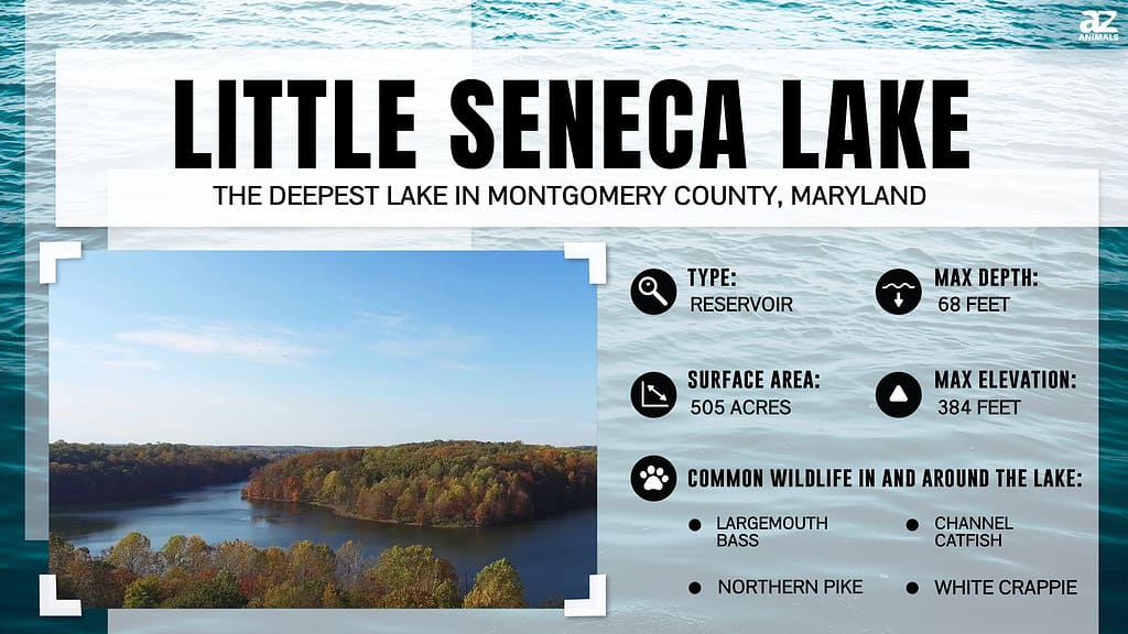
Little Seneca Lake is easily the deepest lake (68 feet) in Montgomery County, Maryland. Like all lakes in Maryland, Little Seneca Lake is a manufactured lake. The lake itself is the result of a nearby dam that was constructed in Black Hill Regional Park in 1984.
Looking at it today, you would never know the lake didn’t exist until well into the 20th century. Families picnic on the shoreline, while little kids swims and anglers hit the water with their kayaks, bass boats, and fish finders.
As with most reservoirs, Little Seneca Lake is fed by another water source. In this case, there are two water sources—Ten Mile Creek and Cabin Branch—that feed into Little Seneca Creek and, eventually, into Little Seneca Lake.

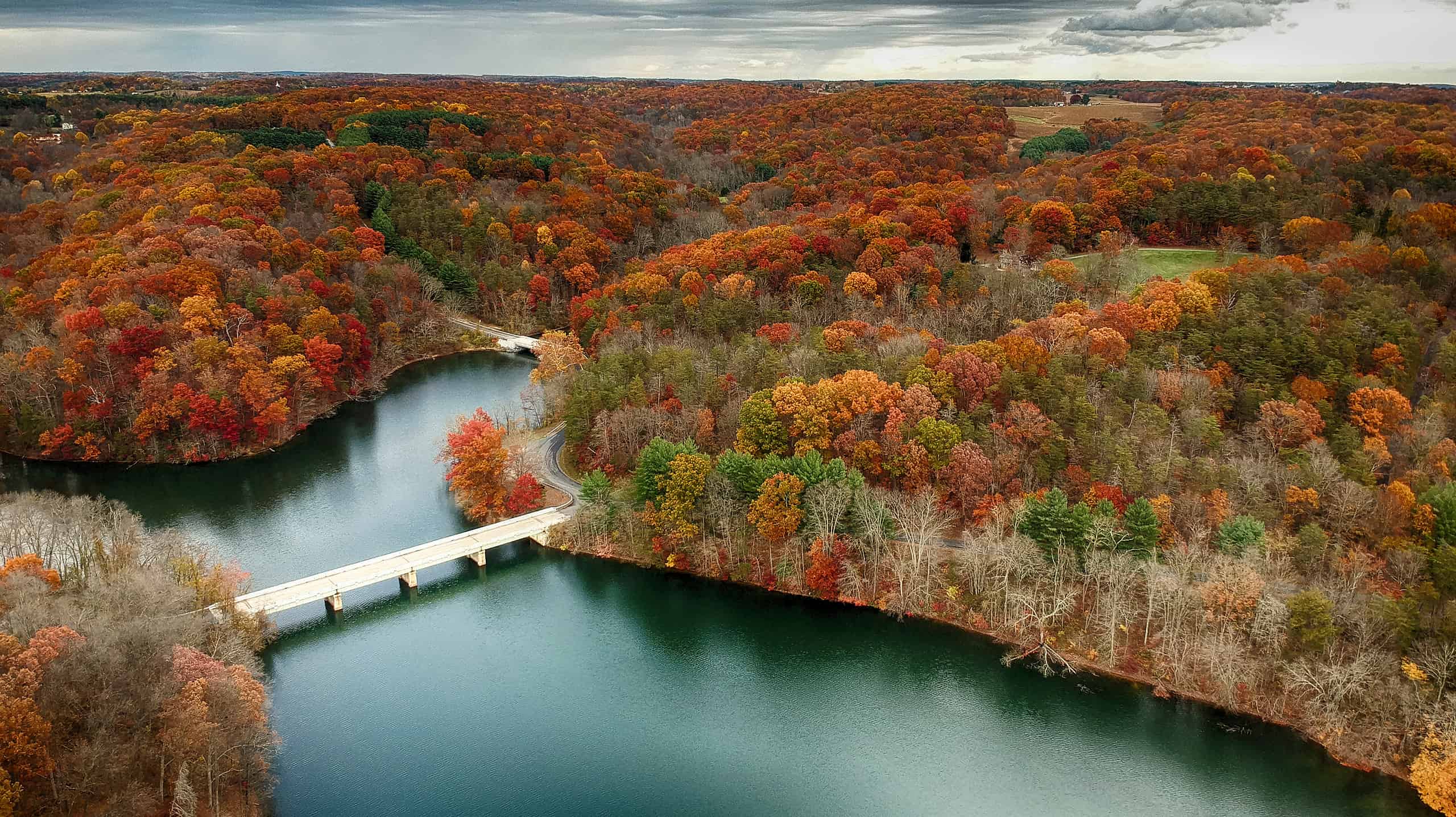
This aerial photograph of Little Seneca Lake shows the Clarksburg Road bridge, which carries Maryland Route 121 across the lake.
©Nicole Glass Photography/Shutterstock.com
How Did Little Seneca Become the Deepest Lake in Montgomery County?
Little Seneca Lake has a history stretching back to the 1960s when the Maryland National Capital Park and Planning Commission (M-NCPPC) purchased the land on which the lake now rests. The purpose of the land purchase was twofold—preservation and management.
M-NCPPC then teamed up with another organization, the Soil Conservation Service (SCS), to begin the planning phase that would result in developing the deepest lake in Montgomery County. Throughout the planning phase for the area, M-NCPPC and SCS discovered that there were three species of threatened animals in the area, especially where the aforementioned creeks converge.
Today, Little Seneca Lake is the result of those efforts. What was once nothing more than a small watershed is now a full-fledged lake, teeming with life. The dam, constructed upstream, serves as the area’s water temperature regulator, while the lake is a recreational area and secondary water supply.
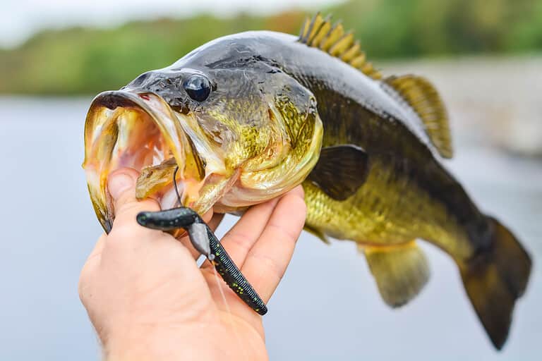
This lake is also a popular place for fishing, and it’s full of largemouth and smallmouth bass, channel catfish, white crappie, walleye, bluegill, muskie, and northern pike. In addition, the lake is surrounded by over 2,000 acres of woodland, which is home to a large diversity of plants and animal wildlife.
The Deepest Part of Little Seneca Lake
Most of Little Seneca Lake is fairly shallow, with the deepest portion reaching 68 feet. Therefore, fishing maps are the primary sources for depth analysis and the underwater topography of the lake. Most of the lake sits in the Black Hills Regional Park and contains 4 billion gallons of water.
It’s not the primary drinking water source for the local community, however. Little Lake Seneca is reserve water, only useful if something happens to the current water supply within the area. The lake extends over 505 acres of real estate and is roughly the shape of the letter “W.”
While it’s the deepest lake in Montgomery County, Little Seneca Lake is otherwise unremarkable. The nearby dam features a water regulation design, and it releases cold water when necessary during the summer months, dropping the overall temperature of the lake.
On nautical charts, Clarksburg Road bisects the lake, which branches off to the northwest and southeast via Barnesville Road and Clopper Road, respectively. Most nautical charts include a series of contours throughout the entire lake, representing the depths from the shallow sections near the shoreline to the deeper waters at the center of the lake.
In most places, the lake is between 40 and 50 feet deep. The deepest sections, where it reaches 60 feet or more in depth, are located in the south-central portion, near where Ten Mile Creek empties into the reservoir.

Little Seneca Lake extends over 505 acres of real estate and is the same shape as the letter “W.”
©Graves Creative Design/Shutterstock.com
Effects of Sediment Disposition
Little Lake Seneca may not always be 68 feet deep. Since there are ongoing efforts to remove or relocate sediment in the forebays, overall depths are subject to change. The forebays are the areas in the top section of the “W,” where sediment settles, keeping too much from flowing into the lake.
Now and then, maintenance crews dredge the forebays to maintain the sediment disposition and keep it from dispersing throughout the lake. If you look at the lake in the “W” shape, the forebays are located at the three top points of the “W”—left, center, and right.
To remove sediment, maintenance crews reduce the water level of the lake by 15 feet, using the dam to close up inflow from Ten Mile Creek and Cabin Branch. The drawdown exposes the accumulation of sediment and allows for removal.
They don’t waste a single pound of sediment, either. Instead, once it’s completely dry, they remove the sediment and recycle it for the farming industry or package it to sell as an excellent topsoil option for local gardeners and landscaping businesses.
Every design and construction layout, whether it’s for water management or sediment removal, is set up years beforehand. For instance, the current planning stage for sediment removal and water drawback plans won’t begin physical implementation until 2028.
Other Deep Lakes in the State of Maryland
Little Seneca Lake may be the deepest lake in Montgomery County, but it’s not the deepest lake in the state. Quarry Lake, in Baltimore County, is the deepest lake in Maryland. Like Little Seneca Lake and all of the lakes in the state of Maryland are entirely artificial.
Quarry Lake only covers about 40 acres of real estate, and unlike Little Seneca Lake, it is not a recreational lake for swimming or boating. Deep Creek Lake is another deep lake in Maryland, slightly behind Little Seneca Lake and Quarry Lake. Deep Creek Lake is also the state’s largest inland body of water.
As another artificial lake, Deep Creek Lake exists for hydroelectric power, thanks to the Deep Creek Dam located eight miles north of the lake.
Where Is Little Seneca Lake Located on a Map?
Located in the most populous county, Montgomery, in the state, Little Seneca Lake lies in the Black Hills Regional Park, or at least most of it does. The lake’s construction is a result of a nearby dam and is fed by two water sources—Ten Mile Creek and Cabin Branch.