

The Flat of the Land, Determining a Winner Isn’t Easy but Pound-for-Pound These are the Flattest States
States have been arguing over who’s the flattest for a long time. There are different ways to measure it, but which are really the flattest states in America? The key metric here is the amount of flat, generally inhabitable land in a given U.S. state. The flattest ten states by this measure are—starting at the flattest—Florida, Louisiana, Illinois, South Carolina, Minnesota, Delaware, North Dakota, Texas, Kansas, and Arkansas.
If a square mile of land has one sheer cliff in the corner that ascends 1,000 feet, is that steeper than a square mile of land that’s at a 45-degree angle?
With the gargantuan expanses of tundra, Alaska likely has the largest square mileage of flat land. Yet, as Smithsonian Magazine points out, it has a 20,237-foot high peak, Mt. Denali! Similarly, how does one effectively rank Hawaii, an island literally in the middle of the sea. Its entire border is sea level!
Which Ones Look Like the Flattest States in America?
Perhaps the most authoritative ranking comes from Jerry Dobson, President Emeritus of The American Geographical Society, and Joshua Campbell. They published a ranking in 2014 that considered 16 different dimensions of measurement. They went further and dissected the continental U.S. into 30-meter sections, ranking each one as “flat,” “flatter,” and “flattest.”
The study was published in Geographical Review magazine in 2014 and gave several data tables and measurements. These are the ten states with the most square footage of the flattest possible land divided by their overall area. These are the ten flattest states in America.
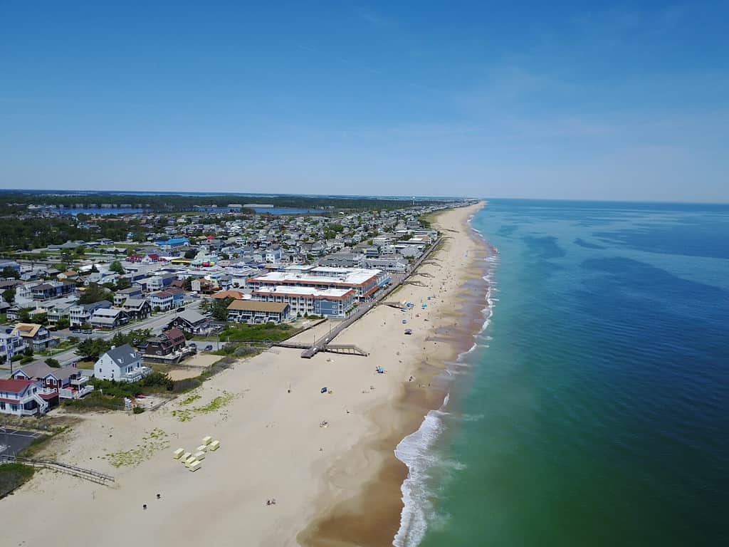
1. FLattest State Number One: Florida
With a state that looks so big, one would think there’d be some hills in there somewhere. There are a few in the northern part. But glancing at a topographical map of the U.S., the whole Gulf Coast and much of the Eastern Seaboard is very friendly with sea level. It is the leader in having the highest ratio of the flattest land.
But, of course, it’s not just sea level. This innovative measure took into account various terrains. Even with that, Florida came up short (but most residents don’t appear to dislike the closeness to the beach).
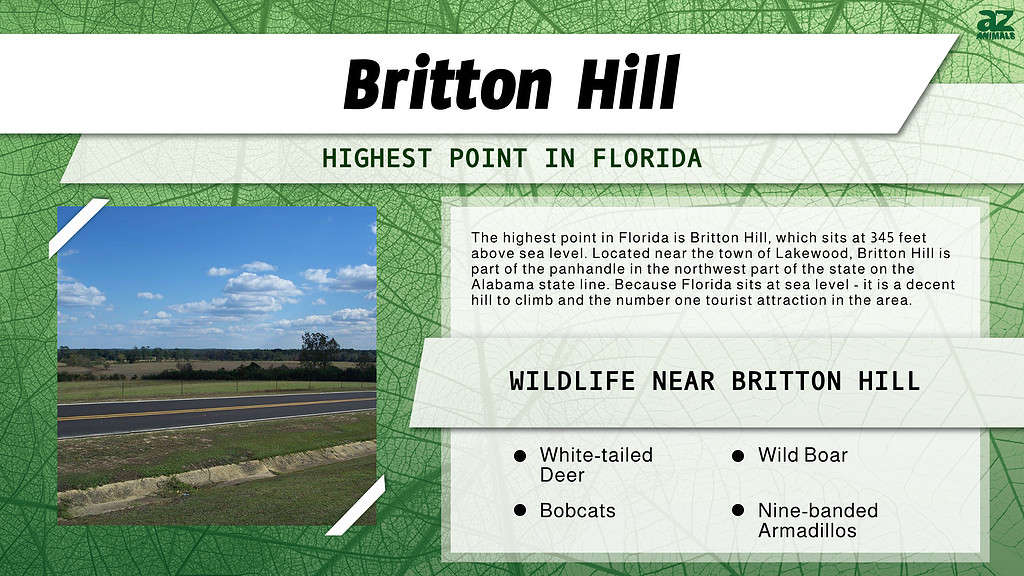
Lakewood Park in Walton County holds Britton Hill. Florida’s Britton Hill is the highest point in the 22nd largest state of the U.S. This flat-top hill summits at 345 feet.
The wetland regions that encompass much of the state account for a lot of its flatness. Also contributing to the flatness is the galaxy of shoals at the southern tip. Many teeny Florida keys may only rise a few feet above sea level and plateau right there.
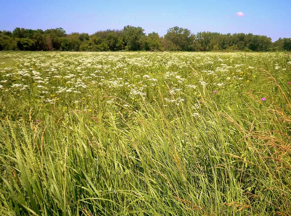
2. Louisiana

Louisiana is second for having the highest ratio of the flattest land.
©Felix Mizioznikov/Shutterstock.com
There are three main regions of Louisiana, and they are all plains. This indicates the flatness of the state and puts it second for having the highest ratio of the flattest land.
Like Florida, the state sits along the Gulf Coast. And, like Florida, it has many small islands around the edge. Louisiana’s are scattered around the toe-end of its boot-shaped territory.
The swamps, the wetlands, and the Mississippi Delta keep this state’s average/mean elevation at 100 feet. Driskill Mountain sits at 535 feet and is the highest point in the Bayou State.
3. Illinois
Moving out of the Gulf Coast, there are two very flat Great Lakes states, and Illinois is one of them. If buildings counted, Illinois would not be so flat. There are six skyscrapers jutting over 1,000 feet above the ground there! But since they don’t, Illinois is in third place for having the most significant share of the flattest land.
The Great Lakes and far north of the continental U.S. have interesting topography. Glaciers carved up a lot of this region in the past, leaving lakes but also flattening or rounding off a lot of terrain. Most notably, Illinois was contoured by the Illinoisian glacier. What a coincidence!
The highest point in Illinois is Charles Mound (yes, “mound”), which sits right near the Wisconsin border. It’s almost an even quarter-mile high at 1,235 feet. The mean elevation of Illinois is 600 feet.
4. South Carolina
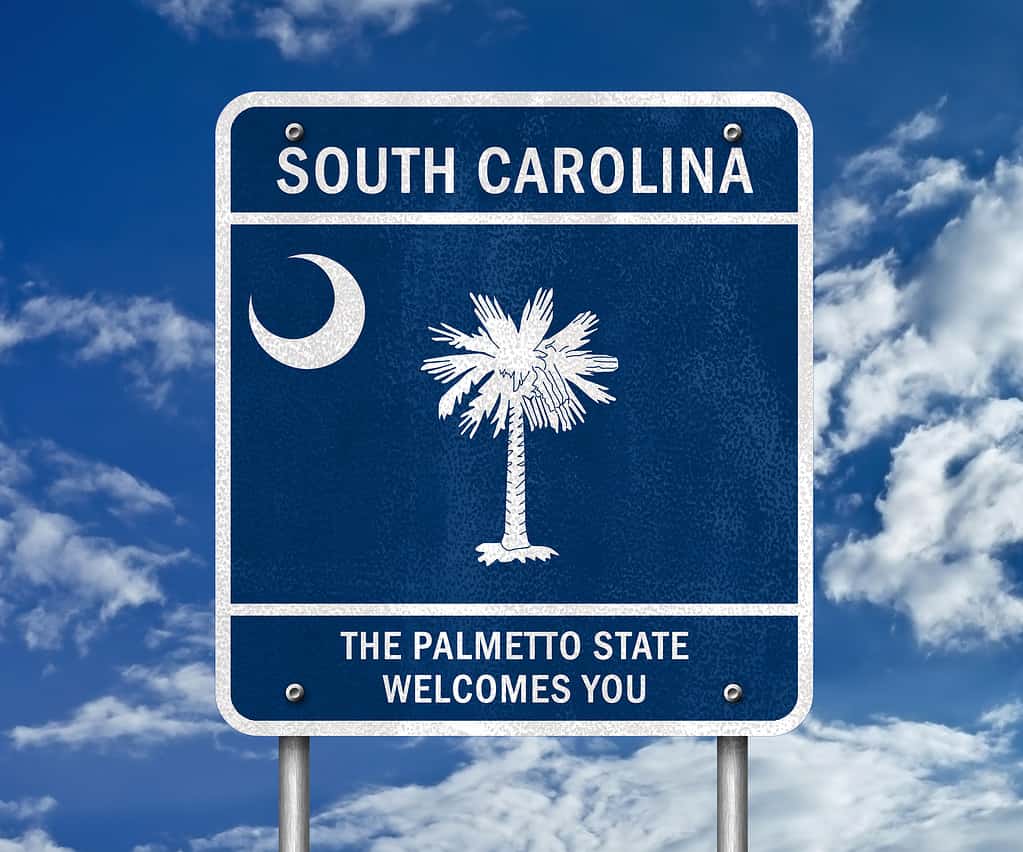
South Carolina, the Palmetto State is the fourth flattest state in America.
©gguy/Shutterstock.com
Like three other Southern states, South Carolina has a lot of beaches, which are ALL at sea level! It has over 100 miles of oceanic coast. But it’s still among the flattest states in the continental U.S. The Palmetto State has the fourth-most percentage of the flattest land. Its average elevation is 316 feet.
Its three main geographic hunks are one plateau, one plain, and a ridge—the Blue Ridge. There are some bigger, steeper hills in the northwest, but it’s more flat than not.
The highest spot is Sassafras Mountain, which apparently just installed a nice elevated observation deck. Their tourism board notes a visitor can see 50 or 60 miles from there on a clear day. Sassafras Mountain rises to 3,553 feet.
5. Minnesota
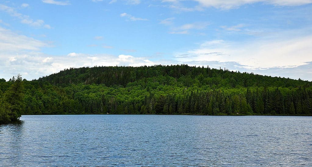
The highest point in Minnesota is Eagle Mountain.
Going back up to the Great Lakes is Minnesota. It’s easy to associate mountains with snow. We think of skiing, sledding, Everest, etc. Yet, despite being quite cold and—depending on location—snowy, Minnesota is quite flat. It has proportionally the fifth most of the flattest of land.
Minnesota was also sculpted mostly by glaciers (and residents might quip, “It feels like they’re still here!”). Its average elevation is actually 1,198 feet, which no doubt is part of its overall colder weather.
The lowest point in the state is actually the bottom of Lake Superior. However, that’s still 602 feet above sea level. The highest point is Eagle Mountain (not to be confused with California’s Eagle Mountain) at 2,301 feet.
6. Delaware – Lowest of the Flattest States in America
Delaware has the sixth-most amount of flat territory.
©Zach Chilelli/Shutterstock.com
Another coastal state, Delaware, shares an isthmus with Maryland along the Eastern Seaboard. Here, again, there are many small islands swimming right off the coast. Delaware has the sixth-most amount of territory in the flattest ranking.
Ranking the flattest states includes using algorithms, countless calculations, considering numerous land features, and much more number-crunching. Yet, in one ranking, Delaware is at the bottom: it has the lowest average mean elevation at about 60 feet.
The highest point is, officially, Ebright Road at 447.58 feet, according to the Delaware Geologic Society. But they have an asterisk. There is a dispute involving surveying that says Centreville is the highest in the state, and it’s a matter of less than two feet.
7. North Dakota
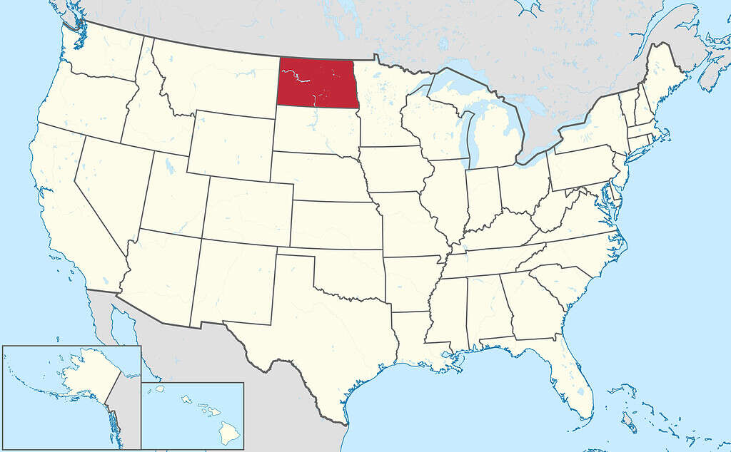
North Dakota is flat, but it sits higher than most flat states. It is the farthest inland of the flattest states.
This one makes sense. North Dakota, one would think, is near the top, right? It has proportionally the seventh-most amount of the flattest type of land.
Like most of its western neighbors, there are a lot of buttes which give some texture to the overall calm prairie landscape. White Butte, at 3,506 feet, is the highest point. While the Peace Garden State is overall quite flat, it’s on an elevated platform, perhaps. The average elevation is 1,902 feet (580 meters).
8. Texas
Alright, alright, alright. Texas has the eighth-most ratio of the flattest type of land. If it weren’t so genuinely enormous, that might be different. It has some high highs and some low lows. A good fifth of the state runs along the Gulf of Mexico. Still, at its northernmost point, it’s only separated from mountainous Colorado by a few dozen miles of Oklahoma panhandle.
Its average elevation is 1,700 feet. Guadalupe Mountains National Park holds Guadalupe Peak, the highest point in Texas. It stands at 8,749 feet in the western part of the Lone Star State, right beneath New Mexico.
9. Kansas
Kansas has the ninth-highest ratio of the flattest type of land.
©Jacob Boomsma/Shutterstock.com
Sitting next to the Rocky Mountain state, it’s normal to think Kansas wouldn’t be so flat. Yet, looking at a Kansas county map, the state looks relatively flat inasmuch as nearly every boundary is a straight line. This state has the ninth-highest ratio of the flattest type of land.
As such, there appears to be little mountainous terrain or few rivers to obstruct the surveyors.
In the far west of the state, Mount Sunflower ascends over 4,000 feet in a sort of farewell to the prairie lands of the Great Plains. This small hillock in the Sunflower State is higher than the highest point in the entire nation of England! Mount Sunflower is apparently a nice, gradual hike.
10. Arkansas
Arkansas’ landscape is flat, but it also contains diamonds!
The Ozarks is a catch-all term for the sub-region of the U.S. straddling the Great Plains and the South. Various sources say it’s both a mountain range and a plateau, somehow. Despite this, Arkansas has the tenth-most percentage of the flattest type of land. It also has the Ouachita Mountains.
The mean elevation of Arkansas is 650 feet. Whatever topographic, tectonic, and geologic processes created this state’s landscape, the state somehow has been able to produce diamonds!
Flat Out the Flattest States in America
If we take the overall contour of a state and determine how much of it is flat, we have a better measurement. Anyone looking for a good hike that isn’t a hike might be inclined to check out these ten states.


How to Add Us to Google News


Thank you for reading! Have some feedback for us? Contact the AZ Animals editorial team.