
A population of just over 11.75 million people secures Ohio’s position of being the seventh most populous state in the U.S. Its proximity to Lake Erie and the Ohio River, as well as the network of 21 interstate highways, make Ohio popular with freight networks. Half of the nation’s states are within a day’s drive of Ohio.
Ohio shares a border with Pennsylvania, West Virginia, Kentucky, Indiana, and Michigan. Pennsylvania and West Virginia are on the eastern and southeastern borders. Kentucky is on the southern border. Indiana is to the west, and Michigan and Lake Erie form the northern border.
Pennsylvania
Pittsburgh,
Pennsylvania
, is approximately half an hour from the state lines and is where the Ohio River starts flowing.
After the end of the Revolutionary War, new land allotments changed the borders as people moved West. The Mason-Dixon Line served as a line between the slave states and free states. However, there was also the Ellicott Line, which was an extension of the Mason-Dixon Line. The Ellicott Line extended north from the end of the Mason-Dixon Line, passing through the top of West Virginia and continuing to Lake Erie. This line forms the border of Western Pennsylvania and Ohio.
The Pennsylvania-Ohio border measures about 92.5 miles. Dixonville, OH, is at the southern end of the state line, while Conneaut is the northernmost town. On the Pennsylvania side, State Game Lands 314 is in the north, and Glasgow is in the southwestern corner.
Pennsylvania’s population is just under 13 million. One of the largest cities, Pittsburgh, sits about 30 minutes from the Ohio border. It’s the first major Pennsylvania city you encounter after leaving Ohio, however, there are several other towns for over-the-border shopping and one shared lake.
Pymatuning Reservoir Crosses State Lines
Pymatuning Reservoir is a man-made lake crossing the Ohio-Pennsylvania line, and the towns of Andover, OH, and Espyville, PA, connect via a causeway bridge. Both Ohio and Pennsylvania have a Pymatuning State Park and access to the lake for boats, camping, fishing, and swimming. Anglers find an abundance of carp in the lake.
West Virginia
Parkersburg is a center point along the border of West Virginia and Ohio.
©iStock.com/Hunter Freeland
The distance of the West Virginia-Ohio border is approximately 240 miles and the longest border in Ohio. The Ohio River forms a natural border that requires bridges to get from one state to the other.
West Virginia’s population is over 1.77 million. The state’s second most populous city, Huntington, is the southernmost point on the border. Take the West Huntington Bridge across the Ohio River to South Point. Lawrenceville and Chester are on the West Virginia side in the northern part of the state, and the Jennings Randolph Bridge brings you into East Liverpool, OH.
Explore History at the Blennerhassett Island Historical State Park
With the Ohio River flowing along the entire West Virginia border, there’s a lot to see and do along the state line. Parkersburg is a halfway point and very close to Blennerhassett Island Historical State Park.
Harman and Margaret Blennerhassett fled Ireland to avoid political persecution and scandal in their homeland. They spent 16 years in their mansion, but scandal hit again when they let Aaron Burr use their mansion as his military headquarters,
Visitors take a riverboat from 2nd Street in Parkersburg to reach the island. Once on the island, there are gift shops and a museum tied to the 1802 Putnam-Houser House that was restored after a fire. Plus, horsedrawn carriage rides provide stunning island views.
Kentucky
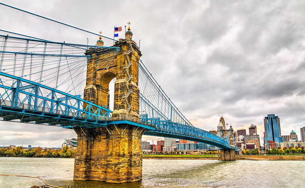
The Ohio River separates Covington, KY, and Cincinnati, OH, with the John A. Roebling Suspension Bridge providing the crossing that connects the cities.
©Leonid Andronov/iStock via Getty Images
At about 159.2 miles, the Kentucky-Ohio border covers much of the southern Ohio state line. Like West Virginia, Kentucky’s border closely follows the Ohio River. Catlettsburg, KY, is on the southeastern line, and the border heads west reaching Idlewild, the town farthest to the east. Head across the river to Ohio, and the Shawnee Lookout Conservation Easements form the southwestern corner of the state, while South Point is in the southeast.
Over 4.51 million people call Kentucky home. Several large agricultural industries shape the state’s economy, including horse racing, goat farming, and beef cattle.
Proximity to Ohio Establishes Several Ohio Valley Destination
Covington, KY, is right across the river from Cincinnati, OH, and nearby Hebron is home to the Cincinnati-Northern Kentucky International Airport. After crossing the John A. Roebling Suspension Bridge, head west to the airport. Devou Park is on the route and houses the Behringer-Crawford Museum, a museum that celebrates the culture, arts, and heritage of the Ohio Valley.
Indiana

Fort Wayne, Indiana, sits about 20 minutes from the Ohio border. Image: Nicholas J Klein, Shutterstock
©Nicholas J Klein/Shutterstock.com
The Indiana-Ohio border spans just over 159 miles and forms the western side of Ohio. Lawrenceburg, IN, is the southernmost point, and York is the northernmost unincorporated community. On the Ohio side, Billingstown is farthest to the north, while the Shawnee Lookout is in the south.
With a population of around 6.8 million, Indiana is the 17th most populous state. Indianapolis is both the capital city and most populous, but Fort Wayne is second. It’s the closest major city to the Ohio border.
Celebrate America’s Pioneers in Johnny Appleseed Park
Fort Wayne is home to Johnny Appleseed Park, a park dedicated to the real-life Johnny Appleseed. John Chapman was a horticulturist and missionary who collected apple seeds from cideries and shared his knowledge as he traveled the country while selling or giving away the seeds and saplings. He ended up in Fort Wayne where he owned a 1,200-acre orchard. The park contains his burial site.
Each September, the park hosts the two-day Johnny Appleseed Festival. It’s a tribute to John Chapman’s life and the contributions he and other settlers made to the area. Living history encampments, a pioneer village, music, and food and goods from more than 200 vendors provide much to see and do.
Michigan
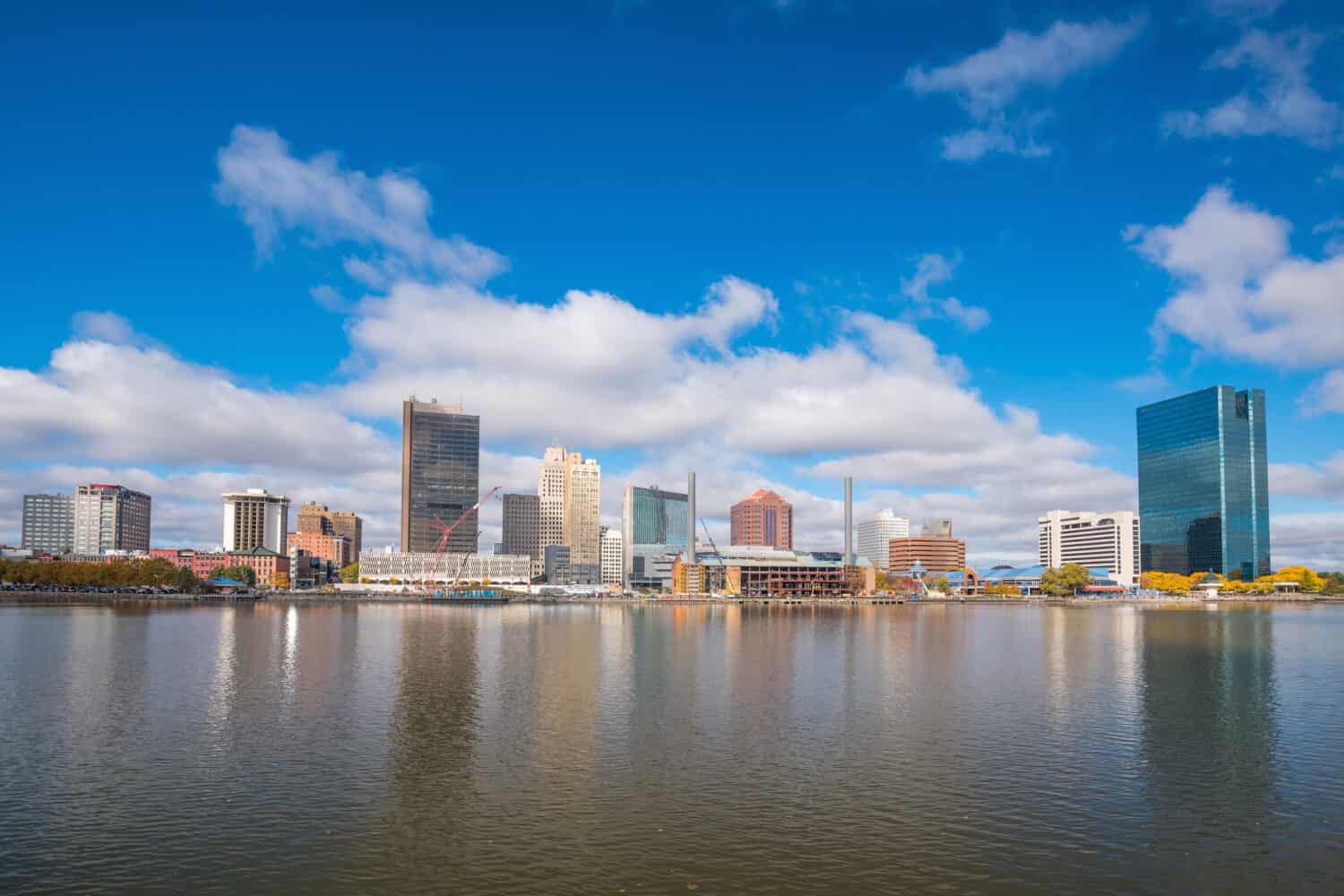
Toledo, Ohio, abuts the Ohio-Michigan border. Image: f11photo, Shutterstock
©f11photo/Shutterstock.com
Michigan’s population of over 10 million makes it the 10th most populous state. The Michigan-Ohio border spans almost 71 miles before ending at Lake Erie. Toledo, OH, is in the northeastern corner, and the Maumee River separates that city. Cross into Lambertville, MI, or take the I-75 up to Monroe, the next largest city.
Lambertville is a Census-designated place with a population of 10,433 and a couple of smaller attractions like a zoo and golf course. Monroe is larger and played a vital role in the War of 1812. River Raisin National Battlefield Park honors that darker part of the city’s history.
Get to the Lost Peninsula Through Ohio
Toledo’s Point Place neighborhood is the only way to reach Michigan’s Lost Peninsula, a portion that became “lost” during the 1835 Toledo War, which resulted in changes to the state lines. Part of Point Place extends past the Michigan border into smaller residential neighborhoods. It is home to the Lost Peninsula Marina, where dock rentals provide the ideal launch area for excursions on Lake Erie.
The Five States That Border Ohio
| State | Border Size (Approximate Miles) | Population (2022 U.S. Census Estimates) |
| Pennsylvania | 92.5 | 12,972,008 |
| West Virginia | 240 | 1,775,156 |
| Kentucky | 159.2 | 4,512,310 |
| Indiana | 178.3 | 6,833,037 |
| Michigan | 70.85 | 10,034,113 |
The photo featured at the top of this post is © iStock.com/gustavofrazao


How to Add Us to Google News


Thank you for reading! Have some feedback for us? Contact the AZ Animals editorial team.