
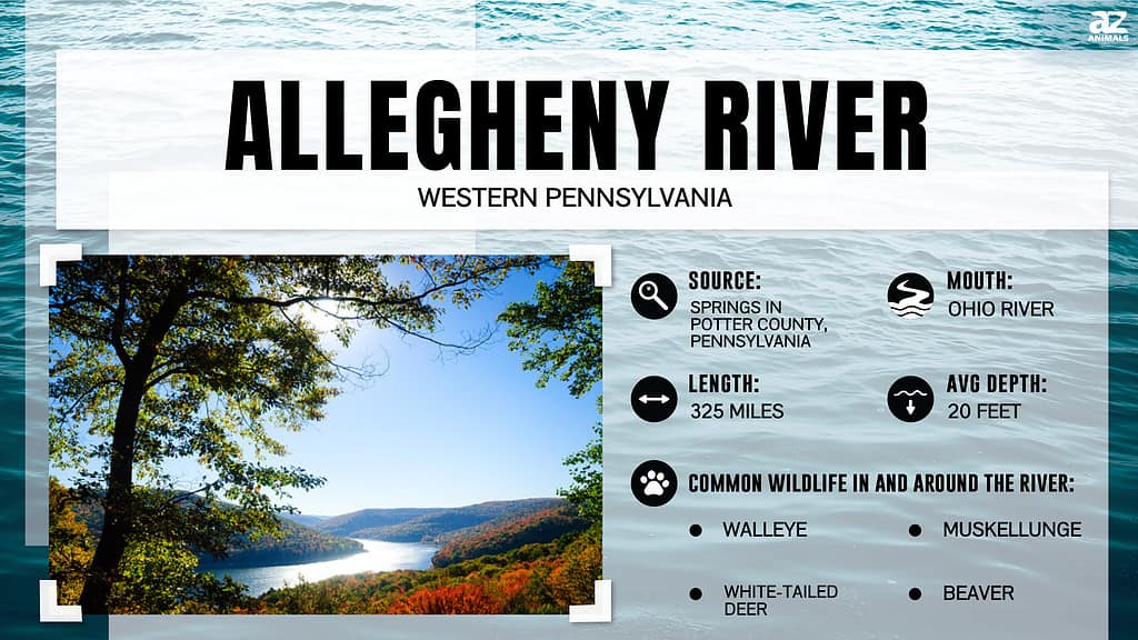
The Allegheny River plays an integral role in the identity of Pittsburgh. Originating from a spring in Potter County, the river winds through Western Pennsylvania before joining the Monongahela River in Downtown Pittsburgh to form the Ohio River. As the Allegheny flows past Pittsburgh’s shores, it provides water recreation, supports aquatic ecosystems, and shapes the city’s landscape. While the river flows visibly through the city, this question lingers: How deep is the Allegheny River?
Measuring the Variable Depths: How Deep Is the Allegheny River?
The Allegheny is naturally dynamic, so its depth fluctuates across seasons and years. The depths also vary significantly based on location along the river’s path. However, there are some typical depth ranges:
The river channel is approximately 16 and 17 feet deep in downtown Pittsburgh near the Point. Over the years, this river portion has been extensively engineered to accommodate commercial river traffic. Farther northeast, near Harmarville, depth measurements ranged from 6 to 15 feet. As the river approaches the New Kensington outskirts, it is shallow enough in parts for wading at only 1-3 feet.
What Controls the River’s Depth?
Several key factors account for the variation in the Allegheny River’s depth through Pittsburgh:
The contours of the riverbed undermine the water’s surface. Bedrock shelves along the edges keep the river relatively shallow against the banks while the main channel dips downwards to enable deep navigation. The geology that has carved out the river basin ultimately controls depth capacity.
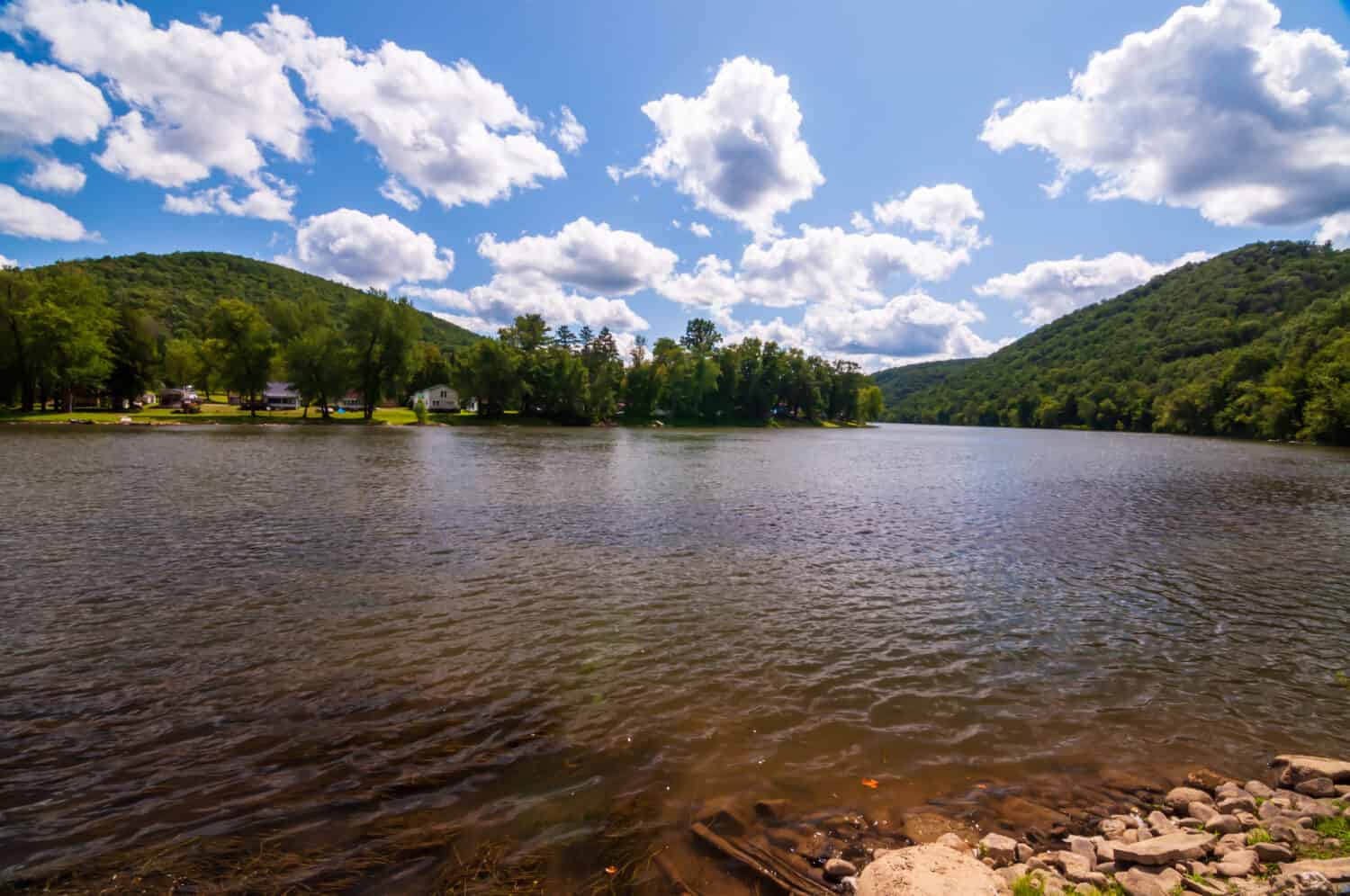
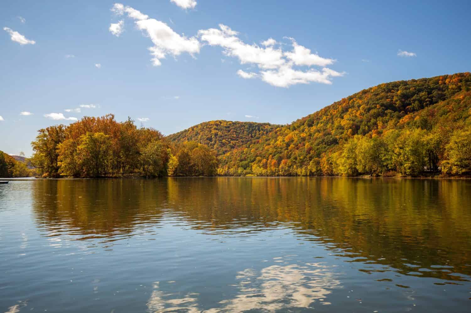
Alleghany River fluctuates throughout seasons and years.
©c.thomas87/Shutterstock.com
Sediment continually settles down from the water column onto the river bottom. Over time, sediment deposits can gradually fill the channel and reduce depth if not flushed out by strong currents or dredging. Flooding events also sometimes radically reshape the riverbed’s form through intense scouring.
Spring snowmelt significantly raises the Allegheny’s discharge. More water volume coupled with a faster current scours sediment from the channel. Winter and summer flows tend to be lower, allowing more deposition on the bottom.
To improve boat navigability, engineers have reshaped segments of the riverbed, often making it deeper. Dredging, dam operations, and wing wall/jetty construction modify natural depth. Ongoing management is required to maintain target conditions.
Attractions Along the Scenic Riverfront
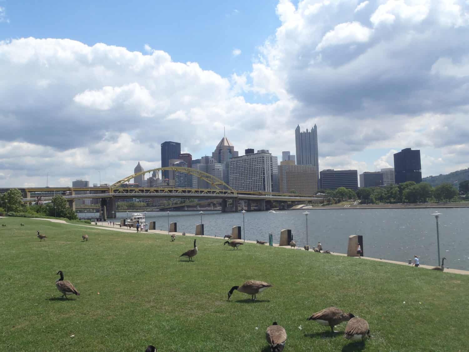
The Three Rivers Heritage Trail stretches along the Alleghany’s shoreline.
©Pascal Vosicki/Shutterstock.com
Pittsburgh’s riverfront parks and trails allow you to soak in natural beauty while appreciating the Allegheny River’s legacy. Scenic outlooks and recreation abound along its banks.
The Three Rivers Heritage Trail stretches for miles along the Allegheny’s shoreline. This paved multi-use trail invites walkers, joggers, bikers, and skaters to exercise with river views. Interpretive signs explain Allegheny’s history and ecosystem. And the trail connects to others for extended adventures.
At Point State Park, the Allegheny meets the Monongahela to form the mighty Ohio River. This iconic green space preserves the historic site of Fort Pitt. Outdoor concerts and festivals at Point State Park let you celebrate Pittsburgh’s rivers. Dip your toes in the converging waters.
The North Shore’s Allegheny Riverfront Park borders the river with walking paths, boat ramps, and open lawns. On warm weekends, watch boats cruise by as you picnic. Cheer on rowing regattas. And sway along to free live music shows.
For an up-close Allegheny experience, rent a kayak or stand-up paddleboard. Paddling downstream, you’ll slice through the flowing water while surrounded by nature in the city. Ducks may even swim beside you. And you’ll gain a sense of the river’s personality and strengths.
The Allegheny Riverfront provides many opportunities to connect with Pittsburgh’s living history. Walk, bike, pond, splash, or paddle along its banks for scenic recreation and reflection.
Scenic Drives and Road Trips Along the Allegheny
The Allegheny River offers excellent opportunities for scenic drives and road trips along its shoreline. Here are some top trips for taking in views of the river:
The Allegheny River Boulevard runs about 20 miles from Fox Chapel to Freeport along the river’s east bank. This winding road passes through forested areas and offers stunning river vistas from multiple overlooks.
Route 28 is a National Scenic Byway that hugs Allegheny’s east shoreline south of Pittsburgh. The river frequently appears as you drive past small towns like New Kensington and Springdale.
North of Pittsburgh, you can take Route 8 and then Route 528 along Allegheny’s west bank towards Foxburg. Stop at scenic pull-offs or launch a kayak into the river.
Route 322 takes you on a 79-mile loop from Franklin to Oil City on both shores of the Allegheny. Floating down the river’s entire length lets you fully appreciate this historic waterway’s glory as it winds northward.
You can plan overnight stays along your road trip route. Various river towns offer cabins, camping, and hotels steeped in Allegheny history and culture. Don’t forget your camera to entirely capture the river’s majestic beauty from the road.
The Allegheny River was a vital transportation highway in the 1700s and 1800s.
©Piper VanOrd/Shutterstock.com
The Allegheny’s History and Ecological Role
The Allegheny River’s story intertwines Pittsburgh’s centuries-long founding and expansion. The Allegheny River has played vital roles, from powering growth as a trade route and industrial engine to enhancing recreation and living.
In the 1700s and 1800s, the Allegheny served as a vital transportation highway into western Pennsylvania and beyond for early explorers. Rivers allowed travel into remote territories at a time when roads did not yet stretch far. The Allegheny partially fueled Pittsburgh’s rise as the “Gateway to the West.”
Later, the Allegheny River enabled mass timber movement from Pennsylvania’s old-growth forests in the mid-1800s. Using clever log rafting methods, loggers transported millions of board feet of logs downriver to Pittsburgh sawmills. The Allegheny fed the excellent logging boom that denuded Pennsylvania’s ancient woodlands in just decades.
Industries sprouted along Allegheny’s banks as Pittsburgh grew into a manufacturing powerhouse. Coal mining, steel mills, foundries, and more utilized the river for shipping raw materials and finished products. The Allegheny carried what Pittsburgh produced worldwide. Pittsburgh’s steel likely formed the backbone of many iconic 20th-century structures.
While Pittsburgh’s economy has evolved, the Allegheny River keeps contributing value. Recreational amenities like trails allow residents to connect with nature in the city. The river cools and beautifies Pittsburgh’s landscape and enhances the quality of life. Though the industry has waned, the Allegheny River remains a cherished asset.
Wildlife Along the River
In addition to influencing watercraft passage and sediment patterns, the Allegheny River’s depths also shape what organisms can inhabit its waters. Some wildlife equipped to handle fast currents and low light levels in the channel’s depths include:
Freshwater mussels that bury themselves in the river bottom and filter feed from the sediment surface, like plain pocketbook, pink heel splitter, and fragile paper shell mussels.
Channel catfish that cruise along the bottom, searching the riverbed for prey. These large fish prefer the cover of deep pools.
Sauger is a type of walleye well-adapted to running water that ambushes small fish from the security of deeper holes.
Sculpins and darters cling to the river bottom, hiding under rocks and taking refuge in crevices.
Conclusion
As you question, “How deep is the Allegheny River?” you should know it is multifaceted in its depths. Flowing past Pittsburgh, the channel dips to 16 and 17 feet deep near the Point but rapidly becomes shallower near the outskirts. This variable topography supports everything from industrial barges to wading fishermen. While depth is necessary ecologically and economically, it does not fully define the Allegheny. The river remains the pulse of Pittsburgh no matter its measured fathoms, with its waters continuing to roll deep through the heart of the city.