
Starting in deepest Alaska and stretching 414 miles (662 km) north is the James W. Dalton Highway. This partially paved road, also known as Alaska Route 11 or Haul Road, is one of the few ways to see the wilds of Alaska from your car! But where exactly does the Dalton Highway start and where does it end?
And most importantly, what do you need to know before you pack your vehicle and start what is called “the road trip of a lifetime.”
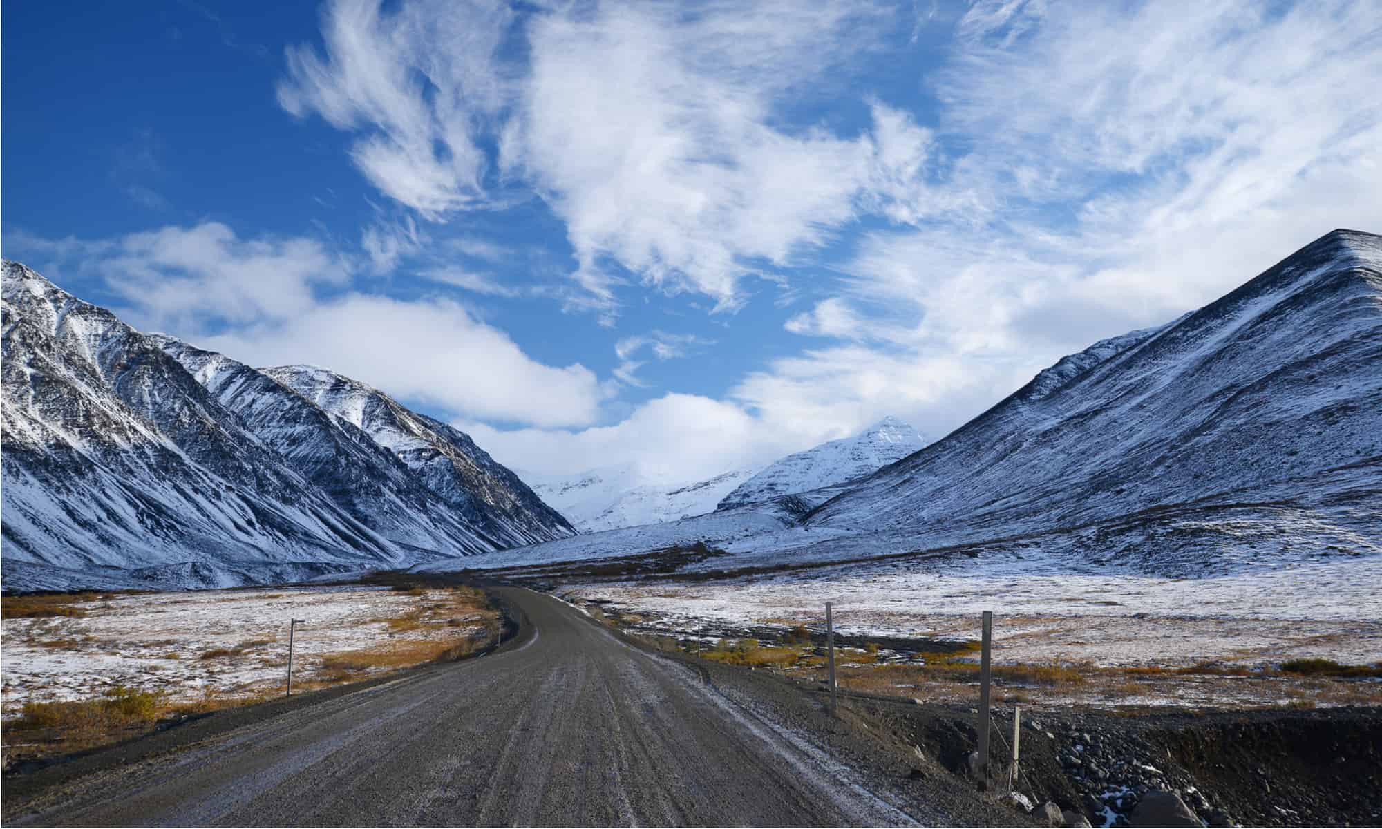
The Dalton Highway will take you through 414 miles of the most spectacular scenery imaginable.
©Nickolas warner/Shutterstock.com
‘The Last Road North’
The Dalton Highway crosses some major landmarks in this wilderness state. If you travel it from beginning to end, you’ll cross the Arctic Circle, the Continental Divide, and the Yukon River.
But simply looking at a map won’t tell you exactly how challenging and treacherous this trip can be.
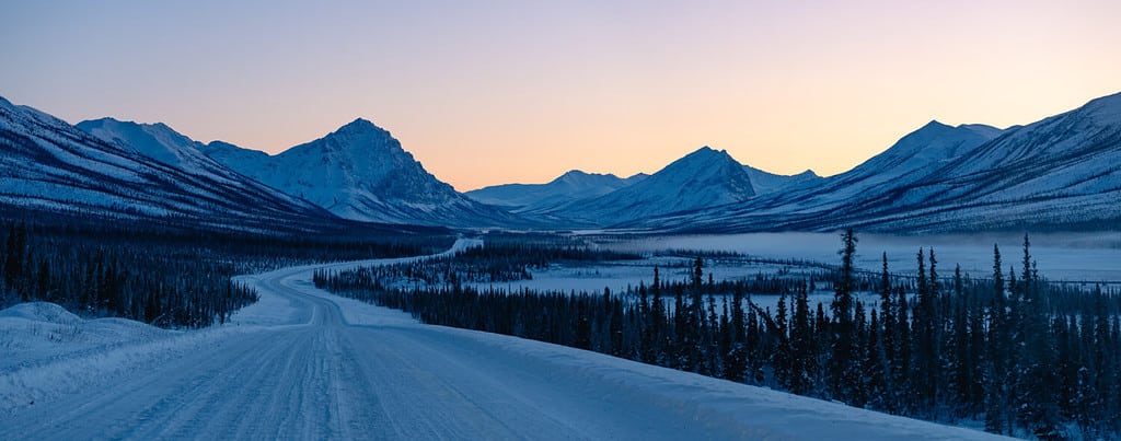
It begins a few miles outside of Livengood, Alaska, a town 80 miles north of Fairbanks. If you drive all 414 miles of it to the end, you’ll find yourself almost at the shores of the Arctic Ocean in Deadhorse.
In between you’ll find some of the most remote territory in Alaska, along with some of the most spectacular wilderness scenery in the U.S. That is, if you’re one of the hardy souls that’s up to the trip.
The Dalton Highway was finished in 1974, but not as a sightseeing route. It was rather specifically constructed to serve as a supply road for the Trans-Alaska Pipeline, which it parallels. It wasn’t even fully open to the public all the way to Deadhorse until 1994.
Considering its original purpose, along with the stunning sights of the Alaskan wilderness, you’ll also encounter commercial truck traffic bringing supplies to the oil fields.
That clash between wilderness and industrialization was depicted by photographer Ben Huff in his book, The Last Road North.
What to Know Before You Go
If you’re planning a trip on the Dalton Highway, even a short exploration, there are some important things to know before you go.
Don’t let the fact that the highway — currently owned and maintained by the state of Alaska — is open year-round fool you! Not only is winter driving treacherous, but winter conditions on this highway don’t always conform to a calendar.
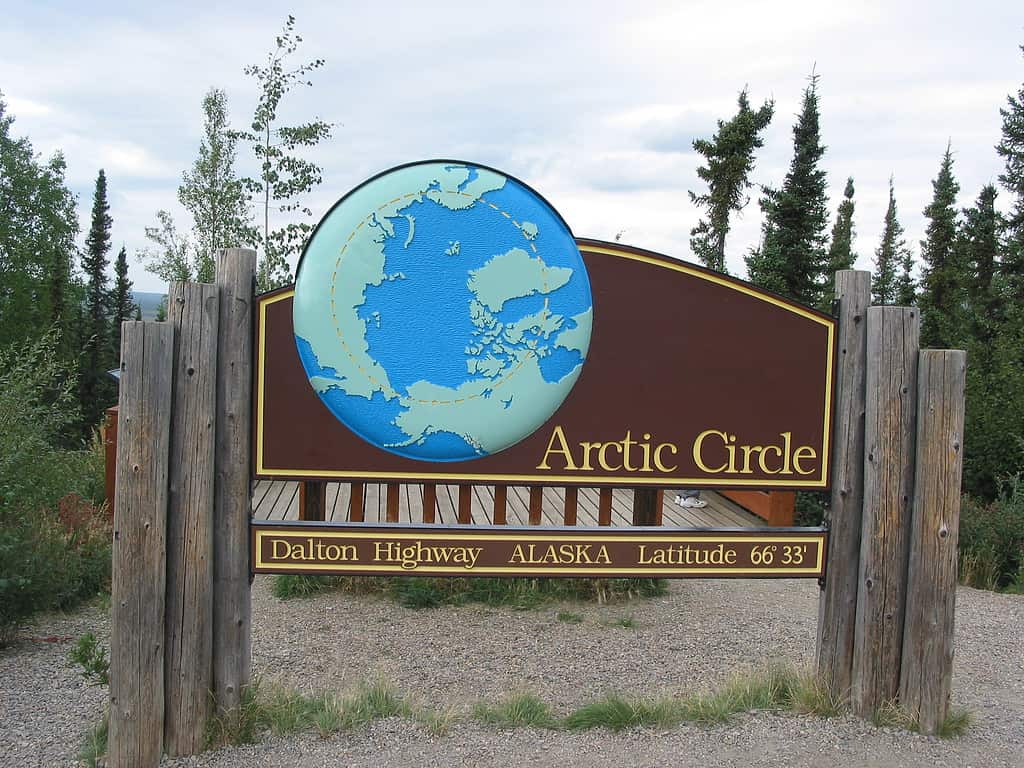
When you see this sign on the Dalton Highway, you’re crossing the Arctic Circle!
©Ixfd64, Public domain, via Wikimedia Commons – Original / License
Some parts of this thoroughfare have had snow in July, and what the Alaska Department of Transportation (DOT) calls winter conditions can extend from August through June! What this means is that to stay safe on the Dalton Highway, you need to be prepared.
As the Alaska DOT says, “This is not your average highway!”
First, what you’re driving needs to be able to withstand some tough terrain. An easy-to-maneuver four-wheel drive vehicle is mandatory. Only a quarter of the road is paved, the rest being gravel. And you’ll need plenty of emergency supplies.
Extra food, water, fuel, clothing, first-aid essentials, and even spare tires are on top of the list to bring along.
A CB radio, which was a popular item back in the 1970s, is another must-have on this road. That’s how the big rigs communicate with each other. In an emergency, it might be the only way you can call for help.
Many Miles Between Stops
Don’t expect to find your typical rest areas along the Dalton Highway, either. After you pass the Hilltop Truck Stop, just north of Fairbanks, the next place to eat or get fuel is over 100 miles north. The Yukon River Camp, an oasis in the remote surroundings, offers lodging, gas, gifts, food, and restroom amenities.
With only three towns to be found along the entire route, you’re definitely on your own. Travelers are warned that there are vast expanses between any services. And getting emergency road assistance “can be very expensive,” the state DOT adds.
The three towns you will find along the way wouldn’t exactly be called metropolises, either.
They include Coldfoot, with a population of only 34. Then there’s Wiseman, which has just a dozen inhabitants, and Deadhorse, with 25 permanent residents. However, oil production workers can temporarily swell the Deadhorse population by thousands.
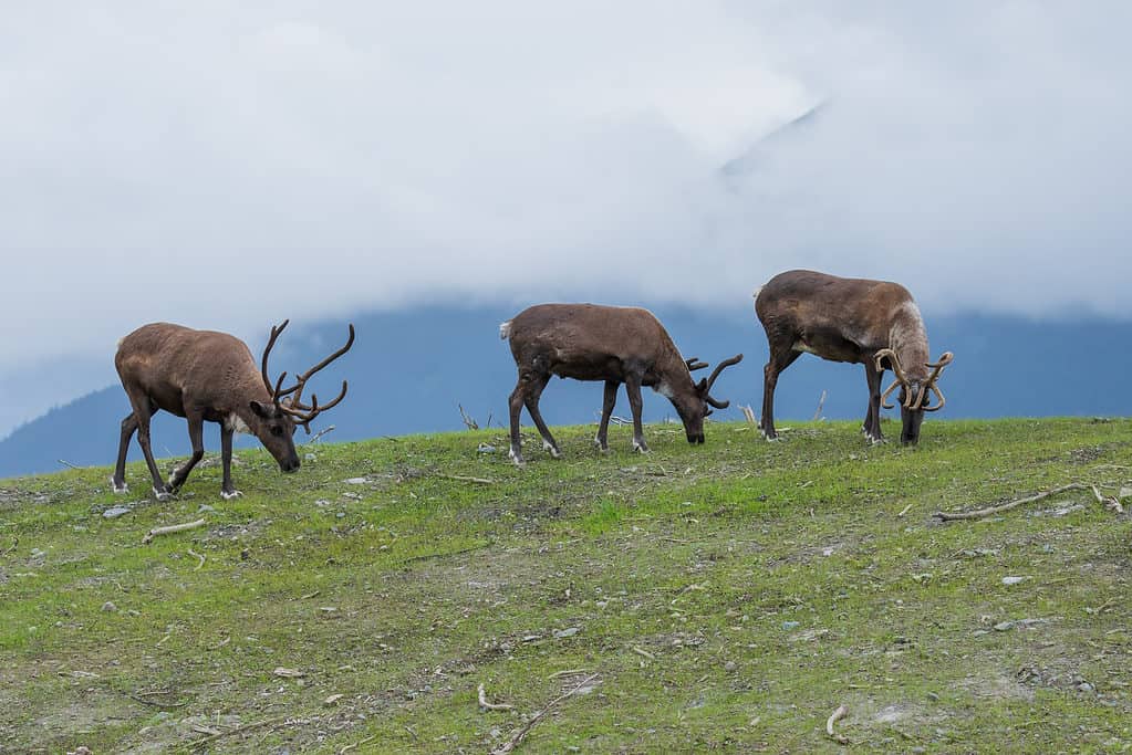
Caribou are a common sight along the Dalton Highway.
©Tom Tietz/Shutterstock.com
Breathtaking Views
Despite all the hazards and difficulties in traversing the Dalton Highway, it’s a one-of-a-kind experience — getting to witness the Alaskan wilderness first-hand in its full glory.
Among the spectacular sights it offers are the peaks of the Brooks Range, where thousands of caribou migrate every year crossing the arctic tundra. The landscape is vast and filled with variety. Depending on the time of year it is, you might see geese, tundra swans, and long-tailed ducks by the highway.
Arctic foxes and caribou are common all year, as are falcons, hawks, and eagles. During the summer, blooms of grasses, mosses, lichen, and flowers cover the landscape.
If you’re planning a full journey, a shorter trip to the Yukon River Camp, or even just an imaginary expedition across Alaska’s wilds, there’s nothing else that can “remotely” match the Dalton Highway!


How to Add Us to Google News


Thank you for reading! Have some feedback for us? Contact the AZ Animals editorial team.