
The interstate highway system paved the way for the construction of highways across America. They would connect each state, from coast to coast. But before the highway system made it possible to drive from California to Florida, there were state highway systems in place. California had such a system that connected major cities. California State Route 1, otherwise known as Pacific Coast Highway, Cabrillo Highway, or Shoreline Highway, was one of the first state highways built in the state and arguably the most famous one in the state.
Of course, the Pacific Coast Highway was somewhat different than it is today. The northern and southern terminuses were slowly expanded as the highway grew or was connected with other coast highways. Let’s take a look at where the Pacific Coast Highway starts and ends, the history of the construction of the PCH, and the wildlife that lives along the California coast.
History of the Highway
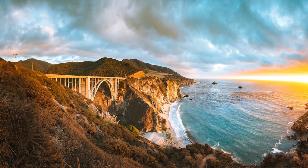
Bixby Bridge was completed in 1932.
©canadastock/Shutterstock.com
The Pacific Coast Highway wasn’t always known as the Pacific Coast Highway and it didn’t always run along the coast from Orange County to Mendocino County. At the beginning of the 20th century, the road was just a vision. In 1911, construction on what would become California State Route 1 began. Originally, the road ran from Ventura to Santa Barbara and the planners wanted it to be part of the first coastal route from Los Angeles to San Francisco. That part of the road was finished in 1913 by the State Highway Commission.
In 1919, the construction of the Carmel-San Simeon Highway (Route 56) was approved by the state, which would connect the coast along Big Sur with the rest of the state. Construction lasted 18 years, from 1919 to 1937. A total of 39 bridges were built, including the iconic Bixby Bridge. When the bridge was completed in 1937, it became known as Roosevelt Highway, after the president at the time, Franklin D. Roosevelt.
In 1925, Route 60, running from Oxnard to San Juan Capistrano was extended to El Rio and then again to San Luis Obispo in 1931. There was also a section of the original State Route 1 from Santa Monica and Oxnard added that was built between 1925 and 1929.
Expansions, Expansion, and More Expansions
In the early 1930s, expansions on Route 56 started. The state wanted expansions in both directions. The southern terminus would be a bit north of Gaviota Pass and the northern terminus of Route 56 was to be extended from Carmel to San Francisco. Some other bits and pieces were added north of San Francisco, as well.
At long last, the coastal highway was complete, but it was not called State Route 1. Each part was called something else and state legislators sought to solve this problem and consolidate the highway into one. In 1964, the California State Legislature designated the two-lane road from Orange County to Mendocino County as California State Route 1. They also named the route by three different names: “Pacific Coast Highway” from Orange to Ventura; “Cabrillo Highway” from Santa Barbara to San Francisco, and “Shoreline Highway” from Marin to Mendocino. But the rest of the world knows it as the Coast Highway or even the Pacific Coast Highway.
Start of the Highway
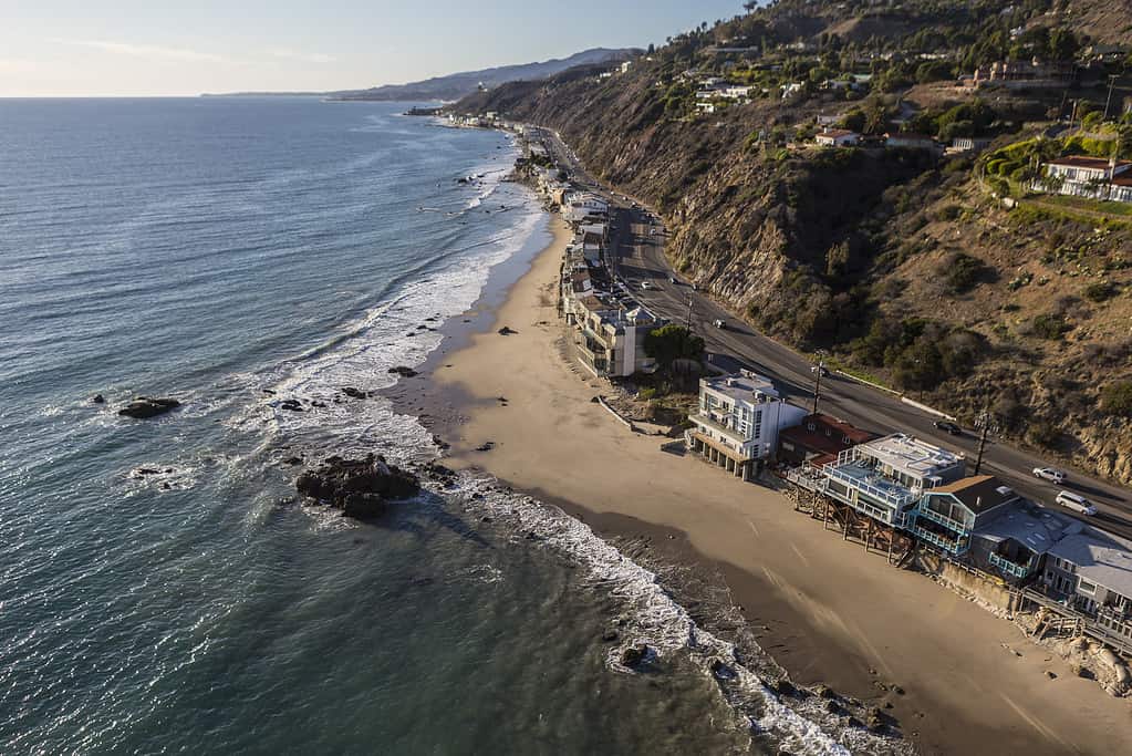
The Pacific Coast Highway passes through the beachfront mansions of Malibu.
©trekandshoot/iStock via Getty Images
The southern terminus is in Orange County and more specifically in Capistrano Beach in Dana Point. The route winds up to Laguna Beach and Newport Beach. It passes through the wealthy enclaves of Orange County including Corona del Mar, Upper Newport Bay, and Newport Coast. As the highway heads north into Huntington Beach, it crosses over from Seal Beach into Los Angeles County entering Long Beach.
The PCH continues to Redondo Beach and Hermosa Beach, but when it enters Manhattan Beach, the highway becomes Sepulveda Boulevard. Except for a portion in El Segundo where it is the PCH, it continues as Sepulveda Boulevard through Los Angeles International Airport. The highway becomes Lincoln Boulevard as it passes through neighborhoods like Westchester, Venice, Marina del Rey, and Playa Vista.
Once it reaches Santa Monica and its famous Southern California palm trees, however, it becomes the Pacific Coast Highway again and you can head down adjacent to the coast. The road heads north into Malibu, passing through beachfront mansions of the many celebrities and wealthy folks that live there. As it leaves Malibu, the road goes into Ventura County.
The highway leaves the coast after Mugu Rock and passes through Oxnard. It then goes upward along the coast and crosses into Santa Barbara. The coastal highway along Santa Barbara is gorgeous, passing through the county’s beach communities.
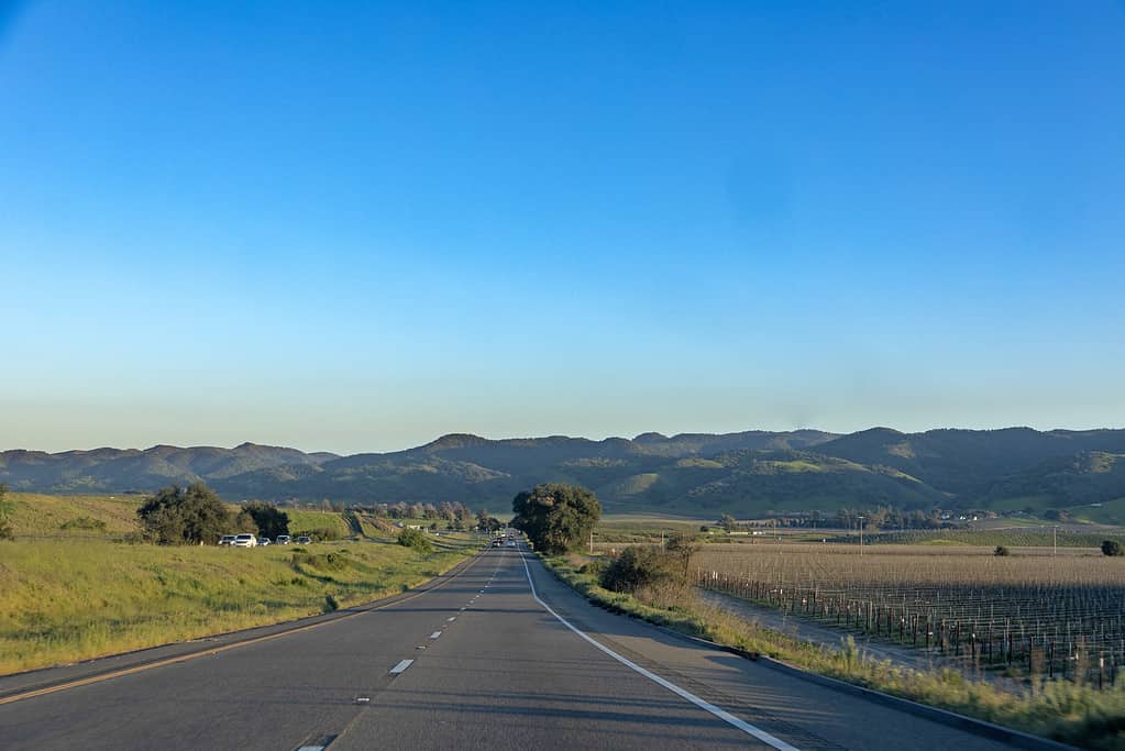
As it leaves Santa Barbara, it briefly goes inland going through Lompoc and then into San Luis Obispo. Once we arrive at Morro Bay, you can finally see the coast, and the drive winds north along the coast, reaching San Simeon.
End of the Highway
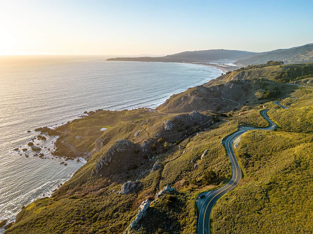
The Pacific Coast Highway goes through Big Sur and northward until it reaches Mendocino County.
©Frederick Thelen/iStock via Getty Images
As you leave the Central Coast of the state, you enter Big Sur and the winding road that serves as the quintessential California scenic road. Going northward, the deep, blue ocean sits on your left and the Santa Lucia Mountains traverse to the east. You’ll pass through many bridges, including the famous Bixby Bridge. The road will then take you to Monterey Bay.
You will be winding between coastal communities in the inland communities of Monterey Bay until you reach Santa Cruz. You’ll pass through the downtown area of the city as you then rejoin the coast and reach San Mateo County. As you make your way to San Francisco, the road will curve inland. Once you’re in San Francisco, you’ll have to head to the Golden Gate Bridge. Cross the majestic bridge as you head onto Marin County.
The road will alternate between running on the coast and going inland until it reaches Mendocino County. You’ll pass through several towns, including Fort Bragg. Furthermore, the landscape will change magically into a more forested terrain. As you head down to Leggett, you will notice the redwood forests that will surround the route. That’s where the route ends and it becomes US Highway 101.
Wildlife Along the PCH
The PCH isn’t just a coastal highway as it goes inland many times.
©travelview/iStock via Getty Images
The California Coast is filled with an abundance of wildlife. There are roughly 34 species of marine mammals that traverse the ocean and shores of the California coast. There are also about 180 species of birds that glide down the ocean or nearby lands along the coast for food or shelter. Whales are the prominent animals you can see migrating down the coast to Baja California to breed. There are also sea turtles that traverse the Pacific Ocean from Japan.
On different legs of the route, you can find different land animals, as well. There are bats, white-tailed deer, and even elk and mountain beavers. Also, you can find harbor seals or elephant seals on rocky beaches along the coast.
Conclusion
As the second-longest highway in the United States, the Pacific Coast Highway is one of the most famous roads in the world. It is an All-American Road and one of the most scenic highways in the country. It provides you with a constant view of the Pacific Ocean, with the waves crashing onto the rocks below.
With stops along the way, this can be the all-scenic road trip you have been dying to take. If you live in San Diego, just drive north to the southern terminus of the PCH. Start your journey and enjoy your time up the coast. Make sure you have a camera ready or storage in your phone because you’re going to want to take pictures of the trip. It will be a drive that you will remember for the rest of your life.
The photo featured at the top of this post is © greta6/iStock via Getty Images


How to Add Us to Google News


Thank you for reading! Have some feedback for us? Contact the AZ Animals editorial team.