
A long-distance hiking and equestrian trail, the Pacific Crest National Scenic Trail stretches its way along the western coastal states of America. The Pacific Crest Trail, as it is more commonly called, or PCT, covers over 2,650 miles through the mountain ranges, 25 national forests, and 7 national parks on the Pacific coast. The trail passes through California, Oregon, and Washington, with elevation ranging from 110 to 13,153 feet.
For those interested in hiking America, the Pacific Crest Trail, Appalachian Trail, and Continental Divide Trail form the Triple Crown of hiking in the United States. The PCT is also part of the Great Western Loop that covers 6.875 miles.
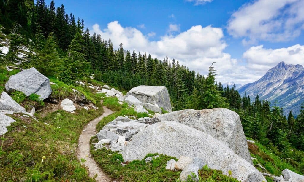
Start and End Points of the Pacific Crest Trail
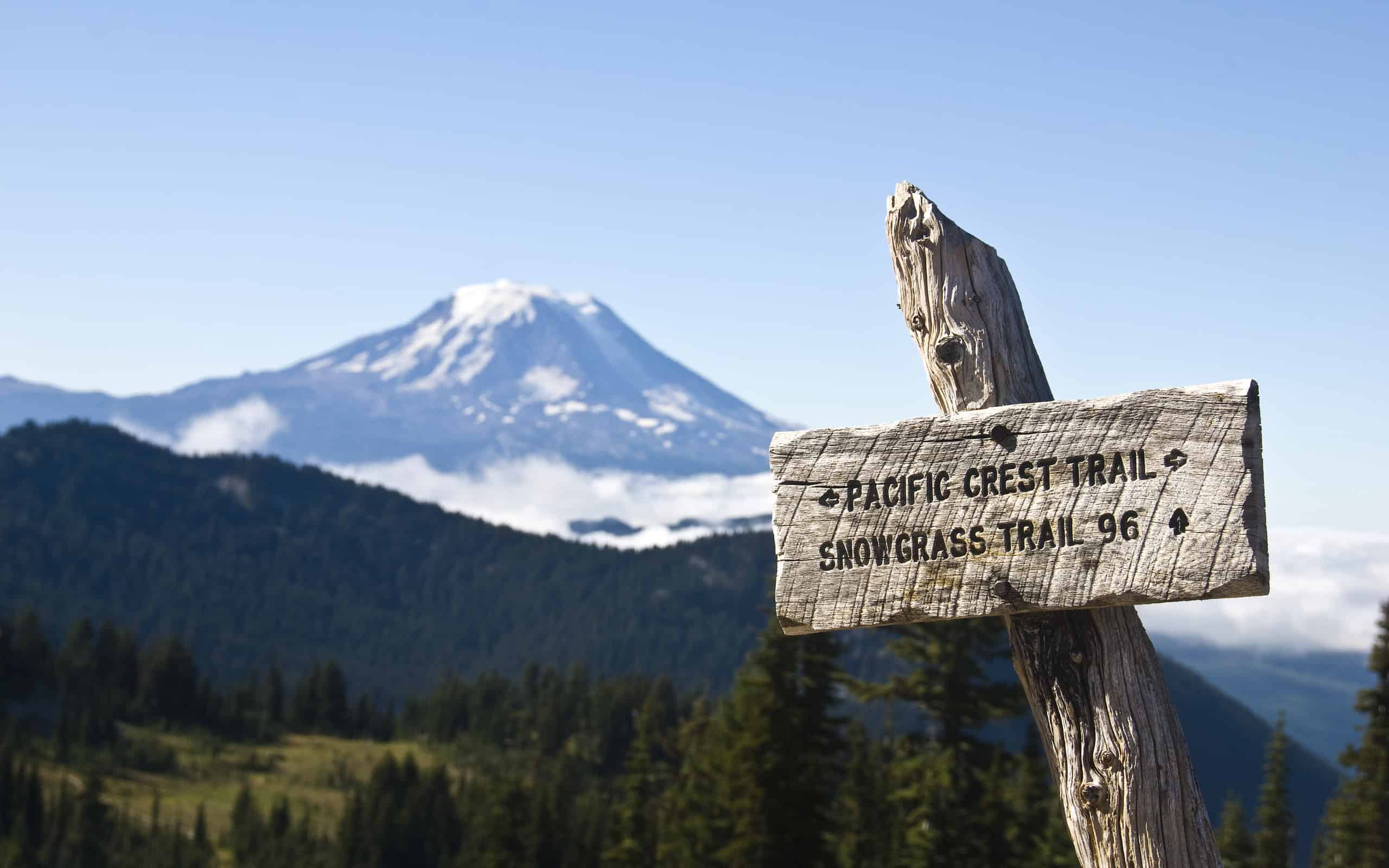
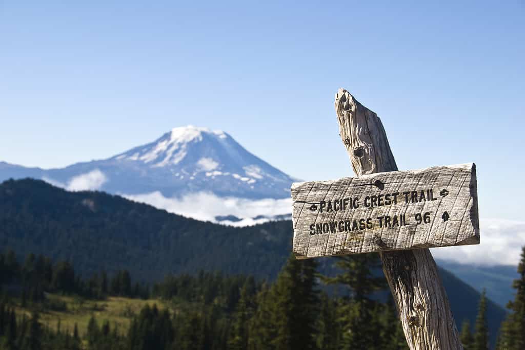
Many folks opt to camp out along the trail, enjoying much or all of the distance. The Pacific Crest Trail requires plenty of planning, though! Start with knowing where you’ll join and end the hike.
©Ron Karpel/iStock via Getty Images
The challenging, long-distance hiking trail known as the Pacific Crest Trail, begins in southern California at the Mexican border. The starting point finds situation on a low hill near Campo, California, a small town on the border.
From this starting point, the trail winds its way over roughly 2,653 miles into Lake Morena County Park. It tunnels beneath Interstate 8 and climbs through numerous mountain ranges. The trail passes through all West Coast states, ending in the north at the Canadian border in Washington state.
The highest point of the trail, at 13,153 feet in Forester Pass, in the Sierra Nevada. After that, it descends and climbs through the mountains and valleys. Then, it eventually reaches its terminus in Manning Park, British Columbia, Canada, right at the border.
Basics Stats of the Pacific Crest Trail
- Southern terminus: Campo, California, near the Mexican border
- Norther terminus: Manning Park, British Columbia, at the Washington border
- Location: California, Washington, Oregon, USA
- Length: 2,653 miles
- Highest point: Forester Pass, 13.153 feet
- Lowest point: Cascade locks, 140 feet
- Elevation change: 420,880 feet
- Time Zone: Pacific Time
- Use: Pedestrian and equestrian
Route for the Pacific Crest Trail
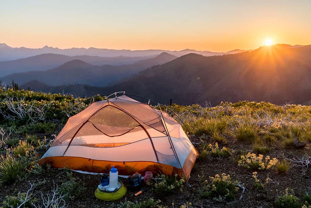
Along the Pacific Crest Trail you’ll see plenty of gorgeous scenery. Beware the intensity, though. It’s not for folks of low fitness levels. You’re climbing those mountains you’ll see!
©RobertCrum/iStock via Getty Images
Making its way primarily through National Forests, Protected Wilderness areas, and National Parks, the Pacific Crest Trail maintains much of the natural, untouched beauty you’d hope for. The trail winds its way through mountain ranges, valleys, forests, and meadows.
National Parks wound through include:
- Sequoia
- Yosemite
- Lassen Volcanic
- Crater Lake
- Mount Rainier
- North Cascades
- Kings Canyon
Mountain ranges include:
- Laguna
- Santa Rose
- San Bernadino
- San Gabriel
- Sierra Nevada
- San Jacinto
- Cascade Range
- Liebre
- Tehachapi
- Klamath
History of the Pacific Crest Trail
Originally proposed in 1932, the Pacific Crest Trail was intended to link several trails. These included the John Muir, Tahoe-Yosemite, Skyline, and Cascade Crest Trails that already existed. These trails crossed the three states. They would be linked to form the new trail, extending further in northward and southern directions. Clinton C. Clarke, the proposer, along with the Boy Scouts, YMCA, and Ansel Adams formed a conference known as the Pacific Crest Trail System Conference to plan and lobby for the trail.
Between 1935 and 1938, the YMCA sent out groups to explore some 2,000 miles of potential trail to plan the route. What was proposed remains mostly what was turned into the Pacific Crest Trail we know today.
Catherine T. Montgomery, a clubwoman and educator from Washington state, was dubbed the “Mother of the Pacific Coast Trail.” She earned the nickname for her contributions to the concept of the trail and explorations of the area. In 1968, President Lyndon B. Johnson defined both the Appalachian and the Pacific Crest Trails within the National Trails System Act. Government officials and volunteers continued their work to eventually have the Pacific Crest Trail officially deemed completed in 1993.
Thanks to these efforts, the Trust for Public Land has purchased and conserved some 3,000 acres along the Pacific Crest Trail in Washington for healthier landscapes and consolidation and management. Since that time, a bicycle trail, paved in some areas, unpaved in others, has developed parallel to the Pacific Crest Trail.
Along the Trail
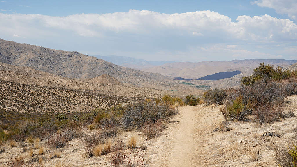
View of the Pacific Crest Trail Desert Section F from Tehachapi Pass to Walker Pass in California, USA. The long desert stretch requires significant preparation if you want to survive.
©Christopher Heil/iStock via Getty Images
Every year, thousands of hikers and equestrians hit the Pacific Crest Trail. They’re looking for the beautiful scenery, challenging climbs, and fresh air adventure. Many entry points allow folks to do just this. An adventure for a few miles or hike the entire trail with breaks along the way awaits.
The terrain varies along the way, with 700 miles of desert in California, before reaching the Sierra base. The Sierra itself is the most significant challenge for hikers, needing specific timing to ensure safe and clear passage to avoid heavy snowfall. After this, you’ll continue hike many miles through forests, like the Sequoia National Park has to offer, mountain trails, and more.
You will come across towns, though, thankfully, for resupply along the way. These small towns know that hikers are coming through, and so offer amenities needed for visitors looking for showers, food, healthcare, and more.
Planning Your Hike of the Pacific Crest Trail
The Pacific Crest Trail demands proper fitness levels and plenty of planning for a successful hike. Know ahead where you’ll stop and pack extra supplies. You’ll also want to make sure you’re hiking with the right partner!
©iStock.com/Bill Kingman
Several things will help you plan your hike along the Pacific Crest Trail.
- Check the official maps for the trail before heading out, both for planning and for understanding current events, like wildfires, along the way.
- Verify you have the correct gear, that it fits well, and that it is in good repair.
- Acquire the correct permits for any sections requiring them. You’ll find the necessary information on the official website for the trail, with links and info about each section.
- Map out your stops and note all the resupply locations. Ensure you have enough food, water, and other needs, plus some extra, to make it between each point of the trail.
- Many folks create resupply packages ahead of time and send them to small towns along the way.
- Ensure you have a plan for purifying water along the way. There are no fountains or pure water spots easily access from the trail in most cases.
- Ensure that your hiking partners are to the same fitness condition that you are. The “hike your own hike” motto applies. This means, be selfish in your decisions. Take care of your needs. And ensure that your partners are able to keep to a reasonable pace for you both.
- Plan a few hotel nights along the way, if so desired. Just because you’re hiking doesn’t mean you have to camp out each night.
- Ignore the advice of inexperienced hikers and even experienced hikers when it comes to your own needs. Be aware of the legitimate needs along the way. But also know your own limits, weaknesses, and strengths, and cater to these as you go. Invest your time in researching and studying the advice for the portion(s) of the trail you’ll be hiking. Look to experts who know their stuff instead of friends and random folks. Check the official FAQs page for the Pacific Crest Trail to answer additional questions you may have.
Pacific Crest Trail Permits
As you prepare, be sure to acquire any necessary permits needed along the Pacific Crest Trail. 33 sections of the trail, about one-third of the trail, require permits. These are mostly needed for Wildernesses and National Parks.


How to Add Us to Google News


Thank you for reading! Have some feedback for us? Contact the AZ Animals editorial team.