
U.S. Route 550 runs north to south, and it travels through gorgeous landscapes in both Colorado and New Mexico. The 25-mile stretch through Colorado is commonly referred to as “The Million Dollar Highway.” Meanwhile, the New Mexico portion is part of the Trails of the Ancients.
Where Does U.S. Route 550 Begin and End?
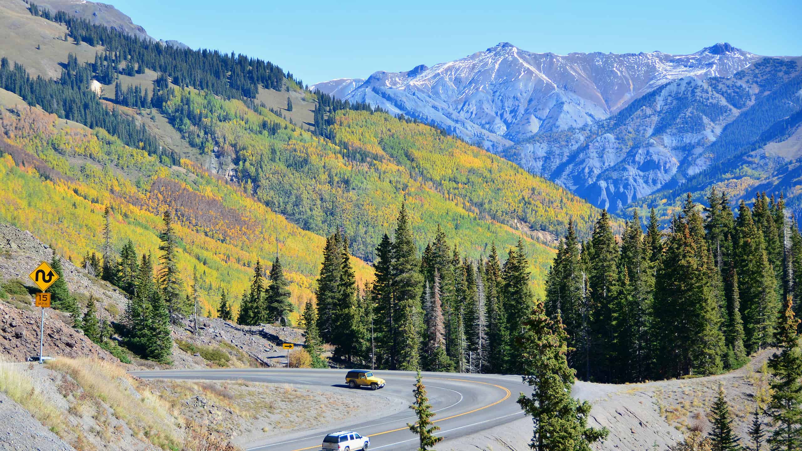
U.S. Route 550 passes through the San Juan National Forest in Colorado.
Route 550 starts in Montrose, CO, and heads south to Bernalillo, NM. This 305.1-mile auxiliary route splits from U.S. Route 50. Only two north-south Colorado highways sit on the west side of the Continental Divide, and Route 550 is one of them.
As the highway heads south from Montrose to Bernalillo, it passes through the San Juan National Forest in Colorado and the Navajo, Jacarilla Apache, Jemez Pueblo, Zia Pueblo, and Santa Ana Pueblo Nations in New Mexico. The highway’s proximity to the different tribal lands and their rich histories and archaeological sites makes it part of the Trails of the Ancient byway.
A Brief History of Route 550
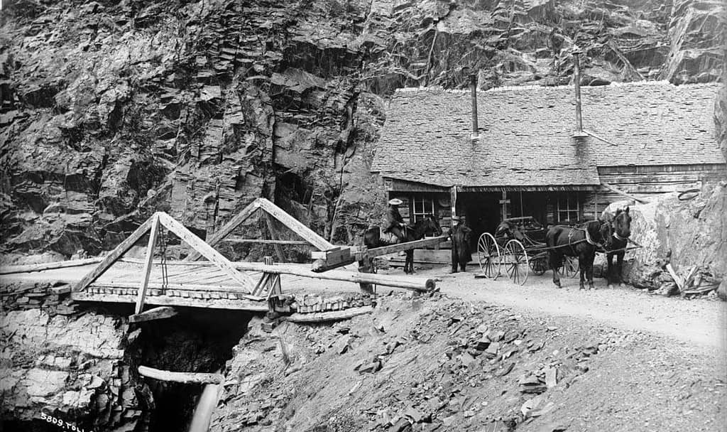
The Million Dollar Highway started as a toll road Otto Mears built over Poncha Pass.
©William Henry Jackson, photo # 5809 / Public domain – Original / License
Born to an English father and Russian mother in 1840, Otto Mears was orphaned at a young age. His maternal uncle in Russia housed him before sending him to paternal relatives in England. His next stop was New York City to live with distant relatives for a year. Once again, he was sent away, this time to California to live with an uncle. No one told him the uncle had moved on to Australia. A woman he met on the train took him in, so he spent several years working odd jobs.
At the age of 21, Otto enlisted in the California Volunteers where he stayed for three years before his discharge in New Mexico. It’s there that he gained the funds to start his own general store in Santa Fe. Within a few years, he’d opened three stores and lived in Colorado where he was a civic leader.
His story is important as he needed a way to get his wheat over the Poncha Pass. He commissioned the Poncha Pass Wagon Road. This was the start of his foray into toll roads, and the original portion of the Million Dollar Highway was one of the roads that his
The government made US 550 part of the federal highway system in 1926. At this time, the Million Dollar Highway went from Montrose to Durango. In 1934, the first expansion extended the 550 to Shiprock, NM, and the next was in 2000 when it reached Bernalillo. The final extension occurred in 2009 when a mile-long extension connected it to the restructured Route 50.
Highlights Found Along the Incredible U.S. Route 550
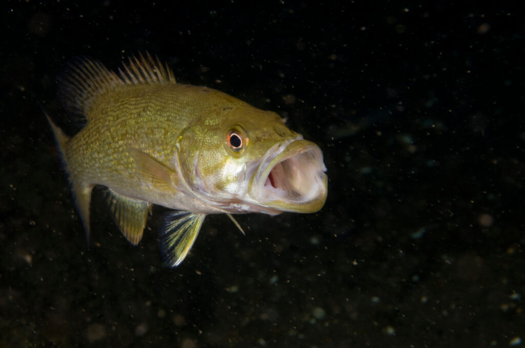
U.S. Route 550 passes Ridgway Reservoir, a reservoir teeming with smallmouth bass.
©RLS Photo/Shutterstock.com
As you leave Montrose heading south, Route 550 splits from Route 50. Ridgway State Park Visitors Center and Ridgway Reservoir are one of the first major attractions. Smallmouth bass thrive in the reservoir, impacting endangered fish species. The state encourages anglers to catch and take home as many as they want. There are no limits.
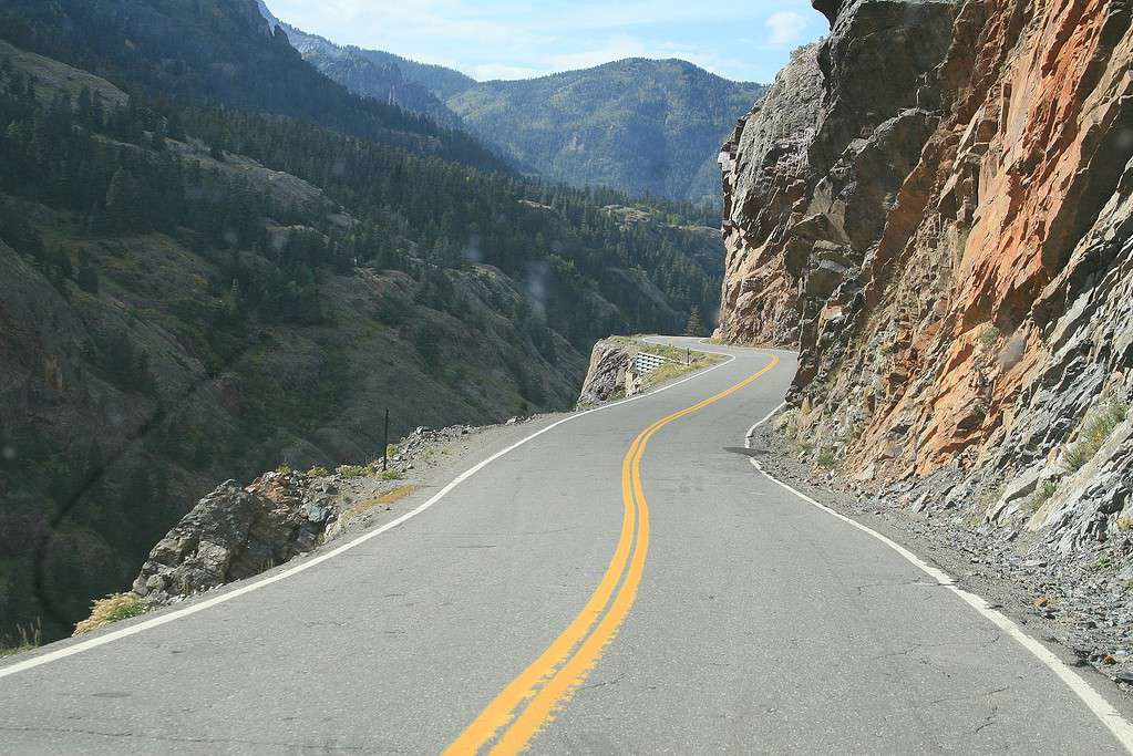
Twists through Ouray have you changing direction a couple of times before reaching Switzerland of America Lookout Point and High Point Lookout. Keep going to reach Bear Creek Trail and the scenic 100-foot Bear Creek Falls. That’s one thing to keep in mind. The Million Dollar Highway is very twisty and some sections lack guardrails. It’s a dangerous pass if you’re not using care while driving, especially in snowy weather.
As you leave Ouray, a lot of hairpin turns take you through Commodore Gulch. That’s not the end of these hairpin turns. You’ll encounter many more before reaching Electra Lake, Hermosa, and Durango. The 140-acre Durango Nature Center is a nature preserve that’s home to beaver and mule deer.
The highway reaches the Colorado-New Mexico border in Cedar Hill, NM, after leaving La Plata Country. Bloomfield is a popular stop as you head south. Kutz Canyon Paleontological Area and Angel Peak Badlands Overlook are popular spots for photography before you reach the Navajo Nation and Huerfano Mountain. Turtle Mountain is next as the highway heads southeast.
As you enjoy the vistas in historic Pueblo land, Pajarito Peak stands out. The highway ends in Bernalillo, at the point where the I-25 and Route 165 meet. Located just north of Albuquerque, Bernalillo is a few minutes south of Santa Ana Pueblo and the Coronado Historic Site.


How to Add Us to Google News


Thank you for reading! Have some feedback for us? Contact the AZ Animals editorial team.