
The mountains in Mexico are just as stunning as the beaches that tourists flock to. If you have wanted to take a hiking vacation or if you just want to improve your hiking skills by taking some mountain climbs in a tropical region, Mexico is a great destination. The mountains in Mexico are usually easily accessible and will give you a great overview of the best scenery that Mexico has to offer. Some of the mountains in Mexico are located right in major cities so you can enjoy nature, some fantastic night life and vibrant markets all in the same place.
10 Mountains In Mexico
When you’re planning a hiking trip or a family vacation in Mexico, there are many mountains to explore. As an active family or solo explorer that appreciates the outdoors and not just lounging on beaches, you might consider visiting these mountains in Mexico:
Pico de Orizaba
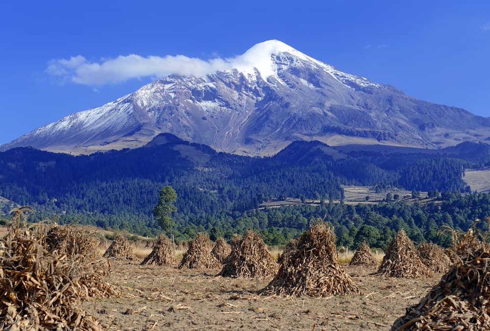
Pico de Orizaba volcano, or Citlaltepetl, is the highest mountain in Mexico, maintains glaciers and is a popular peak to climb.
©nyker/Shutterstock.com
Located in: Veracruz
Height: 18,490 feet
Nearby City: Tlachichuca
Known For: Pico de Orizaba is the highest peak in Mexico. It’s also the third highest peak in North America. This stunning snow capped mountain that looks down over the Orizaba valley is actually a volcano. It’s dormant now, but it’s not an extinct volcano. Pico de Orizaba is also the second tallest volcanic peak in the world. Indigenous people call the mountain “Citlaltépet” which means “Star Mountain”. That name comes from the snow on the top of the mountain which is there all the time and shines like a star.
If you’re hiking Pico de Orizaba make a special effort to be at the peak at sunrise. The shadow that the peak makes on the valley below is something that people who have experienced it call “life-changing”. Hiking this peak can be tough because it topped by a glacier and has snow and cold temperatures year-round. There is a large hut where you can make base camp at the base of the mountain but it’s best to attempt this hike with a group or at least a guide. It’s not recommended for casual climbers or beginner hikers.
Popocatépetl
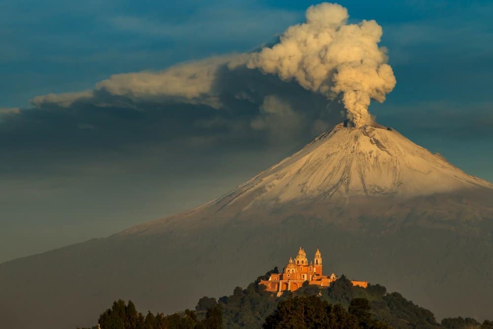
The Popocatepetl, smoking in the morning.
©Cristobal Garciaferro/Shutterstock.com
Located in: Ixtaccíhuatl National Park
Height: 17,801 feet
Nearby City: Puebla
Known For: Popocatépetl is the second highest of the mountains in Mexico and it’s also a volcano. But Popocatépetl is an active volcano. The last eruption was in 2000 and it was a very strong eruption. More than 30,000 of the people living in the areas around the park had to be evacuated because of the smoke, ash, and lava that poured from the volcano. It was the strongest eruption of the volcano in almost 1200 years. This volcano used to be topped by a glacier but the eruption in 2000 destroyed the glacial cap.
Because Popocatépetl is an active volcano it’s no longer possible for visitors to hike on the mountain or camp near it. But there are still many good spots to hike and camp in Ixtaccíhuatl National Park where the mountain is located. When you’re hiking in the national park you can see many different types of birds as well as animals like teporingo rabbits, pumas, lynxes, and coatis.
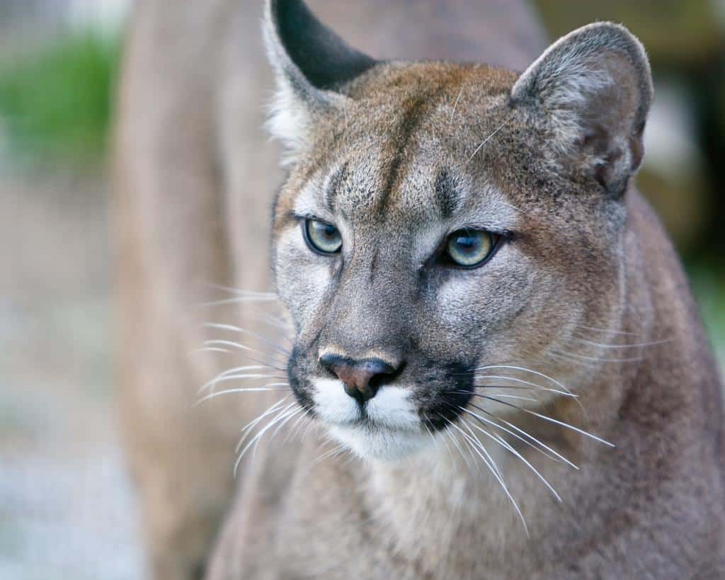
You may spot a puma when you’re hiking in Mexico.
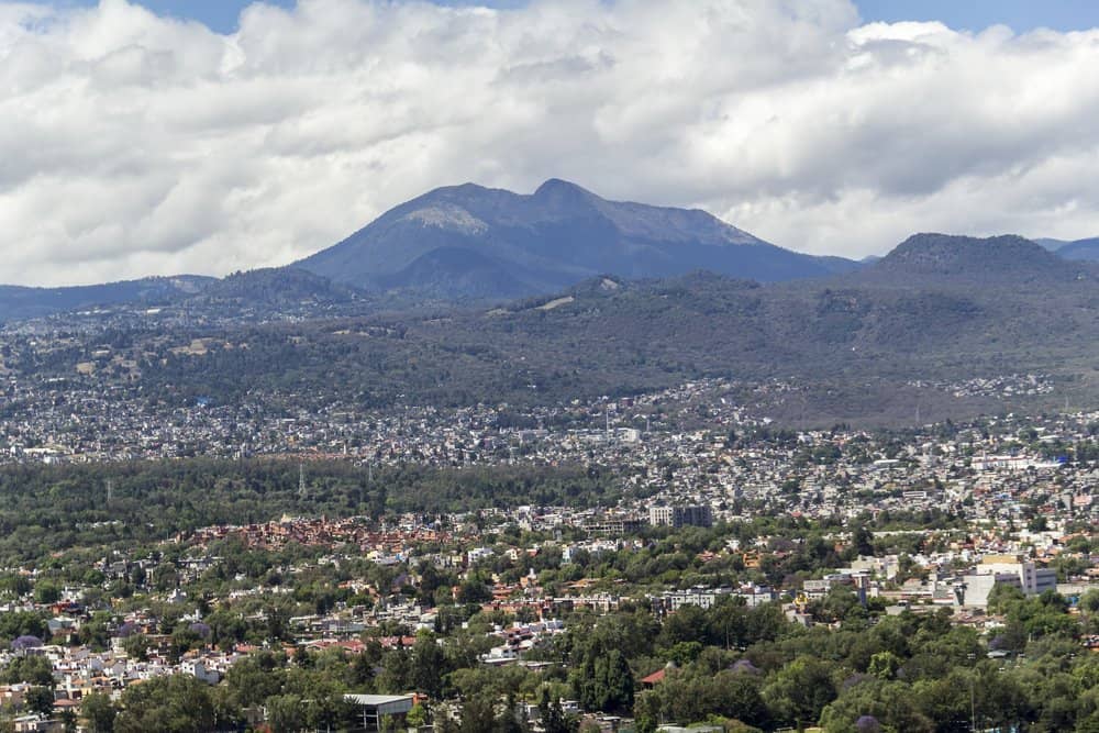
Ajusco
Aerial view of the most southern part of Mexico City, above Tlalpan district and with the mountains Ajusco and Xitle in the background.
©Ulrike Stein/Shutterstock.com
Located in: Mexico City
Height: 12,984 feet
Nearby City: Mexico City
Known For: Ajusco is an extinct volcano so there’s no fear that this mountain will erupt. But if you’re going to hike Ajusco be prepared for lots of company. It’s the most hiked mountain in Mexico, probably because of the location. Ajusco is located directly in Mexico City and it’s an easy getaway for the people in the city so thousands head to Ajusco for day hikes, trail running, biking, and other outdoor fun. Many people also like to spend time on Ajusco because the air is fresh and clean compared to the smog and dust filled air in the city.
The hike to the summit is an easy one and there are plenty of smooth trails that will take you all over the mountain and to the top. This mountain was sacred to the Aztecs and the top of the summit was used in Aztec rituals long ago, but now you will just find other hikers at the top. And you’ll also find some great views of Mexico City if the smog isn’t covering the city too thickly.
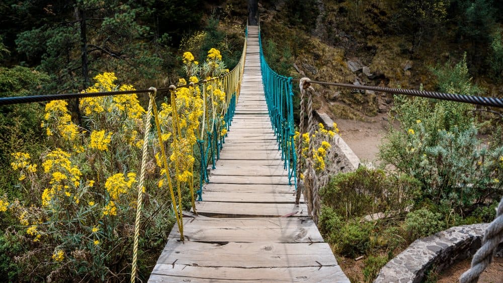
Old bridge leading to the summit of mount Ajusco.
©Tom Ha/Shutterstock.com
Matlalcueitl/La Malinche
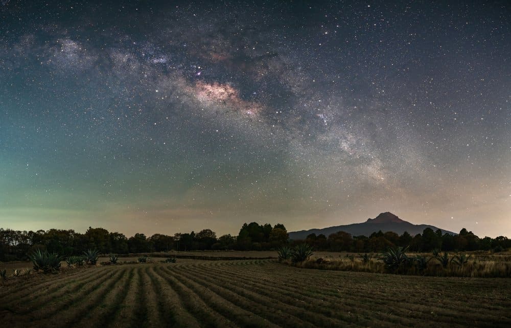
Corn fields at La Malinche volcano.
©rborquez/Shutterstock.com
Located in: La Malinche National Park
Height: 14,635 feet
Nearby City: Tlaxcala
Known For: Sometimes this mountain is called Matlalcueitl but most people know it as La Malinche. It is the primary land feature of La Malinche National Park. This mountain is an inactive volcano that is one of the best hikes in Mexico for practicing hiking skills and getting in shape to tackle some of the bigger mountains in Mexico. If you want to fine tune your fitness and hiking skills before you take on a bigger hike spend a day or two hiking La Malinche to get ready. You will have lots of company. This is a very popular spot for families to escape the city and spend some quality time in the outdoors.
There are multiple smooth trails that you can use to get the summit. All of them are really more like gentle strolls than hikes. Families with small children and senior citizens hike on La Malinche every day. When you’re arriving at La Malinche you can drive almost to the summit on a paved road. At the parking lot there are cabins for camping, shops, restaurants, and picnic areas. This is not a hike to take if you’re looking for solitude. But if you are looking for an easy hike or the chance to warm up for a bigger hike hiking at La Malinche is perfect for that.
Picacho Del Diablo
Picacho del Diablo, is the highest peak of the Baja California Peninsula.
©Pablo Garcia Saldana/Shutterstock.com
Located in: Sierra de San Pedro Mártir National Park
Height: 10,157 feet
Nearby City: Tijuana
Known For: This is one of the more difficult mountains in Mexico to climb. The summit is a series of granite rocks and the incline to get to them is steep. In fact, the hike up Picacho del Diablo is considered to be only appropriate for very experienced or expert hikers and mountain climbers. There are some sections where rock scrambling will be necessary to get to the summit. The views from the summit are spectacular but you will have to work to get there.
There are a series of granite slaps where you can rest before you take on the last bit of the climb to the summit but be careful because these rocks are very slippery and rather steep. You will need to do use some mountaineering skills to reach the summit from these granite slabs.
Typically this is a hike that takes three days. The first day is a relatively easy hike that will bring you to basecamp at Camp Noche. The second day is a long day of hiking to get to the summit and back down to Camp Noche. Then the third say is hiking out.
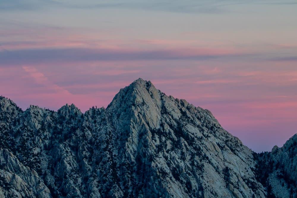
Sierra Madre Occidental
The breathtaking plateau of the Sierra Madre Occidental.
©Alex Bordeline/Shutterstock.com
Located in: Sierra Madre Occidental Pine-Oak Forest
Height: 7,380 feet
Nearby City: Sonora
Known For: The Sierra Madre Occidental is a large plateau that is part of the Sierra Madre chain of mountains in Mexico. These mountains begin in Sonora, Mexico and extends through the southeast part of Mexico. The plateau and the forest surrounding it are most well-known for the wildlife that call this plateau park home. It’s one of the most biodiverse spots in the world and it’s home to thousands of different species of wildlife. Animal lovers will be amazed at the rare and endangered animals that can be found here. Mammals that can be spotted here include puma, jaguar, and black bears, among others.
Bird lovers flock to the Sierra Madres Occidental even though hiking into this terrain can be difficult. That’s because the plateau offers them the rare chance to see birds like: green parakeets, eared trogons, coppery-tailed trogons, Mexican jays, Mexican spotted owls, violet-crowned hummingbirds, and golden eagles.
Sierra Atravesada
There are some fantastic trails to access the peaks of the mountains in the Sierra Atravesada mountains.
©Alex Bordeline/Shutterstock.com
Located in: Oaxaca
Height: 7,380 feet
Nearby City: Oaxaca
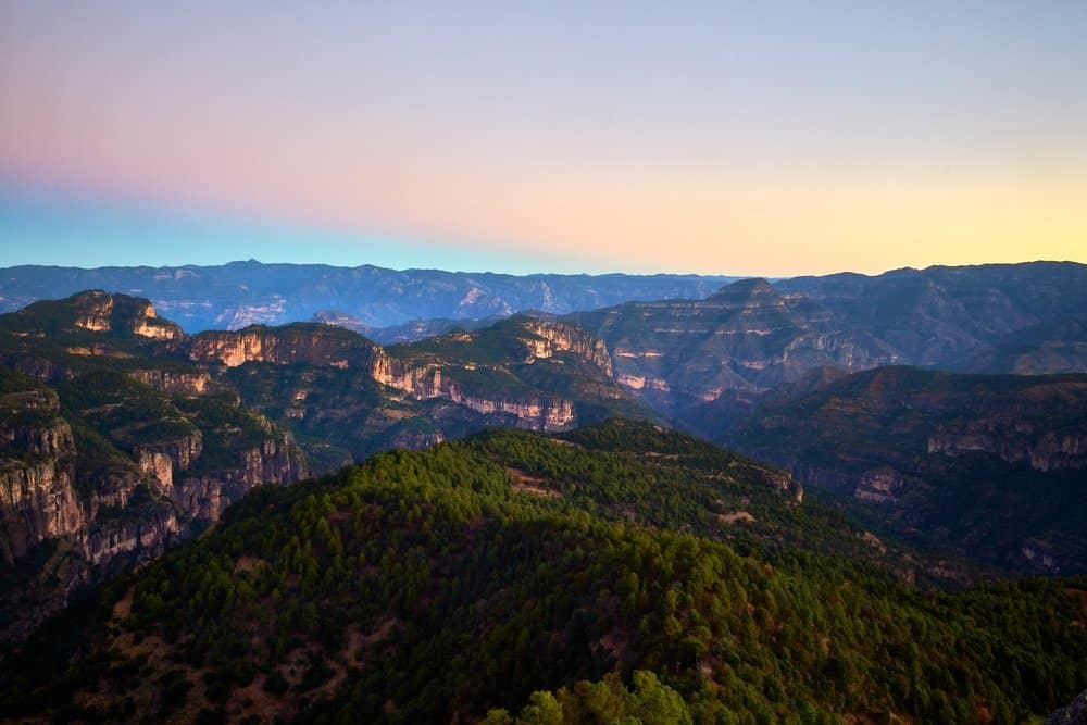
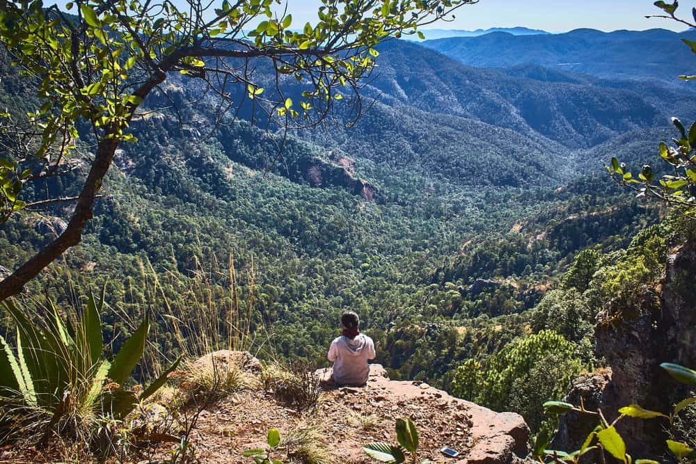
Known For: The Sierra Atravesada mountain range is a subrange of the Sierra Madre mountains. This stretch of the Sierras runs through lush dense tropical forest in Oaxaca, Mexico. Thousands of years ago the Sierra Atravesada mountains and other subranges in the area were connected by foot trails that led through canyons and all the way up over the peaks of the mountains.
For the small indigenous communities that lived in the shelter of the mountains thriving off of the varied and plentiful plant life in the area the many species of birds and mammals who live in the forests those trails acted as a roadway. They connected the communities and formed the only way out of the region.
Now those trails are long covered over with the rich foliage and plant life that this area is famous for. But there’s still some fantastic hiking trails that you can use to get to the peaks of the mountains in the Sierra Atravesada mountains.
Cerro El Potosí
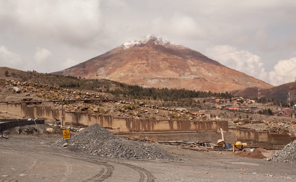
Cerro El Potosi mountain seen from a mining company.
©Christopher Ludwig/Shutterstock.com
Located in: Nuevo León
Height: 12,208 feet
Nearby City: San Luis Potosí
Known For: The Cerro El Potosi mountain is one of the few mountains in Mexico that actually gets snow in the winter. It’s the highest mountain in this part of Mexico and it dominates the landscape. When you’re at the summit of this mountain you can actually get views of five different Mexican states: Tamaulipas, Nuevo Leòn,Coahuila, Zacatecas and San Luis Potosì.
The summit is a collection of three peaks that used to be covered in pine trees. But the mountain was decimated by wild fires in the late 1990s and it’s never really recovered. Even though the summit is a little barren the views are breathtaking. There is a gravel trail that you can take to the summit but most of the rest of the mountain is a tough climb. You may need to bushwhack your way through some foliage at the base when you’re starting out.
Sierra Negra
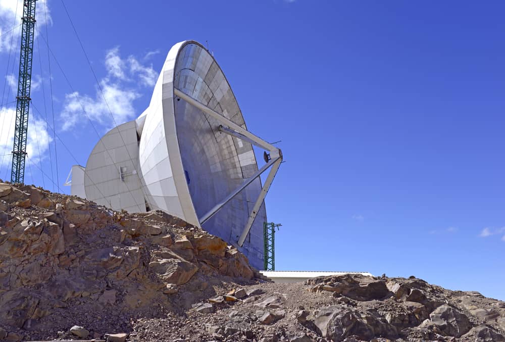
Large millimeter radio telescope on summit of Sierra Negra volcano, Mexico, located near Orizaba, Mexico’s highest peak .
©nyker/Shutterstock.com
Located in: Pico de Orizaba National Park
Height: 15,030 feet
Nearby City: Tlachichuca
Known For: One of the most interesting things about this Sierra Negra is that it’s the site of two very important world-renowned scientific pieces of equipment. Sierra Negra is the site where the Large Millimeter Telescope and the High Altitude Water Cherenkov Observator are located. These two pieces of equipment sent scientific data and astronomical data to scientists all over the world.
There are some hiking trails on the Sierra Negra but this is one of the mountains in Mexico that are not really open to the public. You can hike this mountain, but only if you apply for and are granted special permission. Usually you need to apply for a permit to hike here at least a month in advance of when you want to hike. Permission is only given if you have a legitimate reason to be on the mountain.
Cerro de la Silla
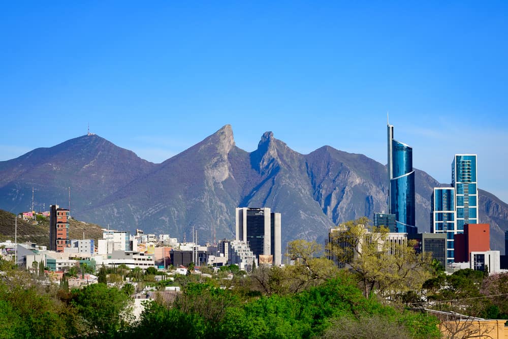
Cerro de la Silla mountain, a symbol of Monterrey city in Mexico.
©Monica Garza 73/Shutterstock.com
Located in: Sierra Madre Oriental
Height: 5,590 feet
Nearby City: Monterrey
Known For: This mountain is located within the city limits of Monterrey and it’s become a sort of unofficial symbol of the city. Technically Cerro de la Silla is a collection of four peaks, with the highest being Pico Norte. This is an extremely popular hiking and trail running destination even though you definitely need to be physical fit to get to the summit. It’s a difficult hike even though the elevation isn’t that high. There are many areas on the ascent where scrambling is necessary and there is a Level 4 scramble at the top that runs for 12 meters.
In the 1960s a tramway was built to help make the mountain more accessible and give more people the chance to see the stunning views from the top. But that was abandoned the day it of its debut, after an accident killed five people.
Today, there is almost nothing left of the tramway that was built and while there is talk of building another tramway there are no plans to do so.
10 Tallest Mountains In Mexico
- Pico de Orizaba
- Popocatépetl
- Iztaccíhuatl
- Nevado de Toluca
- Sierra Negra
- La Malinche
- Nevado de Colima
- Cofre de Perote
- Mount Tlaloc
- Volcán Tacaná
Highest Point In Mexico
Pico de Orizaba -18,406 feet
Summary of 10 Magnificent Mountains in Mexico
| Mountain | Height | Located In | |
|---|---|---|---|
| 1 | Pico de Orizaba | 18,490 feet | Veracruz |
| 2 | Popocatepetl | 17,801 feet | Ixtaccíhuatl National Park |
| 3 | Ajusco | 12,984 feet | Mexico City |
| 4 | Matlalcueitl/La Malinche | 14,635 feet | La Malinche National Park |
| 5 | Picacho del Diablo | 10,157 feet | Sierra de San Pedro Mártir National Park |
| 6 | Sierra Madre Occidental | 7,380 feet | Sierra Madre Occidental Pine-Oak Forest |
| 7 | Sierra Atravesada | 7,380 feet | Oaxaca |
| 8 | Cerro El Potosi | 12,208 feet | Nuevo León |
| 9 | Sierra Negra | 15,030 feet | Pico de Orizaba National Park |
| 10 | Cerro de la Silla | 5,590 feet | Sierra Madre Oriental |
The photo featured at the top of this post is © iStock.com/AlbertoLoyo


How to Add Us to Google News


Thank you for reading! Have some feedback for us? Contact the AZ Animals editorial team.