
Maricopa County sits in south-central Arizona, U.S. Its county seat is Phoenix, the fifth most populous city in the U.S. Despite its highest population, Maricopa County’s landscape includes epically wild forests, deep lakes, deserts, and lofty peaks. Today we will discover the epic path to the highest point in Maricopa County, how to find it, and what you can see there.
Key Points:
- Brown’s Peak is the highest peak in Maricopa County, reaching an elevation of 7,657 feet.
- It’s the tallest of the Four Peaks in Tonto National Forest.
- Brown’s Trail, which leads to the peak, is one of the most challenging hikes in Arizona. It includes a half-mile vertical scree slope crevice.

Maricopa County’s Highest Point
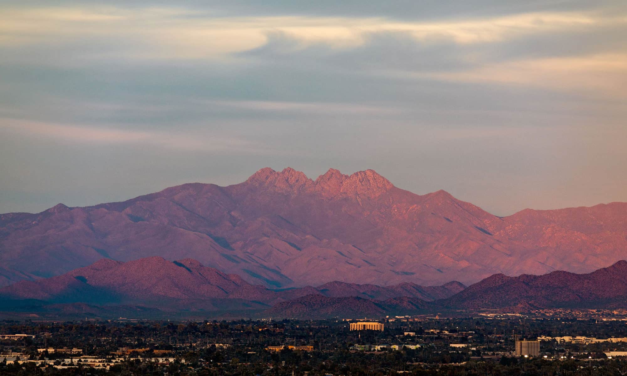
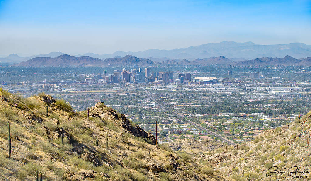
Maricopa County’s highest point is Brown’s Peak reaching a dizzying 7,657 feet. It’s the tallest of four peaks in the Four Peaks Wilderness of Tonto National Forest, about 40 miles northeast of Phoenix. The Four Peaks are so tall that most Phoenix residents view their eastern skyline peaks all year round.
Maricopa County’s Four Peaks lie approximately 40 miles northeast of Phoenix.
©Amine Abassir, CC BY-SA 4.0, via Wikimedia Commons – Original / License
The Path to Brown’s Peak
Brown’s Peak is the tallest point, so it’s natural that thrill seekers want to bag it, but it’s not a straightforward hike.
The epic path to Brown’s Peak is called Brown’s Trail. The trail is challenging; it has some of Arizona’s most difficult terrain to conquer, including a punishing class four scramble up a scree chute.
In spring, winter’s snow and ice cling on, making the trail slippery and the scree chute treacherous, but in summer, it can get very hot and exhausting. No water sources spring up near the trail, and the surrounding wilderness is prone to wildlife. The trail is closed annually due to wildfires, so it’s best to check this website before heading out. Summer’s heat bakes the trail, but the temperature is a good 10 degrees cooler at the peak’s summit.
Brown’s Peak requires dedication, even to reach the trailhead. It’s approximately 20 miles of bumpy dirt road to the trailhead, traversing mountain terrain.
Once you’re parked up at Trail #133, it’s time to hike. Depending on the time of year, you will need hiking boots and plenty of water, sunscreen, or warm layers.
This epic trail starts out gently on a two-mile groomed and well-marked pathway with some elevation. Forest blocks the view, and you’ll spot many trees destroyed by wildfire. Once you reach the treeline, some really beautiful views open up to display Roosevelt Lake, Brown’s Peak, and its upcoming infamous scree chute crevice!
The Infamous Scree Chute Crevice
The crevice looks daunting from the trail below. It’s half a mile of vertical class four scrambling, but sure feet, hands, and lots of patience ease you up and over its loose rocks and large boulders.
Over the chute’s top is a long drop onto a ledge. It’s hard work, but at the top, if it’s a clear day, Humphrey’s Peak in Flagstaff, the highest point in Arizona, Camelback Mountain, and Piestewa Peak are visible.
Previous hikers suggest leaving dogs at home unless they’re seasoned hikers and don’t mind being lifted up the vertical sections with rope on a harness (you will have to take the rope and harness as there are no facilities on Brown’s Trail).
Seasoned scramblers say this scree chute is fun, but newbies unused to climbing with their hands may struggle. Hikers recommend leaving a gap between each climber in case of a falling rock.
The infamous scree chute spends most of its year in the shade, so the boulders feel cold, and there’s often snow, even in spring. Gloves really are essential to keep your fingers supple and avoid cuts from loose rock. Sharp cacti also litter the crevices.
Once you’ve had your fill of the epic view, it’s time to descend back down the scree chute. It’s just as difficult going down and potentially more treacherous due to loose rock. Take your time.
What Is the Scree Chute at Brown’s Peak?
This 0.5-mile epic scree chute cuts through the mountain rock and opens onto Brown’s Peak. It’s littered with loose rocks, steep and challenging to traverse in both directions.
However, hikers determined to bag Brown’s Peak must tackle this epic chute. It’s the only safe way up without wandering into the forests.
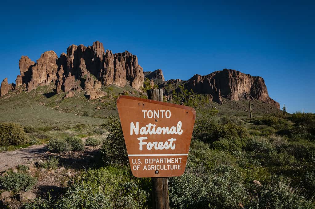
Brown’s Peak is the highest point in the Tonto National Forest.
©iStock.com/Gooda Photography
Is Brown’s Peak Really the Highest Point?
Yes, Brown’s Peak is the highest of the four peaks in Maricopa County at 7,659 feet tall, but only just slightly. For comparison, the second tallest peak in Maricopa County is its neighbor North Peak, which is 7,644 feet.
Where Is Brown’s Peak Located on a Map?
Browns Peak is in Four Peak Wilderness, Tonto National Forest, Arizona, about 60 miles northeast of Phoenix. Its coordinates are latitude 33.6783 and longitude -111.5028.
Can You Drive to Brown’s Peak?
It’s possible to drive to the trailhead of Brown’s Peak and tackle the epic path to Maricopa County’s highest point. It’s a tough drive, and most folks recommend a 4×4. Here’s how to find it.
Leave Phoenix on Highway 87 and then take Forest Service Road 143. This road turns into Lone Pine Trail for a while, but next up is a right turn hairpin bend onto Pigeon Spring Road. Pigeon Spring Road ends in the trailhead’s car park. The road is 20 miles and bumpy. High clearance is required. It may take up to two hours to reach the parking lot.
A longer but smoother way in is via Roosevelt Lake. Take Highway 188 on the Western Lakeshore and turn into El Oso Road. El Oso Road is an easier dirt track that takes you to Pigeon Spring Road, but it’s still rough with some tight bends.
What Is There to Do at Brown’s Peak?
The Four Peaks and Brown’s Trail don’t offer facilities. There’s no food or bathroom at the top! Admire the view, take photos, eat your packed lunch, and descend before dark.
However, you could wild camp. It’s remote, so you’ll need to take everything with you, but there are beautiful spots on the lower trail surrounded by trees, silence, and solitude.
Brown’s Peak and Brown’s Trail offer up some really fascinating geology. The Four Peaks are sandstones and shaly sandstone metamorphosed into impure granites. Impure granites are hard and weather resistant.
Native Americans used amethysts to make arrowheads from this mountain range, and in 1925 a mine opened that still produces beautiful crystals used for jewelry. It’s so remote that workers (and mined amethysts) arrive and leave by helicopter.
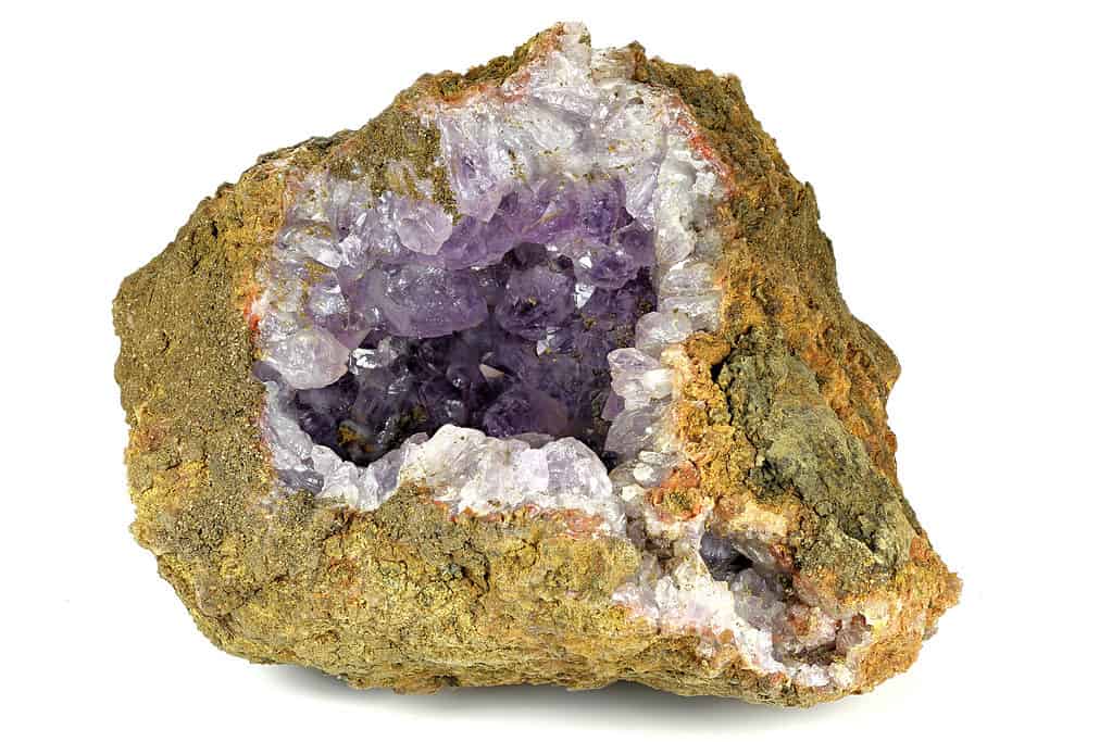
A remote amethyst mine lies in Tonto National Park, near Brown’s Peak.
©Bjoern Wylezich/Shutterstock.com
What Animals Live Near Maricopa County’s Highest Point?
Brown’s Trail is situated in Wilderness Forest, which is part of the three million-acre Tonto National Forest. It’s home to some incredible animals, including the following:
- Black bears
- Skunks
- Coyotes
- Mountain lions
- White-tailed deer
- Bald eagles
- Gila monsters
- Wild horses
- Rattlesnakes
- Scorpions
- Mexican spotted owls
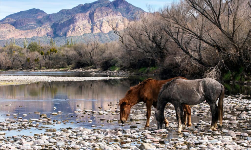
Wild horses are just one of the incredible animals living near Brown’s Trail in Maricopa County.
©Brent Coulter/Shutterstock.com
Discover the Highest Point in Arizona
Maricopa County is in south-central Arizona, but Brown’s Peak isn’t Arizona’s tallest point. That honor belongs to Humphreys Peak, one of three peaks on the San Francisco Mountain in Flagstaff. It’s a stratovolcano that reaches 12,633 feet.
Maricopa County’s Five Highest Points
Maricopa County is home to some vertical lifts! Its five highest points all smash through the 7,000 feet mark:
- Four Peaks – Browns Peak 7,657 feet
- Four Peaks – North Middle 7,642 feet
- Four Peaks – South Middle 7,572 feet
- Four Peaks – South 7,524 feet
- Mount Ord 7,128 feet
Scramble the Epic Path to Maricopa County’s Highest Point
Brown’s Peak is a 7,657-foot tall mountain in Maricopa County, Arizona. It offers majestic views across the state, but its epic pathway is one of the most attractive aspects.
Brown’s Trail is a serious hike that requires sturdy footwear, gloves, and stamina. Hikers nervous of heights may find its half a mile of vertical skidding and slipping overwhelming, but if you like a challenge, you’ll find it here. Screen chutes of this length are uncommon, but it’s one to tick off the bucket list.


How to Add Us to Google News


Thank you for reading! Have some feedback for us? Contact the AZ Animals editorial team.