
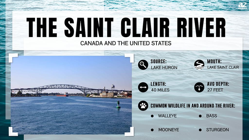
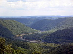
The St. Clair River, also known as Rivière Sainte-Claire in French, is a major waterway in central North America. It flows from the border between Canada (Ontario) and the United States (Michigan). The river is important for navigation as it connects the upper and lower Great Lakes and allows cargo vessels to travel through the Great Lakes Waterway. So, how deep is Michigan’s St. Clair River? Let’s explore and also reveal the history of the area.
The St. Clair River provides a narrow passage between two larger bodies of water, which makes it a strait.
©iStock.com/William Reagan
The River as a Strait
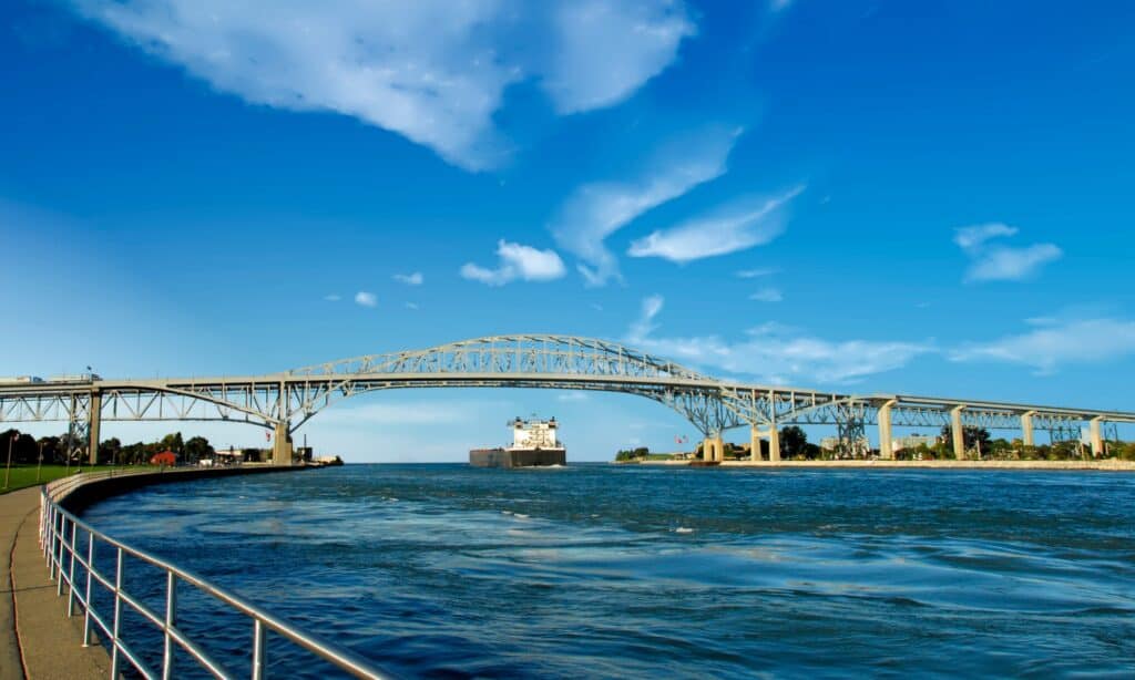
The St. Clair River resembles a strait as it meanders in a southerly direction, establishing a connection between the southern tip of Lake Huron and the northern expanse of Lake St. Clair. At the mouth of the river, the convergence of multiple channels gives rise to an extensive delta recognized as the St. Clair Flats. This watercourse serves as a narrow passage, facilitating the linkage between two larger bodies of water, which explains its occasional reference as a strait.
St. Clair River in Michigan is 40.5 miles.
©Thomas Barrat/Shutterstock.com
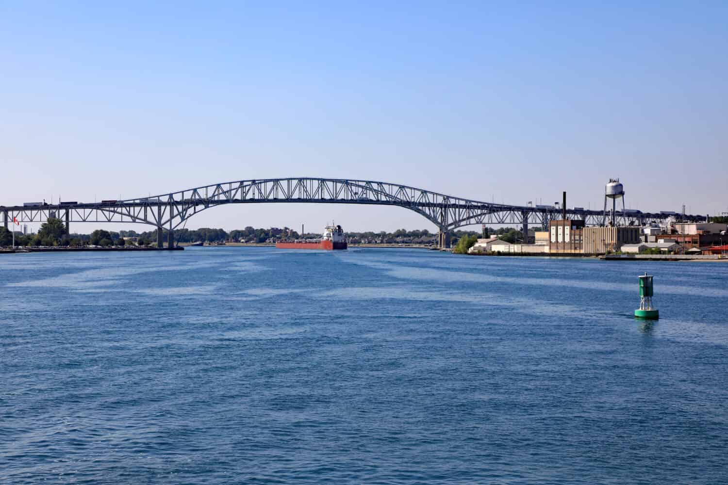
Key Features
Just how deep is Michigan’s St. Clair River? It spans 40.5 miles, featuring a gradual decline in elevation of 5 feet as it flows from Lake Huron to Lake St. Clair. With an average flow rate of approximately 182,000 cubic feet per second, it encompasses a drainage area of 223,600 square miles. This includes the combined drainage areas of Lake Michigan, Superior, and Huron. This section of the river has powerful currents.
Where is The St. Clair River Located on a Map?
The St. Clair River is located in the Southeast region of Michigan, running along the eastern side of the Lower Peninsula. It is a large river that serves as the natural boundary between Michigan and Ontario, Canada. The river measures 202 miles in length, and its watershed covers 8,700 square miles.
Historical Significance
During the 18th century, the river was a crucial trade route for French voyageurs and coureurs des bois. These intrepid explorers engaged in trade with local Native American tribes, utilizing canoes to transport furs to significant trading posts, including Fort Detroit, under the oversight of both French and British traders. The demand for American furs, particularly the prized beaver pelts, remained robust until the 1830s.
As the mid-19th century unfolded and beyond, wooden vessels constructed in Port Huron and Marine City in Michigan facilitated the migration of settlers up the river and further westward through the upper Great Lakes. These enterprising individuals embarked on a transformative journey to establish new homes in the vast expanse of the American West. Also, lumber harvested from The Thumb of Michigan went downstream as log rafts destined for Detroit, which underwent essential processing before being exported to various destinations.
Commercial Importance in the 20th Century
During the early 20th century, steamships played a vital role in the transportation network of the St. Clair and Detroit rivers and across the vast expanse of the Great Lakes. They served as crucial modes of transportation for passengers, facilitating connectivity among small towns along their routes. Over time, steel-hulled lake freighters gained prominence, becoming the primary vessels navigating the expansive waters of the Great Lakes. These robust ships were responsible for transporting diverse commodities, including valuable resources like iron ore from the Mesabi Range, copper, and grain. The iron ore shipments found their way to industrial cities such as Ashtabula, Ohio, where processing and steel manufacturing occurred. Grain shipments, on the other hand, often reached major eastern markets like Cleveland and New York City.
The St. Clair River system has many ecological purposes.
©James W. Thompson/Shutterstock.com
Ecological Significance
The St. Clair River and its associated tributaries in Lambton County, Ontario, contribute approximately 103,210 acres to the watershed. Please note that this estimation excludes the Sydenham River watershed. In Michigan, the counties of Lapeer, Macomb, Sanilac, and St. Clair are home to the Black, Pine, and Belle River, which collectively drain an area spanning 780,600 acres. The river and surrounding areas are crucial in providing habitat for migratory waterfowl, fish spawning, and nurseries. It boasts expansive emergent wetlands, making it one of the most significant wetland systems in the region. The St. Clair River system serves various purposes, including navigation, municipal and industrial waste disposal, recreational boating, fishing, and waterfowl hunting.
Depth of the River
The river that runs in a southern direction, eventually flowing into Lake Saint Clair, serves as the outlet for Lake Huron and forms a portion of the boundary between Michigan in the United States and Ontario in Canada. Spanning 39 miles, the river experiences a drop of 5.7 feet and discharges through a delta with seven mouths, characterized by its silty composition. The South Channel, with a minimum depth of 27 feet, is specifically utilized by deep-drafted vessels.
What to do on the St. Clair River?
The St. Clair River is a popular destination that offers a diverse array of activities for both locals and tourists. It’s a fantastic place to relax, enjoy scenic beauty, or engage in more active pursuits. Here are some activities you can do on the St. Clair River:
Boating
The river’s current is mild, which makes for a relaxing and enjoyable boating experience. Whether you own a speedboat or a leisurely pontoon, the river provides a fantastic opportunity to navigate its waters.
Fishing
Fishing is another popular activity on the St. Clair River. The river’s clean, clear water provides an excellent habitat for fish, contributing to a healthy and diverse fish population.
Water Sports
Water sports enthusiasts can enjoy various activities on the crystal-clear waters of the St. Clair River. From jet-skiing to paddle boarding, there are plenty of activities to enjoy on the river.
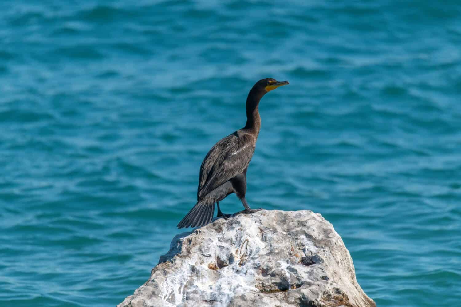
Wildlife Viewing
The St. Clair River’s pristine waters and surrounding environment provide a habitat for various wildlife. Birdwatchers can look forward to spotting several bird species, while those interested in aquatic life can keep an eye out for the river’s various inhabitants.
While this list covers several activities, it’s by no means exhaustive. The St. Clair River offers much more, with opportunities to enjoy the river’s beauty and recreational offerings extending as far as your interests take you. Whether you’re an adrenaline junkie looking for your next thrill or someone who enjoys the peace and tranquility of nature, the St. Clair River has something for you.
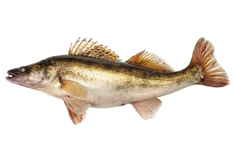
Walleye is a popular fish species in the St. Clair River.
©GSDesign/Shutterstock.com
Popular Fish Species in St. Clair River
Walleye (Sander vitreus)
Walleye, a sport fish widely sought after, is renowned for its exquisite flavor. They are named for their unique eyes, adapted for seeing in low light conditions, making them excellent night and dawn/dusk feeders. Walleye prefer cooler waters and are often found in deeper areas during the day. When available, they feed on other fish, insects, and even small mammals or birds. They can grow quite large, with some individuals reaching over 30 inches. Walleye typically spawn in the spring in rocky or gravelly areas.
Perch (Perca flavescens)
Often referred to as Yellow Perch, small to medium-sized fish are often found in schools. They are popular with anglers, particularly through the ice in the winter. Perch have a varied diet, including small fish, insects, and crustaceans. They prefer clear, cool waters with moderate vegetation. Perch usually breed during spring, laying rows of eggs over plants or other submerged structures.
Smallmouth Bass (Micropterus dolomieu)
The popularity of smallmouth bass as a sport fish is because of their fighting spirit when hooked. They prefer clear, cool, shallow waters with rocky or sandy bottoms, like fallen trees or vegetation, often near a cover. Smallmouth bass are opportunistic feeders and will eat various foods, including insects, crayfish, and small fish. They are known for jumping out of the water when caught on a fishing line. Smallmouth bass usually breeds in the late spring or early summer, with males guarding the nests until the eggs hatch.
Conclusion
As you’re wondering, “Just how deep is Michigan’s St. Clair River? Remember that it has varying depths, and the South Channel is used by deep-drafted vessels. It has a rich history and ecological significance, serving as a crucial commercial waterway and home to diverse species. The challenge for ecosystem managers is balancing human use in preserving waterfowl and fish populations. Knowing the river’s depth and physical characteristics is crucial to achieving this balance and keeping this waterway intact for future generations.
The photo featured at the top of this post is © Thomas Barrat/Shutterstock.com


How to Add Us to Google News


Thank you for reading! Have some feedback for us? Contact the AZ Animals editorial team.