
The Trinity River is an important source of life in Texas, providing water to over 40% of Texans. According to Army.mil, it has an average depth of about 30 feet, but in the past, flooding has caused the depth of the Trinity River to increase significantly.
The Trinity River has four main branches: the West Fork, the Clear Fork, the Elm Fork, and the East Fork. It is the longest watershed entirely within the state of Texas with a length of 710 miles (1,140 km). The Trinity ends by flowing into Trinity Bay, which empties into the Gulf of Mexico.
History of the Trinity River
The Trinity River was a source of life for Native American tribes long before the settlement of the Dallas-Fort Worth area. According to Hiley Hyundai, an indigenous tribe known as the Akokisa settled villages on the lower Trinity River. This tribe carved cypress logs into dugout canoes to fish on the Trinity.
The Trinity River was given its current name in the year 1690. Though he was not the first explorer to discover the river, General Alonzo de Leon came across its banks two days before the Feast of the Most Holy Trinity. He named the river La Santisima de la Trinidad, which translates to “The Most Holy Trinity” in honor of the feast day. The name stuck.
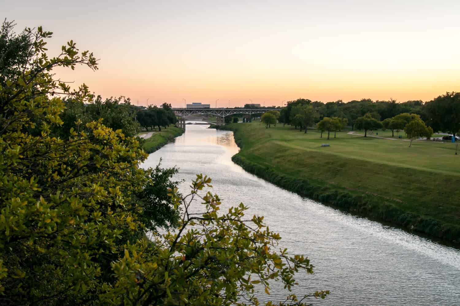
The Trinity River is the longest watershed entirely in Texas.
©Megan McHatten/Shutterstock.com
In 1843, Fort Worth was established at the junction of the West Fork and the Clear Fork of the Trinity River, as a site where white settlers and Native Americans could trade peacefully. The present-day city of Fort Worth remains in the same location.
How Deep is The Trinity River?
The Trinity River is super important to the ecosystem in Texas, serving as a crucial lifeline by supplying water to more than 40% of the state’s population. The river has an average depth of about 30 feet. However, in the past, flooding events have led to a significant increase in the river’s depth, impacting its flow and surroundings.
Flooding of the River
Flooding on the Trinity River has been an issue since the establishment of Fort Worth. In 1908, one of the worst floods occurred. In May of that year, heavy rainfall caused the Trinity River to reach a depth of 52.6 feet, according to The Advocate Magazine. The river flooded, resulting in five deaths, thousands of people left homeless, and $2.5 million worth of destruction.
Years later, Fort Worth adopted the “Kessler Plan,” in an attempt to avoid these terrible consequences. The plan involved building levees, street improvements, and rail facilities. Still, major floods have occurred in more recent years. Downtown Dallas suffered severe flooding from the Trinity River in 1990, causing about $30 million in damages. In the 20th century, minor incidents of flooding have also happened.
Ecology of the Trinity River
In 1994, the Trinity River National Wildlife Refuge was created to protect a remnant of the bottomland hardwood forest found along the Trinity River. The refuge is home to wildlife such as white-tailed deer, American alligators, and alligator snapping turtles.
Bird watchers may encounter American bald eagles, Swainson’s warbler, or even a swallow-tailed kite overhead. A variety of fish also make their home in the Trinity River. The river’s diverse fish population includes catfish, crappie, bluegill, redbreast, and redear sunfish. Alligator gar has even been spotted in the waters of the Trinity.
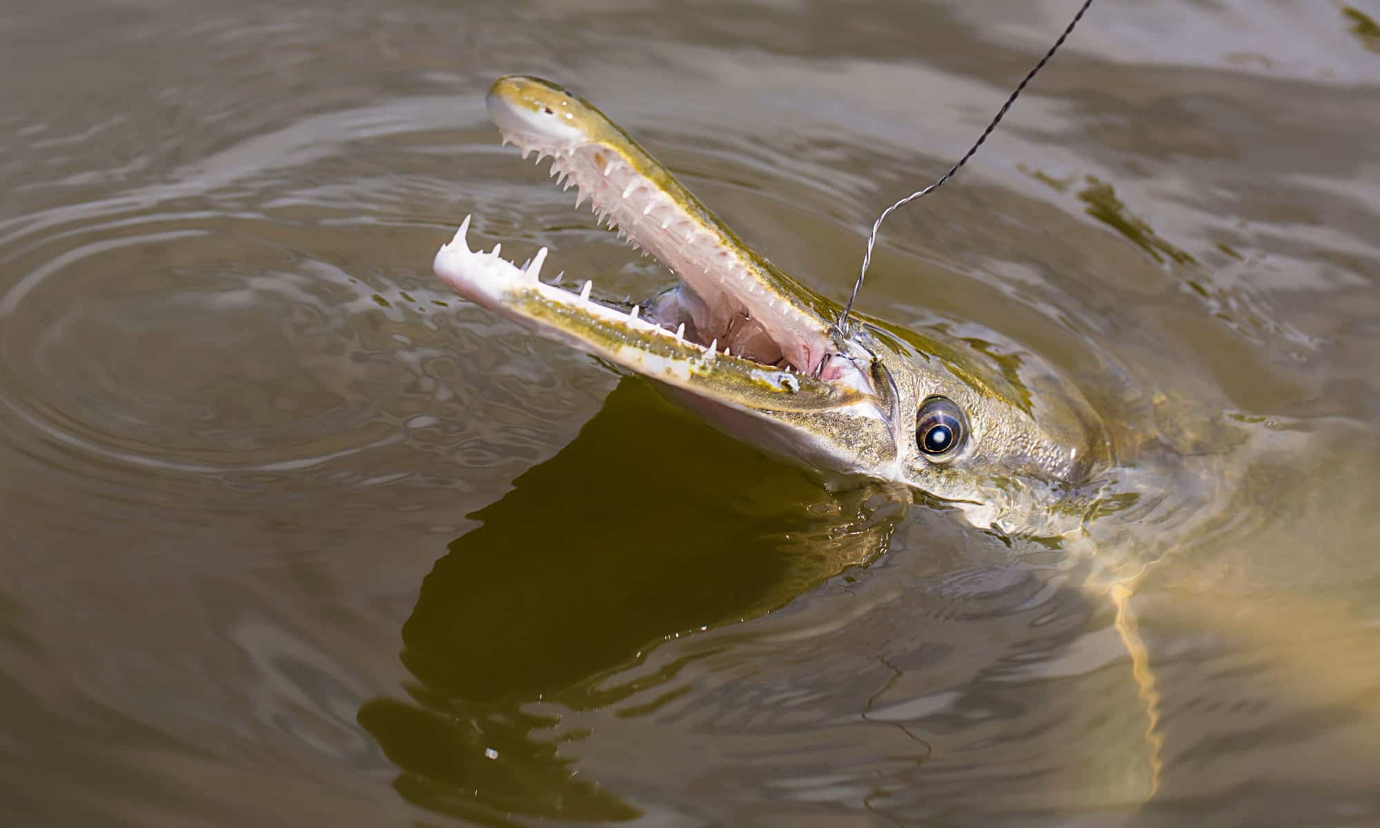
Visitors may find alligator gar in the Trinity River.
©Jennifer White Maxwell/Shutterstock.com
What to Do on the Trinity River
There are plenty of activities and attractions to explore along the Trinity River. The Trinity River Audobon Center teaches visitors about the diverse plant species and wildlife that make their homes near the river’s banks.
A plethora of trails exist for hikers and cyclists. The Trinity Skyline Trail is a four-mile trail ideal for hiking and biking, while the shorter Santa Fe trail offers visitors a stunning view of the river, wildlife, and forest along the way. Within the Great Trinity Forest, visitors will find the Texas Horse Park, a facility that offers horseback riding and family events.
For those seeking a different path, California Crossing Boat Launch is the place to be. The park includes public access to launch kayaks and canoes into the Trinity River. Interestingly, the Trinity River is safe to swim in Fort Worth, but not Dallas. With its diversity of wildlife, there are also plenty of great spots to fish or birdwatch near and along the Trinity River
Where Is the Trinity River Located on a Map?
The Trinity River is located entirely in Texas. The West Fork Trinity River has its headwaters in Archer County. It joins with the Clear Fork Trinity River near downtown Fort Worth. The Elm Fork Trinity River joins these two as they enter the city of Dallas. Finally, the East Fork Trinity River joins the Trinity just southeast of Dallas. The river flows for 710 miles and eventually empties into Trinity Bay.
Here is Trinity River on a map:
The photo featured at the top of this post is © Karen P Stilwell/Shutterstock.com


How to Add Us to Google News


Thank you for reading! Have some feedback for us? Contact the AZ Animals editorial team.