

Have you visited “Wild, Wonderful, West Virginia“? This Appalachian state is the 10th-smallest state by area and the 12th-least populous state in the United States. West Virginia is the only state in the nation that is contained entirely within the Appalachian Mountain range. The state is famous for a variety of things, including Monongahela National Forest, Brad Paisley, and the New River Gorge Bridge. It is also the only state in the entire Union to have achieved statehood by proclamation of the President of the United States.
Today, we’ll be looking at how tall the state is. We’ll imagine a trip from the furthest northern reaches all the way to the southern border, estimate travel distances, and compare the height of the state to other states in the country. So, how tall is West Virginia? Let’s find out.
How Tall Is West Virginia?
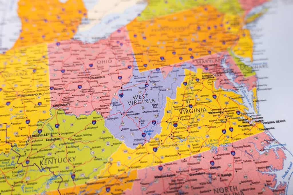
West Virginia is bordered by Virginia, Kentucky, Ohio, Maryland, and Pennsylvania
©Artyom Lezhnyuk/Shutterstock.com
From north to south, West Virginia spans about 130 miles on average. The extreme north-to-south distance of the state is 237 miles. This is in comparison to its width, which is 240 miles and reaches a maximum of 266 miles. The total area of the state is 24,231 square miles, and this is contained within a 1,170-mile boundary. Let’s take a look at the longest north-to-south trip we can take using the help of an interactive map. We will begin our journey in Chester, West Virginia, which is a city along the Ohio River on the border of Ohio and West Virginia. This is the northernmost city in the state. We will make our way south to War, West Virginia, the southernmost city in West Virginia.
As you can see, this trip covers a lot more miles than even the extreme north-to-south distance of the state. That’s because there is no straight-line trip that you can make from the north end of the state to the south end of it. Now, let’s see how this stacks up against other states.
West Virginia vs. Other States
We’re going to use a table to compare West Virginia to other states. There are a number of reasons to make this comparison, but it especially helps us to understand the size of places. We have included West Virginia in this table in bold and used its extreme north-to-south distance. We have also included the largest and smallest states in the nation to get a larger perspective.
| State | Height (North-to-South Distance) |
|---|---|
| Virginia | 200 miles |
| Colorado | 280 miles |
| Wisconsin | 311 miles |
| Rhode Island | 48 miles |
| West Virginia | 237 miles |
| Alaska | 1,420 miles |
| Arizona | 390 miles |
| Michigan | 350 miles |
| Iowa | 199 miles |
More Photos of West Virginia

Aerial drone panoramic shot of the downtown campus of WVU in Morgantown West Virginia showing the river in the distance.
©BackyardProduction/iStock via Getty Images

View of Harpers Ferry, West Virginia at sunset from Maryland Heights.
©Jon Bilous/iStock via Getty Images

Charleston, West Virginia.
©Sean Pavone/Shutterstock.com


How to Add Us to Google News


Thank you for reading! Have some feedback for us? Contact the AZ Animals editorial team.