
In terms of total area, Michigan is the largest state east of the Mississippi River and the eleventh-largest U.S. state overall. Here is a look at the dimensions of this big Midwestern state from north to south.
How Tall Is Michigan?
Michigan is the only state that consists entirely of two peninsulas. The state’s unique shape is outlined mainly by the Great Lakes. Michigan’s irregular footprint means the total distance from north to south can vary, depending on the starting and ending points,
For example, the furthest distance in Michigan when drawing a straight line north-to-south is 350 miles (536 kilometers). That measurement is taken from Whitefish Point in the Upper Peninsula to the convergence of Michigan, Ohio, and Indiana at the very southern point of Lower Michigan. This is not illustrative of Michigan’s complete footprint, though.
It is 456 miles (734 kilometers) from the most northwestern point of the Upper Peninsula to Lower Michigan’s most southeasterly location. Note that this measurement is taken “as the crow flies” and crosses over Wisconsin and the entirety of Lake Michigan. Those same two points are separated by 665 highway miles. The drive would take nearly ten and a half hours, and you would never leave Michigan at any point during the entire route, reinforcing just how big the Wolverine State really is.
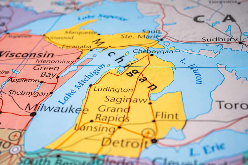
The two peninsulas make it tricky to calculate the precise north-to-south distance of Michigan.
©Alexander Lukatskiy/Shutterstock.com
North-To-South Distances in the Peninsulas
At its tallest point, the Upper Peninsula measures approximately 160 miles (257 kilometers). That measurement runs from just east of Copper Harbor in the north to the Menominee River in the south.
Lower Michigan (also known as the Mitten due to its mitten-like appearance on a map) measures nearly 280 miles (451 kilometers) at its furthest north-to-south points, which are Mackinaw City in the north and the tri-state junction of Michigan, Ohio, and Indiana in the south.
The “thumb” of the Mitten in eastern Michigan measures about 115 miles (185 kilometers) from Point Aux Barques Township in the north to Detroit in the south. It is known as the “thumb” due to the shape created by the peninsula as it meets Lake Huron.
Total Area
The total area of Michigan covers over 97,000 square miles. Land only accounts for 58,110 square miles of that total area. If Michigan was measured strictly by land area, it would drop to the 22nd largest state. The reason it rises to the eleventh-largest is due to all of its water territory.
Approximately 38,575 square miles of Michigan’s total area is covered by the waters of the Great Lakes. The remaining 1,305 square miles of the state’s territory lies in inland waters. The Wolverine State has the second-highest square mileage of territorial inland waters in the U.S., trailing only Alaska. There are 10,083 lakes in Michigan with areas of five acres or more. No point in Michigan is more than six miles from one of the state’s inland lakes. There is also no point in Michigan more than 85 miles from one of the Great Lakes.
The Upper Peninsula, often known simply as the U.P., accounts for about 16,500 of the state’s 58,110 square miles of land. The U.P. alone is bigger than the smallest nine U.S. states. It outsizes Maryland, Hawaii, Massachusetts, Vermont, New Hampshire, New Jersey, Connecticut, Delaware, and Rhode Island. In fact, Michigan’s Upper Peninsula is larger than the latter three states combined.
Lower Michigan, also known as the Lower Peninsula, expands to well over 41,000 square miles of land. Lower Michigan alone is larger than the smallest fourteen U.S. states. Including the ones listed earlier, the Lower Peninsula is also larger than Kentucky, Indiana, Maine, South Carolina, and West Virginia.

Lake Michigan, seen here from the town of Holland, is one of four Great Lakes to border Michigan.
©iStock.com/christiannafzger
Other Michigan Geography Facts
The geographic center of Michigan is in Wexford County, five miles north-northwest of Cadillac.
There are 3,288 miles of Great Lakes shoreline in Michigan. It borders four of the Great Lakes, more than any other state. Lake Ontario is the only Great Lake that doesn’t border Michigan.
Detroit is 391 miles from Washington, D.C. That is a shorter distance from Detroit to the small town of Houghton in Michigan’s Upper Peninsula. Those two points inside the Wolverine State are separated by 425 miles.
Michigan shares land borders with Wisconsin in the northwest and Indiana and Ohio in the south. It shares a maritime border in the Great Lakes with Minnesota, Illinois, and the province of Ontario in Canada.
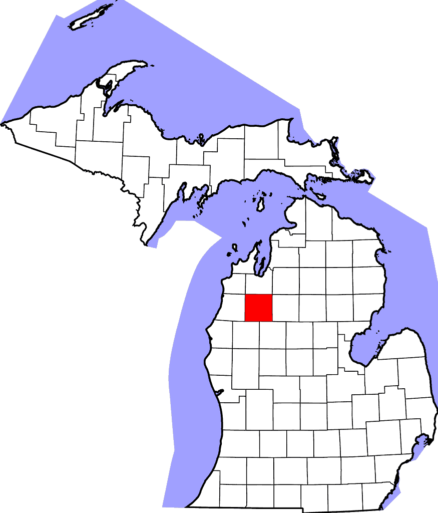
The geographic center of Michigan is in Wexford County.
©David Benbennick / Public domain – License
The photo featured at the top of this post is © Vladimir Molnar/ via Getty Images


How to Add Us to Google News


Thank you for reading! Have some feedback for us? Contact the AZ Animals editorial team.