
The division between North Korea (Democratic People’s Republic of Korea, DPRK) and South Korea (Republic of Korea, ROK) is one of the most significant geopolitical fissures in East Asia. The two countries have remained in a state of armistice since the Korean War (1950-1953). The Korean Demilitarized Zone (DMZ) separates the two nations. The DMZ is the heavily fortified and heavily guarded border that serves as a buffer zone between the two countries. It is 160 miles (250 km) in length and 2.5 miles (4 km) wide. Cross-border communication and contact are extremely limited due to political tensions and ideological differences. In fact, the only thing that is allowed to move freely between these two countries is the water in their rivers, or gangs. “Gang” is the Korean word for river. So, come along as we set sail on a journey of discovery, sailing down the rivers of Korea.
Rivers in South Korea: Nakdonggang
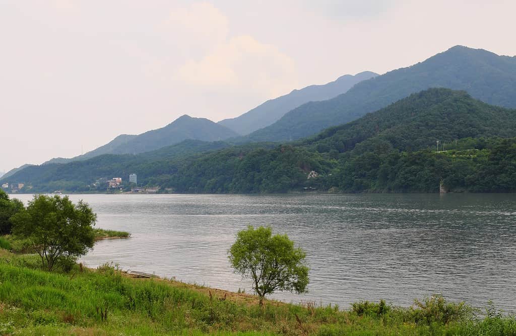
The Nakdong River is a major river in South Korea. It is the longest river in the country, stretching approximately 326 miles (525 km). The river flows through multiple provinces and cities, including North Gyeongsang, South Gyeongsang, and Busan.
The Nakdong River has great historical and cultural significance in South Korea. It has played a crucial role in the development of civilization in the region, as evidenced by the presence of ancient archaeological sites along its banks. The river has served as a lifeline for agriculture, transportation, and trade throughout history. The headwaters of the Nakdong are in the Taebaek Mountain Range in the central part of South Korea. The river flows southward, eventually reaching the South Sea, or Korea Strait near the city of Busan. Along its course, the Nakdong River is fed by numerous tributaries, including the Nam River and the Seomjin River.
The Nakdong River basin is known for its fertile plains and farmlands. The region’s agriculture relies heavily on the river’s water supply for irrigation for the cultivation of rice, fruits, and vegetables. The river also supports habitats for various freshwater fish species.
In addition to its agricultural importance, the Nakdong River serves as a crucial transportation route. Historically, it facilitated trade and transportation of goods between inland regions and coastal areas. However, with the development of modern transportation infrastructure, its role as a primary transportation route has diminished.
The river and its surrounding areas also offer recreational opportunities. There are several parks, promenades, and biking trails along the riverbanks, providing spaces for leisure activities, picnics, and sports. The Nakdong River is particularly popular for its scenic beauty, especially during the cherry blossom season in spring.
The Nakgonggang is the longest river in the country, stretching approximately 326 miles (525 kilometers).
©Daniel7_Kim/Shutterstock.com
Rivers in South Korea: Hangang
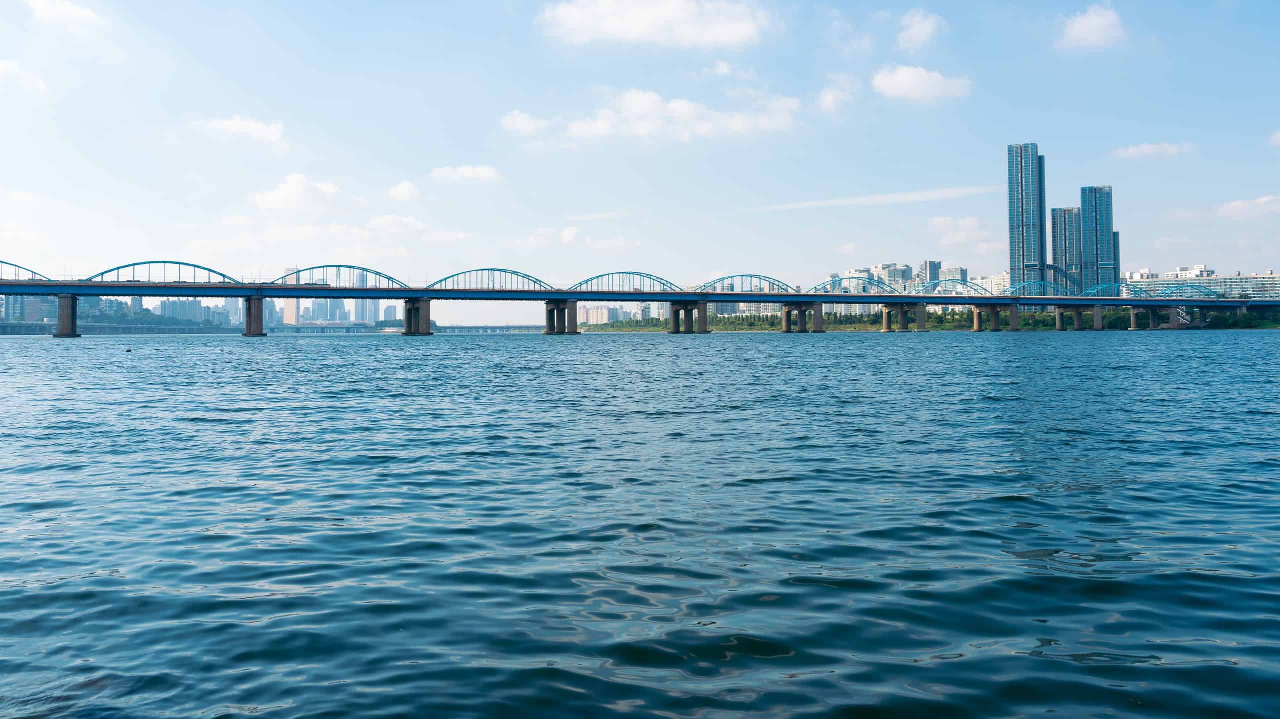
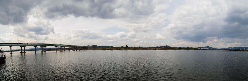
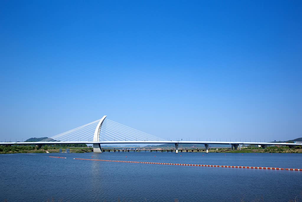
The Han River, or Hangang, flows for 319 miles (514 km), making it the fourth longest river on the Korean Peninsula. It flows through the central part of the country, originating from the Taebaek Mountains in Gangwon Province and flowing westward before reaching the Yellow Sea.
The river basin covers a substantial area, including Seoul and its surrounding regions. The Han River has played a vital role in shaping the development and growth of Seoul. The river is a hub for transportation, commerce, and recreation.
Numerous bridges span the Han River, connecting Northern and Southern Seoul. These bridges are not only essential for transportation but have also become iconic landmarks. The Han River, or Hangang, is known for its iconic Banpo Bridge.
The Banpo Bridge is a major landmark that spans the Han River, connecting the districts of Seocho and Yongsan in Seoul. What makes it distinctive is the Moonlight Rainbow Fountain. The fountain offers a mesmerizing display of water and lights, creating a beautiful spectacle. It is the world’s longest bridge fountain.
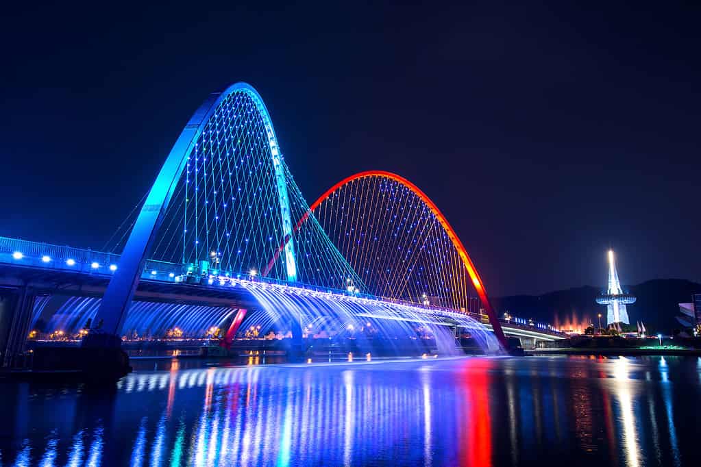
The Banpo Bridge is a major landmark that spans the Han River, connecting the districts of Seocho and Yongsan in Seoul.
©Guitar photographer/Shutterstock.com
Han River Renaissance
The Han River serves as a popular recreational destination. The riverbanks are lined with parks, cycling paths, and walking trails. There is ample space for picnicking, jogging, cycling, and fishing. The parks along the river also host cultural events, festivals, and concerts. The Han River holds cultural significance in Korean literature, poetry, and art. It has been a source of inspiration for many artists, writers, and musicians. The river’s tranquil beauty, especially during sunrise and sunset, has been a recurring theme in Korean art and literature.
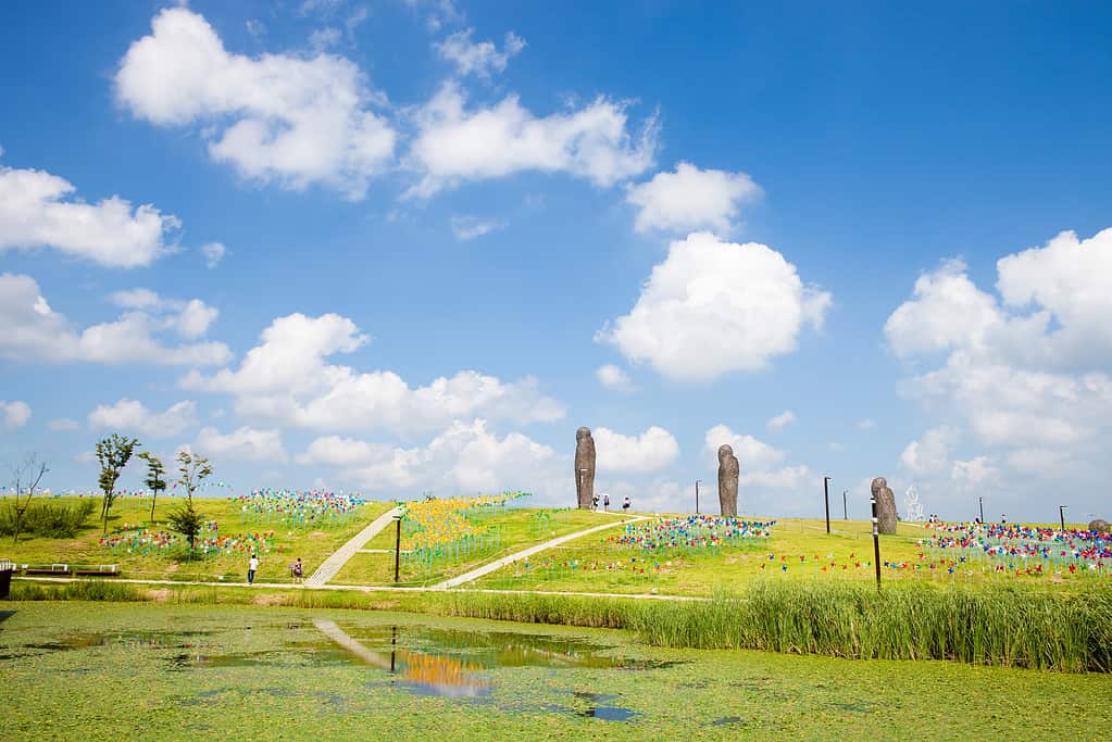
The Han River also plays a crucial role in providing water to over eight million South Koreans in Seoul and the surrounding area. The river’s waters also support irrigation for agricultural crops in the surrounding areas. In recent years, there has been a focus on revitalizing the Han River and its surroundings.
The Han River Renaissance Project’s objective is to enhance the river’s ecological environment, improve water quality, and create more recreational spaces for people to enjoy. The project has led to the development of new parks, waterfront plazas, and cultural centers along the riverbanks.
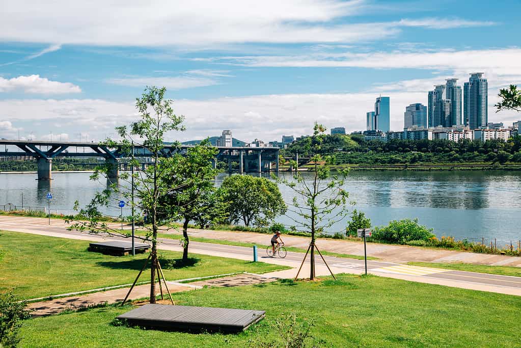
Banpo Hangang Park is a popular recreational area along the Han River.
©Sanga Park/Shutterstock.com
Rivers in South Korea: Geumgang
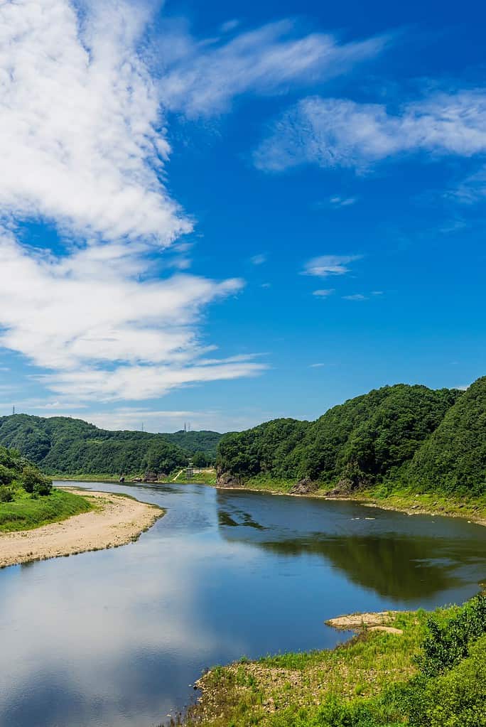
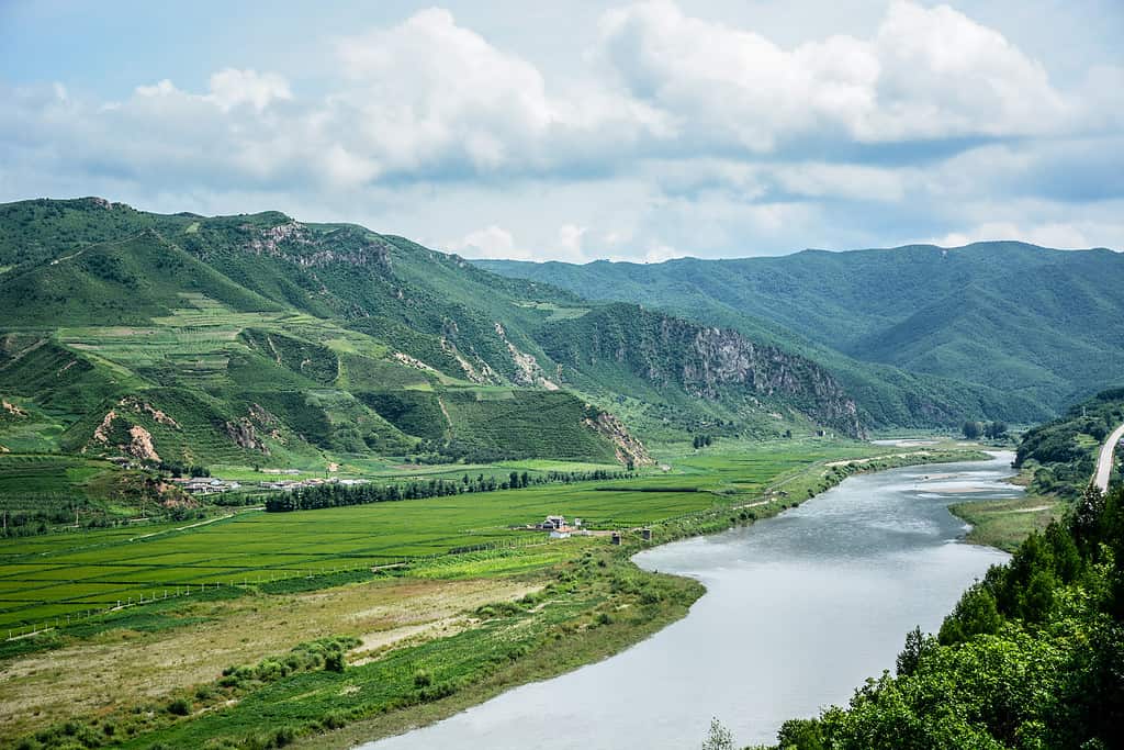
The Geum River, or Geumgang, flows through the central-western part of the country, originating from the Taebaek Mountains in Gangwon Province and running westward before emptying into the Yellow Sea near Gunsan. The Geum River is 248 miles (400 km) long, making it the fourth-longest river in South Korea.
The river and its tributaries serve as a crucial source of water for irrigation, both for agricultural purposes and industrial uses. The Geum River basin is renowned for its fertile plains, often referred to as the Geumgang Plain. This region produces rice, barley, and vegetables. The water from the Geum River is vital for the irrigation of these crops.
The Geum River is 248 miles (400 km) long, making it the fourth-longest river in South Korea.
©photo_jeongh/Shutterstock.com
Geumgang: History
The Geum River has played a role in Korean history and culture. Along its banks, there are several historical sites and cultural landmarks. Gongju and Buyeo, two ancient capital cities of the Baekje Kingdom, feature archaeological relics, tombs, and historical artifacts that reflect the region’s rich heritage.
The Geum River and its surrounding wetlands support diverse ecosystems and provide habitats for various plant and animal species. The river is known for its diverse fish population, including species like carp, catfish, and bitterling. It is also an important migratory route for birds, particularly during the spring and fall seasons.
The Geum River offers a variety of recreational opportunities. The river and its adjacent areas provide for fishing, boating, and kayaking. There are also cycling paths and walking trails along the river that offer scenic views.
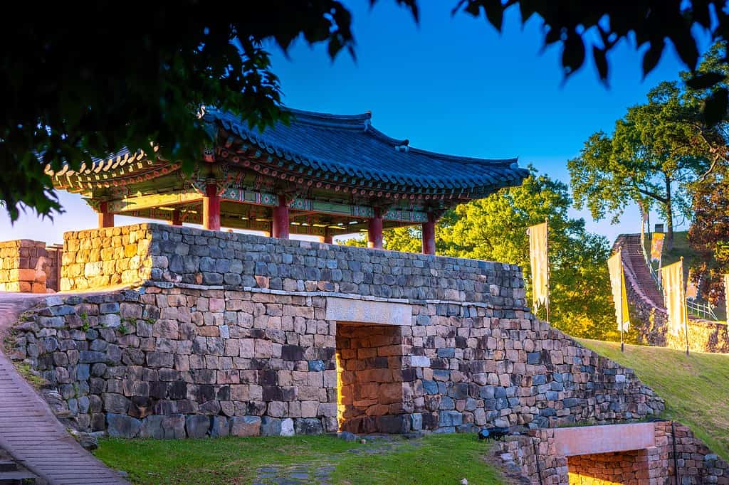
Gongju (pictured) and Buyeo, two ancient capital cities are located near the Geum River.
©Benz Photograph/Shutterstock.com
Rivers in North and South Korea: Imjingang
The Imjin River is a significant waterway that flows through both North Korea and South Korea. The Imjin River originates in North Korea’s Kangwon Province, near the border with South Korea. It flows southward, passing through North Korea’s Hwanghae Province and South Korea’s Gyeonggi Province. The river flows for 133 miles (214 km) before reaching the Yellow Sea.
The Imjin River basin is crucial for the water supply and irrigation of nearby agricultural areas. Efforts to protect and preserve the river’s ecosystems while promoting peace and cooperation remain important for the sustainable management of the Imjin River, and serve as a reminder of the complexities and challenges facing the region.
The Imjin River flows for 133 miles (214 km) before reaching the Yellow Sea.
©kdreams/Shutterstock.com
The Demilitarized Zone
The Imjin River has great historical and strategic significance due to its proximity to the Korean Demilitarized Zone (DMZ). During the Korean War, the river witnessed intense military action and served as a border between the two opposing forces. The area surrounding the river has seen numerous conflicts and tensions throughout history. The DMZ is a sensitive and heavily fortified zone.
The Imjin River and its surrounding ecosystem are important for biodiversity conservation. The river and its tributaries provide habitats for various plant and animal species, including fish, birds, and mammals. The river’s natural landscapes and wetlands contribute to the preservation of the region’s ecological balance.
The river’s scenic beauty and natural surroundings attract visitors who enjoy activities such as fishing, boating, and hiking along its banks. The Imjingak Pavilion, located near the river in South Korea, serves as a symbol of hope and peace between the two Koreas.
Like many rivers, the Imjin River faces environmental challenges, including water pollution and habitat degradation caused by industrial and agricultural activities. The ongoing political tension between North and South Korea adds complexities to the management and conservation efforts of the river and its surrounding areas.
The Imjingak Pavilion, located near the river in South Korea, serves as a symbol of hope and peace between the two Koreas.
©photo_jeongh/Shutterstock.com
Rivers in North and South Korea: Bukhangang
The headwaters of the North Han River, also known as the Bukhan River or Bukhangang, are located in North Korea near Mount Geumgang (Geumgangsan) in Kangwon Province.
The river originates from the slopes of Mount Geumgang in North Korea and then flows southward, crossing the border between North and South Korea before continuing its course through South Korea’s Gangwon Province, Gyeonggi Province, and eventually joining the South Han River near Seoul.
The North Han River holds significant geographical and cultural importance as it passes through both North and South Korea. The area surrounding the headwaters, particularly near Geumgangsan, is known for its scenic beauty.
©pro artist/Shutterstock.com
Rivers in North Korea: Tumengang
The Tumen River serves as a natural border between North Korea, China, and Russia. The Tumen River stretches for 323 miles (521 km), originating in the Changbai Mountains on the border of China and North Korea. It flows eastward, forming part of the boundary between China and North Korea before reaching the East Sea (Sea of Japan). The river basin covers an area of 16216 square miles (42,000 km²).
The Tumen River plays a vital role in providing water resources for agriculture and supporting local ecosystems. The Tumen River has economic significance for the region. It serves as a transportation route for goods, facilitating trade and commerce between China, North Korea, and Russia. The river also supports fishing activities, providing livelihoods for local communities.
The Tumen River serves as an important source of hydroelectric power generation, contributing to the energy needs of the surrounding areas. It has been a focal point for regional cooperation among China, North Korea, and Russia. The Tumen River Area Development Program’s focus is to promote economic development, enhance trade, and facilitate tourism along the river basin. The program seeks to harness the potential of the river for sustainable growth and cooperation among the participating countries.
Efforts have been made to protect and preserve the natural environment of the Tumen River and its surrounding areas. Environmental conservation initiatives focus on preserving biodiversity, restoring habitats, and addressing pollution issues. These efforts aim to maintain the ecological balance of the river and safeguard its diverse flora and fauna.
The Tumen River serves as a natural border between North Korea, China, and Russia.
©Mrmaa/Shutterstock.com
Rivers in North Korea: Taedonggang
The Taedong River is a major river in North Korea that flows through the capital city of Pyongyang.
The Taedong River has a total length of 273 miles (439 km) and flows through Western North Korea. It originates in the Rangrim Mountains and flows westward, passing through various regions before reaching West Korea Bay.
The river basin covers a significant portion of North Korea’s territory, serving as a vital water resource for agriculture, industry, and domestic use. The Taedong River flows through the capital city of Pyongyang. The river has been a subject of admiration in literature, art, and songs, symbolizing the nation’s pride and identity. The riverbanks feature iconic landmarks, including the Juche Tower, the Tower of the Juche Idea, and the Mansudae Grand Monument. These monuments reflect the country’s political ideology and cultural heritage.
The Taedong River plays a significant economic role in North Korea. It serves as a transportation route for goods, enabling trade and commerce within the country. The river’s proximity to the capital city facilitates economic activities, with factories and industrial zones established along its banks. The Taedong River is also utilized for hydropower generation, contributing to the energy needs of the region.
The Taedong River offers scenic beauty and recreational opportunities for locals and tourists. River cruises and boat rides allow visitors to enjoy panoramic views of Pyongyang’s skyline and surrounding landscapes. The riverbanks feature parks and recreational areas where people can relax, engage in water sports, or walk along the banks of the Taedong.

River cruises and boat rides on the Taedonggang allow visitors to enjoy panoramic views of Pyongyang’s skyline and surrounding landscapes.
©David Stanley from Nanaimo, Canada, CC BY 2.0 – Original / License
Rivers in North Korea: Yalugang
The Yalu River, also known as the Amrok River, is a significant river that forms part of the border between North Korea and China. It plays a crucial role in the region’s economy, culture, and history. The Yalu River flows for 490 miles (790 km) and serves as a natural boundary between North Korea and China. Its headwaters are in the Changbai Mountains in Northeastern China. The river forms the border between Jilin Province in China and North Korea’s North Pyongan Province.
The river eventually flows into Korea Bay. The Yalu River has an extensive drainage basin and plays a crucial role in water supply, irrigation, and transportation in the region. The Yalu River is vital for economic activities in the border areas. It serves as a transportation route for goods between China and North Korea, facilitating trade and commerce. The river also provides water for agricultural purposes, supporting farming and fisheries along its banks.
The Yalu River holds cultural and historical significance for both China and North Korea. It has witnessed various cultural exchanges and interactions between the two countries. The Yalu River faces environmental challenges, including pollution and habitat degradation due to industrial development. The discharge of untreated wastewater, agricultural runoff, and industrial waste has affected water quality and ecosystem health.
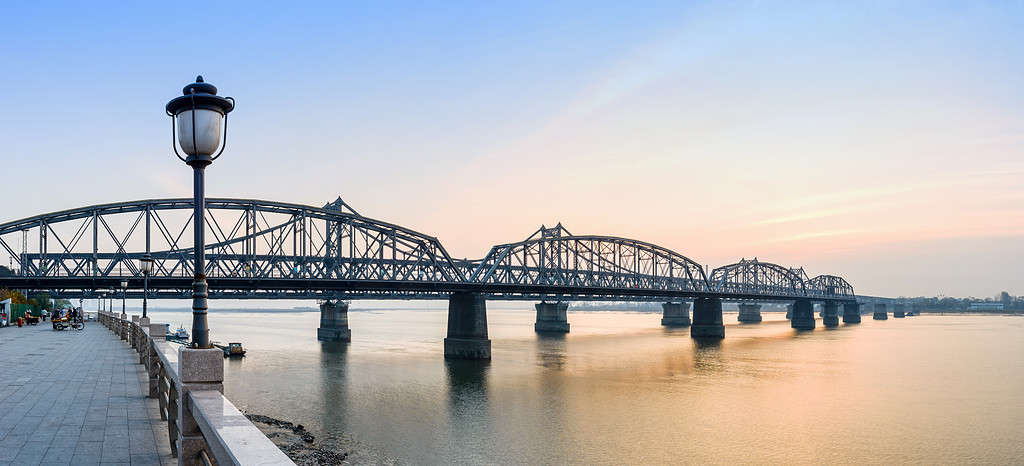
The Yalu River, also known as the Amrok River, is a significant river that forms part of the border between North Korea and China.
©aphotostory/Shutterstock.com


How to Add Us to Google News


Thank you for reading! Have some feedback for us? Contact the AZ Animals editorial team.