
Aglow with natural grandeur and drenched in southern charm, North Carolina is a delightful haven. Yet, lurking beneath the state’s beauty is an undercurrent of danger. It’s home to some of the nation’s most treacherous roads. From the mist-shrouded coastal byways to the sinuous mountain passes, navigating these roads demands an amplified degree of vigilance. Discover North Carolina’s 14 most perilous roads. Explore their inherent risks and the ongoing efforts to bolster road safety.
The Most Dangerous Roads of North Carolina
Often referred to as “The Dragon,” locals who by necessity frequent the Tail of the Dragon call it “that damn road to Tennessee.”
©Kent Weakley/Shutterstock.com
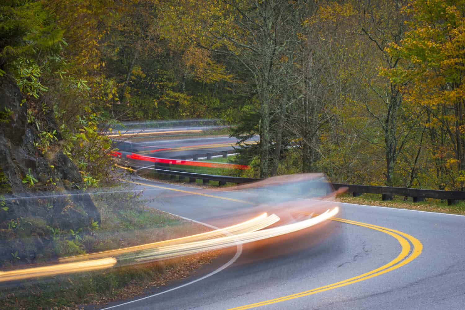
1. The Scary Drive on the Tail of the Dragon: Number 1 in the Nation
The “Tail of the Dragon,” an 11-mile stretch of US-129, is the epitome of a thrilling drive. This daunting route, starting at Deals Gap on the Tennessee/North Carolina line, is a global magnet for thrill-seekers and motorcyclists. Its 318 curves, sparse guardrails, and remote location blend to concoct a high-octane mix of adventure and danger.
Its lush forest backdrop houses occasional scenic overlooks, yet the road itself is the main attraction. Each curve is unique, with many mirroring a racetrack’s bank. But drivers beware, off-camber twists and diminishing radius curves await along this challenging route.
Beyond testing your driving skills, the Tail of the Dragon presents a test of nerve. Encounters with wildlife such as bears, turkeys, and wild boars are common, and winter snow and ice add to its peril.
Tales of nighttime ghostly whispers contribute to the road’s eerie mystique and legacy, which includes an unfortunate average of one fatality per year.
Yet, for motoring enthusiasts, the Tail of the Dragon remains a “bucket-list” drive, a roller coaster unmatched in thrill. However, remember this: one false move could send you careening off the mountainside. Drive safe and savor the journey!
2. Charlotte’s Interstate 85 (I-85): The 42 Fatalities (and Counting) of Death Alley
The stretch of I-85 between exits 36 and 41 in Charlotte is the deadliest five-mile road segment in North Carolina. This particular stretch of road, reminiscent of a real-life version of the Frogger game, witnessed 42 fatalities in 39 separate accidents during the first two decades of the 21st century. Other cities with deadly stretches include Asheville, Greensboro, Gastonia, and Rocky Mount.

Auxiliary routes for I-85 include the planned I-785. (Interstate highways with three digits denote auxiliary highways.)
©Randy Kostichka/Shutterstock.com
3 & 4. US 29 and Interstate 40 (I-40): The Deadly Duos of Greensboro and Its Many Heavy Trucks
Between speeding semitruck, tractor trailers, and frequent rockslides, I-40 along the Pigeon River Gorge is the definition of dangerous.
©Ashley Perrin Johnson/Shutterstock.com
Two of the deadliest stretches of highway in North Carolina are in Greensboro. US-29 in East Greensboro and a section of I-40 through the Pigeon River Gorge. Known for its sharp curves and heavy truck traffic, this stretch of highway is a hotspot for accidents. The natural beauty of the gorge can contribute to the distraction of drivers.
I-40 has earned a notorious reputation as the deadliest highway in the state, particularly during the summer months. A study focusing on travel from May to September between 2015 and 2017 revealed a staggering 61 fatalities. This makes it one of the most lethal stretches of road in North Carolina.
5. The Fatal Fayetteville Road: North Carolina’s Deadliest 5 Miles
From 2018 to 2020, Cliffdale Road from Beverly Drive to Lansdowne Road in Fayetteville was the deadliest short road stretch in North Carolina. The five-mile stretch of road saw 10 fatal accidents. Speeding and drunk driving were the most common factors in these fatal crashes. Approximately two crashes per mile occur on this five-mile stretch of road. The North Carolina Department of Transportation (NCDOT) is planning several changes to make Cliffdale Road safer. These include installing medians and creating reduced conflict intersections on several sections of the road. Avoid if possible.
High speed and inclement weather are dangerous enough without having to contend with drunk drivers.
©Sharkshock/Shutterstock.com
6. Interstate 95 (I-95): Wet in More Ways Than One
I-95 runs from Florida to Maine and is notorious for its high rate of fatal accidents. Approximately 55.1 fatal accidents occur on this road per 100 miles. In North Carolina, I-95 near Robeson County is considered dangerous. A major contributor to this road’s danger level is the significant amount of precipitation it gets. From 2011 to 2015, there were 109 fatal accidents on this road due to rain or snow. Furthermore, drunk driving is a significant issue on I-95. During the same period, there were 266 fatal accidents on this road due to drunk drivers.

Wet roads and drunk drivers don’t mix well, to which I-95 near Robeson County can testify.
©MakDill/Shutterstock.com
7. Interstate 85 (I-85): An Unlit Path
I-85, which travels from Alabama to Virginia, is another hazardous road in North Carolina. There are approximately 17.3 fatal accidents on this road per 100 miles. One of the main reasons for its danger is inadequate lighting. Between 2011 and 2015, there were 116 fatal accidents on this road in the dark.

A number of studies on the effects of increased lighting on highways supports the intuition that more light saves lives.
©bluefish_ds/Shutterstock.com
8. US-17: The Coastal Hazard
US-17 is a coastal highway that stretches from Florida to Virginia, where it intersects with US-50. With a high rate of fatal accidents, this road has earned a reputation as particularly dangerous. From 2011 to 2015, 130 total fatal accidents occurred on this road. The most recent data from 2021 paints an even more concerning picture. In North Carolina alone, US-17 saw 1,174 total crashes in that year. Of these, 17 were fatal and 502 resulted in injuries.
The reasons for the high accident rate on US-17 are multifaceted. The coastal location of the road exposes it to severe weather conditions, which can make driving dangerous. As a result of the highway’s popularity with both locals and tourists, heavy traffic can contribute to accidents. It’s also important to note that drunk driving is a major contributor to fatal accidents on this road.
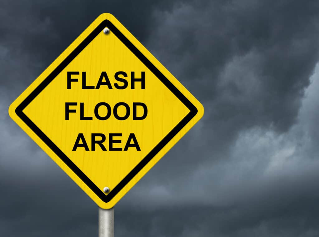
Coastal highways like US-17 are highly susceptible to flash floods.
©karen roach/Shutterstock.com
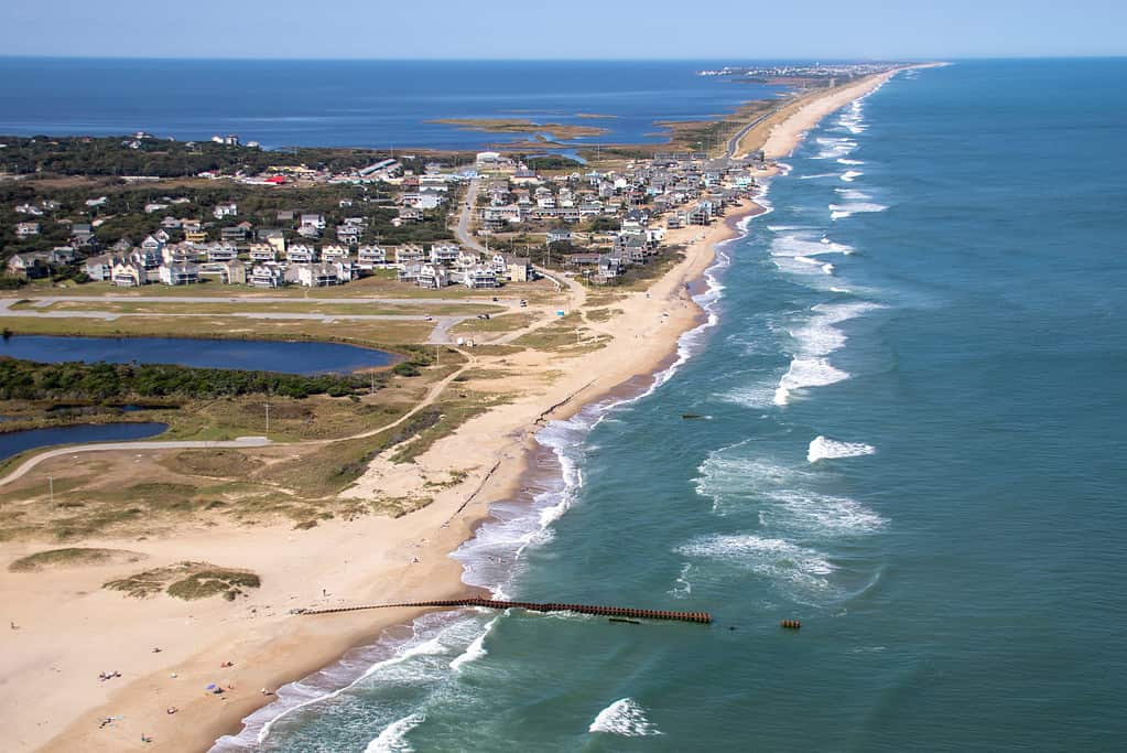
9. NC Highway 12: The Vulnerable Coastal Route
NC Highway 12 is a unique road that runs along the barrier islands that make up the Outer Banks, known as the Outer Banks Scenic Byway. It often suffers damage during tropical storms, hurricanes, nor’easters, and periods of higher-than-normal tides. The North Carolina Department of Transportation (NCDOT) has identified seven “hot spots” on Highway 12. These are spots that can become overwashed by the ocean or experience soundside flooding during storms.
Due to overwash, sections of the road have been closed for days, completely isolating Hatteras Island residents. In areas of Hatteras and Ocracoke Island, where flooding is common, the highway is particularly vulnerable. Highway 12 is the only road in and out of many Outer Banks communities. The constant threat of flooding and subsequent damage has led to numerous discussions on how to keep NC Highway 12 open and safe. Representatives of the community and government recently met in Hatteras village to brainstorm and explore both short-term and long-term solutions. Several obstacles, including environmental concerns and prohibitive implementation costs, make finding a long-term solution particularly challenging.
The Outer Banks isn’t only dangerous due to its roads: it has also earned the nickname “Graveyard of the Atlantic” due to the over 2,000 shipwrecks found in its surrounding waters.
©Jason Schronce/Shutterstock.com
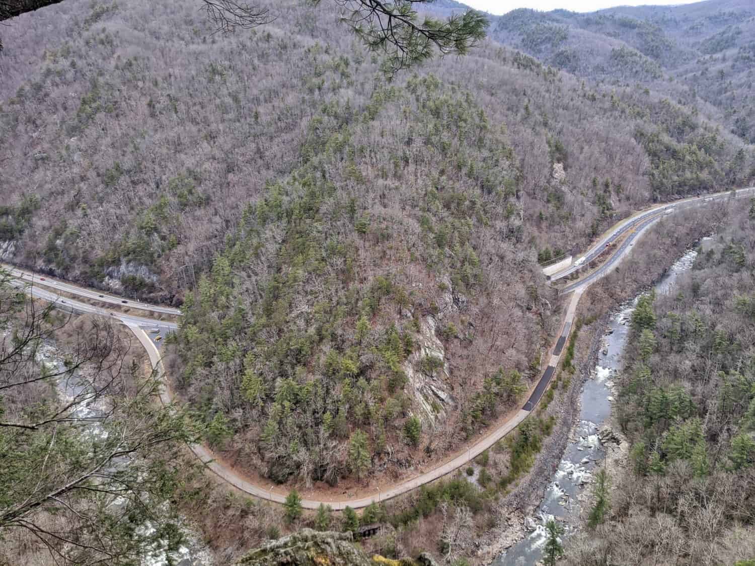
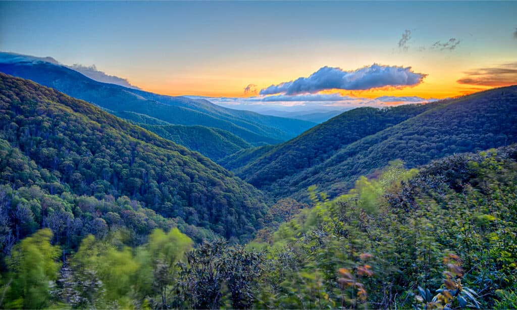
10. Blue Ridge Parkway: A Scenic Yet Challenging Drive
Dubbed “America’s Favorite Drive,” the Blue Ridge Parkway weaves a scenic tapestry of Virginia and North Carolina’s resplendent landscapes. However, beneath its breathtaking panoramas, the Parkway presents unique challenges.
Constructed during the Great Depression, the Blue Ridge Parkway stretches 469 miles through the heart of the South Appalachian Mountains. Along this length are untouched stretches of nature and charming hamlets. A number of attractions line the course.
Locals and visitors alike rave about the stunning tunnels and outstanding fall foliage of Blue Ridge Parkway.
©digidreamgrafix/Shutterstock.com
But don’t let the seductive beauty of the road lull you into complacency. An average of 200 incidents a year remind us that this picturesque highway has its share of hazards.
A vigilant team regularly scrutinizes the road conditions, closing sections for repair works or during unwelcome weather conditions. This precaution is taken to safeguard unsuspecting drivers from precarious circumstances. A uniform speed limit of 45 mph governs the entire Parkway, a rule that’s rigorously enforced.
As you journey along the Blue Ridge Parkway, vigilance is your best co-pilot. While the road is open round the clock, specific wilderness zones are off-limits after sunset. With streetlights being a scarce commodity, drivers must rely heavily on their headlights and high beams.
Further adding to the adventure, wildlife encounters are a commonplace occurrence. From the smallest squirrel to the imposing bear, these animals can dart across your path without warning, making alertness an essential trait for all drivers.
Yet, despite these obstacles, the allure of the Blue Ridge Parkway persists. It holds a stellar rating on Tripadvisor, boasting over 5,800 five-star reviews. Travelers celebrate the scenic allure of the drive, unequivocally pronouncing it as an experience not to be missed. But these seasoned travelers also leave words of caution about fluctuating weather conditions. They recommend packing layered clothing and remaining vigilant for the specter of fog on the road.
11. U.S. Highway 64: The Long and Winding and Narrow
US Highway 64 is a major east-west highway in North Carolina. It runs from the Tennessee state line to the Outer Banks. The stretch of US 64 between Franklin and Highlands has been noted for its high accident rate. It’s considered one of the most dangerous roads in the state. The road is winding and narrow, and it is especially dangerous in wet conditions.
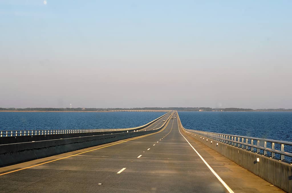
The longest bridge in North Carolina, the Virginia Dare Memorial Bridge, carries the US-64 Bypass.
©Rita Robinson/Shutterstock.com
12. US Highway 74: Slow Your Roll
US Highway 74 runs east-west from Chattanooga, TN, to Wrightsville Beach, NC, and covers 515 miles. It’s been the site of many fatal accidents over the years, particularly in the section between Asheville and Wilmington. The North Carolina Department of Transportation has implemented several safety measures to reduce the number of accidents. They include installing rumble strips, improving signage, and increasing law enforcement.
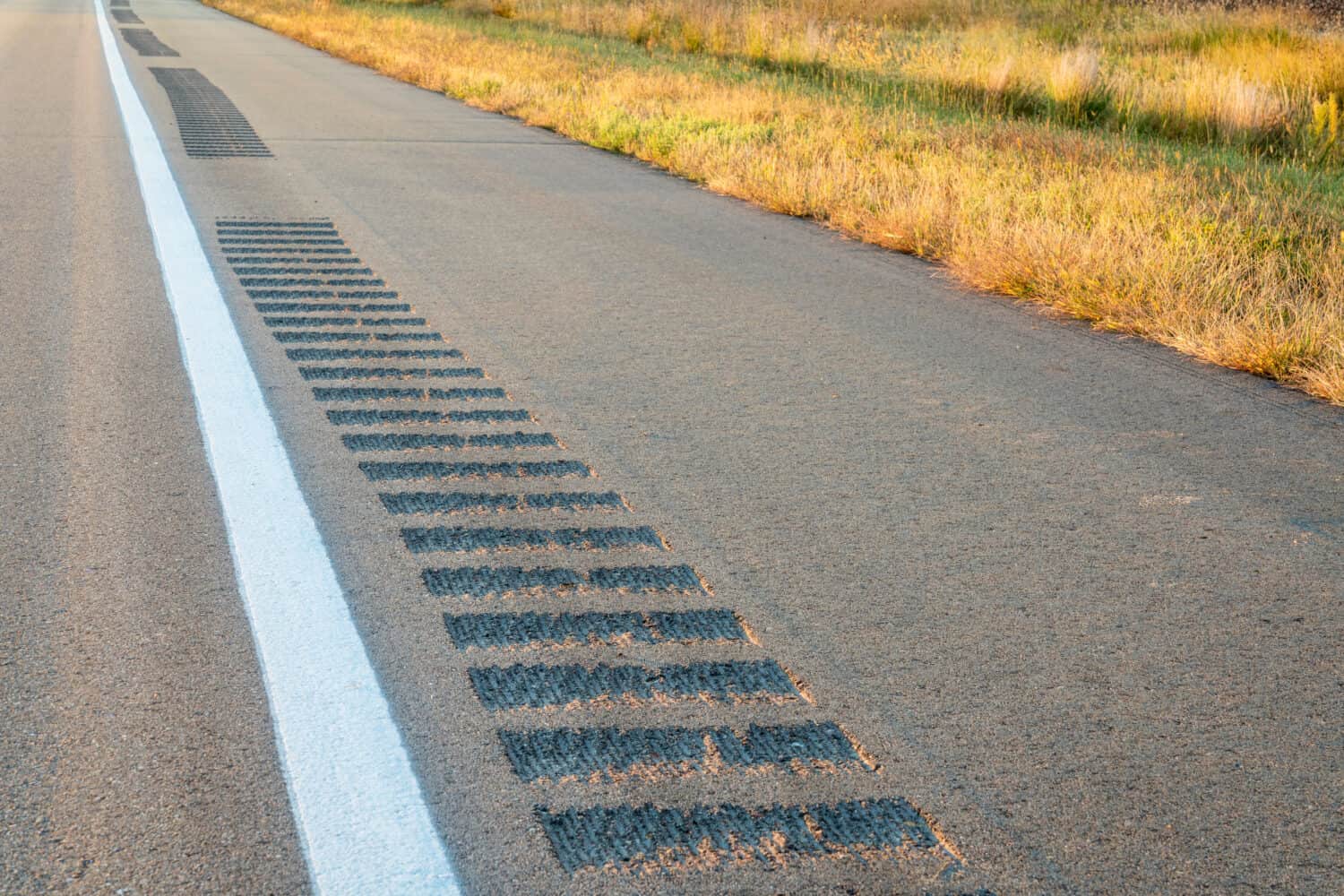
According to the Federal Highway Administration, rumble strips reduce fatal and injury crashes by up to 50 percent in rural two-lane roads and 91 percent in urban two-lane roads.
©marekuliasz/Shutterstock.com
13. US 321 Near Gaston and Lincoln County: Signal to Turn
This road has been the site of many fatal accidents. US Highway 321 in North Carolina has been identified as a dangerous road. Certain areas are more dangerous than others, such as the intersection with US Highway 105 in Boone. Considered the most dangerous intersection in Boone, crossing this intersection warrants caution.

Fatal accidents periodically shut down portions of US 321.
©Volodymyr Baleha/Shutterstock.com
14. Rural Roads: A Lack of Signage
Rural roads in North Carolina, such as Old Fairground Road, lack safety features and have high crash rates. State transportation leaders have these and similar roads on their safety improvement radar.
Being low-traffic, rural roads often don’t have their missing and damaged signage replaced or repaired in a timely manner.
©Mikeiamunion21, CC BY-SA 3.0, via Wikimedia Commons – Original / License
Super Fog: A Case Study of the Impact of Pulp Road Fire on North Carolina Roads
The perilous phenomenon known as “super fog” adds an extra layer of danger on North Carolina’s roads. A byproduct of wildfires that can plunge visibility to less than 10 feet, super fog can be deadly.
Wildfires leave a profound mark on road safety in North Carolina, often conjuring hazardous conditions that call for utmost vigilance. Reckless burning of debris stands as the leading wildfire culprit in the state, stressing the need for proper outdoor fire safety.
The Pulp Road Fire spawned extremely perilous driving conditions. This triggered a “Super Fog Alert” and led to the temporary shutdown of Highway 211. At the time, the fire, yet to be contained, had ballooned to an alarming 16,000 acres. This triggered a Red Alert air quality warning for Brunswick County due to the billowing smoke plumes.
The wildfire threat isn’t new to North Carolina’s roads. The North Carolina Forest Service (NCFS), maintaining wildfire records since 1928, has observed significant fluctuations in both the frequency of wildfires and the acreage ravaged. Notably, 2016 and 2022 hold the records for the highest numbers. As of June 29, 2023, the Pulp Road Fire was declared 100 percent contained.
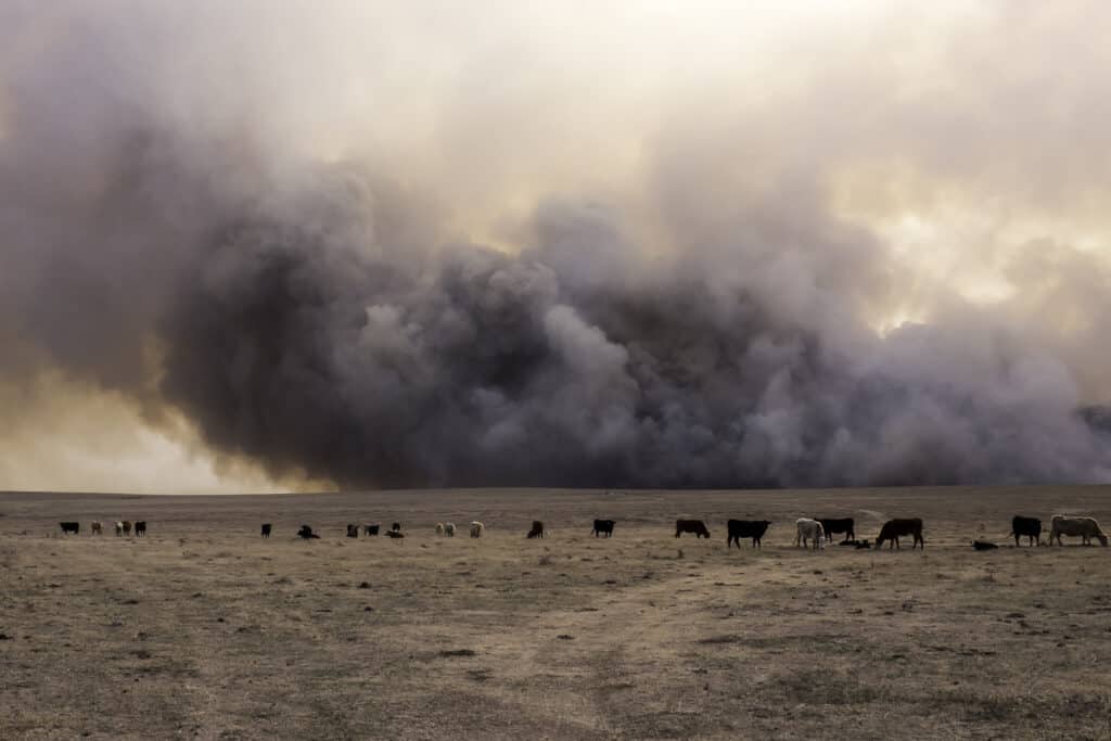
When wildfire smoke and moisture combine, they can produce super fog.
©Eugene R Thieszen/Shutterstock.com
Speeding: A Predominant Factor in Traffic Collisions
However, wildfires are not the only risk. Speeding, too, has etched its mark on North Carolina’s Deadly Highways, particularly during the busy summer season. Interstate 40, with the highest tally of fatal car crashes between 2015 and 2017, holds the grim title of the state’s deadliest highway, closely followed by Interstate 85 and US-64.
Speeding is a predominant factor behind these traffic collisions, underscoring the significance of respecting speed limits. Indeed, speeding has been linked as a critical factor in traffic fatalities, not only on these highways but across the entire United States.
Tragically, North Carolina has witnessed a sharp spike in traffic crash fatalities in recent years. In 2020 alone, 1,658 people lost their lives in 1,523 fatal crashes. This marks a worrying 10% increase from the previous year. From 2019 to 2022, there was a surge of 21 percent in traffic fatalities. And 2021 set a new record with more than 1,700 car crashes, making it the state’s deadliest year.
Assessing Road Safety: Key Metrics and Techniques
Metrics like Crash Rate and the Rare Event Concentration Coefficient (RECC) offer vital road safety insights. The Crash Rate counts the number of crashes. On the other hand, the RECC measures the concentration of accidents.
Robust safety data and analysis are vital. They underpin efforts to improve road safety. By identifying critical safety concerns, these data help assess the most effective interventions.
Innovative techniques are also available. One such technique involves aggregating crash data into a space-time cube. Another is performing hot spot analysis. These methods can pinpoint clusters of high and low crash values. In turn, they aid in the formulation of effective policies.
The Role of Infrastructure Interventions in Enhancing Road Safety
Infrastructure interventions have a role to play in safety. Central hatching and crash cushions have reduced crashes. They’ve also boosted road safety.
Crash Modification Factors (CMFs) are vital too. These factors quantify expected changes in crash frequency. They relate these changes to specific interventions. Thus, CMFs are key in evaluating safety measures’ effectiveness.
Regular observation is necessary. So are behavioral studies. Together, they monitor the impact of safety interventions. They also identify potential hazards or areas of improvement.
The United States Federal Highway Administration has made several proposals. The Canadian Government has done the same. Their shared goal is to enhance road safety.
Conclusion
Road safety is a global imperative, requiring comprehensive and persistent interventions to mitigate accidents. Understanding risks is essential. Acting cautiously is another vital step. Together, we can make our roads safer. In doing so, we can save lives.
You might be a North Carolina local. You might just be passing through. Regardless, remember this: staying alert and driving safely should be number one on your list.
The photo featured at the top of this post is © WNCUAV/Shutterstock.com


How to Add Us to Google News


Thank you for reading! Have some feedback for us? Contact the AZ Animals editorial team.