
Rivers provide many essential services. They supply drinking water, enhance navigation, and irrigate farmland. Additionally, rivers offer recreational opportunities and can generate hydroelectric power for homes and businesses. They provide shelter and food for plants and animals and create opportunities for life to flourish.
Also known as Rio de los Brazos de Dios, the Brazos River is one of the longest rivers in Texas. For centuries, the river has played an important role in the region’s history. Today, the river continues to irrigate crops and provide fresh drinking water to communities in its drainage basin. It’s also a popular site for fishing, boating, camping, and picnicking. That said, where does the Brazos River start and end?
Keep reading to learn about the Brazos River’s winding course. We’ll follow its journey from its headwaters to its mouth and see what areas its passes through along the way. We’ll also learn what makes the river important and what threats it faces today.
Where Does the Brazos River Start?
Before we discuss where the Brazos River starts, we must first define what we mean by headwaters, main stem, and mouth. The headwater of a river or stream represents the furthest point from its source to its mouth (the place where it ends). A river may have many sources or tributaries but typically only has one headwater. However, it can be difficult to identify a river’s headwater, especially if it has multiple sources. Meanwhile, the main stem of a river represents the primary downstream part of a river. When we talk about where rivers start, we are usually referring to the beginning of the main stem.
The headwaters of the Brazos River lie near Blackwater Draw in Roosevelt County, New Mexico. This intermittent stream begins just 11 miles southwest of Clovia, New Mexico. From there, it flows southeast toward Lubbock, Texas, where it eventually joins the North Fork Double Mountain Fork of the Brazos River.
Meanwhile, the main stem of the Brazos River begins at the confluence of the Double Mountain Fork and Salt Fork. These two tributaries form the Brazos River proper on the plains of the Llano Estacado, a mesa in northern Texas.
What States Does the Brazos River Flow Through?
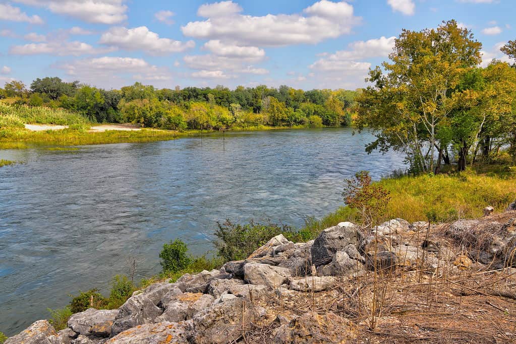
The Brazos River flows through Texas and New Mexico.
©iStock.com/Wirestock
If you count the headwaters as part of the river’s total length, then the Brazos River runs through two states, New Mexico and Texas. However, if you only consider the main stem of the river, then the Brazos River is located entirely in Texas.
Where Does the Brazos River End?
From the beginning of its main stem in northern Texas, the Brazos River briefly runs east before cutting south. It passes through three dams on its journey south, all of which are located on the Upper Brazos River north of Waco. These dams form Possum Kingdom Lake, Lake Granbury, and Lake Whitney. After passing through Lake Whitney, the Brazos River weaves through several towns, including Waco, Calvert, College Station, and Richmond. The river ends at its confluence with the Gulf of Mexico to the south of the city of Freeport.
How Large Is the Brazos River?
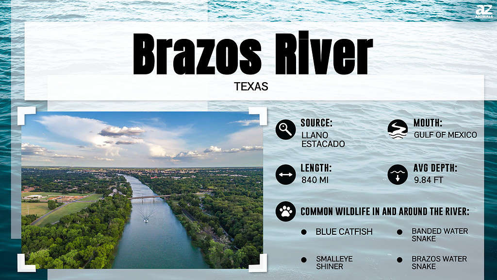
The Brazos River is 840 miles from the start of its main stem on the Llano Estacado to its confluence with the Gulf of Mexico. That said, if you include its headwaters at Blackwater Draw, the river measures nearly 1,280 miles long.
The Brazos River drains an area of approximately 45,000 square miles. Its discharge varies wildly depending on the point along the river and the time of year. On average, the river discharges around 8,390 cubic feet per second. Meanwhile, some points discharge as little as 27 cubic feet per second, while others hit around 84,000 cubic feet per second.
Where Is the Brazos River Located on a Map?
The Brazos River’s headwaters are in Roosevelt County, New Mexico, with its source in Llano Estacado, and the source confluence in Stonewall County, Texas. The mouth is the Gulf of Mexico at Brazosport in Brazoria County, Texas.
Is the Brazos River the Longest River in the Region?
The state of Texas contains approximately 11,000 named streams and rivers. Most of these streams measure no more than a few miles, while others span nearly the entire state. Although the Brazos River ranks as one of the longest rivers in Texas, it doesn’t measure as the longest. That distinction belongs to the Rio Grande, which measures 1,896 miles long. The Red River of the South comes in second place at 1,360 miles long. Meanwhile, the Brazos River ranks 3rd at 840 miles long (or 1,280 miles long from its headwaters).
Why is the Brazos River Important?
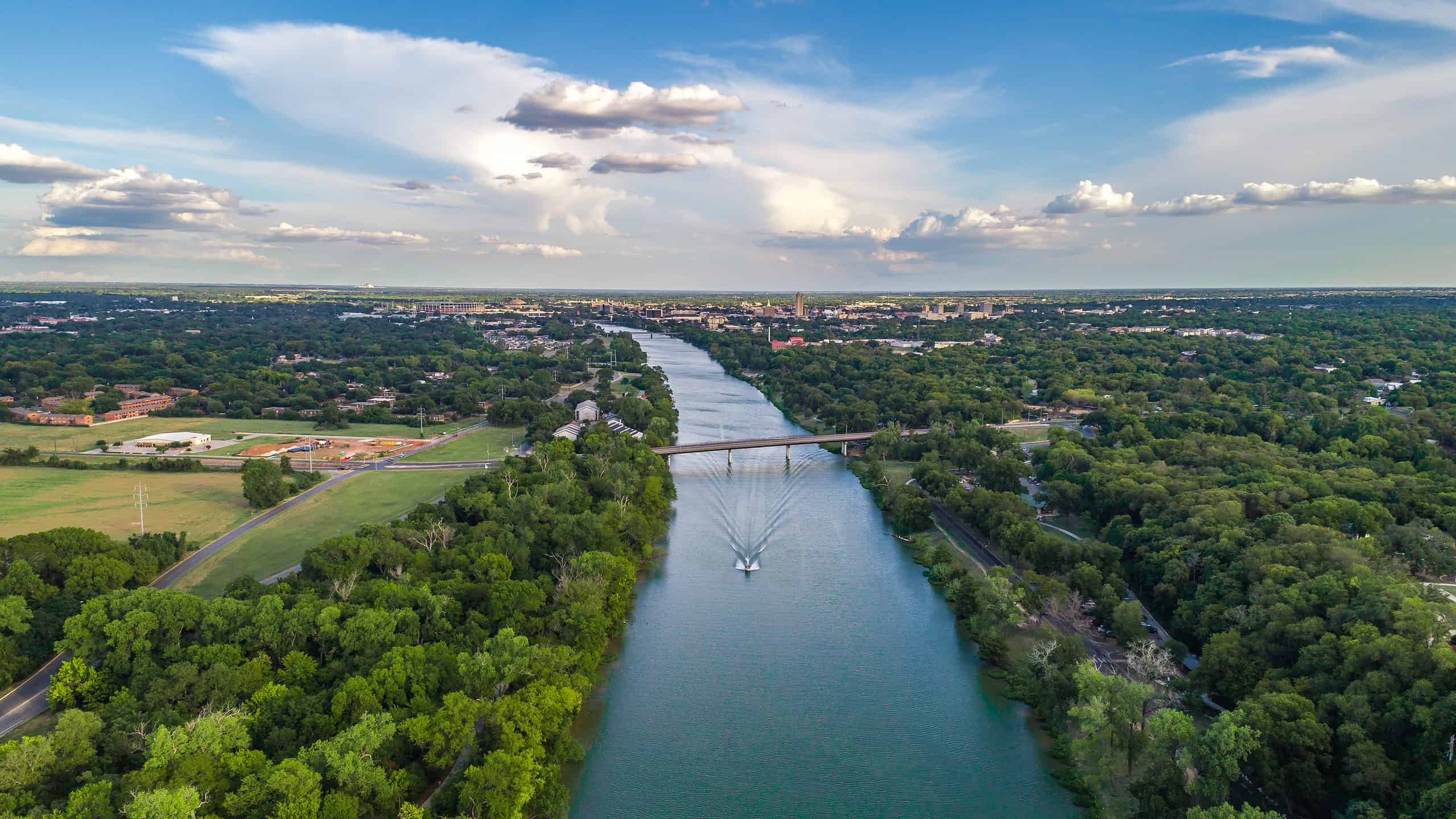
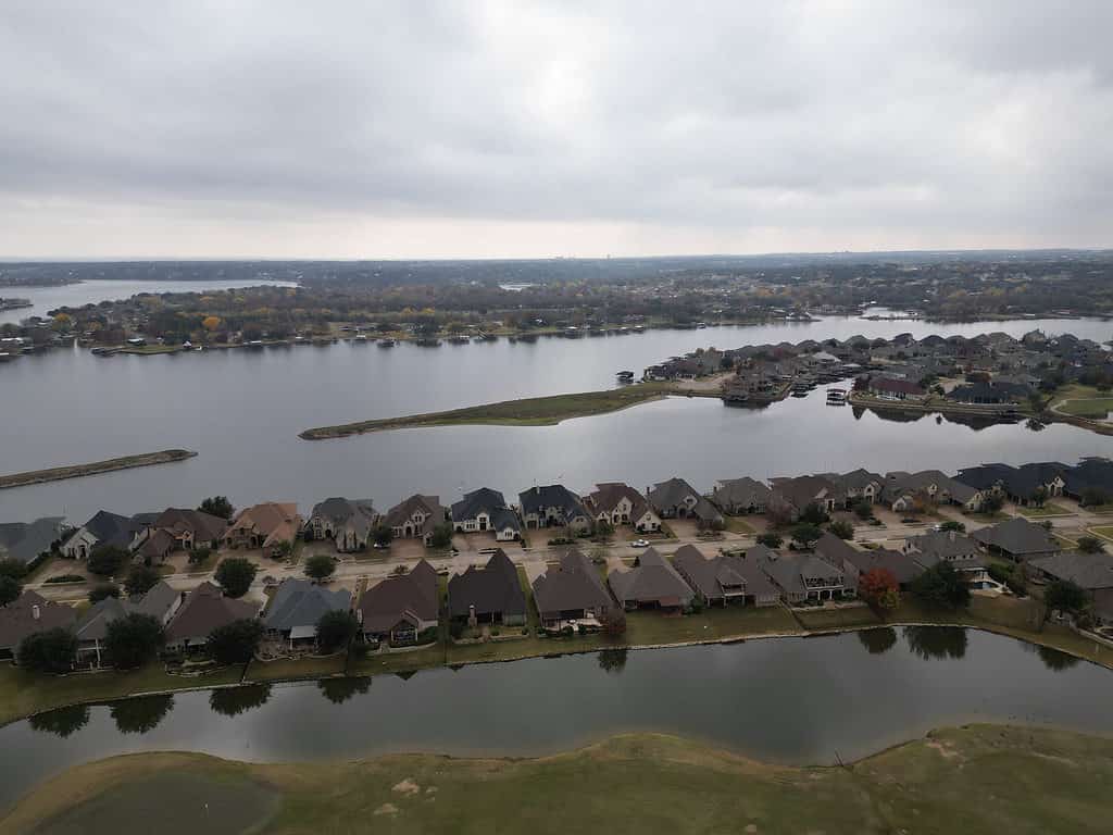
Some of the first English-speaking settlements in the state were located along the Brazos River.
©iStock.com/Hudley_Photography
You can’t tell the story of Texas without mentioning the Brazos River. People first arrived in the Brazos River Valley thousands of years ago. Several Native American tribes lived along its banks, including the Caddo, Comanche, Wichita, Tonkawa, and Karankawa. In the Caddo language, the river went by the name “Tokonohono.” The tribes that lived along the Brazos relied on the river for drinking water, food, and crop irrigation.
The river also served an important role in the expansion of European settlers into Texas. Some of the first English-speaking settlements in the state were located along the Brazos River. In 1836, leaders of the Texas independence movement officially declared independence from Mexico at Washington-on-the-Brazos, a community along the Brazos River located in modern-day Washington County. Upon declaring independence, Texas revolutionaries went to war with Mexico. These two sides fought several battles, including a naval battle along the Brazos River.
For hundreds of years, the Brazos River has served as a key navigation route in central Texas. Today, thousands of commercial ships travel down the river each year to bring goods to Freeport, Texas. The river also provides drinking water to millions of people in its drainage basin and irrigates thousands of acres of cropland. Several dams along its course provide hydroelectric power for homes and businesses. Some of these dams have also created reservoirs, the most important of which are Possum Kingdom Lake and Lake Whitney. Additionally, the river also provides recreational opportunities, including boating, fishing, picnicking, and sailing. These activities drive tourists to the region and fuel the economy of central Texas.
What Threatens the Brazos River?
Like many rivers in the United States, the Brazos River struggles with water-quality issues. Numerous pollutants flow into the river from various sources. Some of the primary polluters of the river include agricultural runoff, sewage, and chemical byproducts from manufacturing. All of these pollutants deteriorate the water quality of the river. These pollutants also often produce unexpected consequences. In recent years, the river has seen large blooms of toxic golden algae. This algae can kill fish and other organisms in the river and occurs due to elevated saline levels in the water. Industrial and chemical pollution can increase saline levels, thereby creating the specific environment in which toxic algae thrives.
In addition to pollution, the Brazos River also faces another major threat: over-allocation. Local governments often set limits on how much water can be drawn from a river. Without these limits, rivers can be over-allocated and run dry. Over the past few decades, the Brazos River recorded numerous years with record low water levels. Numerous factors contributed to these dry conditions, most notably persistent droughts and an over-allocation of water rights. The State of Texas authorizes water rights to waterways across the state through the Texas Commission on Environmental Quality (TCEQ). In the case of the Brazos River, the Brazos River Watermaster assumes the responsibility of monitoring water permits and use on the river. Some critics point a finger at the TCEQ and the Watermaster for failing to manage the river’s resources effectively. Drought conditions in the state make the situation even worse, as the Brazos River doesn’t get the essential rain it needs to replenish the water taken out.