
Illinois ranks in the bottom 25 percent of states in terms of mean elevation. The mean elevation of the state is 600 feet above sea level. That is quite a bit lower than Colorado’s mean elevation of 6,800 feet, the highest in the United States. It is much closer to Delaware’s mean elevation of 60 feet, the lowest in the U.S. But, even though the overall elevation of the state is low, what is the lowest point in all of Illinois?
River Confluence
The lowest point in Illinois is found in the extreme southern tip of the state. The confluence of the Ohio and Mississippi Rivers at Fort Defiance State Park is the lowest point in Illinois, with an elevation of 279 feet above sea level.
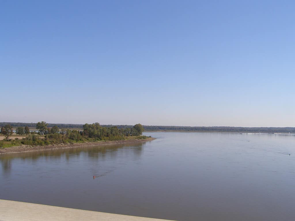
The peninsular land of Fort Defiance State Park at the confluence of the Mississippi and Ohio Rivers is the lowest point in Illinois.
Fort Defiance State Park
Constructed on Cairo Point (or simply “The Point”), visitors will find Fort Defiance State Park at the most southern point of Illinois. This small park is named for Fort Defiance, a Union military installation built on this spot during the Civil War. More on that in a bit.
The park marks the actual spot of Illinois’ lowest point at 279 feet above sea level. Guests can stand at the Ohio/Mississippi confluence, one of the most impressive river confluences on Earth.
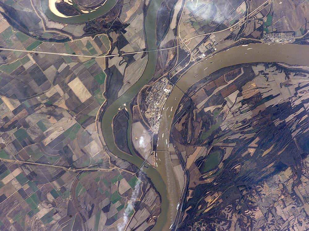
This picture of the Ohio/Mississippi confluence was taken from the International Space Station. Cairo can be seen in the center. The small brown rectangle at the confluence of the two
rivers
is Fort Defiance State Park.
©ISS Crew Earth Observations experiment and the Image Science & Analysis Group, Johnson Space Center, NASA / Public domain – Original / License
This land is where Lewis and Clark trained members of the Corps of Discovery Expedition on the use of navigational equipment before the journey began. There are markers in the parking lot commemorating this historic event.
Today, there are sixteen campsites in the park, eight of which have electrical hookups. There are different hiking trails in the 191-acre park, as well as three equestrian trails. Picnicking and fishing opportunities are also available.
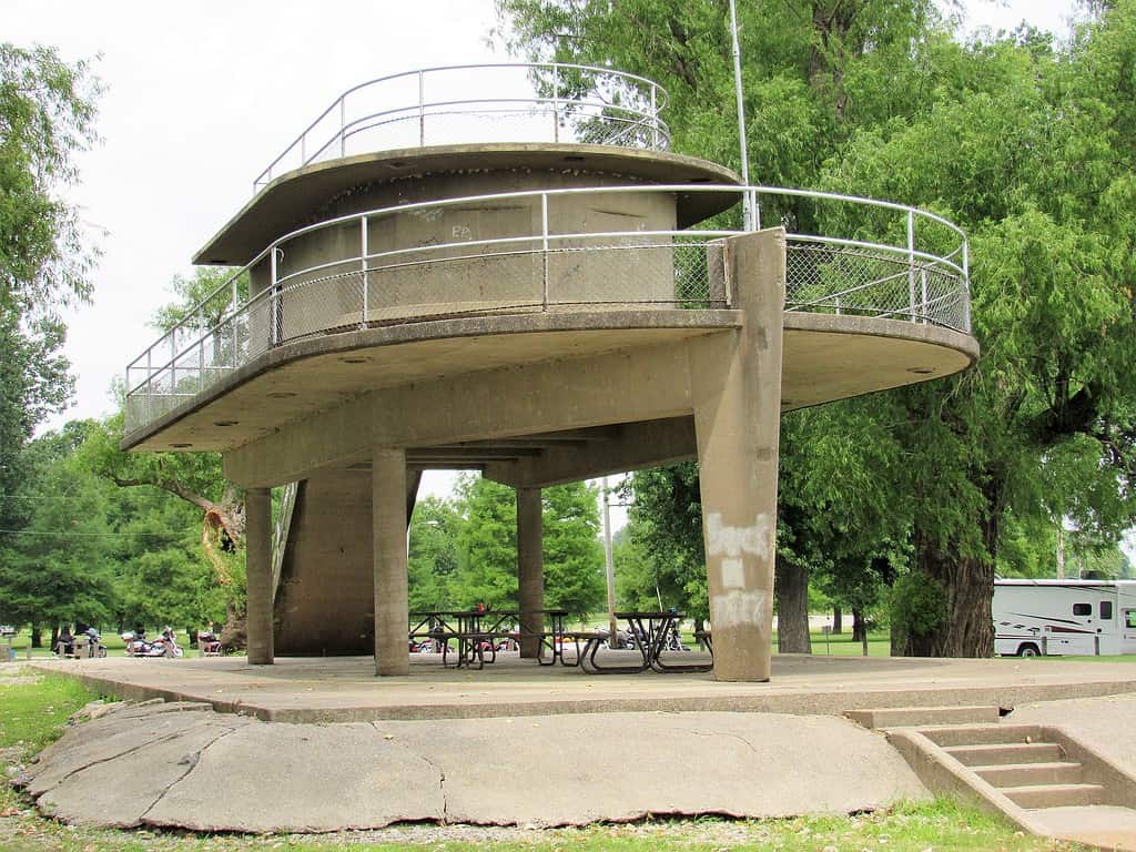
A picnic shelter and a small number of campsites are available at Fort Defiance State Park.
Cairo, Illinois
The peninsular land at the confluence of the Ohio and Mississippi Rivers is also home to the city of Cairo, Illinois (pronounced KAIR-oh). This historic town played a key role in pivotal moments of American history.
Cairo was an important passageway on the Underground Railroad in the lead-up to the Civil War. Escaped slaves crossed the rivers and then were hidden in rail freight cars bound northward to Chicago.
In 1998, city workers discovered structures under a sidewalk on Levee Street. The Illinois Central Railroad had tracks on that street in the past. The structures were dated to the 1850s. These underground rooms joined with a tunnel that ran for several blocks along the street. It is believed that escaped slaves would hide in these rooms and move through the tunnel.
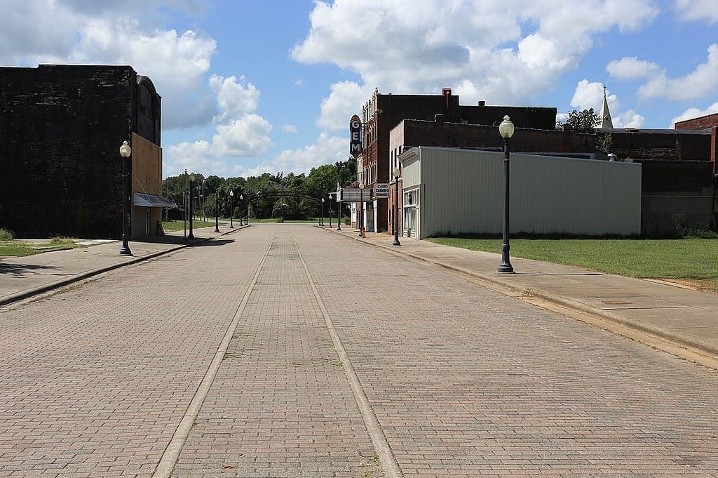
Cairo was once a bustling railroad town. The tracks can still be seen in places.
Civil War
During the Civil War, Cairo’s strategic location at the confluence of two major rivers made it an ideal location for a military hub and naval station. General Ulysses S. Grant came to the city in 1862, and Fort Defiance was constructed at the Ohio/Mississippi confluence. Cairo remained an important military installation and supply hub for the remainder of the war.
Booming Growth and Dark Days
Cairo grew to over 15,000 residents by 1907, thanks in large part to its strategic location for river shipping and commerce, along with its railroad access. However, racial tensions were also flaring. Segregation, riots, and lynchings are the very dark and violent chapters of Cairo’s history that led to a steep decline in the city’s population.
Along with the deep racial divide, a railroad bridge built across the Mississippi River at Thebes, Illinois, in 1905 drastically reduced rail traffic in Cairo. It also rendered the railroad ferry operations, which had been an economic boon to the city in the past, completely obsolete.
The city and surrounding area also suffered because of its geography. Flooding is always a danger when the lowest point in the state also sits at the confluence of two mighty rivers. Destructive floods, and the threat of further flooding, also drove people out of Cairo.
Cairo Today
Today, Cairo only has around 1,600 residents. Many of the businesses have been shuttered. The impoverished town has tried to mount multiple comebacks, but the struggles remain.
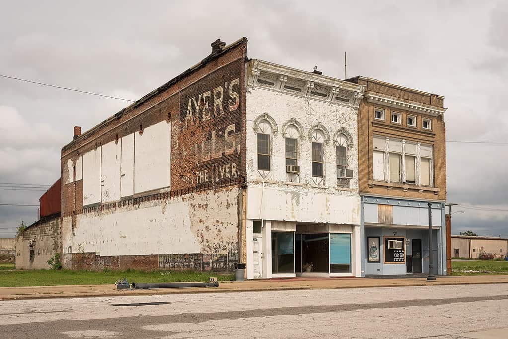
Cairo is filled with reminders of the vibrant businesses that once existed in the city.
The Highest Point in Illinois
The lowest and highest points in Illinois seemingly could not be further apart. While the lowest point lies in the extreme southern tip of the state, the highest point in the state is Charles Mound, located in the upper northwestern corner of the state, less than half a mile from the Illinois/Wisconsin border. Charles Mound has an elevation of 1,235 feet above sea level, more than 950 feet higher than Fort Defiance State Park.
The photo featured at the top of this post is © Chris Light / CC BY-SA 4.0 – License / Original


How to Add Us to Google News


Thank you for reading! Have some feedback for us? Contact the AZ Animals editorial team.