
Iowa is in the Midwestern region of the United States, an area known for being relatively flat. While Iowa does have a small height difference between its highest and lowest points compared to other states, its geography is notable for another reason. Iowa has one of the highest low points of any state, which is unusual given that it is in the Midwest. This article explores the lowest point in Iowa, including its history, nearby wildlife, and how it compares to the lowest points of other U.S. states.
What Is the Lowest Point in Iowa?
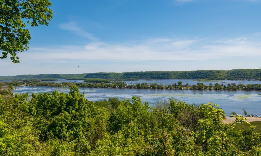
The Mississippi River forms Iowa’s eastern border with Wisconsin and Illinois.
©Ralf Broskvar/Shutterstock.com
Like much of the Midwestern U.S., Iowa is a relatively flat state. However, while it is flat, it is nowhere near sea level. According to the United States Geological Survey, the lowest point in Iowa is on the Mississippi River in Lee County, at 480 feet above sea level.
Let’s explore how the Mississippi River was formed and the history of Lee County, Iowa.
How Was the Mississippi River Formed?
The Mississippi River was formed from the Laurentide Ice Sheet, which once covered much of the United States. As this ice sheet melted, during the transition out of the last Ice Age, it drained into the Gulf of Mexico. The path it carved is now the Mississippi River.
How Did the Mississippi River Get Its Name?
The name Mississippi is from the Anishinaabemowin word Misi-ziibi, which means the river now known as the Mississippi River. French colonists interpreted this word as Messipi. The spelling Mississippi became common during the French Louisiana period.
Lee County History
The United States Congress established the Territory of Iowa in 1838. Soon after, in 1846, President James K. Polk signed the law that admitted Iowa into the Union as a state. Interestingly, Lee County is older than the state of Iowa itself. In 1836, before Iowa was even a territory, Lee County was named as a part of the Wisconsin Territory. It then became a part of the Iowa Territory in 1938, and a part of the state of Iowa in 1846.
Lee County has two county seats: Fort Madison and Keokuk. Fort Madison is the largest city in Lee County as well as one of the oldest, established during the War of 1812. Today, Lee County has a population of 32,840, according to the U.S. Census Bureau. The population of Fort Madison is 10,134.
Wildlife Near the Lowest Point in Iowa

Trumpeter swans migrate south from Canada during winter.
©iStock.com/Zeke1
The Mississippi River is home to an abundance of fish, birds, reptiles, and amphibians. Just 50 miles north of Fort Madison, the Point Louisa National Wildlife Refuge provides crucial habitat for Mississippi River wildlife. Let’s explore some of the animals that live in the Louisa Point NWR.
Point Louisa NWR is a reptile and amphibian conservation area. Some of the reptiles found in the NWR are the snapping turtle, painted turtle, copperbelly water snake, and diamondback water snake. Amphibian species include the boreal chorus frog and the northern leopard frog.
The wetlands in Point Louisa is also provide important habitat for migratory birds, including mallards, Canada geese, and trumpeter swans.
How Does the Lowest Point in Iowa Compare To Other States?
Iowa’s lowest point is 480 feet above sea level. That’s higher than the lowest point of 36 other states! The lowest point of 22 U.S. states is sea level, which is a testament to the massive amount of coastline in the United States. Additionally, 14 states have a lowest point between sea level at 480 feet above sea level.
Let’s see how Iowa compares to other U.S. states. Only 13 states have a higher lowest point than Iowa. These are Colorado, Idaho, Kansas, Michigan, Minnesota, Montana, Nebraska, New Mexico, North Dakota, South Dakota, Utah, and Wyoming. While most of these states are in the High Plains or Rocky Mountains, Iowa is unique for being a Midwestern state with such a high low point.
Colorado is the state with the highest low point in the U.S. The lowest point in Colorado is 3,315 feet above sea level. That’s 2,835 feet higher than the lowest point in Idaho!
Finally, let’s explore the highest point in Iowa to see how it compares to the lowest point.
What Is the Highest Point in Iowa?
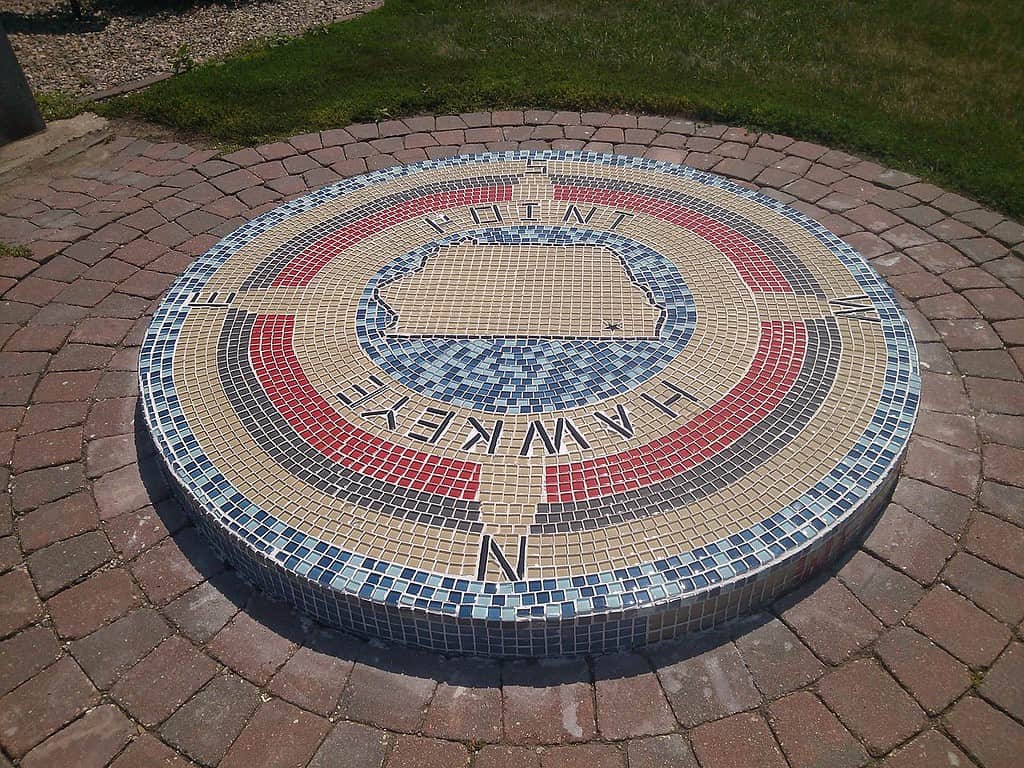
Hawkeye Point is in northern Iowa on the Minnesota border.
©Evilwop66 / CC BY-SA 3.0, Wikimedia Commons – Original / License
According to the United States Geological Survey, the highest point in Iowa is Hawkeye Point in Osceola County, at 1670 feet above sea level. That’s 1,190 feet taller than the lowest point in Iowa. This illustrates how flat Iowa is compared with many other states. For example, the highest point in California is 14,776 feet taller than the lowest point. Or, to compare a state closer to Iowa, the highest point in Nebraska is 4,584 feet taller than the lowest point.
Where Is the Lowest Point in Iowa Located On a Map?


How to Add Us to Google News


Thank you for reading! Have some feedback for us? Contact the AZ Animals editorial team.