The widest river in Canada is one of the country’s many incredible natural wonders. Canada is the second-largest country in the world by area, behind only Russia. The total area of Canada is 3,855,100 square miles (9,984,670 square kilometers). Despite its huge size, Canada has a relatively small population. This is due to how far north it is. It is difficult for humans to live in Northern Canada’s harsh Arctic and subarctic climate. The vast majority of people living in Canada live in the south, especially Southern Ontario and Southern Quebec. Far north of these densely populated regions is where you will find Canada’s widest river.
With a maximum width of 20,000-23,000 feet, the Mackenzie River is the widest river in Canada. It is around 3.8-4.4 miles wide! The Mackenzie River runs through the Northwest Territories, one of Canada’s three northern territories. The Northwest Territories has a total area of 519,734 square miles (1,346,106 square kilometers). Its population is 41,070. The Northwest Territories is mostly tundra and boreal forest, biomes that are too cold to grow food in. In the Northwest Territories, the Mackenzie River runs south to north through boreal forests until it reaches its mouth at the Arctic Ocean. Sometimes called the “Cold Amazon” or “Amazon of the North,” the Mackenzie River’s size rivals the massive South American river. This article explores the Mackenzie River including its location, history, and nearby wildlife.
The Mackenzie River is part of a large river system that includes the Slave, Peace, and Finlay Rivers.
©iStock.com/eppicphotography
Mackenzie River Location
Mackenzie River Headwaters
The widest river in Canada begins at Great Slave Lake in the Southern Northwest Territories. Like the Mackenzie River, Great Slave Lake is a massive body of water. It is the 10th-largest lake in the world by area, at 10,500 square miles (27,200 square kilometers). Great Slave Lake is also the deepest lake in North America, at 2,014 feet (614 meters) deep. The Mackenzie River begins on the western end of Great Slave Lake. This location is about 93 miles (150 kilometers) southwest of Yellowknife, the only city in the Northwest Territories.
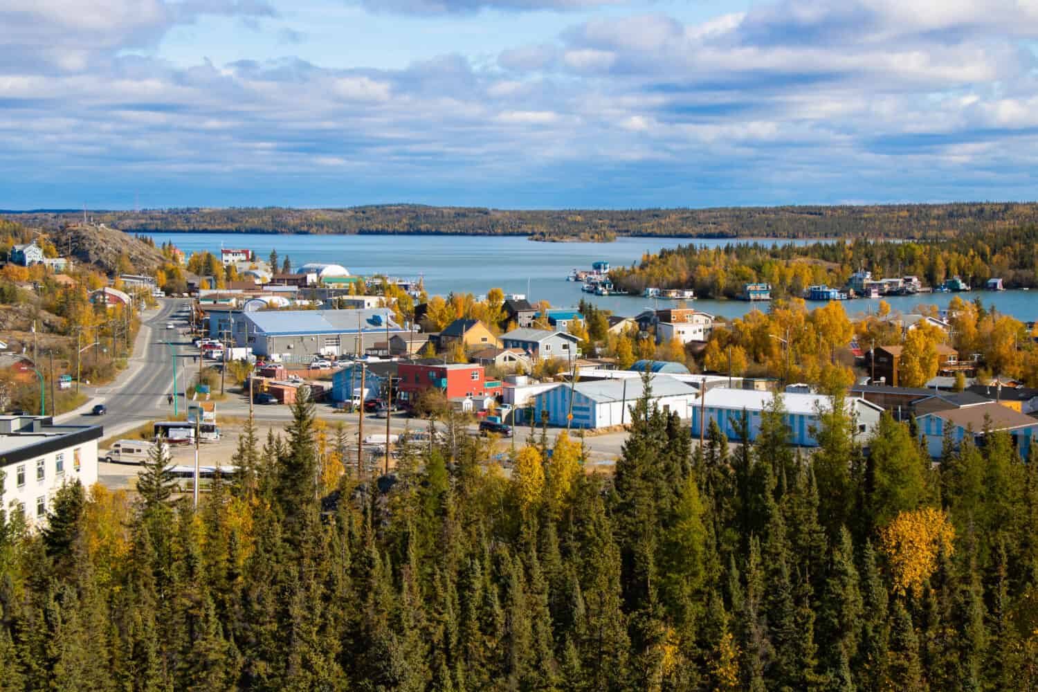
Yellowknife, the only city in the Northwest Territories, is on the northern shore of Great Slave Lake.
©ti1993/Shutterstock.com
Mackenzie River Course
From Great Slave Lake, the Mackenzie River flows west through the hamlet of Fort Providence. After it passes Fort Providence, the river widens and flattens. People call this area Mills Lake, but it is a part of the Mackenzie River. After Mills Lake, the river flows 62 miles (100 kilometers) west to the villages of Jean Marie River and Fort Simpson. The Liard River joins the Mackenzie River at Fort Simpson. It is the biggest direct tributary of the Mackenzie River. At Camsell Bend, the North Nahanni River flows into the Mackenzie River. From this confluence, the Mackenzie River flows north through the boreal forest toward the Arctic Ocean. Along its northward course, the Mackenzie River joins the Root River, Redstone River, and Keele River.
At the hamlet Tulita, the Great Bear River joins the Mackenzie River. The Great Bear River flows from the Great Bear Lake to the east. After its confluence with the Great Bear River, the Mackenzie River passes through Sahtu lands. Sahtu and Métis people own the Sahtu lands. Near the town of Norman Wells on Sahtu lands, the Mackenzie river expands to its widest point. The river is around 3.8-4.4 miles wide at this point. From Norman Wells, the Mackenzie passes through several other small settlements and through Gwich’in lands. At the Gwich’in community of Tsiigehtchic, the Mackenzie and Red Arctic Rivers meet.
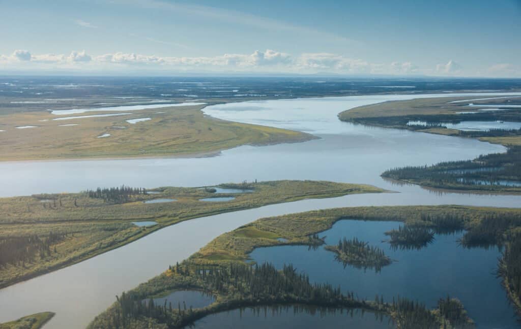
Mackenzie River Delta and Mouth
From Tsiigehtchic, the river flows another 19 miles (39 kilometers) northwest. Here, it becomes the Mackenzie River Delta. At 4,600 square miles (12,000 square kilometers), this delta is massive. It is around 130 miles (210 kilometers) long and 30-50 miles (50-80 kilometers) wide. The Mackenzie River additionally joins the Peel River at its delta. The river channels then empty into the Beaufort Sea of the Arctic Ocean.
Mackenzie River History
Despite its location in one of the harshest climates on Earth, humans have traveled and lived along the Mackenzie River for thousands of years. Several indigenous peoples including the Inuvialuit and Gwich’in have lived near the Mackenzie River since time immemorial. Tsiigehtchic, a Gwich’in community, is the oldest continuous human settlement on the river. Tsiigehtchic is on the confluence of the Mackenzie and Arctic Red Rivers. Current archaeological evidence suggests that humans have lived in Tsiigehtchic for around 1400 years.
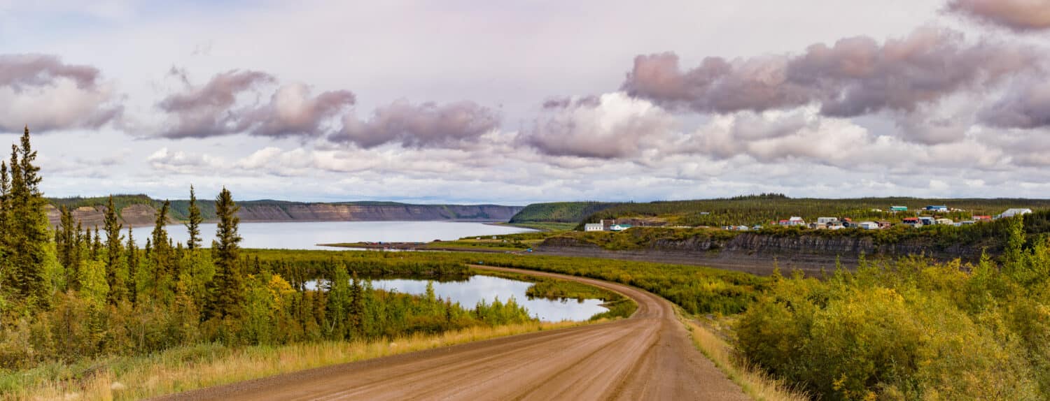
The Dempster Highway runs along the widest river in Canada near the community of Tsiigehtchic.
©Pi-Lens/Shutterstock.com
The Mackenzie River was the primary route by which Europeans came to northwestern Canada. In the late 18th century, a Scottish man named Alexander Mackenzie navigated the river hoping to reach the Pacific Ocean. However, in 1789 he arrived at the river’s mouth on the Arctic Ocean. The Mackenzie River was later named after him. The next European to reach the mouth of the river was Sir John Franklin in 1825. Soon after, more Europeans arrived, and they stablished a fur trade there.
The North West Company in Montreal built forts along the river for fur trading. Trappers primarily hunted beaver and muskrat, and the populations of these animals began to decline.
In the late 19th and early 20th centuries, illnesses brought to the area by Europeans devastated native communities on the Mackenzie River.
After oil was discovered near Norman Wells in the 1920s, the Mackenzie River experienced significant industrial development. Oil was pumped, mines were opened, and steamboats traveled along the river carrying people and resources. Today, there are around 400,000 people living around the Mackenzie River. The communities along the river include indigenous people as well as people who work in the natural resource industries.
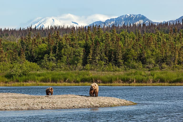
Wildlife Near the Widest River in Canada
Since the Mackenzie River is sparsely populated by humans, it is abundant with wildlife. Additionally, since it is in the Arctic and subarctic climate zones, it is home to many interesting species that are adapted to cold climates. Let’s explore some of the fantastic animals that live around the Mackenzie River, from Arctic Sea mammals to migratory birds.
Beluga Whale (Delphinapterus leucas)
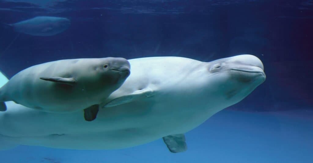
Beluga whales use echolocation to navigate in murky water with low visibility.
©CampCrazy Photography/Shutterstock.com
The beluga whale is uniquely adapted to live in the Arctic and subarctic. Belugas lack a dorsal fin, the fin located on the back of most whales and dolphins, so that they can more easily swim under the ice.
Caribou (Rangifer tarandus)
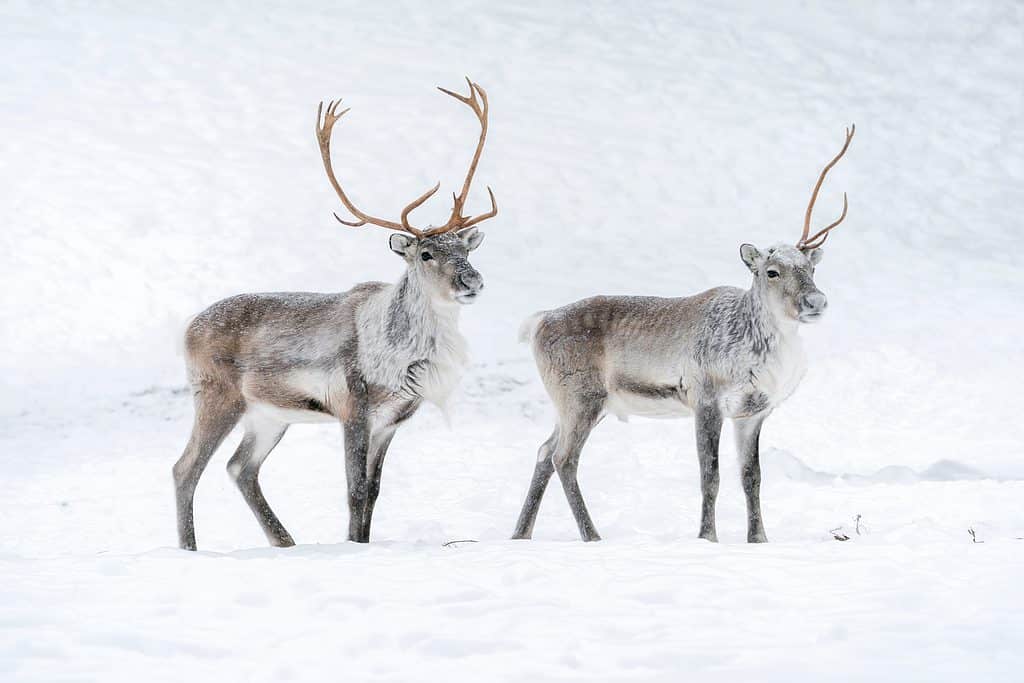
Both male and female caribou grow antlers.
©Tam and Trace Photography/Shutterstock.com
Caribou is a species of deer adapted to the cold climates of higher latitudes. There are seven subspecies of caribou. The barren-ground caribou is the subspecies that live near the mouth of the widest river in Canada.
Tundra Swan (Cygnus columbianus)
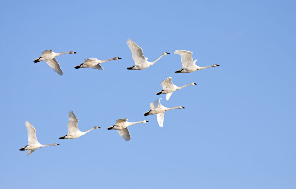
Tundra swans breed in the Arctic but migrate south for the winter.
©Delmas Lehman/Shutterstock.com
The tundra swan is a migratory bird that breeds in the tundra near the Mackenzie River. When migrating south for the winter, tundra swans can fly up to five miles high. When birds migrate in a V-formation, the birds in the back use less energy by riding the currents of the leading bird.
Chinook Salmon (Oncorhynchus tshawytscha)
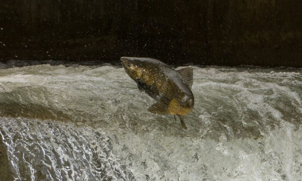
Chinook salmon are anadromous fish, meaning they migrate upriver from the ocean to spawn.
©Evan Linnell/Shutterstock.com
The Chinook salmon is the largest Pacific salmon species. Although the Mackenzie River is north of its historic range, people are beginning to find Chinook salmon in the river. This is thought to be due to increasing temperatures in the Northwest Territories and the Arctic as a whole.