Located in the Tennessee Valley in the Southeastern United States, the Tennessee River is the largest tributary of the Ohio River. This famous river has a rich history. Evidence of its past has been discovered through painted petroglyphs on cliffs overlooking the water. The Cherokee people built their homes around this river, initially referred to as the Cherokee River.
Today, the Tennessee River is an essential part of everyday life. People in the region utilize the rushing waters for transportation, water, and other natural resources. You may be wondering the exact length or this river. Continue reading to learn about the river’s length, width, and depth.
Where Does the Tennessee River Start?
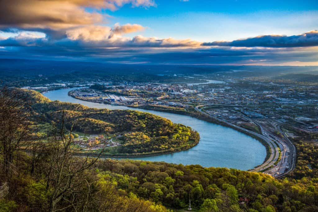
The grand river starts one mile upstream of Knoxville, Tennessee.
©Kevin Ruck/Shutterstock.com
The Tennessee River begins one mile upstream of Knoxville. At milepost 652, The French Broad River and the Holston River meet to form the Tennessee River. And like with most rivers, there was fierce debate spanning generations about the proper starting point.
During the 18th century, researchers believed that the beginning of the Tennessee River was at the mouth of the Little Tennessee River. By the 19th century, people thought that the start of the river began at the mouth of the Clinch River.
Finally, by the late 1800s, federal law officially stated that the beginning is where we know it today. You may ask yourself, why does it matter so much?
You can keep a river clean and healthy if you know its source. Headwaters contribute to the growth of organisms like fish and insects while keeping sediment and pollutants out of the lower parts of the stream.
Knowing all the parts of a river is also crucial for the states or countries around it. The state of Georgia went to great lengths to dispute its northern border with Tennessee. It claimed that the drawing of its border was incorrect and that parts of the Tennessee River flowed through Georgia. The river misses Georgia by about 250 feet; the dispute is ongoing.
Rivers contribute to economic and industrial development; in other words, states benefit significantly from having major rivers.
Where is the River’s Mouth?
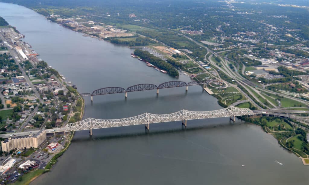
The Tennessee River ends in Paducah, Kentucky.
©jessica.kirsh/Shutterstock.com
The Tennessee River ends at the Ohio River near Paducah, Kentucky. The last leg of the Tennessee’s run is north across Western Kentucky, where it separates the Jackson Purchase from the rest of the state. The Tennessee River joins the Ohio River 12 miles west of the Cumberland River Confluence and 30 miles east of the junction between the Ohio and Mississippi Rivers.
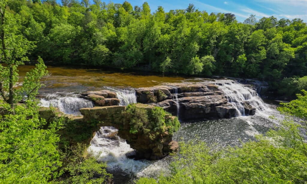
How Long is the Tennessee River?

The main channel of the river is 652 miles long.
©iStock.com/benkrut
The length of the Tennessee River is 652 miles (1,049 kilometers). The river system covers 41,000 square miles and drains 60 Tennessee counties and seven states. The river flows southwest in east Tennessee and cuts through Chattanooga before crossing the border into Alabama. It continues its journey through parts of Alabama – Huntsville, Decatur, and Muscle Shoals – before forming a part of the Mississippi border. From there, it crosses back into Tennessee before making its final appearance in western Kentucky.
The Tennessee River is one of the very few in the United States that cuts through a state twice. Interestingly, the Cumberland River, which flows through Tennessee, enters Kentucky twice. The U.S. Army Corps of Engineers designed a project to reduce the distance from Tennessee, northern Alabama, and northern Mississippi to the Gulf of Mexico. The Tennessee Tombigbee Waterway added a link from the Tombigbee River in Mississippi to the Tennessee River. The new route cuts hundreds of miles and allows barge traffic to quickly reach Mobile Bay and the Gulf of Mexico.
How Wide is this Famous River?
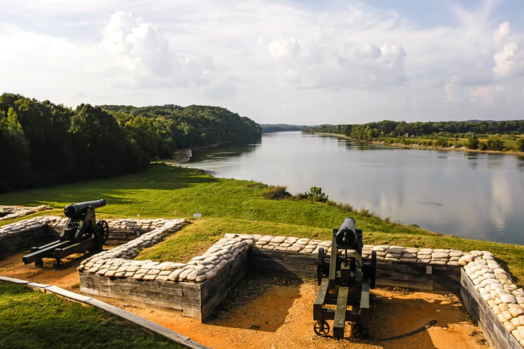
The width of the Tennessee River varies between 0.5 miles to one mile.
©iStock.com/csfotoimages
The average width of the Tennessee River is between 0.5 miles to a little more than one mile in some areas. At its widest point, the river is 1.5 miles long. The first significant battles of the Civil War occurred on the river’s north-flowing lower course. The valley offered an invasion route, but it was generally seen as something that just needed to be crossed.
After the war, the iron and timber industries established operations near the river and used it as a means to transfer material. Work began on a canal and dam system near Muscle Shoals in 1875, and by 1900 the US Army Corps of Engineers started on the dam below Chattanooga to provide industries and residents with hydroelectric power.
The Tennessee Valley Authority (TVA) established itself in 1933. Its mission was to control flooding and generate power. By the 1980s, the TVA was responsible for the existence of over 30 dams on the river.
The TVA initiated a Reservoir Release Improvement Program in 1991 to increase flows and improve water quality. Studies found positive ecological changes. The TVA has been a great success from the very beginning and continues to work to improve economic hardship.
Dams serve an excellent purpose for nearby communities. They provide river navigation, hydroelectric power generation, irrigation, and other industrial uses.
How Deep is the Tennessee River?
The Tennessee River is 9 feet deep on average.
©Gabriel Quiles/Shutterstock.com
The average depth of the Tennessee River is 9 feet (2.7 meters). By the late twentieth century, the river system increased its focus on recreation and environmental preservation while continuing its efforts on industry and commerce. 34,000 Barges, flat-bottomed boats carrying bulk goods, travel the Tennessee River Annually.
Tourism dominates the river system and is an essential part of the Great Loop, the recreational water area in Eastern North America. You can access the main channel by watercraft at over 200 public access points. People flock to this recreational space yearly for fishing, canoeing, kayaking, and paddleboarding. Many trailheads near the river are also perfect for hiking and biking.
Rivers are essential for everyday life, from food to lumber industries serving the community. It also serves as a recreational space for residents to unwind and connect with nature.