
There are plenty of reasons why hiking is great exercise. That is unless you’re planning a trip to one of the 11 most dangerous hiking locations in the world.
Come along as we take you on a journey to find the riskiest places in the world to take a hike.
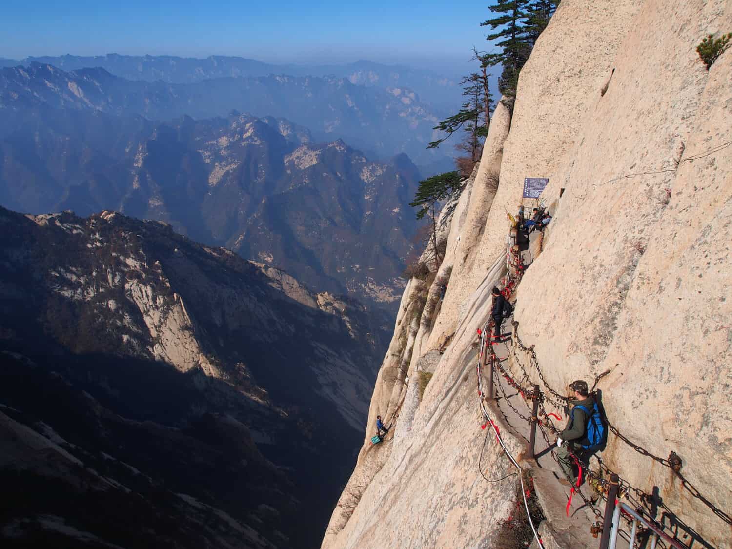
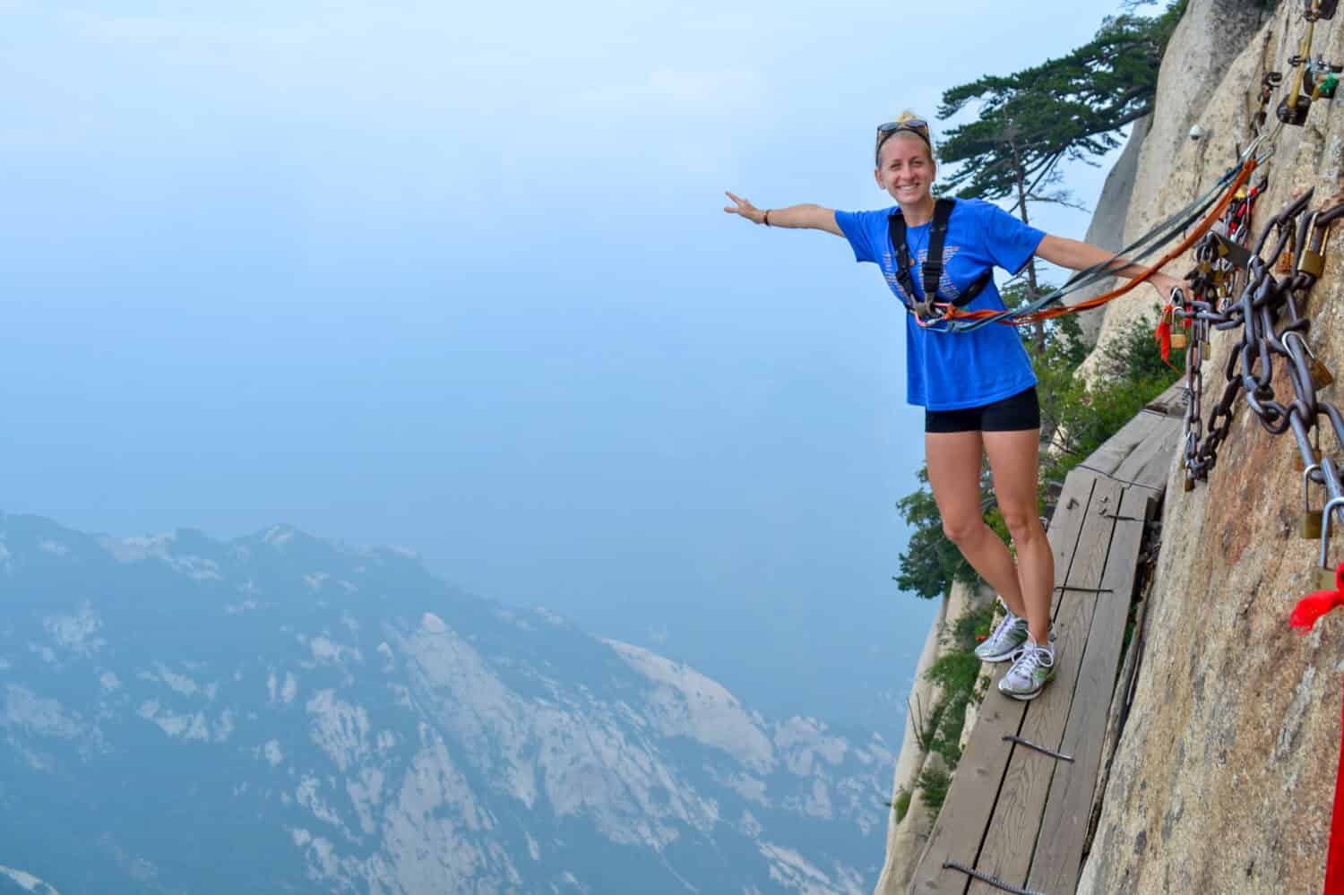
1. Huashan Mountain Trail / China
Plank Road is a wooden path that juts out of a vertical cliff on the South Peak.
©vonnahmed1/Shutterstock.com
Not too many hikes require the rental of a harness to keep you from tumbling off a dizzyingly high cliff. The Huashan Mountain Trail happens to be one of them!
Some of the pathways on this trail are called “sky planks,” over 2,000 feet high. Others are just carved footholds in the mountainside. All in all, it’s an extreme hike that will test your limits.
Mount Huashan, in the province of Shaanxi, China, is considered one of the five sacred mountains. In ancient times pilgrims made their way up it as a spiritual retreat. Now busloads of tourists come to see if they have the nerve to make the climb.
Due to the popularity of the hike, some “safety” devices were added, such as chain handrails and metal rope railings to hook your carabiner.
Mount Huashan has five peaks, each with its special list of hazards. To get to the East Peak, for example, you’ll be crossing passes with names such as “thousand-food precipice,” and “hundred-foot crevice.”
The terrifying Plank Road is a foot-wide wooden path with each plank built out of several pieces of wood. It juts out of a vertical cliff on the South Peak over 6,500 feet (2,000 meters) in the air. And it’s a two-way “road,” so be prepared to step around someone who’s going the other way!
A warning: Taking selfies on this hike can prove deadly. It’s said that 100 people a year die while hiking the mountain.
As one hiker stated after traversing the South Peak, “It’s a long way down.”
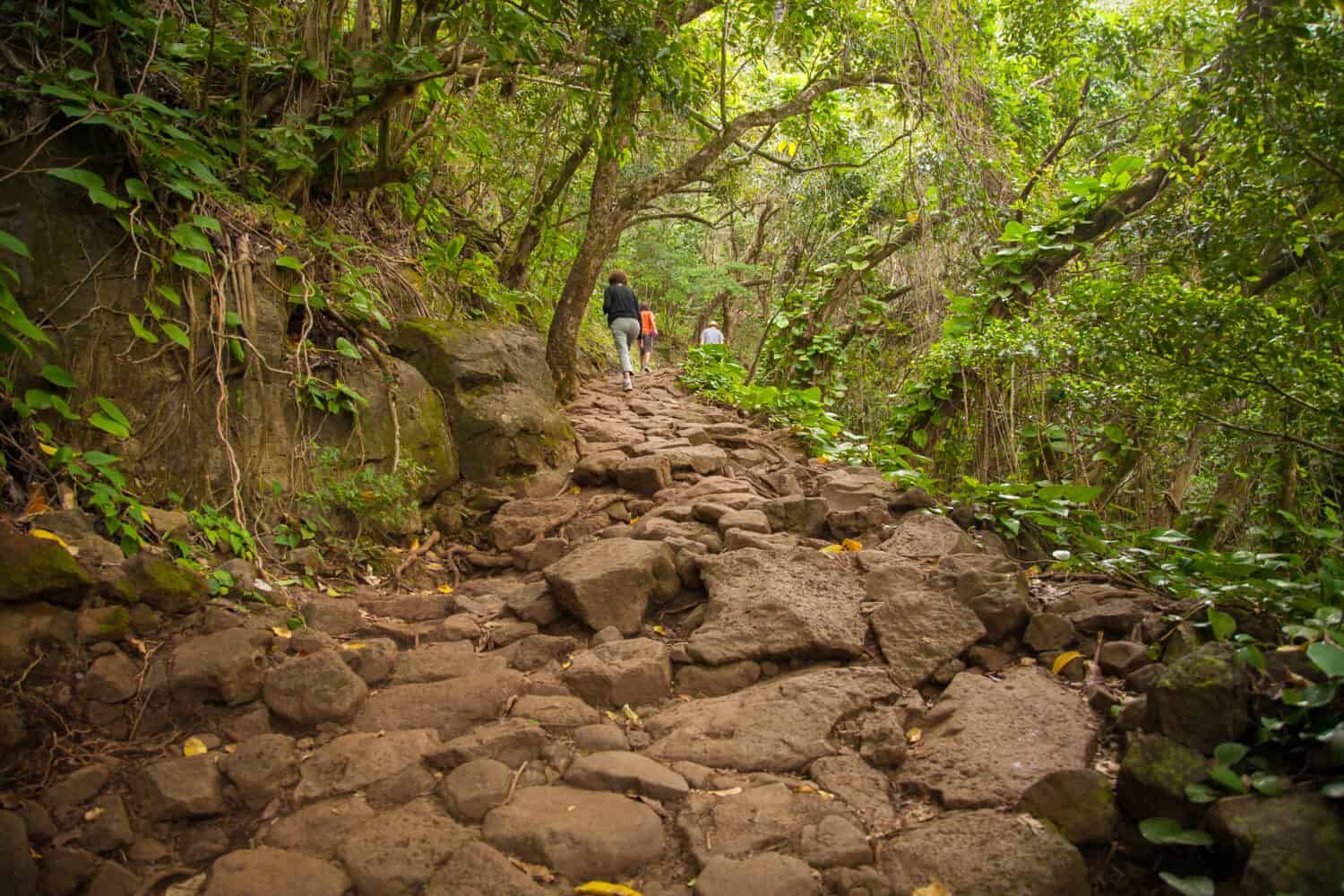
2. Kalalau Trail USA / Hawaii
Some call the Kalalau Trail “sheer terror with an amazing view.”
©Bob Pool/Shutterstock.com
If you’re looking to experience some of the most spectacular scenery Hawaii has to offer, there’s no doubt you’ll find it on the Kalalau Trail. Located on the Na Pali Coast on the island of Kauai, it’s said to be the most petrifying 11 miles you can hike. And that’s just one way!
The Kalalau Trail hike traverses the tops of soaring sea cliffs, crosses three major streams, and meanders through lush and verdant valleys, ending at Kalalau Beach. Some call it “sheer terror with an amazing view.”
If you want to get an idea of how remote this trail is, it’s the only land access to that part of the Kauai coast. Trail walkers are warned that the streams can rise suddenly, presenting a life-threatening situation. Should that happen, your only choice is to wait it out, even if that means sleeping on the rocks overnight. Most of the trail’s fatalities are the result of hikers who thought they could brave such flash floods and make it to the other side.
One of the trail’s “fun” features includes Crawler’s Ledge. The name alone should give you an idea of what this portion of the trail is like. This narrow, rock-strewn path on the ledge of a cliff is not for the faint of heart. And don’t be tempted to look down!
Remember, this is a wilderness area, says the state in its visitor’s safety video, “and you should be prepared for anything that can go wrong.”
3. Half Dome USA / California
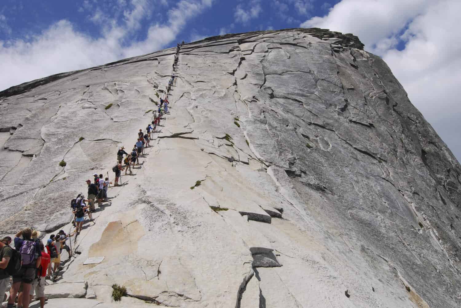
Ascending Half Dome is both strenuous and terrifying.
©Mark Yarchoan/Shutterstock.com
To hike the strenuous and perilous stretch called Half Dome, in California’s Yosemite National Park, you must win a permit via a lottery.
Only 300 people a day are permitted to take the hike, a 15-mile round trip that takes upwards of 12 hours to complete. If the sun, overexertion, a broken bone or two, or severe dehydration don’t get you, the last 400 feet of the hike well might.
That’s when you’ll experience the thrill — or sheer terror — of ascending Half Dome. It’s a steep granite peak with nothing standing between you and a fatal fall but cable handrails. And even those are removed every October. Being that you’ve already elevated yourself 4,800 feet by the time you reach the climb up to the Dome, it’s no wonder so many of this trail’s hikers require rescue each year.
Of course, what goes up must come down. So, if you thought it was terrifying going up Half Dome, coming down from an elevation of 8,846 feet might be even worse. Some hikers even do most of the downhill trek backward to make it “easier.”
4. Angel’s Landing USA / Utah

Hiking Angel’s Landing gives many opportunities for breathtaking views.
©Flystock/Shutterstock.com
The Angel’s Landing hike in the Zion National Park in Springdale, Utah is not for anyone with even the tiniest fear of heights. But those who do white-knuckle their way to the top are rewarded with some of the most breathtaking views imaginable.
Every step of the trek to the top of this 270-million-year-old rock formation is filled with another opportunity to fall — with dire consequences. And once at the peak, you’ll be over 1,000 feet from the valley below, with no rails to mark where an extra step becomes a point of no return.
The last section of the trail leading to the summit is called Hog’s Back. It’s an extremely narrow uneven, rocky path with cliffs on both sides. Since the late 1980s, there have been at least 14 known fatal falls at Angel’s Landing. February of 2021 was an especially bad year at the park, with two people falling to their deaths on the trail.
Despite the risk, Angel’s Landing is one of the most popular hikes in Zion National Park. So much so that to get a permit to go all the way you need to enter a lottery held months in advance.
The total hike to the summit and back is a meager five-mile round trip. But it will likely be the most nerve-wracking and exhausting five miles you’ve ever trekked.
5. Maze Overlook Trail USA / Utah
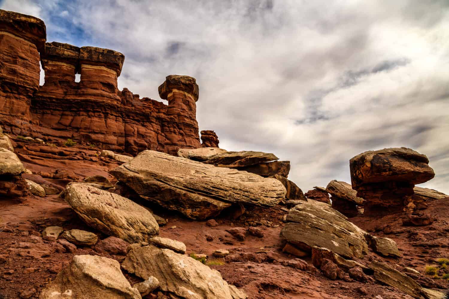
It’s not hard to lose your way while on the Maze Overlook trail.
©Arlene Waller/Shutterstock.com
Located in Utah’s Canyonlands National Park, there has never been a trail named more accurately than Maze Overlook.
The Maze is the least accessible area in a “sedimentary rock” wilderness. It’s also one of the most remote places in the lower 48. The Maze is described by the U.S. Geological Survey as being characterized by “deep, labyrinth-like canyons and standing rocks reaching skyward.”
In other words, getting lost there is incredibly easy. Along with necessary supplies to last for the hike, typically a minimum of three days, paper maps are considered mandatory.
To get to the Maze Overlook, one has to climb multiple steep rockfaces, shimmy through crevices, and have the balance of a mountain goat. If you make it in one piece, you’ll be rewarded with an unparalleled view of rock layers deposited hundreds of millions of years ago.
The trail itself is only eight miles long, but requires a 46-mile drive through “brutal” conditions to reach the first step, the Hans Flat Ranger Station. From there it’s another three-to-six-hour drive to access the Maze Overlook Trail. This is no place for an RV. High-clearance, four-wheel drive vehicles are the only ones that stand a chance in these conditions.
The National Park Service warns that relying on GPS will “frequently lead people astray.” And that the Maze offers no services, food, gas, or potable water.
6. West Coast Trail / Canada
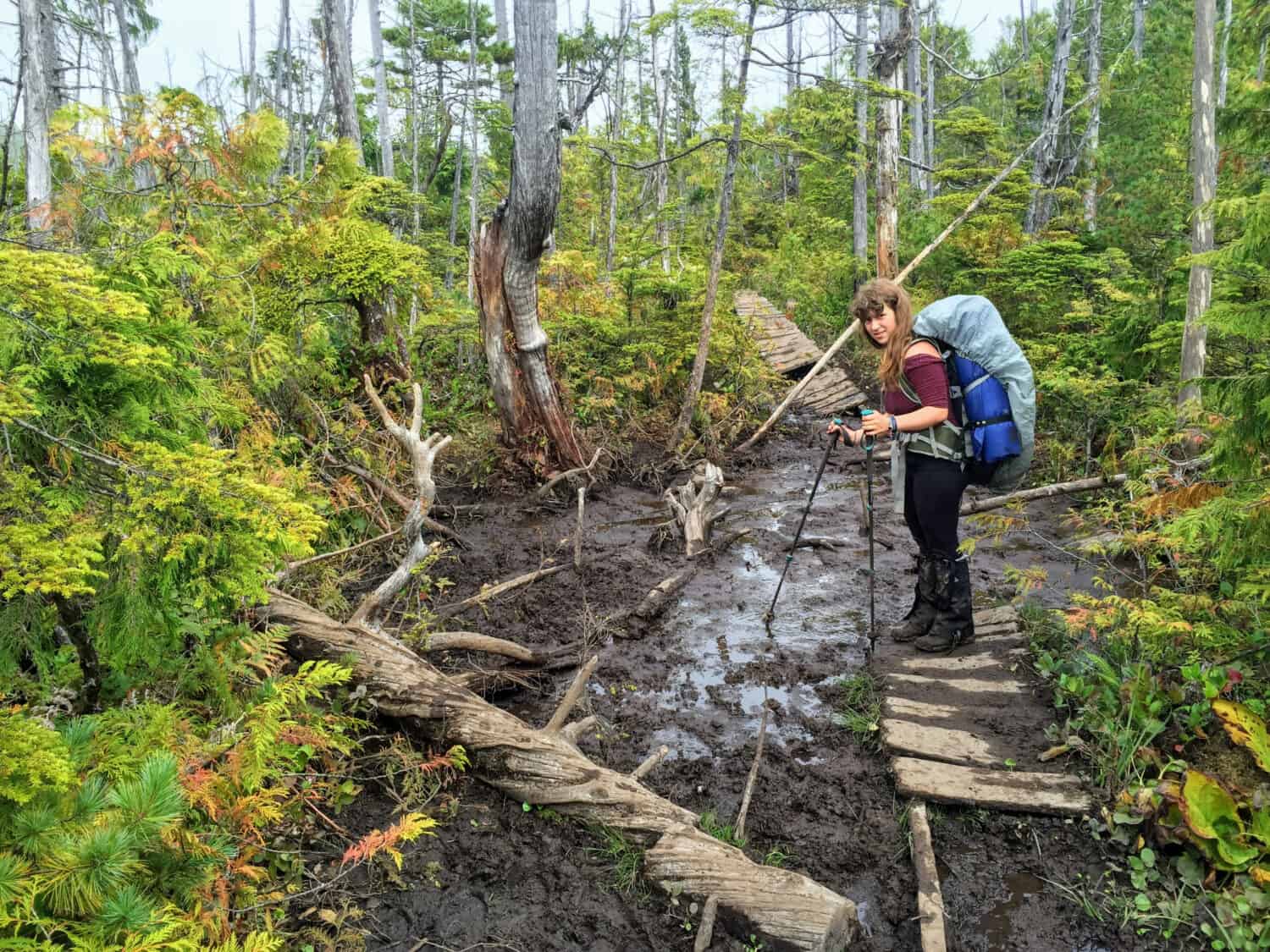
Hiking the West Coast Trail requires a lot of preparation and really good hiking boots!
©christopher babcock/Shutterstock.com
Spanning nearly 47 miles (75 kilometers) over the southwestern edge of Vancouver Island in the province of British Columbia, the West Coast Trail was constructed in 1907 to rescue shipwreck survivors.
Originally called the Dominion Lifesaving Trail, it cut a swath through a wilderness area to help stranded sailors make their way back to civilization. Shelters were also built, containing food, clothes and blankets.
By 1970, no longer needed as a safe haven for mariners, the trail became part of the Pacific Rim National Park Preserve. And it has proven to be its most popular stretch, testing hikers to their limits.
Be Ready for Bogs, Boulders and Bears
Considering the length of the trail, and the fact that it’s not circular, you can pick up a private shuttle bus during the summer months to get back to all the starting and end points.
But it’s not the distance that makes this trail a bucket list requirement for those who enjoy living on the edge. Hiking the full trail will have you descending a cliff using ropes, climbing up and down towering wooden ladders (often covered with slippery moss), traversing forests, and heavy mud bogs, walking soft-sand beaches, and crossing over rivers and boulders.
To add to the danger (or excitement for some), encounters with bears, wolves, and cougars are common.
Many who start the trek don’t make it, needing rescue. Falls are common, as is hypothermia. And when hiking this extreme trail, you don’t need to fall very far to incapacitate yourself. Jagged rocks abound, as do unexpected encounters with knife-like tree branches.
Be sure to arrive prepared, as the full trip typically takes a week. There are 13 campsites, and you’ll need to carry all necessary provisions on your back for the duration of the hike.
And don’t forget to bring a first-aid kit.
7. Camp Muir USA / Washington
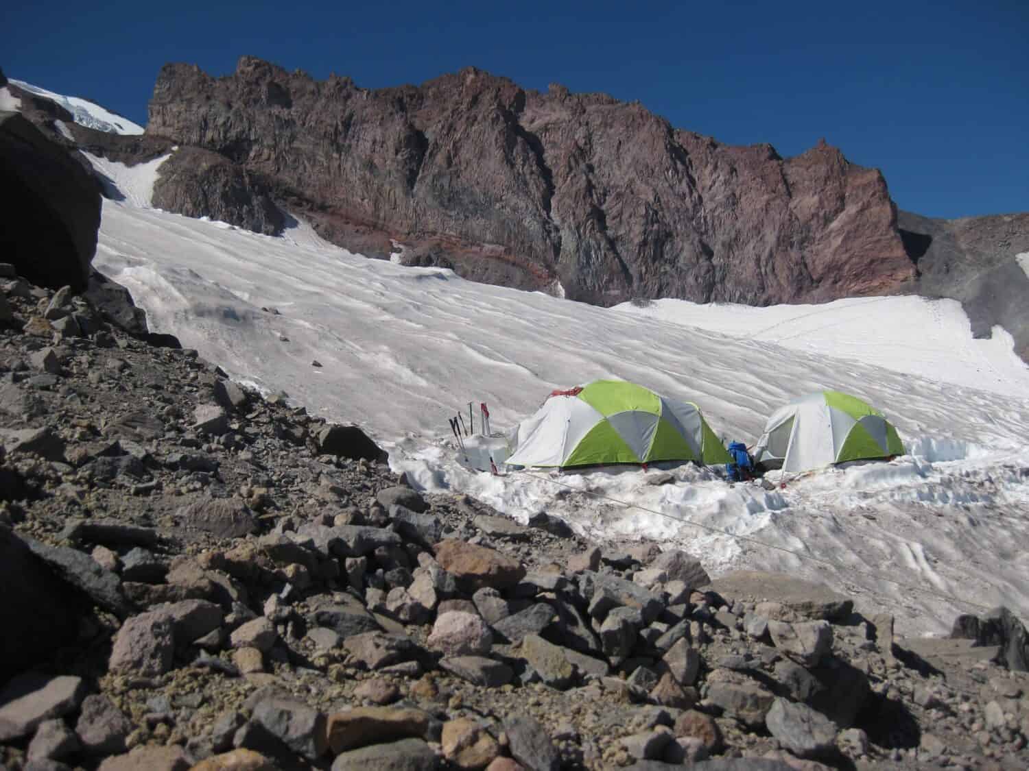
At Camp Muir, white-out conditions can happen any time of the year.
©Angela Feltes/Shutterstock.com
The Camp Muir hike is perfect for those who aren’t officially into mountain climbing but still want the thrill of reaching a high elevation. It’s also for those who aren’t fazed by a June blizzard, or snow-covered rocks in August and can walk for eight strenuous miles in rarefied air.
Named after naturalist John Muir, Camp Muir perches higher than the summits of all the other mountains in Washington state. It’s considered either a treacherous day hike or a base camp for skilled mountaineers who are ascending Mount Rainer. If you make it to Camp Muir, you’ll have reached an elevation of 10,080 feet (3,072 meters).
Like Walking Over ‘Soft Ice Cream’
The weather is one of the major threats of this hike. In September 2020 a hiker died on the trail after becoming disoriented in high winds during a white-out.
Often fatalities on climbs to Camp Muir involve hikers who didn’t realize the potential for severe winter-like weather throughout the year. One climber advises that the trip back down is more dangerous than heading up. “In good weather, the snow will have warmed to the consistency of soft ice cream,” he said. Then there’s the potential danger of Mount Rainier itself. It may not have erupted during the last 500 years but is still considered “potentially the most dangerous volcano in the Cascade Range,” according to the U.S. Department of Interior.
8. Bright Angel Trail USA / Arizona
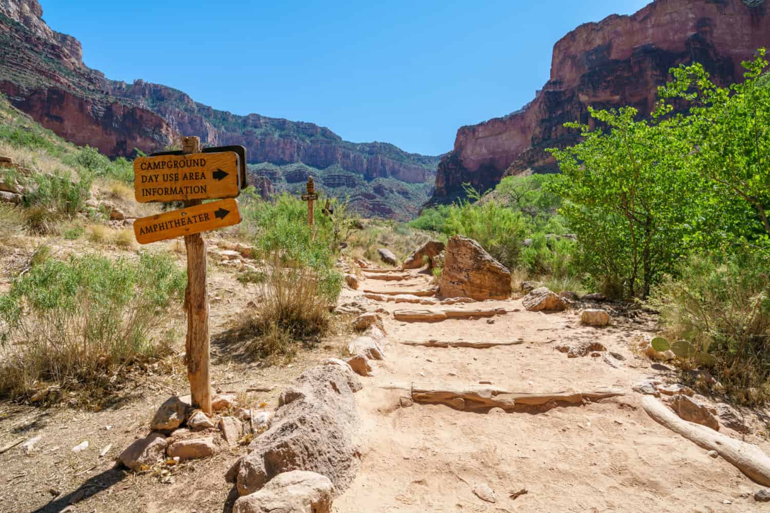
One of the main dangers while on the Bright Angel Trail is the extreme heat.
©cb_travel/Shutterstock.com
Many unfortunate hikers have learned the hard way that the Bright Angel Trail, which begins on the South Rim of the Grand Canyon and goes down to the Colorado River, is a very deceptive eight miles. If you take the full hike to the Phantom Ranch at the river, it’s ten miles.
It’s such a demanding walk during the summer months that the park has a special rescue team at the ready. They advise that for every hour hiking down, you should allow two for the ascent.
While it’s always possible to take a deadly fall, the majority of injuries and fatalities on this trail have to do with dehydration, overexertion, and heat stroke. For that reason, the park maintains several seasonal water stations along the way, but not to the end.
No Way to Escape the Heat
Park Rangers issue warnings every summer that the temperature on the exposed parts of the trail can get over 120 degrees Fahrenheit (49 °C). And that’s in the shade! In May of 2022, a 36-year-old woman from Indiana became the latest victim of the trail. She attempted to hike to the Colorado River and back again in one day.
On one page of the Nation Parks Service website that describes this hike, you’ll get an idea of some of its potential perils.
For example, the trail is described as being “well-maintained and graded,” and “fairly easy to walk down” making it sound like an easy hike for beginners. However, the next line cautions, “This can be a blessing or a curse.” In other words, those who walk down must also walk back up. And that walk back goes from an elevation of 2,546 feet (776 meters) at the river to 6,860 (2093 meters) at the trailhead on the South Rim.
Still, in spite of all those risks, the Bright Angel Trail remains the most popular ways to explore Arizona’s amazing Grand Canyon.
9. El Caminito Del Rey / Spain

The walkway at El Caminito Del Rey was originally constructed in the early 1900s.
©Guillermo Garcia/Shutterstock.com
Before starting on this hike in Malaga, Spain, visitors are handed hard hats. Their shoes are inspected to make sure they are “suitable.” Still, considering how this trail looked just a short time ago, it certainly now gives the illusion of “safety.”
The steep walkway that appears to cling to the side of a massive cliff that makes up part of this spectacular and frightening hike was first constructed between 1901 and 1905. Its original purpose was to provide access to workers constructing a pioneering hydroelectric dam.
By 1914 a bridge spanning the gorge was added. And in 1921, when the dam was officially opened, King Alfonso XIII officiated by crossing the walkway. Ever since then, it’s been known by the name El Caminito Del Rey, which translates to “the king’s path.”
As you can imagine, over the years the footpath has deteriorated — quite a bit! That little issue, however, hasn’t stopped people from taking this hike. Even when it involved crossing 10-foot gaps in the walkway using a single beam teetering 300 feet over a gorge.
A Deadly Hike
After five widely publicized deaths occurred, the walkway and bridge were closed in 2001 pending repairs. But even that, along with the threat of a fine, didn’t stop thrill-seekers. Four more fell to their deaths in 2013. The true number of those who have perished there is unknown.
In 2015, after ten months of renovations, El Caminito Del Rey reopened to the public. Even though the walk was made considerably safer, that didn’t prevent another tragedy. Five years later a woman lost her balance while on the rebuilt suspension bridge and fell to her death.
Under five miles long (8.04 kilometers), the hike is a one-way trip that crosses the Gaitanejo gorge leading to the “hanging bridge.” After crossing another gorge, you’ll be hiking 328 feet (100 meters) above the ground.
Should you want to take the ultimate test for acrophobia, there’s a glass-floored balcony jutting out from the walkway.
10. The Presidential Traverse USA / New Hampshire
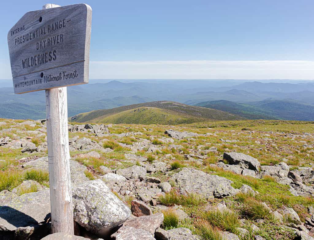
Hiking the Presidential Traverse means you’re above the tree line and exposed to all kinds of weather conditions.
©NatureN8/Shutterstock.com
This hike, part of the Appalachian Trail, is a grueling 20-mile trek that will have you exposed to the elements the entire way.
Part endurance contest, part history lesson, the trail will lead you through each mountain in the Presidential Range of the White Mountains in New Hampshire. The highest will be the crossing of the state’s highest peak, Mt. Washington, at 6,288 feet (1917 meters). That’s followed by Mt. Adams at 5,774 feet (1759 meters).
As the hike is done above the tree line, you’ll be exposed to everything Mother Nature has to offer. This can include snow, lightning, hail, and whiteout conditions.
In 2022, a 53-year-old hiker from Massachusetts died while attempting to complete the Presidential Traverse. He had sent a text to his wife, who was not with him, asking for help. Those who came to his aid described “driving rain, blowing snow, and sustained 50-60 mph winds with gusts over 80 mph…”
And those conditions were at the end of June.
11. Notch Trail USA / North Dakota
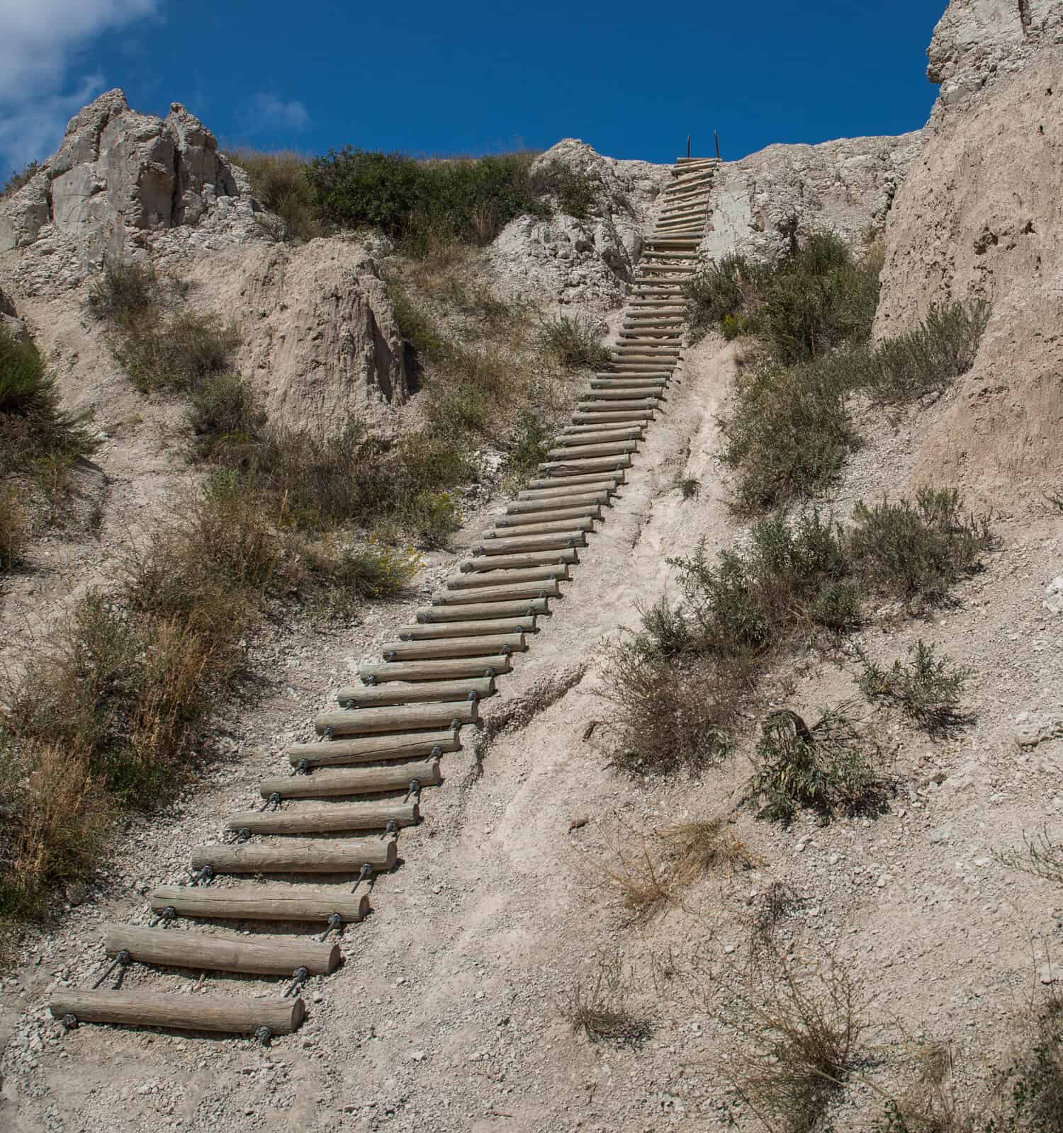
The most risky feature at the Notch Trail is said to be the 50-foot wooden ladder climb.
©Pbd1950/Shutterstock.com
At just 1.5 miles, the Notch Trail seems easily doable. Its most risky feature is said to be the 50-foot wooden ladder climb. But when you’re hiking in North Dakota’s Badlands, risk can come at you unexpectedly.
Just ask Dave Johnson. His ego took a beating when he slipped, fell, and got stuck in a rock crack while hiking Notch Trail. He made it out alive thanks to a group of other hikers who spotted him. If they hadn’t, his story may have had a less happy ending. He needed the South Dakota National Guard to make a helicopter rescue and transfer him to an air ambulance.
Despite the lack of guard rails, slippery terrain, and remote setting, Notch Trail has a reputation for being an all-level hike. And that includes the 50-foot-long ladder called the “stairway to nowhere.”
That somewhat benign reputation is likely why folks such as Dave come woefully unprepared. Due to the short length of the hike, he left his phone, water bottles, and backpack in his car. He estimated the adventure would take under two hours. Dave also ignored the warnings about wearing sturdy boots and informing someone of his itinerary before setting out.
And that can be a fatal error. Especially when exposed to the burning rays of the sun without any shade in sight.
Wherever you may hike, there are certain essentials you must have according to the American Hiking Society. They include appropriate footwear, a paper map and compass (and knowing how to use them), adequate water, as well as a way to purify stream water, a light, a fire starter, and a whistle.
Summary of the Top 11 Most Dangerous Hikes
| Rank | Name | Location |
|---|---|---|
| 1. | Huashan Mountain Trail | China |
| 2. | Kalalau Trail | Hawaii |
| 3. | Half Dome | California |
| 4. | Angel’s Landing | Utah |
| 5. | Maze Overlook Trail | Utah |
| 6. | West Coast Trail | Canada |
| 7. | Camp Muir | Washington |
| 8. | Bright Angel Trail | Arizona |
| 9. | El Caminito Del Rey | Spain |
| 10. | The Presidential Traverse | New Hampshire |
| 11. | Notch Trail | North Dakota |


How to Add Us to Google News


Thank you for reading! Have some feedback for us? Contact the AZ Animals editorial team.